Urban Floods
Jiadhal River and Change of its Course
From UPSC perspective, the following things are important :
Prelims level: Jiadhal River, Brahmaputra and its tributaries
Mains level: NA

Why in the news?
- Climate Change is disrupting Jiadhal River’s (Dhemaji district, Assam) tranquil flow, leading to unprecedented shifts in its course and causing upheaval for residents.
About Jiadhal River:
- It flows through the districts of Darrang, Udalguri, and Baksa in the northeastern state of Assam.
- It is also known Kumotiya River after flowing from Gogamukh.
- Origin: From the Hills of Bhutan, flows through the Assam Himalayas before meandering through the plains of Assam. It is formed by the confluence of several smaller streams.
- Major tributaries: Kolong River and the Daokao River.
- It eventually joins the Brahmaputra River near the town of Nalbari.
- It is known as the ‘Sorrow of Dhemaji’ for the heavy damage caused by annual floods and erosion.
Factors leading to changes in the Jiadhal River’s Course
- Erosion: Flowing water gradually wears away the riverbanks and bed, causing the river to meander and change course.
- Sediment deposition: Accumulation of sediment can create new channels or alter the flow pattern of the river.
- Human activities: Dams, channelization, urbanization, deforestation, and mining can disrupt natural river processes, leading to changes in flow and morphology.
- Climate change: Changes in precipitation, temperature, and glacier melt affect river flow patterns and behavior.
- Tectonic activity: Uplift, subsidence, and faulting influence river topography and drainage patterns, leading to adjustments in course and behavior.
PYQ:[2017] With reference to river Teesta, consider the following statements: 1. The source of river Teesta is the same as that of Brahmaputra but it flows through Sikkim. 2. River Rangeet originates in Sikkim and it is a tributary of river Teesta. 3. River Teesta falls into Bay of Bengal at the border of India and Bangladesh. Which of the statements given above is/are correct? (a) 1 and 3 only (b) 2 only (c) 2 and 3 only (d) 1, 2 and 3 |
Get an IAS/IPS ranker as your 1: 1 personal mentor for UPSC 2024

Urban Floods
Himachal Floods: A man-made disaster?
From UPSC perspective, the following things are important :
Prelims level: NA
Mains level: Himachal Flood

Central Idea
- Himachal Pradesh has experienced devastating flash floods during the recent monsoon season, resulting in a significant loss of lives and assets.
- This article explores the factors contributing to the floods, including climate change and anthropogenic actions, and raises questions about the current development model’s sustainability.
Reasons for amplified Flood Impacts
[A] Climate Change and Floods
- IPCC’s Warning: The IPCC VI report predicts that the Himalayas and coastal regions of India will be the hardest hit by climate change. Increased precipitation in shorter periods is evident in the Himalayas, leading to heavy rains and floods.
- Abnormal Rainfall: Normal rainfall is expected to be between 720mm and 750mm, but instances of exceeding 888mm in 2010 and 926.9mm in 2018 have been observed. The current precipitation has been a result of the combined effect of the southwest monsoon and western disturbances.
[B] Impact of Development Model
- Dr. Parmar Model: Himachal Pradesh’s development model, initiated in 1971, transformed the state into a model of development for mountain regions. It focused on land reforms, social welfare investments, and human resource development.
- Shift in Development: Liberalization brought demands for fiscal reforms, forcing the state to generate its own resources. Exploitation of natural resources such as forests, water, tourism, and cement production became the focus of development efforts.
- Hydropower Projects: Dominant focus on hydropower projects led to uncontrolled construction, transforming mountain rivers into streams, and causing ecological damage.
- Tourism Expansion: Road expansion for tourism promotion resulted in bypassing geological studies, leading to landslides and destruction during rainfall.
- Cement Plants: Establishment of massive cement plants altered the landscape, reducing the land’s water absorption capacity and contributing to flash floods.
- Changing Crop Patterns: Shift from traditional cereal farming to cash crops increased the demand for hastily constructed roads without proper drainage, leading to rapid swelling of rivers during rainfall.
Way Forward
- Commission of Inquiry: Instituting a Commission of Inquiry involving major stakeholders can address policy framework failures and project aspects.
- Empowering Local Communities: A new architecture is needed to empower local communities over their assets. Insuring assets and involving local communities as custodians can expedite rebuilding efforts.
- Sustainable Infrastructure: With climate change as a reality, infrastructure planning should adapt to avert disasters and mitigate the impacts of heavy rainfall.
Conclusion
- The flash floods in Himachal Pradesh demonstrate the consequences of both climate change and human-induced development.
- It calls for a comprehensive approach that considers sustainable development practices, empowers local communities, and prioritizes environmental conservation to protect lives and assets in the region.
Get an IAS/IPS ranker as your 1: 1 personal mentor for UPSC 2024
Urban Floods
Urban Deluge due to rising Yamuna Level in Delhi
From UPSC perspective, the following things are important :
Prelims level: NA
Mains level: Urban Deluge

Central Idea
- The Yamuna River in Delhi is experiencing it’s highest-ever water levels, causing concerns and necessitating emergency actions.
- Heavy rainfall in northwest India, including the Yamuna basin states, and increased water release from the upstream Hathnikund Barrage in Haryana are contributing to the unprecedented water levels.
Unprecedented Water Levels and Emergency Response
- Delhi’s Yamuna River is currently flowing at the highest-ever recorded level in the city.
- Delhi CM has written to Union Home Minister, requesting controlled water release from the Hathnikund Barrage to manage the situation.
- The water release from the barrage, typically around 352 cusecs during non-monsoon months, reached a peak of 3.59 lakh cusecs due to heavy rainfall in northwest India.
Importance of Water Release
- Impact of Upstream Water Release: The water level in the Yamuna River in Delhi is determined by the release of water upstream from the Hathnikund Barrage.
- Regulation of Water Flow: The barrage acts as a regulator and can only control the amount of water released downstream and to canals.
- Flooding Concerns: Failure to release water from the upstream can lead to increased flooding in areas upstream, including Haryana.
Potential Consequences of Water Accumulation
- Increased Flooding: Failure to regulate the water levels in the Yamuna River can result in severe flooding in Delhi and surrounding areas.
- Infrastructure Damage: High water levels pose a risk to infrastructure, including roads, buildings, and public utilities.
- Displacement of Residents: Excessive flooding can force people to evacuate their homes, leading to displacement and potential humanitarian challenges.
Addressing the Emergency
- Controlled Water Release: Controlled water release from the Hathnikund Barrage can mitigate the flooding risks.
- Collaboration and Coordination: Cooperation between Delhi and Haryana authorities, as well as with central government agencies, is essential to manage the situation effectively.
- Monitoring and Emergency Preparedness: Continuous monitoring of water levels, timely communication, and preparedness to handle any evacuation or relief efforts are crucial during this emergency situation.
Conclusion
- The unprecedented water levels in the Yamuna River in Delhi demand immediate attention and coordinated efforts to prevent further damage and protect affected communities.
Also read:
Get an IAS/IPS ranker as your 1: 1 personal mentor for UPSC 2024
Urban Floods
Urban Challenge, Problems and Solutions
From UPSC perspective, the following things are important :
Prelims level: NA
Mains level: Urab floods,Urban challenges and solutions
Context
- After flooding of major metropolitan cities of Bengaluru, Gurgaon and Delhi following heavy rainfall, the Centre has pointed to two cities – Davanagere and Agartala – as successful examples of cities that have curbed urban flooding.
Why cities are so important in India?
- Drivers of Growth: Urbanisation has played and will continue to play a critical role in India’s growth story in the 21st century.
- Cities are seen as GDP multipliers: By some estimates, Indian cities already contribute up to 70% of the country’s GDP. Yet, depending on which official estimates you use, India is just 26% or 31% urban. But there is growing evidence that India is more urban than is officially recognized.
- Cities have more productivity: Well-functioning and diverse cities allow for the sharing and cross-pollination of ideas, which in turn drive greater productivity.

What are the Urban challenges?
- Lack of Planning: current urban planning policies and practice have led to suboptimal use of land in Indian cities. This has multiple consequences. There is not enough floor space for accommodating migrants in search of economic opportunities; they make space for themselves in informal settlements. There is also not enough land in the public domain for developing adequate open spaces or augmenting infrastructure capacities.
- Lack of Housing:The pandemic revealed that the cities’ economies rely on migrant populations in the formal and informal sectors. Workers in both markets move from rural to urban and urban to urban areas as they find better opportunities; they are mobile and need adequate rental options. Today, in most Indian cities, this demand is not met and leads to unaffordable options, pushing the poorer sections out to slums and other informal settlements.
- Lack of Transport: Indian cities are infamous for their road congestion; three of them rank in the 10 most congested in the world according to the 2020 TomTom Travel Index with Mumbai ranking second. The existing public transportation systems are already overcrowded and of poor quality.
- Lack of Public health: Like other health crises, the COVID-19 pandemic revealed the need to ensure adequate healthcare services and sanitation infrastructure for a healthy population in cities. In the initial months of the outbreak, the focus of health services shifted entirely towards addressing the novel coronavirus, leaving other health issues unaddressed and shutting down routine care services.
- Impact on Environment: The causes for low air quality are multiple; vehicular movement and on-road congestion are major contributors. A safe and clean environment is key to good public health.
- Problems faced by vulnerable sections: The economic shock and work from home guidelines changed migration patterns; workers in cities returned to their home towns and villages. Slum dwellers, with limited access to adequate infrastructure, and migrant workers, disenfranchised from social protection systems or daily wagers, were more vulnerable to this shock. In the medium and long term, it is difficult to predict what the job market will be in cities.

What can be done to address the urban challenges?
- Future planning is necessary: Manage the spatial growth of cities and allow them to build more planned road networks for future horizontal expansion and revoke faulty policies that constrain the use of floor space to build vertically.
- Housing for all scheme is important: Focus on providing public housing for the poor; India can learn from successful models in Singapore or Hong Kong and understand the strategic challenges of other international examples such as Mexico. India can also work toenable efficient rental markets
- Holistic transport should be focused: Integrate formal and informal modes of transportation into holistic transportation strategies to ensure seamless mobility, as well as first and last mile connectivity.
- Increasing funds to Cities: Decentralise fiscal powers to the local level and train city authorities so that they can make more strategic decisions in health expenditures or public health infrastructure, as well as gain the capacity to raise their own resources.
- Need of a healthy Environment: Increase the number of open spaces in the public domain, maintain them and monitor their use. Prepare for disasters with robust framework of physical infrastructures, road networks and large open spaces. Build adequate infrastructure to support the sustainable development of emerging Tier-2 and Tier 3 towns.
- More attention to vulnerable: Develop more systematic identification mechanisms of the urban poor to ameliorate the delivery of public services and social protection. Collect accurate data on migrant population and capture their socio-economic diversity to better address their needs. Monitor access to services, housing and jobs of the vulnerable communities in real time.

Conclusion
- Urban infrastructure is crumbling day by day. In the next 25 years, cities will have more population than rural areas. Indian cities need urgent reform in order to unlock their economic potential and transform quality of life.
Mains Question
Q.Discuss the urban infrastructure challenges? What are the governments scheme and actions to address the urbanization challenges?
UPSC 2023 countdown has begun! Get your personal guidance plan now! (Click here)
Get an IAS/IPS ranker as your 1: 1 personal mentor for UPSC 2024
Urban Floods
The heavy rainfall and the crazy Banglore flood: A case to study
From UPSC perspective, the following things are important :
Prelims level: NA
Mains level: urban floods mitigation
 Context
- The recent events of heavy downpours in short period of time and the recent example of Banglore flood, highlights how cities in India and elsewhere need to adapt to climate change as it brings more extreme rainfall in the future.
What is heavy downpour?
- A downpour or cloudburst is a sudden and unexpected heavy fall of rain.
- It is usually local in nature and of brief duration. Most so-called cloudbursts occur in connection with thunderstorms.
- Heavy downpour in short period causes flood, damage to buildings and infrastructure can disrupt transport, communications and connectivity, loss of crops and livestock.
The heavy rainfall and the Banglore flood causes
- Rise in built up area: Lakes and natural depressions may not always fill up during many monsoons so the people who are unaware of hydrology tempts to build and buy in the catchment areas of water-bodies, which will be disastrous when it rains heavily as there is rise in the quantity.
- Water-logging: rainwater and sewage water are forced to build up, which results in water-logging. The highway acts as a dam for the water ,Garbage frequently clogs drains, which limits the flow of sewage, and they are too small to support the weight of the expanding population.
- Physical shrinkage of water-bodies: Destruction of lakes is a major issue .lakes can store the excess water and regulate the flow of water however the pollution of natural water bodies and converting them for development purposes has increased the risks of floods. Unplanned growth, Rise in population, rise in the built up areas along streams, canals, around the lakes, leaving no storage capacity.
- Compromised runoff potential and health hazards: Choked and encroached drains and lakes, ill designed infrastructure and missing pipes compromising run off potential. Not only the physical quantity of the runoff that poses a hazard. When polluted drains and lakes overflow, the flood can pose a health hazard especially to vulnerable and exposed marginal communities living in informal settlements.
- Zero or limited ability to allow infiltration of water: Encroachments in and around wetlands and green lands harming the natural way of water infiltration and ground water recharge.
- Lack of vision in rain water harvesting: Ignorance towards the tradition rain water harvesting techniques and no or limited vision for creating new systems of rain water harvesting. Exceptionally heavy monsoon rains have been exacerbated by poor urban planning in the Indian tech hub, showing the need for improved water systems.
 What are the reasons behind the frequent floods in urban areas?
- Meteorological factors: change in the weather patterns, increase in the temperature leading to heavy rainfall, sudden downpour, cloudburst, thunderstorms, hailstorms etc.
- Hydrological factors: Natural surface infiltration rate, soil moisture level, presence or absence of Overbank flows, Presence of impervious cover, the occurrence of high tides impeding the drainage in coastal cities.
- Man-Made factors:
- Unplanned urbanization: Unplanned settlement is one of the main cause of urban flooding. Blocking of natural drainage pathways through construction activity and encroachment on catchment areas, streams, rivers, lakebeds. Reduced infiltration and ground water recharge of water, destruction of lakes, Land-use changes (e.g. surface sealing due to urbanization, deforestation) increase runoff and sedimentation. Inefficiency or non-maintenance of infrastructure etc.
- Outdated Drainage systems: The old and ill-maintained drainage system is one of the main factor making cities in India vulnerable to flooding
- Encroachments on and around water-bodies: Illegal Habitations started growing into towns and cities alongside rivers and watercourses. As a result of this, the capacity of the natural drains has decreased, resulting in flooding.
- Climate Change: Climate change due to various anthropogenic events has led to extreme weather events, increasing temperature which resulting in heavy rainfall in one part while drought and dry spells in other.
- Poor Solid Waste Management System: Indiscriminate disposal of solid waste, poor waste management system, clogging drains because of accumulation of non-biodegradable wastes are major concerns. Domestic, commercial and industrial waste and dumping of it into the drains also contribute significantly to reducing their capacities.
- Reduced Seepage: use of hard and non-porous construction material making the soil impervious, reducing the seepage capability in no of cities in India.
- Weak Implementation and lack of awareness:Even with provisions of rainwater harvesting, sustainable urban drainage systems, etc, in regulatory mechanisms like the Environmental Impact Assessment (EIA), adoption at user end as well as enforcement agencies remains weak.
- No Community Participation:Flood control measures planned without participation of the affected community are unsustainable as they do not meet the needs of relevant stakeholders.
What can be done to prevent the urban floods and prevent losses?
- Developing climate Resilient Infrastructure: using permeable material for roads and pavement, green roofs and harvesting systems in buildings. To reduce the burden of road infrastructure in cities Outer Ring Road should be explored. Innovative approaches like Sponge Cities wetland restoration, flushing systems using collected rooftop water, public spaces as flexible water retention facilities can be applied to Indian urban areas.
- Use of technology in Early Warning Systems and Communication: Early-warning systems using sensors across waterbodies and drains, and a network of communication for hotspots of emerging flood risk in the wet-season should be put in place. Providing real-time data where traditional systems fail. Tools such as predictive precipitation modelingcan help do that and are also able to link it with the adaptive capacity of urban land use.
- Proper management and regular upgrade of Urban Drainage System: drains need to be cleaned on a regular basis to permit the free flow of water .Proper management of the drainage system is necessary to ensure that the water does not get stored in one place. Watershed management and emergency drainage plan should be clearly enunciated in policy.
- Rainwater Harvesting: It will serve the twin purposes of lowering the peak runoff and raising the groundwater table. Many municipal corporations in India have already made rainwater harvesting compulsory.
- Conservation of Water Bodies: Urban water bodies like lakes, tanks, and ponds also play a very important role in the management of urban flooding by reducing the flood water run-off by capturing it.
- Holistic approach: Improved monitoring, forecasting, and decision-support systems. Find out the different method for improving the preparedness for urban flooding.
- Responsibility on every stakeholder: Locally, citizens, local ward officials and staff will need to work together to minimize dumping of solid waste and garbage in storm-water drains. As this is a socio –political problem, public participation awareness and responsibility of citizen is the need of the hour. To develop a long-lasting solution, all parties must acknowledge the issues and adopt a thorough strategy.
What we as citizens can do on a personal level to prevent the urban environment?
- Raising voice at all available forums and platforms
- Making politicians and bureaucrats accountable
- Refuse to buy a house in the encroached lands.
- Applying methods of rain water harvesting on individual level.
Way ahead
- Exceptionally heavy monsoon rains have been exacerbated by poor urban planning in the Indian tech hub, showing the need for improved water systems.
- Urbanization is a global and inevitable process, and with cities as engines of the economy, built-up areas will continue to grow. But we need to draw upon these experiences and the growing perils of climate change and extreme rain events and change course.
- According to UN projections, by 2050 more than 68% of the world’s population could be concentrated in urban areas.
- In this context, resilience-based strategies should be adopted to improve the capacity to handle the crisis arising out of climate change.
- Wetlands are the kidneys of the earth, let’s keep it healthy.
Mains Question
Q. What are the factors causing flood in the urban cities? What are the measures to prevent the urban flooding keeping in mind the sustainable development? Discuss.
UPSC 2023 countdown has begun! Get your personal guidance plan now! (Click here)
Get an IAS/IPS ranker as your 1: 1 personal mentor for UPSC 2024
Urban Floods
Urban floods mitigation
From UPSC perspective, the following things are important :
Prelims level: NA
Mains level: disaster management

Context
- Bengaluru floods are alarming us to go for robust disaster management strategies.
What is flood?
- Floods are the most frequent type of natural disaster and occur when an overflow of water submerges land that is usually dry. Floods are often caused by heavy rainfall, rapid snowmelt or a storm surge from a tropical cyclone or tsunami in coastal areas.
Causes of frequent urban floods
Natural
- Meteorological Factors:Heavy rainfall, cyclonic storms and thunderstorms causes water to flow quickly through paved urban areas and impound in low lying areas.
- Hydrological Factors: Overbank flow channel networks, occurrence of high tides impeding the drainage in coastal cities.
- Climate Change: Climate change due to various anthropogenic events has led to extreme weather events.
Anthropological
- Unplanned Urbanization:Unplanned Urbanization is the key cause of urban flooding. A major concern is blocking of natural drainage pathways through construction activity and encroachment on catchment areas, riverbeds and lakebeds.
- Destruction of lakes: A major issue in India cities. Lakes can store the excess water and regulate the flow of water. However, pollution of natural urban water bodies and converting them for development purposes has increased risk of floods.
- Unauthorised colonies and excess construction: Reduced infiltration due paving of surfaces which decreases ground absorption and increases the speed and amount of surface flow
- Poor Solid Waste Management System: Improper waste management system and clogging of storm-water drains because of silting, accumulation of non-biodegradable wastes and construction debris.
- Drainage System:Old and ill maintained drainage system is another factor making cities in India vulnerable to flooding.
- Irresponsible steps: Lack of attention to natural hydrological system and lack of flood control measures.
 Impact of the devastation due to floods:
- On economy: Damage to infrastructure, roads and settlements, industrial production, basic supplies, post disaster rehabilitation difficulties etc.
- On human population and wildlife:Trauma, loss of life, injuries and disease outbreak, contamination of water etc.
- On environment:Loss of habitat, tree and forest cover, biodiversity loss and large scale greenery recovery failure.
- On transport and communication: Increased traffic congestion, disruption in rail services, disruption in communication- on telephone, internet cables causing massive public inconvenience.
Solutions for effective flood management
- Improved flood warning systems: effective flood warning systems can help take timely action during natural calamities and can save lives. Pre-planning can significantly reduce the effects of floods, giving people time to migrate to safer locations and stock up essentials.
- Building flood-resilient housing systems: concreting floors can be very useful during floods. Houses should be water proofed and electric sockets should be placed at higher levels up the walls to reduce the chances of shocks.
- Constructing buildings above flood levels: buildings should be constructed a metre above from the ground to prevent flood damage and evacuation during floods.
- Resilience to Climate change: drastic climate changes have increased the frequency of natural disasters in many parts of the world. Governments should bring about environment-friendly policy level changes and eliminate the ones hazardous to the environment to tackle the problem of global warming.
- Create wetlands and encourage reforestation: creating more and more wetlands can help soak up excessive moisture since wetlands act as sponges. Wooded areas can also slow down heavy water flow, minimizing the effects of floods. Reforesting upstream regions can significantly reduce the effects of flood damage.
- Improve soil conditions: improper soil management, animal hooves, and machinery can make soil compacted. As a result, instead of holding water in and absorbing moisture, the water runs off immediately. Properly drained soil can absorb large amounts of rainwater and can prevent it from flowing into the rivers.
- Installing flood barriers: these are flood gates designed to prevent the area behind the barrier from flooding. They can also be kept around buildings to keep floodwaters outside the boundary created.
- Development of GIS– Geographical Information System (GIS) based National Database: for disaster management. GIS is an effective tool for emergency responders to access information in terms of crucial parameters for disaster-affected areas.
- Developing a Federal flood management plan: with responsibilities of union and state clearly defined.
- Creation of 2nd flood commission: (Rashtriya Barh Aayog, created in 1976) to study the flood situation in India under rising challenges of climate change and propose a national-level flood resilience and management plan.
Way forward
- Resilience of people: The rapid transformation in rainfall characteristics and flooding patterns demand building people’s resilience.
- Reconsider projects: Construction projects that impede the movement of water and sediment across the floodplain must be reconsidered.
- Use of technology: At the same time, climate-imposed exigencies demand new paradigms of early-warning and response systems and securing livelihoods and economies.
Conclusion
- We can learn to live with nature, we can regulate human conduct through the state and we can strategically design where we build. We need to urgently rebuild our cities such that they have the sponginess to absorb and release water without causing so much misery and so much damage to the most vulnerable of our citizens.
Mains question
Q. We need to urgently rebuild our cities such that they have the sponginess to absorb and release water. Discuss the statement in context of urban flood management strategy in India.
UPSC 2023 countdown has begun! Get your personal guidance plan now! (Click here)
Get an IAS/IPS ranker as your 1: 1 personal mentor for UPSC 2024
Urban Floods
What are Cloudbursts? Why are they rising across India?
From UPSC perspective, the following things are important :
Prelims level: Cloudburst
Mains level: Flash floods and cloudbursts

Over 20 people have been killed in destruction caused by cloudbursts and flash floods in different parts of Himachal Pradesh and Uttarakhand over the last three days.
What are Cloudbursts?
- A cloudburst is a localised but intense rainfall activity.
- Short spells of very heavy rainfall over a small geographical area can cause widespread destruction, especially in hilly regions where this phenomenon is the most common.
- Not all instances of very heavy rainfall, however, are cloudbursts.
- A cloudburst has a very specific definition: Rainfall of 10 cm or more in an hour over a roughly 10 km x 10-km area is classified as a cloudburst event.
- By this definition, 5 cm of rainfall in a half-hour period over the same area would also be categorized as a cloudburst.
How is it different from normal rainfall?
- To put this in perspective, in a normal year, India, as a whole, receives about 116 cm of rainfall over the entire year.
- This means if the entire rainfall everywhere in India during a year was spread evenly over its area, the total accumulated water would be 116 cm high.
- There are, of course, huge geographical variations in rainfall within the country, and some areas receive over 10 times more than that amount in a year.
- But on average, any place in India can be expected to receive about 116 cm of rain in a year.
- During a cloudburst event, a place receives about 10% of this annual rainfall within an hour.
How common are cloudbursts?
- Cloudbursts are not uncommon events, particularly during the monsoon months.
- Most of these happen in the Himalayan states where the local topology, wind systems, and temperature gradients between the lower and upper atmosphere facilitate the occurrence of such events.
- However, not every event that is described as a cloudburst is actually, by definition, a cloudburst.
- That is because these events are highly localized.
- They take place in very small areas which are often devoid of rainfall measuring instruments.
Why are they so destructive?
- The consequences of these events, however, are not confined to small areas.
- Because of the nature of terrain, the heavy rainfall events often trigger landslides and flash floods, causing extensive destruction downstream.
- This is the reason why every sudden downpour that leads to destruction of life and property in the hilly areas gets described as a “cloudburst”, irrespective of whether the amount of rainfall meets the defining criteria.
- At the same time, it is also possible that actual cloudburst events in remote locations aren’t recorded.
Can cloudbursts be forecasted?
- The India Meteorological Department forecasts rainfall events well in advance, but it does not predict the quantum of rainfall — in fact, no meteorological agency does.
- The forecasts can be about light, heavy, or very heavy rainfall, but weather scientists do not have the capability to predict exactly how much rain is likely to fall at any given place.
- Additionally, the forecasts are for a relatively large geographical area, usually a region, a state, a meteorological sub-division, or at best a district.
- As they zoom in over smaller areas, the forecasts get more and more uncertain.
- Theoretically, it is not impossible to forecast rainfall over a very small area as well, but it requires a very dense network of weather instruments and computing capabilities that seem unfeasible with current technologies.
- As a result, specific cloudburst events cannot be forecast. No forecast ever mentions a possibility of a cloudburst.
- But there are warnings for heavy to very heavy rainfall events, and these are routinely forecast four to five days in advance.
- Possibility of extremely heavy rainfall, which could result in cloudburst kind of situations, are forecast six to 12 hours in advance.
Are cloudburst incidents increasing?
- There is no long-term trend that suggests that cloudbursts, as defined by the IMD, are rising.
- What is well established, however, is that incidents of extreme rainfall, as also other extreme weather events, are increasing — not just in India but across the world.
- While the overall amount of rainfall in India has not changed substantially, an increasing proportion of rainfall is happening in a short span of time.
- That means that the wet spells are very wet, and are interspersed with prolonged dry spells even in the rainy season.
- This kind of pattern, attributed to climate change, does suggest that cloudburst events might also be on the rise.
UPSC 2023 countdown has begun! Get your personal guidance plan now! (Click here)
Get an IAS/IPS ranker as your 1: 1 personal mentor for UPSC 2024
Urban Floods
Making sense of Assam floods
From UPSC perspective, the following things are important :
Prelims level: Not much
Mains level: Paper 3- Floods in Assam
Context
This year’s floods in Assam have been merciless. In many parts of the state, both rural and urban, shoals of water drove people from their homes and forced many of them to seek shelter for their livestock.
Understanding the reasons for massive flood in Assam this year
- The Bay has a major influence on the monsoon in Northeast India.
- Two coupled ocean-atmosphere phenomena, one from the distant Pacific, La Niña and another in the tropical Indian Ocean, a negative dipole condition, combined to create high rainfall in the Bay of Bengal.
- To add to that, a warmer atmosphere because of climate change can hold more moisture leading to intense bouts of rain.
- Apart from embankment failures, a number of unofficial and media reports suggest that the devastation in the floodplains is also a consequence of the way the dams and reservoirs are operated.
- This indicates that environmental factors unique to each locality are responsible for the floods.
- The flooding pattern is usually repeated year-to-year. However, at times, this pattern is disturbed — this year for example.
- The incidence of such megafloods depends on several variables like unusually high rainfall and the failure of critical embankments.
Role of floods in the making of the floodplain environment and ecology
- Rejuvenation of ecosystem: Floods cause disruption and damage but they also generate a bounty of fish and rejuvenate flood-plain ecosystems all along the Brahmaputra, including in the Kaziranga.
- Landscape: This landscape has been shaped over millions of years with the help of an active monsoonal environment and mighty rivers that carry sediments weathered from the still-rising Himalaya.
- Every year, the Brahmaputra and its tributaries — which are at the centre of Assam’s environment — transport billions of tonnes of sediment, mainly from the Eastern Himalaya, making the landscape volatile.
- Flooding helps release waters to surrounding land and distribute sediments and nutrients across the floodplains and wetlands.
How human presence has influenced floodplains
- As the human footprint intensified on the floodplains, the landscape was increasingly “developed and engineered”.
- The engineered and planned landscape has affected the floodplains in two ways: It has undermined their ability to store and absorb water and reduced their capacity to transport sediment.
- Urban floods: This year’s floods took an especially worrying proportion in several urban areas.
- Guwahati has historically been a lowland and the city has been uniquely shaped by three hills that accumulate water during the monsoon.
- Its northern side faces one of the most turbulent rivers in the world.
- However, extensive swamps, channels and their tributaries worked in tandem to make the place habitable.
- A transformation, however, took place in the 20th century, especially in the later decades, when these natural features were forced to disappear.
- From an estimated 11,000 people in 1901, the city now is home to close to 1.1 million people.
- Such a population increase is bound to have several footfalls and not all of them could have been prevented.
- What has hit the city hardest is the disappearance of some of its critical environmental features.
Way forward
- Human interventions such as dams to “tame” rivers and “stabilise” hydrologically dynamic landscapes and riverscapes should be based on guidelines that account for the environmental conditions in Northeast India, especially the fragile geology, changing rainfall patterns, high seismicity and the risk of landslides.
- Resilience of people: The rapid transformation in rainfall characteristics and flooding patterns demand building people’s resilience.
- Reconsider projects: Construction projects that impede the movement of water and sediment across the floodplain must be reconsidered.
- Use of technology: At the same time, climate-imposed exigencies demand new paradigms of early-warning and response systems and securing livelihoods and economies.
Conclusion
Floods have played a key role in Assam’s ecology. But increasing human footprint has affected the ability of flood plains to absorb water and transport sediment.
UPSC 2023 countdown has begun! Get your personal guidance plan now! (Click here)
Get an IAS/IPS ranker as your 1: 1 personal mentor for UPSC 2024
Urban Floods
Why Assam gets flooded every year
From UPSC perspective, the following things are important :
Prelims level: Brahmaputra River
Mains level: Flood management

Disaster struck Dima Hasao, central Assam’s hill district, in mid-May after incessant heavy rainfall.
Impacts of the disaster
- The 170 km railway line connecting Lumding in the Brahmaputra Valley’s Hojai district and Badarpur in the Barak Valley’s Karimganj district was severely affected.
- The Assam government and Railway Ministry’s assessments said the district suffered a loss of more than ₹1,000 crore, but ecologists say the damage could be irreversibly higher.
How severe has the rain been in Assam?
- Assam is used to floods, sometimes even four times a year, resultant landslides and erosion.
- But the pre-monsoon showers this year have been particularly severe on Dima Hasao, one of three hill districts in the State.
- Landslips have claimed four lives and damaged roads.
- The impact has been most severe on the arterial railway, which was breached at 58 locations leaving the track hanging in several places.
- The disruption of train services, unlikely to be restored soon, has cut off the flood-hit Barak Valley, parts of Manipur, Mizoram and Tripura.
Why is the railway in focus post-disaster?
- Dima Hasao straddles the Barail, a tertiary mountain range between the Brahmaputra and Barak River basins.
- The district is on the Dauki fault (the prone-to-earthquakes geological fractures between two blocks of rocks) straddling Bangladesh and parts of the northeast.
- British engineers were said to have factored in the fragility of the hills to build the railway line over 16 years by 1899.
- The end result was an engineering marvel 221 km long over several bridges and through 37 tunnels, laid along the safer sections of the hills.
A faulty experiment
- A project to convert the metre gauge track to broad gauge was undertaken in 1996 but the work was completed only by March 2015 because of geotechnical constraints and extremist groups.
- The broad-gauge track was realigned to be straighter, but a 2009-10 audit report revealed that the project had been undertaken without proper planning and visualisation of the soil strata behaviour.
- The report gave the example of the disaster-prone Tunnel 10 on the realigned track that was pegged 8 meters below the bed of a nearby stream.
Is only the railway at fault?
- There is a general consensus that other factors have contributed to the situation Dima Hasao is in today.
- Roads in the district, specifically the four-lane Saurashtra-Silchar (largest Barak Valley town) East-West Corridor, have been realigned or deviated from the old ones that were planned around rivers and largely weathered the conditions.
- The arterial roads build over the past 20 years often cave in and get washed away by floods or blocked by landslides.
- Shortened cycles of jhum or shifting cultivation on the hill slopes and unregulated mining have accentuated the “man-made disaster”.
- Massive extraction of river stone, illegal mining of coal and smuggling of forest timbe has led to the disaster.
- These activities have increased water current besides weakening either side of riverbanks.
How vital are the rail and highway through Dima Hasao?
- Meghalaya aside, Dima Hasao is the geographical link to a vast region comprising southern Assam’s Barak Valley, parts of Manipur, Mizoram and Tripura.
- Moreover, this track is vital for India’s Look East policy that envisages shipping goods to and from Bangladesh’s Chittagong port via Tripura’s border points at Akhaura and Sabroom.
- These are the last railway station near the Feni River that serves as the India-Bangladesh border.
UPSC 2023 countdown has begun! Get your personal guidance plan now! (Click here)
Get an IAS/IPS ranker as your 1: 1 personal mentor for UPSC 2024
Urban Floods
Devastation in Dima Hasao and its after-effects
From UPSC perspective, the following things are important :
Prelims level: NA
Mains level: Flash floods
Disaster struck Dima Hasao, central Assam’s hill district, in mid-May after incessant heavy rainfall.
Impacts of the disaster
- The 170 km railway line connecting Lumding in the Brahmaputra Valley’s Hojai district and Badarpur in the Barak Valley’s Karimganj district was severely affected.
- The Assam government and Railway Ministry’s assessments said the district suffered a loss of more than ₹1,000 crore, but ecologists say the damage could be irreversibly higher.
How severe has the rain been in Assam?
- Assam is used to floods, sometimes even four times a year, resultant landslides and erosion.
- But the pre-monsoon showers this year have been particularly severe on Dima Hasao, one of three hill districts in the State.
- Landslips have claimed four lives and damaged roads.
- The impact has been most severe on the arterial railway, which was breached at 58 locations leaving the track hanging in several places.
- The disruption of train services, unlikely to be restored soon, has cut off the flood-hit Barak Valley, parts of Manipur, Mizoram and Tripura.
Why is the railway in focus post-disaster?
- Dima Hasao straddles the Barail, a tertiary mountain range between the Brahmaputra and Barak River basins.
- The district is on the Dauki fault (the prone-to-earthquakes geological fractures between two blocks of rocks) straddling Bangladesh and parts of the northeast.
- British engineers were said to have factored in the fragility of the hills to build the railway line over 16 years by 1899.
- The end result was an engineering marvel 221 km long over several bridges and through 37 tunnels, laid along the safer sections of the hills.
A faulty experiment
- A project to convert the metre gauge track to broad gauge was undertaken in 1996 but the work was completed only by March 2015 because of geotechnical constraints and extremist groups.
- The broad-gauge track was realigned to be straighter, but a 2009-10 audit report revealed that the project had been undertaken without proper planning and visualisation of the soil strata behaviour.
- The report gave the example of the disaster-prone Tunnel 10 on the realigned track that was pegged 8 meters below the bed of a nearby stream.
Is only the railway at fault?
- There is a general consensus that other factors have contributed to the situation Dima Hasao is in today.
- Roads in the district, specifically the four-lane Saurashtra-Silchar (largest Barak Valley town) East-West Corridor, have been realigned or deviated from the old ones that were planned around rivers and largely weathered the conditions.
- The arterial roads build over the past 20 years often cave in and get washed away by floods or blocked by landslides.
- Shortened cycles of jhum or shifting cultivation on the hill slopes and unregulated mining have accentuated the “man-made disaster”.
- Massive extraction of river stone, illegal mining of coal and smuggling of forest timbe has led to the disaster.
- These activities have increased water current besides weakening either side of riverbanks.
How vital are the rail and highway through Dima Hasao?
- Meghalaya aside, Dima Hasao is the geographical link to a vast region comprising southern Assam’s Barak Valley, parts of Manipur, Mizoram and Tripura.
- Moreover, this track is vital for India’s Look East policy that envisages shipping goods to and from Bangladesh’s Chittagong port via Tripura’s border points at Akhaura and Sabroom.
- These are the last railway station near the Feni River that serves as the India-Bangladesh border.
UPSC 2023 countdown has begun! Get your personal guidance plan now! (Click here)
Get an IAS/IPS ranker as your 1: 1 personal mentor for UPSC 2024
Urban Floods
Recurring urban floods point to need for moving away from land-centric urbanism
From UPSC perspective, the following things are important :
Prelims level: Not much
Mains level: Paper 3- Urban floods
Context
Flood in Chennai has revived memories of the devastating Chennai floods of 2015, a collective trauma that its residents are yet to outlive.
Role of climate change
- In August this year, as monsoon floods raged across the subcontinent, IPCC’s 6th Assessment Report (AR6) was published.
- The report noted the increasing frequency of heavy precipitation events since the 1950s and inferred that they were being driven by human-induced climate change.
- The climate crisis, is here.
- It has made extreme rainfall events more severe and unpredictable than ever before.
Role of poor planning and encroachment
- In 2015, the National Green Tribunal in India formed a committee to report on the status of natural stormwater drains in Delhi.
- On inspection, out of the 201 “drains” recorded in 1976, 44 were found to be “missing.
- Geospatial imaging established that 376 km of natural storm drains — encroached on and paved over — had disappeared from Bengaluru.
- In both cases, these “missing” waterways were either encroached and built over or connected to sewage drains.
- Poor design and corruption significantly contribute to urban floods.
- By violating environmental laws and municipal bye-laws, open spaces, wetlands and floodplains have been mercilessly built over, making cities impermeable and hostile to rainwater.
Way forward
- We need to move away from land-centric urbanisation and recognise cities as waterscapes.
- We need to let urban rivers breathe by returning them to their floodplains.
- The entire urban watershed needs to heal, and for that to happen, we need less concrete and more democracy and science at the grassroots.
Conclusion
Ever since concretisation became shorthand for urbanisation, rainfall in a changing climate no longer finds its way towards subterranean capillaries or surface water bodies.
UPSC 2022 countdown has begun! Get your personal guidance plan now! (Click here)
Get an IAS/IPS ranker as your 1: 1 personal mentor for UPSC 2024
Urban Floods
Why cloudbursts could become more frequent?
From UPSC perspective, the following things are important :
Prelims level: Cloudburst
Mains level: Flash floods

Recently, cloudbursts have been reported from several places in J&K, Ladakh, Uttarakhand and Himachal Pradesh. A
What is a Cloudburst?
- Cloudbursts are short-duration, intense rainfall events over a small area.
- According to the IMD, it is a weather phenomenon with unexpected precipitation exceeding 100mm/h over a geographical region of approximately 20-30 square km.
What causes Cloudburst?
- A study published last year studied the meteorological factors behind the cloudburst over the Kedarnath region.
- They analyzed atmospheric pressure, temperature, rainfall, cloud water content, cloud fraction, cloud particle radius, cloud mixing ratio, total cloud cover, wind speed, wind direction, and relative humidity during the cloudburst, before as well as after the cloudburst.
- The results showed that during the cloudburst, the relative humidity and cloud cover was at the maximum level with low temperature and slow winds.
- It is expected that because of this situation a high amount of clouds may get condensed at a very rapid rate and result in a cloudburst.
Impact of climate change
- Several studies have shown that climate change will increase the frequency and intensity of cloudbursts in many cities across the globe.
- As temperatures increase the atmosphere can hold more and more moisture and this moisture comes down as a short very intense rainfall for a short duration.
- This results in flash floods in the mountainous areas and urban floods in the cities.
- Also, there is evidence suggesting that globally short duration rainfall extremes are going to become more intense and frequent.
Answer this PYQ in the comment box:
Q.During a thunderstorm, the thunder in the skies is produced by the:
- meeting of cumulonimbus clouds in the sky
- lightning that separates the nimbus clouds
- violent upward movement of air and water particles
Select the correct option using the codes given below:
(a) 1 only
(b) 2 and 3 only
(c) 1 and 3 only
(d) None of the above
Get an IAS/IPS ranker as your 1: 1 personal mentor for UPSC 2024
Urban Floods
Tide–Rainfall Flood Quotient
From UPSC perspective, the following things are important :
Prelims level: Tide–Rainfall Flood Quotient
Mains level: Flood management
To understand if a coastal city is more prone to floods caused by tidal events or extreme rainfall, a team from the IIT Bombay devised a new metric or measure called the Tide–Rainfall Flood Quotient.
Try this PYQ:
The 2004 Tsunami made people realize that mangroves can serve as a reliable safety hedge against coastal calamities. How do mangroves function as a safety hedge?
(a) The mangrove swamps separate the human settlements from the sea by a wide zone in which people neither live nor venture out
(b) The mangroves provide both food and medicines which people are in need of after any natural disaster
(c) The mangrove trees are tall with dense canopies and serve as art excellent shelter during a cyclone or tsunami
(d) The mangrove trees do not get uprooted by storms and tides because of their extensive roots
Tide–Rainfall Flood Quotient
- Using the past rainfall data, tidal data, and topography of the region one can apply this framework to pinpoint the major factor at play.
- This quotient helps understand the main driver of the flooding events for effective disaster management.
- It considers three geographically diverse flood-prone coastal regions – Mithi Catchment in Mumbai, , Jagatsinghpur District in Odisha, and Greater Chennai to test their new metric.
- The new method helped classify these regions into ‘storm-tide dominated’ or ‘pluvial (rainfall) dominated’ regions.
- In Mithi, they found a devastating impact of storm-tide reaching even up to a distance of 7 km from the coastal boundary.
- It concluded that Mithi catchment was ‘storm-tide dominated’, while Jagatsinghpur and Chennai were ‘pluvial dominated’
A tool for flood management
- This metric can help disaster management experts in framing better flood risk management systems directed towards long term planning.
- For storm-tide dominated regions, severe flood hazard can be alleviated by building coastal defence structures such as closure dams, tide breakers, and storm-surge barriers at appropriate locations.
- The tide and surge forecasting systems in these regions should be equipped with state-of-the-art ocean circulation models.
- On the other hand, for pluvial dominated regions, structural measures such as rainwater storage structures, lakes, and detention basins should be prioritized in the flood management plans.
Get an IAS/IPS ranker as your 1: 1 personal mentor for UPSC 2024
Urban Floods
Bihar to change Kosi’s course to save the ancient site
From UPSC perspective, the following things are important :
Prelims level: Kosi River
Mains level: Floods in India

The Bihar government will try to divert the course of the mighty Kosi River in Bhagalpur district to save an archaeological site discovered recently.
Tap to read more about the Himalayan Drainage System:
Kosi River: The Sorrow of Bihar
- The Kosi is a trans-boundary river which flows through Tibet, Nepal and India.
- The river crosses into northern Bihar, India where it branches into distributaries before joining the Ganges near Kursela in Katihar district.
- Its unstable nature has been attributed course changes and the heavy silt it carries during the monsoon season, and flooding in India has extreme effects.
- It is also known as the “Sorrow of Bihar” as the annual floods affect about 21,000 km2 of fertile agricultural lands thereby disturbing the rural economy.
Why change its course?
- Several priceless artefacts have been found at the Guwaradih village in Naugachhia sub-division of Bhagalpur district during the excavation of a mound.
- These items could be 2,500-years-old and could be of interest for historians if conserved.
- The historical sites are facing threats from the Kosi floods.
- The Kosi currently flows around 300-400 metres from the site, while its old course is about two kilometres from the village.
Threats posed by the move
- Environmentalists have warned that changing the Kosi’s course could be disastrous for Bihar as seen in 2008.
- At that time, the river had breached its mud embankments at Kushaha in Nepal.
- The Kosi frequently changes its course naturally. If its course is artificially changed, it will cause floods and erosion in new areas, leading to massive displacement of people.
- It then caused extensive damage to life and property downstream in five densely populated districts of northeast Bihar.
- Some 500 people were killed and four million rendered homeless.
Get an IAS/IPS ranker as your 1: 1 personal mentor for UPSC 2024
Urban Floods
Need for Sponge cities Mission in India
From UPSC perspective, the following things are important :
Prelims level: Not much
Mains level: urban floods
Issue of flood in the cities
- Over 50 peple died in the wake of torrential rains in the third week of October in Hyderabad.
- This experience is not unique to the city of Hyderabad, five years ago Chennai saw a massive flood costing much damage and lives.
- Gurugram over the past few years comes to a complete standstill during the monsoon months.
- And for Mumbai, the monsoon has become synonymous with flooding and enormous damages.
Causes of frequent urban floods:
Natural:
- Meteorological Factors: Heavy rainfall, cyclonic storms and thunderstorms causes water to flow quickly through paved urban areas and impound in low lying areas.
- Hydrological Factors: Overbank flow channel networks, occurrence of high tides impeding the drainage in coastal cities.
- Climate Change: Climate change due to various anthropogenic events has led to extreme weather events.
Anthropological:
- Unplanned Urbanization: Unplanned Urbanization is the key cause of urban flooding. A major concern is blocking of natural drainage pathways through construction activity and encroachment on catchment areas, riverbeds and lakebeds.
- Destruction of lakes: A major issue in India cities. Lakes can store the excess water and regulate the flow of water. However, pollution of natural urban water bodies and converting them for development purposes has increased risk of floods.
- Unauthorised colonies and excess construction: Reduced infiltration due paving of surfaces which decreases ground absorption and increases the speed and amount of surface flow
- Poor Solid Waste Management System: Improper waste management system and clogging of storm-water drains because of silting, accumulation of non-biodegradable wastes and construction debris.
- Drainage System: Old and ill maintained drainage system is another factor making cities in India vulnerable to flooding.
- Irresponsible steps: Lack of attention to natural hydrological system and lack of flood control measures.
Impact of the devastation due to floods:
- On economy: Damage to infrastructure, roads and settlements, industrial production, basic supplies, post disaster rehabilitation difficulties etc.
- On human population and wildlife: Trauma, loss of life, injuries and disease outbreak, contamination of water etc.
- On environment: Loss of habitat, tree and forest cover, biodiversity loss and large scale greenery recovery failure.
- On transport and communication: Increased traffic congestion, disruption in rail services, disruption in communication- on telephone, internet cables causing massive public inconvenience.
What is to be done
1) Management of wetlands
- We neglect the issues of incremental land use change, particularly of those commons which provide us with necessary ecological support — wetlands.
- We need to start paying attention to the management of our wetlands by involving local communities.
- The risk is going to increase year after year with changing rainfall patterns and a problem of urban terrain which is incapable of absorbing, holding and discharging water.
2) Implementing the idea of sponge cities

- The idea of a sponge city is to make cities more permeable so as to hold and use the water which falls upon it.
- Sponge cities absorb the rain water, which is then naturally filtered by the soil and allowed to reach urban aquifers.
- This allows for the extraction of water from the ground through urban or peri-urban wells.
- This water can be treated easily and used for city water supply.
- In built form, this implies contiguous open green spaces, interconnected waterways, and channels and ponds across neighbourhoods that can naturally detain and filter water.
- It implies support for urban ecosystems, bio-diversity and newer cultural and recreational opportunities,
- These can all be delivered effectively through an urban mission along the lines of the Atal Mission for Rejuvenation and Urban Transformation (AMRUT), National Heritage City Development and Augmentation Yojana (HRIDAY) and Smart Cities Mission.
On a top priority, such a mission should address the following.
- 1) Wetland policy: In most of our lakes, the shallow ends, which often lie beyond the full tank level, have disappeared.
- These shallow ends are best characterised as wetlands.
- Regardless of ownership, land use on even this small scale needs to be regulated by development control.
- 2) Watershed management and emergency drainage plan is next.
- This should be clearly enunciated in policy and law.
- 3) Ban against terrain alteration is third.
- Lasting irreversible damage has been done to the city by builders, property owners, and public agencies by flattening terrain and altering drainage routes.
- 4) Use of porus material: Our cities are becoming increasingly impervious to water, not just because of increasing built up but also because of the nature of materials used.
- To improve the city’s capacity to absorb water, new porous materials and technologies must be encouraged or mandated across scales.
- Examples of these technologies are bioswales and retention systems, permeable material for roads and pavement, drainage systems which allow storm water to trickle into the ground, green roofs and harvesting systems in buildings.
Conclusion
We can learn to live with nature, we can regulate human conduct through the state and we can strategically design where we build. We need to urgently rebuild our cities such that they have the sponginess to absorb and release water without causing so much misery and so much damage to the most vulnerable of our citizens, as we have seen.
Get an IAS/IPS ranker as your 1: 1 personal mentor for UPSC 2024
Urban Floods
National Flood Commission
From UPSC perspective, the following things are important :
Prelims level: NFC
Mains level: Paper 3- Urban floods and related issues
At least 43 years after India’s first and last commission on floods was constituted, there is no national-level flood control authority in the country so far.
Try this question for mains:
Q. What are the various causes of urban floods in India?
National Flood Commission
- Rashtriya Barh Ayog or the National Flood Commission (NFC) was set up by the Ministry of Agriculture and Irrigation in 1976.
- It aimed to study India’s flood-control measures after the projects launched under the National Flood Control Programme of 1954 failed to achieve much success.
NFCs recommendation
- In 1980, the NFC made 207 recommendations and four broad observations:
- First, it said there was no increase in rainfall in India and, thus, the increase in floods was due to anthropogenic factors such as deforestation, drainage congestion and badly planned development works.
- Second, it questioned the effectiveness of the methods adopted to control floods, such as embankments and reservoirs, and suggested that the construction of these structures be halted until their efficacy was assessed.
- Third, it said there have to be consolidated efforts among the states and the Centre to take up research and policy initiatives to control floods.
- Fourth, it recommended a dynamic strategy to cope with the changing nature of floods. An analysis of the report suggested that the problem began with the methods of estimating flood-prone areas of the country.
Why revive NFC?
- An accurate estimate is crucial for framing flood management programmes.
- The NFC estimated that the total area vulnerable to floods in 1980 was around 40 million hectares.
- There is another problem. The very definition of the flood-prone area does not reflect the effectiveness of the flood management works undertaken.
Get an IAS/IPS ranker as your 1: 1 personal mentor for UPSC 2024
Urban Floods
I-FLOWS: Mumbai Flood Management System
From UPSC perspective, the following things are important :
Prelims level: IFLOWS
Mains level: Urban floods in India

Integrated Flood Warning System for Mumbai (I-FLOWS Mumbai), a state-of-the-art flood warning system has been developed for the city.
Practice question for mains:
Q. Urban floods in India are consequences of unplanned urbanization in India. Discuss with references to the frequent annual floods in Mumbai.
What is IFLOWS-Mumbai?
- IFLOWS is a monitoring and flood warning system that will be able to relay alerts of possible flood-prone areas anywhere between six to 72 hours in advance.
- The Ministry of Earth Sciences (MoES) has developed the system with in-house expertise and coordination with the Brihanmumbai Municipal Corporation (BMC).
- The system can provide all information regarding possible flood-prone areas, likely height the floodwater could attain location-wise problem areas across all 24 wards and calculate the vulnerability and risk of elements exposed to flood.
- Mumbai is only the second city in the country after Chennai to get this system. Similar systems are being developed for Bengaluru and Kolkata.
How will it work?
- The primary source for the system is the amount of rainfall, but with Mumbai being a coastal city, the system also factors in tidal waves and storm tides for its flood assessments.
- The system has provisions to capture the urban drainage within the city and predict the areas of flooding.
- The system comprises seven modules- Data Assimilation, Flood, Inundation, Vulnerability, Risk, Dissemination Module and Decision Support System.
Why was this system needed in Mumbai?
- Mumbai, the financial capital of India, has been experiencing floods with increased periodicity.
- Floods, especially the ones in 2005 and 2017, are etched in everyone’s memory.
- Last year, post-monsoon and unseasonal rainfall as late as October, two tropical cyclones in the Arabian Sea had caught authorities off guard and left a trail of destruction.
- The flood during 26th July 2005, when the city received a rainfall of 94 cm, a 100 year high in a span of 24 hours had paralyzed the city completely.
- Urban flooding is common in the city from June to September, resulting in the crippling of traffic, railways and airlines.
- As preparedness for floods before they occur, the system will help in warning the citizens so that they can be prepared in advance for flooding conditions.
Benefits
- IFLOWS-Mumbai will enhance the resilience of the city by providing early warning for flooding, especially during high rainfall events and cyclones.
- Using this, it will be possible to have an estimate of the flood inundation three days in advance, along with immediate weather updates.
- The Union Minister said the system was “one of the most advanced” ones and will help the city, which has been experiencing floods with increasing periodicity.
- The hi-tech system will predict floods before they occur, therefore enabling Mumbaikars to take due precautions in advance.
Get an IAS/IPS ranker as your 1: 1 personal mentor for UPSC 2024
Urban Floods
Private: Urban Flood Management
From UPSC perspective, the following things are important :
Prelims level: Not Much
Mains level: Urban flood management
Context
- Urban flooding is a common experience in most of the cities around the world.
- In India, it becomes more pronounced on the onset of monsoons and hampers the daily activities of the huge urban population.
- To prevent flooding there is a need for efficient urban water management systems, especially in cities, which are largely based on traditional engineering approaches till date.
Urban Flooding:
What is urban flooding?
- Flood is defined as “an overflow of a large body of water over areas not usually inundated”. Thus, flooding in urban areas is caused by intense and/or prolonged rainfall, which overwhelms the capacity of the drainage system.
- Urban flooding is significantly different from rural flooding- urbanization increases flood risk by up to 3 times, increased peak flow results in flooding very quickly. Further, it affects large number of people due to high population density in urban areas
Causes of urban flooding
Meteorological Factors:
- Heavy rainfall, cyclonic storms and thunderstorms
Hydrological Factors:
- Overbank flow channel networks, occurrence of high tides impeding the drainage in coastal cities.
Anthropogenic Factors:
1.Unplanned Urbanization:
Unplanned Urbanization is the key cause of urban flooding. A major concern is blocking of natural drainage pathways through construction activity and encroachment on catchment areas, riverbeds and lake beds.
Some of the major hydrological effects of urbanization are:
- Increased water demand, often exceeding the available natural resources;
- Increased wastewater, polluting rivers and lakes and endangering the ecology-
- Destruction of lakes is a major issue in India cities. Lakes can store the excess water and regulate the flow of water. However, pollution of natural urban water bodies and converting them for development purposes has increased risk of floods
- Reduced infiltration due paving of surfaces which decreases ground absorption and increases the speed and amount of surface flow
- Reduced groundwater recharge, increased use of groundwater, and diminishing base flow of streams
- Increased peak flow
2.Climate Change:
- Climate change due to various anthropogenic events has led to extreme weather events
3.Poor Solid Waste Management System:
- Improper waste management system
- Clogging of storm-water drains because of silting, accumulation of non-biodegradable wastes and construction debris.
4.Drainage System:
- Old and ill maintained drainage system is another factor making cities in India vulnerable to flooding.
Impact of Urban Flooding:
1.Impact on Human:
- Loss of life & physical injury
- Increased stress; psychological trauma
2.Disease outbreak:
- Contamination of water supplies leading to diseases
- Rise in mosquito borne diseases
3.Impact on Economy:
- Damage to buildings, roads and other infrastructures
- Disruptions to industrial production
- Disruptions to utility supplies
- Impact on heritage or archaeological site
- Post-disaster rescue and rehabilitation adds to financial burden of the government
4.Impact on Transport and Communication:
- Increased traffic congestion, disruption in rail services
- Disruption in communication- on telephone, internet cables
5.Impact on environment:
- Loss of tree cover, loss of habitat
- Impact on animals in zoo, stray animals
Notable Urban Flooding Events in India since 2000:
- Hyderabad in 2000
- Ahmadabad in 2001
- Delhi in 2002 and 2003, 2009, 2010
- Chennai in 2004, 2015
- Mumbai in 2005, 2017
- Surat in 2006
- Kolkata in 2007
- Jamshedpur in 2008
- Guwahati in 2010
- Bengaluru in 2017
National Disaster Management (NDMA) Guidelines on Urban Flood Management:
- In 2010, NDMA had issued guidelines on Urban Flood Management in India to create a National Hydro-meteorological Network.
- The guidelines say that for providing early warning, the Central Water Commission (CWC) CWC should maximize the real-time hydro-meteorological network to cover all urban centres to effectively deal with the problem of urban flooding
- Use of Doppler Weather Radarsto be expanded to cover all urban areas in the country
- An inventory of the existing storm water drainage system to be prepared. The inventory will be both watershed based and ward based.
- Catchment to be the basis for planning and designing the storm water drainage systems in all ULBs
- All future road and rail bridges in cities crossing drains to be designed such that they do not block the flows resulting in backwater effect
- Every building in an urban area must have rainwater harvesting as an integral component of the building utility.
- Low-lying areas in cities have to be reserved for parks and other low-impact human activities.
- Encroachments on the drain should attract penal action.
- Pre-monsoon desilting of all major drains to be completed by March 31 each year.
- Urban Flooding has to be dealt as a separate disaster, de-linking it from riverine floods which affect the rural areas.
- Suitable interventions in the drainage system like traps, trash racks can be provided to reduce the amount of solid waste going into the storm sewers.
- Inlets to be provided on the roads to drain water to the roadside drains and these has to be designed based on current national and international practices.
- Every building in an urban area must have rainwater harvesting as an integral component of the building utility.
- Concept of Rain Gardens to be incorporated in planning for public parks and on-site storm water management for larger colonies and sites those are to be developed.
- Flood hazard assessments should be done on the basis of projected future scenarios of intensities and duration of rainfall and land use changes.
Way Forward:
- Better forecasting of rainfall events; timely dissemination of information to the mass- ‘Nowcasting’ alerts or real-time weather updates
Example: The Municipal Corporation of Greater Mumbai has installed 60 automatic weather stations for recording the rainfall every 15 minutes. This information is disseminated through the GMDMA (Greater Mumbai Disaster Management Authority) web portal in real-time during the monsoon.
- Installation of proper, functional drainage system. Maintenance of existing drainage channels, providing alternative drainage path
- Develop ‘sponge’ cities in line with cities in China
- Proper solid waste management system- control of solid waste entering the drainage systems
- Restrict encroachments in natural drainage areas; clearance of river beds, proper implementation of Coastal Regulation Zone rules.
- Each city should have their Flood mitigation plans strongly embedded within the master plan of the city.
- There should be prompt, well-coordinated and effective response in case of urban floods to minimize casualties and loss of property and also facilitate early recovery.
Global case studies
- Heavy rainfall in July 2011 prompted the city of Copenhagen to develop a Cloudburst Management Plan in 2012 to prepare the city for one of the biggest climate change challenges — extreme rainfall and pluvial flooding.
- The plan contains site identification, developing stormwater roads and pipes that transport water towards lakes and harbour, detention areas to store large volumes of water, green roads to detain and hold back water in smaller side streets.
- The Netherlands is dotted with ponds, lakes, seaside parking garages and city plazas that double up as water storage ponds during flooding events.
- To address the urban flooding issue, China’s sponge city initiative set an ambitious goal — by 2020, 80 percent of urban areas should absorb and re-use at least 70 percent of rainwater.
- The initiative seeks to reduce the intensity of rainwater runoff by enhancing and distributing absorption capacities more evenly across targeted areas.
- The resulting groundwater replenishment increases availability of water for various uses.
URDPFI guidelines:
- According to guidelines from the Urban and Regional Development Plans Formulation & Implementation (URDPFI), 2016, the maximum percentage of land is allotted to residential areas in different sizes of urban centres — metropolises to small towns.
- Residential clusters, which occupy the largest share (35 to 45 per cent, apart from recreational areas of 18 to 20 per cent) of land use in cities and towns, comprise building rooftops, sidewalks, paved parking spaces and previous areas that could be gardens or just open land and accessible roads.
- According to the guidelines, the average built-up area for an urban area is 24 per cent, while for an open space, it is 76 per cent.
- The standards and guidelines provide enough open areas to design such stormwater management projects.
- The 2019 manual on storm water drainage systems, prepared by Central Public Health and Environmental Engineering Organisation, included a chapter on innovative stormwater management practices.
- It talked about integrating smart practices such as water sensitive urban design.
- However, it is a herculean task to be incorporated at city level.
Conclusion:
- There is a need to include public open spaces within urban fabric in the form of storm management infrastructure, which could help our cities transform into water-sensitive cities.
- It requires effective policy implementation, addressing technical integration problems, legislative constraints, social equity, and community acceptance for Urban management of flooding.
Get an IAS/IPS ranker as your 1: 1 personal mentor for UPSC 2024
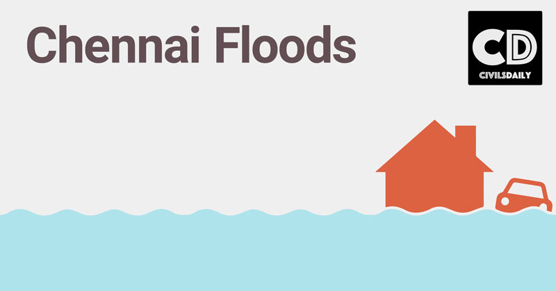
Chennai floods: Unfolding the real cause
Chennai witnessed its worst rainfall in 100 years. Let’s take a look at what are the main causes, it’s impact and possible ways forward to achieve [long and short term targets]
What exactly happened that wrecked a havoc in Chennai?
- The catastrophic flooding in Chennai is the result of the heaviest rain in several decades.
- This forced authorities to release a massive 30,000 cusecs from the Chembarambakkam reservoir into the Adyar river over two days. Causing it to flood its banks and submerge neighbourhoods on both sides.
- It did not help that the Adyar stream is not very deep or wide, and its banks have been heavily encroached upon over the years.
- Similar flooding triggers were in action at Poondi and Puzhal reservoirs, and the Cooum river that winds its way through the city.
- So, unusually heavy rain has exposed the city’s broken urban planning, revealed its stolen natural waterways, and exposed its tolerance of illegal construction.
3 important Geo-climatic factors for heavy rain in 100 years –
- Strong el-nino
- Upper Air divergence
- High moisture content
How does a strong El-nino affect Chennai?
- The summer (southwest) monsoon is adversely affected, while the northeast monsoon or the winter monsoon is favourably affected.
- In mid-November, the sea surface temperature in the central tropical Pacific was 3 degrees Celsius warmer than normal, the largest positive deviation in recorded history.
- To officially beat the 1997-98 El Niño as history’s worst, sea surface temperatures must stay at these levels for three months.
How does inefficient urban planning causes floods?
- 1.5 lakh Illegal construction
- Chocking of water exits
- Badly planned or unimplemented projects
But, what was wrong with the Urban planning?
- Chennai is located in a relatively flat area, hence it depends on natural water bodies, canals and rivers to drain the heavy water runoff during rains.
- Its drainage and stormwater network, which is absent in many places, is inadequate even to convey water during moderate rains.
- As a result, the city has a high exceedance flow (excess water that cannot be drained through the drainage system).
- It often inundates neighbourhoods, particularly those in the suburbs, which are built in low-lying areas and poor roads. This scenario was foreseeable.

Let’s get into some details of unplanned Urban Space
- Today, Chennai has a host of expensive infrastructure aimed at ushering in a “Make in Chennai” boom, a brand-new (though leaky) airport built on the floodplains of the River Adyar.
- A sprawling bus terminal in flood-prone Koyambedu, a Mass Rapid Transit System constructed almost wholly over the Buckingham Canal and the Pallikaranai marshlands.
- An IT corridor and a Knowledge Corridor consisting of engineering colleges constructed on waterbodies, and automobile and telecom SEZs and gated residential areas built on important drainage courses and catchments.
- So, fact remains that the mindless development of Chennai over the last 2 decades, the filling up of lowlands and choking of stormwater drains and other exits for water has played a major part in the escalation of the crisis.
Way forward : Lessons from International Practices
First task : To enhance Preventive measures
- It can learn a lesson or two from cities in Japan, Malaysia and Europe.
- Well-prepared cities have mapped flood zones.
- By combining field surveys, historical records, satellite imagery and infrastructure assessment, they have identified vulnerable areas.
- Such maps and data are shared with citizens, which help them understand the status of their neighbourhoods and decide where to move or buy new homes.
- More importantly, this data is used to regulate development.
- The United Nations Office for Disaster Risk Reduction has collated data spanning 3 decades, starting from the 1980s, for various places in Tamil Nadu including Chennai.
- The city corporation can quickly build on it.
Second task : To enhance Mitigation
- Kuala Lumpur and Tokyo have built extensive water discharge tunnels to divert and store floodwater. This reduces the volume of water that washes the city.
- Tokyo has one of the largest underground tunnels, running to a length 6.5 km, and the tank can hold 6,70,000 cubic metre of diverted water, which is later pumped into safe watercourses using turbines.
- Canals such as the Veerangal Odai, which connected Adambakkam lake with Pallikaranai marsh in the suburbs, have almost disappeared. Reclaiming these water bodies is critical.
- The city should also explore, as many others have done, the possibility of designing highways to conduct runoff water.
- All this would warrant a thorough review of its urban engineering.
Third task : To enhance Response measures
- In the first week following the heavy rains, ground reports reveal that the government response was inadequate and uncoordinated.
- The spirited effort of citizens propelled rescue efforts, without which the damages would have been more severe.
- As cities increasingly face natural hazards and terrorist attacks, they are investing in setting operation centres for early warning and rescue work.
- For example, Rio de Janeiro has spent $14 million and created a real-time monitoring centre of infrastructure and traffic flows.
- The recent experience clearly shows the need for early warning and dissemination of reliable information about floods and rescue.
- Improved governance and non-interference of political parties in relief measures are critical.
Can you ponder on any long or short term solutions or any way ahead?
Let us know, as UPSC is fond of asking such solution based questions in Mains!
Published with inputs from Arun