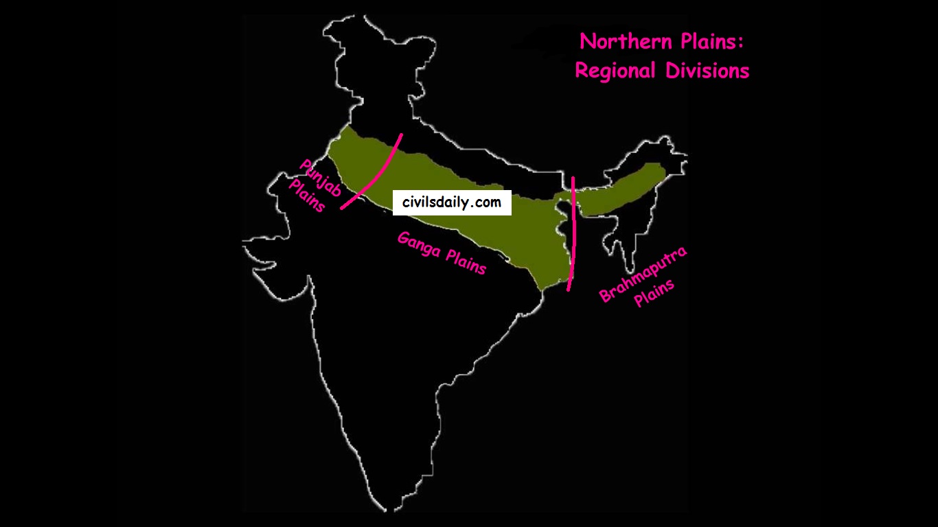
- Punjab Plains:
- The Punjab plains form the western part of the northern plain.
- In the east, the Delhi-Aravalli ridge separates it from the Ganga plains.
- This is formed by the Indus and its tributaries; like Jhelum, Chenab, Ravi, Beas and Sutlej. A major portion of these plains is in Pakistan.
- It is divided into many Doabs (do-“two” + ab- “water or river” = “a region or land lying between and reaching to the meeting of the two rivers”).
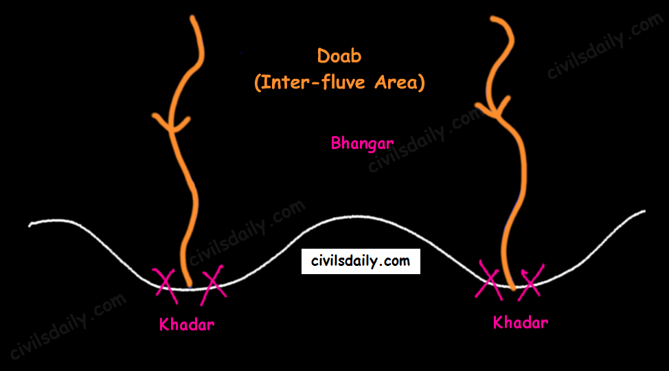
Khadar and Bhangar - Important features:
- Khadar rich flood plains known as ‘Betlands’ or ‘Bets’.
- The rivers in Punjab-Haryana plains have broad flood plains of Khadar flanked by bluffs, locally known as Dhayas.
- The northern part of this plane adjoining the Shivalik hills has been heavily eroded by numerous streams, which are called Chhos.
- The southwestern parts, especially the Hisar district is sandy and characterized by shifting sand-dunes.
- Ganga Plains:
- The Ganga plains lie between the Yamuna catchment in the west to the Bangladesh border in the East.
- The lower Ganga plain has been formed by the downwarping of a part of the Peninsular India between Rajmahal hills and the Meghalaya plateau and subsequent sedimentation by the Ganga and Brahmaputra rivers.
- The main topographical variations in these plains include Bhabar, Tarai, Bhangar, Khadar, levees, abandoned courses etc.
- Almost all the rivers keep on shifting their courses making this area prone to frequent floods. The Kosi river is very notorious in this respect. It has long been called the ‘Sorrow of Bihar’.
- The northern states, Haryana, Delhi, UP, Bihar, part of Jharkhand and West Bengal in the east lie in the Ganga plains.
- The Ganga-Brahmaputra delta: the largest delta in the world. A Large part of the coastal delta is covered tidal forests called Sunderbans. Sunderbans, the largest mangrove swamp in the world gets its name from the Sundari tree which grows well in marshland. It is home to the Royal Tiger and crocodiles.
- Brahmaputra Plains:
- This plain forms the eastern part of the northern plain and lies in Assam.
- Its western boundary is formed by the Indo-Bangladesh border as well as the boundary of the lower Ganga Plain. Its eastern boundary is formed by Purvanchal hills.
- The region is surrounded by high mountains on all sides, except on the west.
- The whole length of the plain is traversed by the Brahmaputra.
- The Brahmaputra plains are known for their riverine islands (due to the low gradient of the region) and sand bars.
- The innumerable tributaries of the Brahmaputra river coming from the north form a number of alluvial fans. Consequently, the tributaries branch out in many channels giving birth to river meandering leading to the formation of bill and ox-bow lakes.
- There are large marshy tracts in this area. The alluvial fans formed by the coarse alluvial debris have led to the formation of terai or semi-terai conditions.
Significance of this region:
- The plains constitute less than one-third of the total area of the country but support over 40 percent of the total population of the country.
- Fertile alluvial soils, flat surface, slow moving perennial rivers and favourable climate facilitate an intense agricultural activity.
- The extensive use of irrigation has made Punjab, Haryana and western part of Uttar Pradesh the granary of India (Prairies are called the granaries of the world).
- Cultural tourism: Several sacred places and centres of pilgrimage are situated in these plains e.g. Haridwar, Amritsar, Varanasi, Allahabad, Bodh Gaya etc.
- The sedimentary rocks of plains have petroleum and natural gas deposits.
- The rivers here have very gentle gradients which make them navigable over long distances.
Now that we are done with this part, let’s try to attempt some questions from the past UPSC examinations:
Prelims:
2000
Question: Assertion (A): The frequency of floods in North Indian plains has increased during the last couple of decades.
Reason(R): There has been reduction in the depth of river valleys due to deposition of silt.
Ans. A (Both A and B are true and R is the correct explanation of A)
Question: Assertion (A): Ganga plain is the most densely populated part of India.
Reason(R): Ganga is the most harnessed river of India.
Ans. C (A is true but R is false)
Mains:
Question: Write a short note on Tarai region. (2008/2marks)


very nice info , thanks
very nice info, thanks