Why in the News
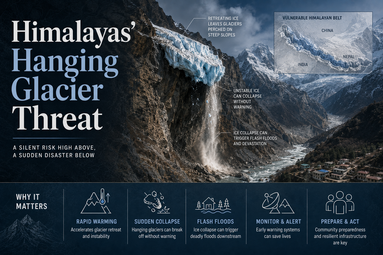
A Nature study identified 219 hanging glaciers in the Alaknanda basin, highlighting rising Himalayan flood risks as glacier instability assessments remain limited despite repeated major incidents.
What is a hanging glacier?
- A perched ice mass: It is ice sitting on a steep slope in a position from which it can detach as a mass rather than melt away in place.
- Instability is defined by velocity: An unstable glacier is one whose velocity may change by an order of magnitude or more over a comparatively short period.
- The instability redistributes the ice: That change redistributes ice across the glacier, accompanied by geometric, structural and tectonic shifts, and the redistribution is what produces a hanging glacier on a steep slope.
- Detachment starts a chain rather than an event: A break-off can trigger secondary hazards such as a glacial lake outburst flood, where a lake dammed by loose moraine debris is breached and releases its water downstream.
What did the Alaknanda inventory actually measure?
- 219 hanging glaciers in one basin: The study identified that number across the Alaknanda basin of the Garhwal Himalaya.
- The unstable ice clusters upstream: Nearly a third of it is concentrated in the Upper Alaknanda basin.
- The inventory carries area and volume: The glaciers cover 71.7 ± 3.5 sq km with an estimated ice volume of 2.39 ± 0.42 cubic km, including 0.74 ± 0.14 cubic km of hanging ice mass.
- The named driver is warming and variability: Himalayan glaciers are increasingly exhibiting geometric and dynamic instability owing to rapid warming and climate variability.
- The method is new to this range: Hanging glaciers have been studied extensively in the Alps, and basin scale assessments in the Himalaya remain limited.
- The work is Indian institutional: It was carried out by researchers at the School of Earth, Ocean and Climate Sciences at the Indian Institute of Technology Bhubaneswar and the Divecha Centre for Climate Change at the Indian Institute of Science, Bengaluru.
What would a break-off do in the Badrinath and Mana sector?
- Simulated avalanche flows exceed 50 metres in height: The study’s simulations place flows above that height in that sector of Uttarakhand.
- Settlements sit directly in the path: A severe event on that scale would swallow major settlements and infrastructure.
- The exposed population is seasonal as well as resident: Badrinath is one of the Char Dham shrines and Mana sits at the head of the same route, so footfall peaks in the months when the slopes are least stable.
Why is exposure rising faster than the ice is failing?
- Built exposure more than doubles by 2030: Buildings and infrastructure land area at risk in the basin is projected to be 120 per cent higher in 2030 than in 2000.
- The exposed population rises by 17 per cent: The number of people living in those at-risk areas is projected to surge by that share.
- Identification and monitoring are the first response: Systematic identification and monitoring of high-risk glaciers is what the study calls for to reduce downstream hazard.
- Land-use planning is the second half of it: Risk-informed land-use planning has to run alongside monitoring in mountain regions.
- Monitoring is cheap against the loss it prevents: Much greater funding of monitoring programmes is required, and that funding is small compared with the cost of lost lives and livelihoods, per the Director of the International Cryosphere Climate Initiative.
What separated Chamoli from Blatten?
- Chamoli killed over 200 people in 2021: A massive wall of ice and rock collapsed into the Rishiganga valley, destroying hydropower plants and sweeping away bridges.
- Blatten killed one person: A large ice-rock avalanche buried most of that Swiss village four years later.
- The difference was preparedness, not luck: A second study published in Nature in March attributes the survival to preparedness, monitoring and rapid response.
- Precursory signs were acted on: Authorities and residents in Blatten responded to signs of slope instability, which enabled a timely evacuation.
- The hazards are cascading rather than isolated: These events should be treated as cascading hazards rather than as separate landslides, avalanches or floods, per the head of planetary sciences at the University of Aberdeen’s School of Geosciences.
- Attribution should not be rushed during the emergency: Establishing which process caused an event should not be hurried during the immediate emergency response.
Challenges to monitoring hanging glaciers in the Himalaya
- The instrument network is sparse and seasonal: High altitude weather and movement sensors are few and go offline through winter, so precursor slope movement is unobserved in the months it develops. Eg. Glacier mass balance in India is measured on a handful of benchmark glaciers such as Gangotri and Chhota Shigri rather than basin wide.
The Fix: Fund a permanently telemetered high altitude sensor network, with satellite radar interferometry as the standing backup layer. - A hazard map does not bind a builder: Slope and glacier instability assessments are advisory inputs, so they do not stop an approval for a road or a power project below an unstable face. Eg. Construction continued in the Rishiganga and Dhauliganga valleys after repeated warnings about instability in those catchments.
The Fix: Make valley level hazard zonation a statutory input to environmental clearance for any project above a set altitude. - Warning does not reach the valley floor: An identified hazard produces a scientific alert rather than a siren in the settlement that would be hit. Eg. Workers at downstream barrage sites in the 2021 Chamoli event had no alert before the flood wave arrived.
The Fix: Install siren based valley warning tied to the sensor network, with a mandated evacuation drill calendar for every downstream settlement and project. - Pilgrim traffic concentrates people in the exposed months: The season when the route is open is the season when avalanche and outburst risk is highest, so peak exposure and peak hazard coincide. Eg. Char Dham footfall peaks between May and October, which is also the melt and monsoon window.
The Fix: Route daily pilgrim entry against a published hazard advisory rather than against a fixed carrying capacity number alone.
Conclusion
The hanging glacier threat shows that Himalayan disaster risk is becoming a race between environmental instability and expanding human exposure. Continuous monitoring, enforceable hazard zoning, real-time warnings and evacuation preparedness can turn scientific knowledge into lives saved and resilient mountain development.
Back2Basics: Alaknanda River
- Source: It rises at the Satopanth and Bhagirath Kharak glaciers in the Chamoli district of Uttarakhand.
- Status in the Ganga system: It is one of the two headstreams of the Ganga, and it carries the larger discharge of the two at their meeting point.
- Panch Prayag: Its five confluences are Vishnuprayag, Nandprayag, Karnaprayag, Rudraprayag and Devprayag.
- Formation of the Ganga: It joins the Bhagirathi at Devprayag, and the river takes the name Ganga from that point onward.
[2020, GS1, 10 marks] How will the melting of Himalayan glaciers have a far-reaching impact on the water resources of India?
