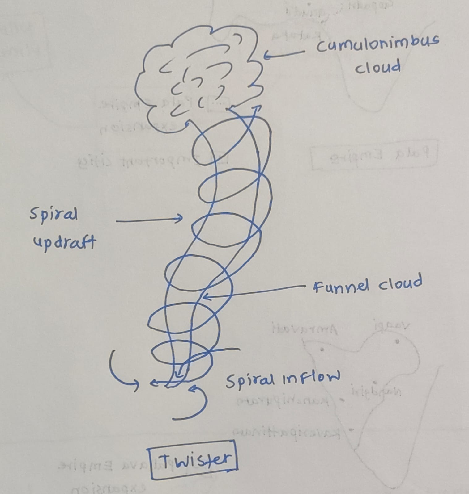
Key Features of a Twister
Funnel-shaped cloud – Visible condensation funnel extending downward.
Very high wind speeds – Can exceed 300 km/h (EF5 category).
Short duration – Typically lasts minutes but causes intense damage.
Narrow path of destruction – Damage track often a few hundred meters wide.
Associated with supercell thunderstorms
Low pressure core – Central pressure drop causes debris uplift.
Occurs mostly in mid-latitudes – Especially continental interiors.
Formation Process of a Twister
Warm, moist air near the surface rises rapidly.
Cold, dry air above descends below.
Wind shear develops – Change in wind speed and direction with height.
Horizontal rotation forms in the lower atmosphere.
Updraft tilts rotation vertically, forming a mesocyclone.
Supercell thunderstorm develops.
A funnel cloud forms and extends to ground, becoming a tornado.
Reasons for Majority of Twisters Around the Gulf of Mexico
Continuous supply of warm, moist air – Gulf waters average 25-30°C.
Collision of contrasting air masses – Warm Gulf air meets cold Canadian air over central U.S.
No Latitudinal Barriers- Unlike Europe’s Alps, North America has no east-west mountain ranges to block the collision of these contrasting air masses.
Low-Level Jet Streams from the Gulf provide the necessary wind shear to initiate rotation near the ground.
Dryline effect – Dry air from Rockies creates a sharp moisture gradient leading to storm development.
The Great Plains and Mississippi Valley offer a smooth “runway” that prevents the disruption of rotating storm structures.
Proximity to Tornado Alley – Central U.S. records ~75% of world’s tornadoes.
The high frequency of thunderstorms in the gulf region creates tornados. 83% of Gulf hurricanes since 1950 have produced at least one tornado.
As climate variability enhances the frequency and intensity of tornados, advanced radar detection and robust disaster preparedness is needed for disaster risk reduction.