India’s coastline, extending approximately 7,517 km (with high-resolution mapping in 2026 citing nearly 11,100 km including islands), is the backbone of the nation’s Blue Economy.
Natural Resource Potential of Indian Coastline
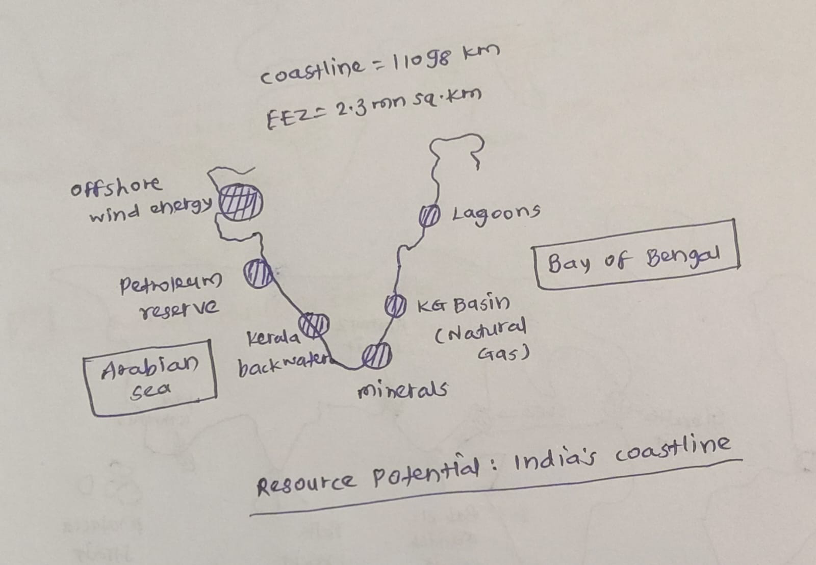
Deep-Sea Mineral Wealth-The Exclusive Economic Zone (EEZ) contains vast deposits of polymetallic nodules and crusts rich in cobalt, nickel, and manganese.
Hydrocarbons-Offshore basins are a source of oil and gas. Eg- The Mumbai High and Krishna-Godavari (KG) Basin.
Beach Sand Minerals-Eg- The Monazite and Ilmenite sands of Kerala and Odisha are critical for India’s nuclear energy and aerospace programs.
Offshore Renewable Energy-The wind speeds along the western and southern coasts offer a potential of over 70 GW for offshore wind energy. Eg- Gujarat and Tamil Nadu.
Tidal and Wave Energy-Eg- The Gulf of Khambhat and Gulf of Kutch.
Salt Production-India is the 3rd largest salt producer globally, with coastal topography favoring extensive salt pans.
Marine Biotechnology (Blue Carbon)-Coastal ecosystems like mangroves and seagrass act as carbon sinks and sources of bioactive compounds.
Coastal Tourism – Eg- Goa beaches and Kerala backwaters.
Mangroves and Coastal Ecosystems – Support fisheries, carbon sequestration and shoreline protection. Eg- Sundarbans mangrove forests.
Status of Natural Hazard Preparedness
Advanced Early Warning Systems (EWS)-Eg- The IMD’s latest models in 2026 provide hyper-local cyclone alerts with a lead time of 5-7 days.
The Indian Tsunami Early Warning Centre (ITEWC) at INCOIS provides real-time alerts to the entire Indian Ocean region. Over 100 coastal villages in Odisha have now achieved UNESCO’s “Tsunami Ready” certification.
Bio-Shield Protection-Eg- The MISHTI Scheme (2023-27) has successfully restored nearly 3,000 hectares of mangroves along the East Coast.
Hazard Line Demarcation-The Survey of India (SOI) has integrated this line into the updated Coastal Zone Management Plans (CZMP) for all maritime states.
Last-Mile Connectivity-Eg- The NavIC-based GAGAN system provides emergency alerts to deep-sea fishermen even beyond cellular range.
Integrated coastal zone management and Coastal regulation zones to regulate development activities.
Cyclone-resistant infrastructure – Eg- Multipurpose cyclone shelters in Odisha and Andhra Pradesh.
Challenges
Nearly 33% of India’s coastline is experiencing active erosion
Sea-Level Rise (SLR) threatens to submerge low-lying deltas and “sinking” cities. Eg- Mumbai.
Pollution and Eutrophication-Runoff from coastal cities and farms creates “dead zones” in the ocean.
Lack of last mile connectivity
Increasing frequency and intensity of Cyclones.
Way Forward
Integrated Coastal Zone Management (ICZMP)-Focus on holistic “Ridge-to-Reef” planning rather than localized seawalls.
Innovative Financing-Eg- Parametric Insurance for faster post-disaster recovery.
Green Port Transition-Incentivize the “Harit Sagar” guidelines to reduce the carbon footprint of maritime trade.
Blue Carbon Economy-Eg- Integrating MISHTI scheme outcomes with the National Carbon Market (NCM).
Mandatory enforcement of the National Building Code (2016) for all new coastal constructions.
Technology-Led Monitoring-Use AI, IoT sensors, and drones for 24/7 surveillance of the “Hazard Line.”
These measures are essential to ensure that India’s vast coastline becomes a source of long-term prosperity rather than vulnerability.