Mains Ready By December. Smash Mains & Smash PYQ Admissions Open

GS Paper: GS3-18.Conservation, Environmental Pollution and Degradation, Environmental Impact Assessment.

  • Delhi announces vehicle curbs, construction bans, 50% WFH to tackle winter pollution

    Why in the News

    Delhi’s winter pollution response has moved from curbs imposed after the air turns severe to a permanent, pre-announced action plan for the whole season. A meeting chaired by the Union Environment Minister with the Delhi Chief Minister and the Commission for Air Quality Management (CAQM) fixed curbs on vehicles, offices, construction and industry in advance of the annual winter spike.

    What is the winter action plan?

    1. What it is: A fixed, season-long set of pollution curbs announced before winter, like a timetable rather than an alarm sounded only after the air turns toxic.
    2. Why it is needed: As the southwest monsoon withdraws, cooler and stiller air traps dust and exhaust near the ground, so the National Capital Region (NCR) sees a sharp rise in pollution.
    3. Implementing bodies: The Union Environment Ministry, the Delhi Government and CAQM, the NCR’s statutory air quality body, run the plan together.
    4. Airshed approach: Delhi will coordinate action with NCR cities as one airshed, meaning the shared body of air a region breathes, because pollution crosses city limits.
    5. The takeaway: Pollution control becomes a standing seasonal routine, not a scramble after air quality turns severe.

    How will vehicles be curbed?

    1. Entry restriction: From 1 November to 31 January, vehicles registered outside Delhi that do not meet BS-VI (Bharat Stage VI, the strictest national emission standard) will be kept out.
    2. No PUCC, No Fuel: Vehicles without a valid Pollution Under Control Certificate (PUCC) will be denied fuel at all 500 fuel stations. Automatic Number Plate Recognition cameras will check each vehicle.
    3. End-of-life vehicles: Petrol vehicles older than 15 years and diesel vehicles older than 10 years will not be given fuel.
    4. Early campaign: A special awareness and enforcement drive at petrol pumps begins on 1 October.
    5. Parking charges: Charges at authorised parking sites will double, except at facilities of the Delhi Metro Rail Corporation.

    What changes for offices and construction?

    1. Work from home: Government and private offices must keep 50% of their staff working from home during the season.
    2. Staggered timings: Municipal Corporation of Delhi and Delhi Government offices will keep different hours, spreading rush hour traffic.
    3. Full construction ban: All construction and demolition stops from 10 December to 20 January, the peak smog window.
    4. Season-long dust curbs: Dust-generating demolition and outdoor civil construction are prohibited for the whole restriction period.
    5. Deadlines for works: Cement-concrete works are to finish by 31 October and bitumen (road tarring) works by 15 November.

    How will enforcement and monitoring work?

    1. Industrial crackdown: An artificial intelligence (AI) enabled command-and-control centre will drive enforcement against polluting industries. Of 11,271 units surveyed, 2,283 have already been closed or sealed.
    2. Monitoring network: Continuous air quality monitoring stations will rise from 47 to 60, mapping pollution sources more finely.
    3. Field enforcement: 334 enforcement teams will act on local sources, backed by weekly inspections of pollution hotspots.
    4. Citizen participation: Residents can report pollution and use a new citizen suggestions portal. Daily evening Air Quality Index (AQI) bulletins will inform the public.

    Challenges

    1. Pollution from outside: Delhi’s rules cannot reach farm fires and industry in neighbouring States. Eg. Stubble burning in Punjab and Haryana.
    2. Fuel-ban leakage: Vehicles refused fuel in Delhi can refill at pumps in NCR towns just across the border.
    3. Workers’ livelihoods: A six-week halt on building work cuts off daily wages for construction labourers.

    Way Forward

    1. Airshed-wide rules: CAQM should extend the same vehicle and fuel rules to NCR towns in Haryana, Uttar Pradesh and Rajasthan.
    2. Wage support: The Delhi Government should pay registered construction workers during the ban from the construction workers’ welfare cess fund, a levy collected on building work for workers’ welfare.
    3. Shared plate data: Link number plate recognition data across NCR fuel stations, so a refused vehicle cannot refuel next door.

    Conclusion

    Delhi has turned its winter response into a pre-announced, season-long regime rather than a reaction to smog. Its real test is whether NCR neighbours adopt matching rules, since the airshed does not stop at Delhi’s border.

    Back2Basics: Commission for Air Quality Management (CAQM)

    1. Legal basis: A statutory body under the Commission for Air Quality Management in National Capital Region and Adjoining Areas Act, 2021, first set up by ordinance in 2020.
    2. Replaced EPCA: It replaced the Supreme Court-mandated Environment Pollution (Prevention and Control) Authority (EPCA), set up in 1998.
    3. Jurisdiction: The NCR and adjoining areas of Punjab, Haryana, Rajasthan and Uttar Pradesh.
    4. Powers: It issues binding directions on air pollution and enforces the Graded Response Action Plan (GRAP), the stage-wise curbs tied to AQI levels.

    Matching Previous Year Question

    “[2025, GS3, 10 marks] What is Carbon Capture, Utilization and Storage (CCUS)? What is the potential role of CCUS in tackling climate change?”

  • From Waste to Purpose: Indian Cities and Plastic Waste Management

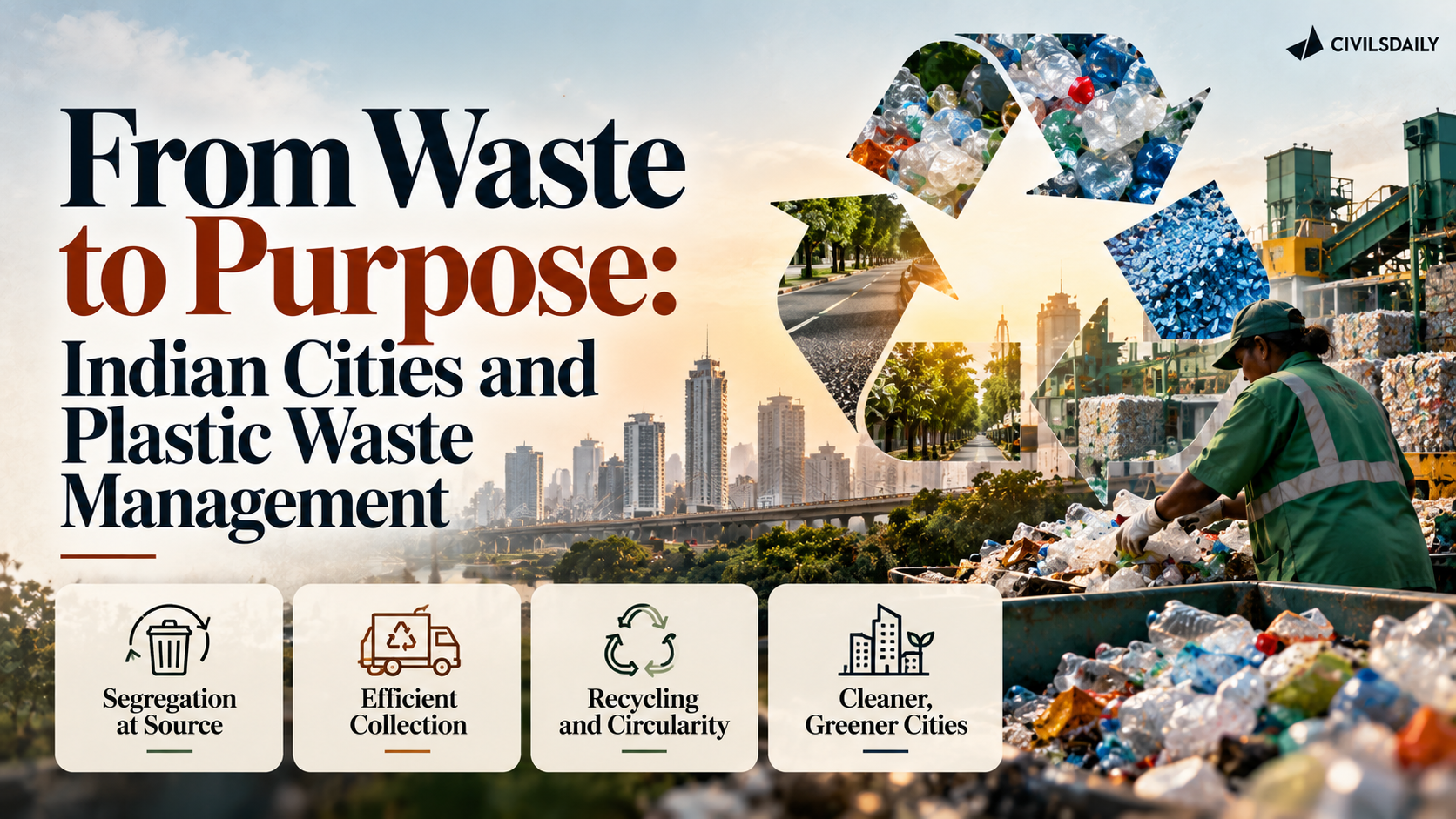
    From Waste to Purpose: Indian Cities and Plastic Waste Management

    Why in the News?

    • Indian cities are adopting local initiatives to reduce, reuse, return, recover and recreate plastic waste.
    • The Swachh Bharat Mission (SBM), launched on 2 October 2014, has strengthened waste collection, segregation and recovery systems. Identified single-use plastic items have been prohibited since 1 July 2022.

    Key Highlights

    • Focus: Plastic waste reduction, reuse, recovery and circular economy.
    • Trichy: Market-level campaign to reduce single-use plastic.
    • Vita, Maharashtra: Thaila ATMs provide reusable cotton bags.
    • Andaman & Nicobar Islands: Buy-back system for used milk pouches.
    • Bengaluru: Material Recovery Facility under UNDP Project Prithvi.
    • Patiala: Multilayered Plastic (MLP) converted into durable chipboards.
    • SBM focuses on source segregation, door-to-door collection, scientific waste processing and material recovery.

    Reduce – Trichy Market Initiative

    • Three farmers’ markets covered:
      • Tennur
      • K.K. Nagar
      • Woraiyur
    • 220 vendors engaged.
    • ThunippaiThiruvizhai or Cloth-Bag Festival promoted reusable bags.
    • Single-use plastic avoided:
      • Tennur: 2,200 kg in one year
      • K.K. Nagar: 620 kg in four months
      • Woraiyur: 300 kg in six months

    Reuse – Thaila ATM

    • Location: Vita town, Maharashtra.
    • Five Thaila ATMs installed at crowded locations.
    • Provide reusable cotton bags through a vending-machine model.
    • Based on Global System for Mobile Communications (GSM) technology for remote stock monitoring.
    • Local Self-Help Groups (SHGs) stitch the bags.
    • Around 6,000 bags sold.
    • Weekly market recorded nearly 200 bags in a day.
    • In Indapur, authorities seized 25 kg plastic bags and imposed a ₹90,000 fine.

    Return – Milk Pouch Buy-back

    • Location: Andaman and Nicobar Islands.
    • Used plastic milk pouches exchanged for rewards such as:
      • Fresh milk
      • Discounts
    • Implemented with ANIIDCO and SVPMC.
    • By November 2024:
      • 17,600 milk pouches collected.
      • 352 litres of milk provided as rewards.
    • Uses incentives to encourage responsible disposal and recycling.

    Recover – Bengaluru

    • UNDP Project Prithvi supports plastic waste recovery.
    • Swachhata Kendra, a Material Recovery Facility (MRF), established in 2019.
    • Centre sorts plastic and processes it through:
      • Shredding
      • Baling
    • Processed material becomes suitable for recyclers.
    • Provided employment to 76 Safai Saathis during the COVID-19 pandemic.
    • Processed plastic used for:
      • Roads
      • Agricultural water pipes
      • Furniture
    • Demonstrates the circular economy by returning waste into productive use.

    Recreate – Multilayered Plastics

    • Multilayered Plastics (MLPs) combine materials such as:
      • Plastic
      • Paper
      • Aluminium
    • Their multiple layers make separation and recycling difficult.
    • Patiala uses a Plastic Recycling Facility (PRF).
    • Process:
      • Sorting → cleaning → shredding → hot/cold pressing
    • Produces chipboards, an alternative to plywood.
    • Applications include:
      • Furniture
      • Roofing
      • Temporary shelters
    • Capacity: 10 tonnes/day
    • Produces 75-100 chipboards.
    • Supports circular economy and reduces landfill waste.

    Prelims Quick Revision

    • SBM: Launched on 2 October 2014.
    • Identified single-use plastic items prohibited from 1 July 2022.
    • Trichy: 220 vendors across three farmers’ markets engaged in plastic reduction.
    • Vita, Maharashtra: Five Thaila ATMs provide reusable cotton bags.
    • Andaman & Nicobar: 17,600 milk pouches collected by November 2024.
    • Bengaluru: Swachhata Kendra MRF established in 2019 under Project Prithvi.
    • Patiala: MLP waste converted into chipboards.
    • The five-part plastic approach highlighted is reduce, reuse, return, recover and recreate.

    UPSC Prelims Trap

    • MRF vs PRF: The Bengaluru initiative involves a Material Recovery Facility, while Patiala uses a Plastic Recycling Facility.
    • MLP: Multilayered plastics are difficult to recycle because they combine multiple material layers.
    • Thaila ATM: It provides reusable cotton bags, not plastic alternatives.
    • Circular economy: The Bengaluru and Patiala examples demonstrate conversion of discarded plastic into new productive materials/products, rather than simply disposing of it.
  • Zones of worry

    Why in the News

    The seventh draft notification for an Ecologically Sensitive Area (ESA) in the Kerala stretch of the Western Ghats proposes to bring 9,993.7 sq km across 131 villages under the regime. The Kerala government will reiterate a counter position confining the area to 8,590.69 sq km across 98 villages, excluding human habitations and agricultural land. The first draft, based on the report of the High Level Working Group, covered 123 revenue villages and was never finalised, and six further drafts have followed without settling the dispute. The window for filing objections to the seventh draft closed on 25 September. The disagreement is no longer about whether the Ghats need protection. It is about whether an ecologically sensitive line is drawn around ecology or around land use.

    What does the Ecologically Sensitive Area regime restrict?

    1. Purpose of the designation: Those framing the proposals state that the notification is intended to regulate activities that can damage fragile ecosystems, rather than to remove human presence from the landscape.
    2. What the draft prohibits: Mining, quarrying and sand mining are barred in the notified areas.
    3. What the draft leaves untouched: There are no restrictions on the repair, extension or renovation of existing residential houses, or on changes in ownership of land.
    4. The basis of the classification: The zonation rests on ecological sensitivity, the approach proposed by the Western Ghats Ecology Expert Panel.

    How far apart are the Centre’s draft and Kerala’s counter position?

    1. The area proposed: The seventh draft, issued on 27 July, covers 9,993.7 sq km across 131 villages in Kerala.
    2. The forest and non forest split: Of that area, 9,107 sq km is forest and 886.7 sq km is non forest.
    3. The State’s figure: Kerala will press for 8,590.69 sq km across 98 villages, with the ecologically sensitive areas confined to forests and leased forest plantations.
    4. The principle behind the State’s figure: Kerala argues that inhabited and cultivated landscapes should not be treated in the same manner as forests and other ecologically fragile areas. The demand reflects a position held by successive State governments across the political divide.

    Why do high range residents read the notification as a threat to their land?

    1. Origin of the settlements: The Grow More Food campaign of the erstwhile Travancore administration in the early 1940s encouraged migration into the high ranges. Families moved in to farm, and habitations turned large stretches of the mountains into agricultural landscapes.
    2. Damage done by uncertainty rather than by rules: After 2013 people began cutting down trees for fear they would not be able to use their land later. Farmlands were abandoned and land prices fell.
    3. Effects already visible: The Melukavu panchayat president in Kottayam says the issue has affected access to loans and land transactions, and has told on the marriage prospects of young people in the region.
    4. The ecological rationale questioned: The president of the Rubber Producers’ Society at Edamaruku in Kottayam points out that the nearest forests lie about 30 km to the north and about 50 km to the south of the village proposed for inclusion.
    5. The jurisdictional fear: The chairperson of the Kerala Independent Farmers Association argues that inclusion takes a holding out of the jurisdiction of the State Revenue department and places it with the Central regime, so residents would have to seek Central clearance for almost every activity. The proposal in that reading creates two categories of residents, those inside the ESAs and those outside.

    How did the Gadgil report and the Kasturirangan review set the terms of the dispute?

    1. The original proposal: The Western Ghats Ecology Expert Panel, chaired by Madhav Gadgil, proposed a comprehensive zonation of the Ghats based on ecological sensitivity.
    2. How it was received in the high ranges: The report generated fears that agriculture and development would be restricted, and that existing settlements could eventually face displacement.
    3. The review that followed: The Centre appointed a High Level Working Group chaired by K. Kasturirangan to review the Gadgil recommendations. Environmentalists hold that the group watered down the restrictions.
    4. The first draft and the stalemate after it: The first draft notification, based on the High Level Working Group report, proposed 123 revenue villages in Kerala, mainly in Idukki and Wayanad. Protests prevented a final notification and six more drafts followed.
    5. The State’s own committee: A committee appointed by the State government under Oommen V. Oommen recommended excluding inhabited areas, plantations and agricultural lands through physical verification and field surveys. It also proposed re fixing the ecologically sensitive areas using cadastral maps, which are plot level land records, approved by the Kerala State Biodiversity Board.

    What have conservationists and the panel’s own members said in reply?

    1. The fears called propaganda: The president of the Wayanad Prakruthi Samrakshana Samiti says apprehensions of restrictions on building houses and digging wells are baseless political propaganda pushed by vested interest groups.
    2. Existing law already protects forests: The same view holds that a host of laws, including the Forest Act and the Wild Life (Protection) Act, 1972, already protect forests, so classifying forest areas as ESAs adds nothing.
    3. What the Gadgil report asked for: A member of the panel states that the report recommended a shift to organic farming and never opposed farming. It opposed the pollution of water resources through chemical pesticides, called for non polluting industries, and placed no restrictions on local infrastructure development.
    4. Who was to decide: The panel’s approach was to give local communities a decisive role in determining how development should proceed in ecologically sensitive landscapes, in place of a blanket ban on local activity.
    5. The latest draft already concedes ground: The chairman of the State appointed committee notes that the current draft has excluded farmlands and plantations from the ESAs, which leaves the objection directed at fragile rocky land the high range communities do not own.

    How has the dispute reshaped mobilisation and politics in the high ranges?

    1. Idukki as the epicentre: Fifty one villages in Idukki figure in the latest draft, and all the grama sabhas there have passed resolutions urging the Union and State governments to exclude their villages from the regime.
    2. An organised church led agitation: The Idukki Diocese of the Syro Malabar Church has been at the forefront of the anti ESA agitation since 2013, and the High Range Samrakshana Samiti under its patronage has organised protests across the high ranges. The Church’s position is that human habitations and farmlands must be fully excluded.
    3. The electoral consequence: In the 2014 Lok Sabha election the Samiti’s legal adviser, standing as an Independent backed by the Left Democratic Front (LDF), won the Idukki seat, long considered a Congress citadel.
    4. The heritage listing drawn in: The State vice president of the All India Kisan Sabha, the farmers’ wing of the Communist Party of India, has demanded that the Western Ghats be removed from UNESCO World Heritage Site status, which requires more stringent conservation. The counter cited is that UNESCO guidelines themselves require exclusion of an area where a project disrupts the livelihood or daily life of the local population.

    Can protection and settlement be mapped on the same hills?

    1. The question conservationists are asking: For conservationists the central issue is whether human activity in the Western Ghats can continue without weakening ecological safeguards.
    2. The question residents are asking: For residents the distinction between forest and settlement is critical, because their houses, farms and livelihoods are embedded in the same landscape that conservation policy seeks to protect.
    3. The same hills read two ways: The same slopes are treated as a fragile ecological system requiring protection and as a lived landscape of farms, homes and communities built over generations. The disagreement has simmered through more than a decade of committees, consultations and draft notifications.

    Conclusion

    Seven drafts have narrowed the area and settled nothing. The Centre and the State are not arguing about protection; they are arguing about the unit the line is drawn on, and each successive draft has restated that disagreement rather than resolved it. With the objection window now shut, the decision point is whether the Centre finalises the notification on its own mapping or reopens the plot level verification the State’s committee asked for.

    Matching Previous Year Question

    “[2016] Gadgil Committee Report’ and ‘Kasturirangan Committee Report’, sometimes seen in the news, are related to (a) constitutional reforms (b) Ganga Action Plan (c) linking of rivers (d) protection of Western Ghats Answer: (d)”

  • New cat in habitat, and some glimmer of hope

    Why in the News

    A new species of wild cat, Leopardus tilcayo, has been described in Bolivia, the first feline species identified in a hundred years. A new penguin species, also the first in a century, has been described on a group of subantarctic islands, and a new snake species has been described in New Guinea. A 2025 University of Arizona study records that 15 per cent of all known species were described in the last 20 years. The tension the item raises is that species are being found faster than ever at the same moment that loss of species dominates public attention, and that most of these discoveries reach no audience beyond the scientific and conservation communities.

    What has actually been described?

    1. A new wild cat: Leopardus tilcayo has been described in Bolivia. It is the first discovery of a feline species in a hundred years, which is why it drew the loudest response of the three.
    2. A new penguin: A new penguin species has been described on a group of subantarctic islands, and it too is the first in its group in a century.
    3. A new snake: A new snake species has been described in New Guinea and named after the guitarist Slash.
    4. What a description is: A species is described when a specimen is formally published with a diagnosis separating it from every named relative and a binomial name. Recognition of the animal by local communities usually long predates the formal description.

    Why is the rate of description rising?

    1. The measured pace: The 2025 University of Arizona study finds that 15 per cent of all known species were described in the last 20 years, so the quest to identify every species has accelerated rather than exhausted itself.
    2. Genetic tools separate look alike populations: DNA sequencing distinguishes populations that field observation had grouped as one species, which converts a known animal into two or more named ones.
    3. Survey effort has widened: Camera traps, acoustic recorders and systematic surveys in regions that were never surveyed intensively produce records that no expedition method previously returned.
    4. Museum collections are being re examined: Specimens collected decades ago and shelved without close study are now being sequenced, and some are found to belong to undescribed species.

    Why do most of these discoveries go unnoticed?

    1. The preference for the photogenic: Public and media attention follows animals that are visually appealing, which is why a wild cat and a penguin were reported and the invertebrate descriptions of the same period were not.
    2. Attention decides funding: Conservation money follows public interest, so charismatic vertebrates draw project funding while the taxa that carry most of the planet’s species diversity do not.
    3. The scale of what is unrecorded: Most described species are insects and other invertebrates, and the undescribed share of global diversity sits overwhelmingly in those groups rather than among mammals and birds.

    Challenges to protecting newly described species

    1. A name confers no protection: Formal description creates a scientific record, not a legal status, and assessment and listing are separate processes that follow it. Eg. An International Union for Conservation of Nature Red List assessment and a Convention on International Trade in Endangered Species listing are each decided after a species has been named.
      The Fix: Grant an interim protected status on description, lapsing once a formal assessment is completed.
    2. Publicity raises collection pressure: A newly named species with a small known range becomes a target for private collectors and the exotic pet trade, and the published description tells them where to look. Eg. Newly described reptiles and amphibians have appeared in the international pet trade shortly after their descriptions were published.
      The Fix: Withhold precise locality coordinates from published descriptions of small range species and release them only to designated authorities.
    3. Taxonomy has too few working specialists: The number of trained taxonomists able to describe a group has fallen while the backlog of collected specimens has grown. Eg. Specimens from tropical surveys routinely wait years in museum collections before anyone describes them.
      The Fix: Fund standing taxonomy positions tied to national collections and digitise specimen records so that identification is not gated on a single expert.
    4. Splitting one species into several shrinks each unit: When genetic work divides a widespread population into separate species, each resulting species holds a smaller range and a smaller population than the original did. Eg. A taxon once assessed as secure can yield two narrowly distributed species that each qualify as threatened.
      The Fix: Require a conservation reassessment of every resulting species immediately after a taxonomic split, rather than at the next scheduled review.
    5. Habitat is lost faster than it is surveyed: Land conversion in the regions that hold the most undescribed diversity removes populations before anyone records that they existed. Eg. Andean and New Guinean forests, where two of these three species were found, are under conversion and fragmentation pressure.
      The Fix: Protect habitat at the landscape level in high endemism regions rather than species by species after each description.

    Conclusion

    The rate of description and the rate of loss are both rising, and the two are not in tension, because a species can be named and lost within the same decade. What the description of a large mammal after a hundred year gap establishes is that the inventory is far from complete, which undercuts any assumption that conservation is working on a known list. The part that remains unaddressed is the gap between naming a species and protecting it, since nothing in the act of description obliges any state to do anything. What to watch is whether these three species receive conservation assessments and any protected status, and how quickly.

    Matching Previous Year Question

    “No direct PYQ traced in the provided files”

  • World Rhino Day

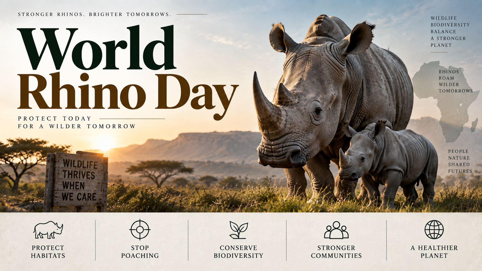
    World Rhino Day

    Why in the News?

    • On World Rhino Day, the Prime Minister highlighted conservation efforts for the greater one-horned rhinoceros and announced the initiation of Project Rhino.
    • The project will provide financial and technical support to rhino range states for species conservation.

    Key Highlights

    • Species: Greater one-horned rhinoceros.
    • Assam: Holds nearly 80% of the world’s rhino population.
    • Kaziranga: Its efforts to combat rhino poaching have been widely appreciated.
    • Rhinos have either returned or are well protected in parts of:
      • Bihar
      • West Bengal
    • Dudhwa, Uttar Pradesh: Successful reintroduction of rhinos highlighted as an important conservation achievement.
    • Project Rhino: Initiated to strengthen species conservation through financial and technical support to range states.

    Project Rhino

    • Provides support for:
      • Rhino protection
      • Habitat management
      • Genetic improvement
      • Understanding population dynamics
    • Focuses on supporting rhino range states.
    • Aims to strengthen active wildlife management and species conservation.

    Rhino Conservation in India

    • Assam: Major stronghold of the world’s greater one-horned rhino population.
    • Kaziranga: Important for rhino protection and anti-poaching efforts.
    • Bihar and West Bengal: Rhino populations have either returned or remain protected in parts of these states.
    • Dudhwa, Uttar Pradesh: Rhino reintroduction has been highlighted as a conservation success.

    Prelims Quick Revision

    • World Rhino Day: Associated with conservation of rhinos.
    • Species highlighted: Greater one-horned rhinoceros.
    • Assam: Nearly 80% of the world’s rhino population.
    • Kaziranga: Major focus on combating rhino poaching.
    • Dudhwa: Successful rhino reintroduction in Uttar Pradesh.
    • Project Rhino: Provides financial and technical support to range states.
    • Key areas under Project Rhino: protection, habitat management, genetic improvement and population dynamics.

    UPSC Prelims Trap

    • Project Rhino in the article is specifically focused on conservation of the greater one-horned rhinoceros.
    • Do not confuse rhino protection with only anti-poaching measures: Project Rhino also covers habitat management, genetic improvement and population dynamics.
    • Dudhwa is associated with rhino reintroduction, while Kaziranga is highlighted for its anti-poaching efforts.
  • Karnataka Houses adopt resolution against report on Western Ghats

    Why in the News

    The Karnataka Legislative Assembly and the Legislative Council have adopted a unanimous resolution urging the Union government to confine the Ecological Sensitive Area (ESA) identified as per the Kasturirangan report on conservation of the Western Ghats to notified forests alone. The resolution follows the Centre’s seventh draft notification on the ESA in the State. It asks that the draft not be finalised for one year. A physical survey of the areas coming under the ESA would be completed in that period. It also asks that the final decision be taken only after the State submits its report and only after detailed discussion between the Centre and the State. The contest is between a delineation drawn from satellite data and a State claim that only a joint survey on the ground can fix which land belongs inside an ecologically protected zone.

    What is the Ecological Sensitive Area proposed for the Western Ghats?

    1. Source of the delineation: The ESA is the area identified for conservation as per the Kasturirangan report on the Western Ghats.
    2. Route of notification: The Centre gives the ESA effect through a draft notification, and the draft issued on 27 July is the seventh in the series.
    3. Extent in Karnataka: That draft covers 20,668 sq km, spread over 1,449 villages across 10 districts of the State.

    What does the resolution ask the Centre to do, and on what terms?

    1. ESA confined to notified forests: The resolution urges the Union government to restrict the ESA to notified forests, leaving other categories of land outside it.
    2. One-year pause on finalisation: The draft notification should not be finalised for the next one year, by when the physical survey would be completed.
    3. State report before any decision: The final decision on the ESA should follow the State’s own report and a detailed discussion between the Centre and the State.

    Why does the State say the delineation is wrong?

    1. Satellite data instead of a ground survey: The resolution alleges the ESA is not accurate, because it was determined from satellite data rather than a joint physical survey by the Forest and Revenue departments.
    2. Scale of the correction sought: The State’s stand on the ESA would reduce the notified area to about 16,000 sq km.
    3. High-level committee: Karnataka would constitute a high-level committee to suggest measures correcting the “lacunae” in the report through appropriate modifications.

    Challenges to the Western Ghats ESA notification

    1. A regime that never reaches finality: Successive draft notifications keep the protective regime provisional, so neither the conservation restriction nor land use certainty actually operates. Eg. The notification now in contention is the seventh draft on the ESA.
      The Fix: Fix a statutory outer date by which a draft must either be notified or withdrawn, so the interim period cannot be extended indefinitely.
    2. Village boundaries decide household livelihoods: The ESA is applied over villages, so an error at a village boundary decides which households face restrictions on what they may do with their land. Eg. The draft covers 1,449 villages across 10 districts of Karnataka.
      The Fix: Publish the village-wise survey numbers proposed for inclusion, so an objection can be filed against a specific parcel rather than against the map as a whole.
    3. Ecologically significant land outside notified forests: Confining the ESA to notified forests leaves out ecologically sensitive stretches that are recorded as revenue or plantation land. Eg. Karnataka’s stand would cut the ESA to roughly three-quarters of the area the Centre proposes.
      The Fix: Retain non-forest ecologically significant stretches under a lighter regulatory category, instead of removing them from the notification altogether.
    4. A resolution carries no legal force: The notifying power sits with the Union government, so a State legislature can only urge rather than alter the instrument. Eg. Both Houses adopted the resolution unanimously and still had to address it to the Centre as a request.
      The Fix: Route the State’s objections through the formal objection process the draft notification itself provides, with the survey findings attached as the evidentiary record.

    Conclusion

    The question of who fixes an ecological boundary is now open between a Centre that holds the notifying power and a State that holds the forest and revenue records. Karnataka has committed itself to a survey it has yet to begin, and its demand for a pause is only as strong as that survey’s completion. The thing to watch is whether the Centre holds the draft for the survey year the resolution asks for, or finalises it as it stands.

    Matching Previous Year Question

    “[2014] With reference to ‘Eco-Sensitive Zones’, which of the following statements is/are correct? 1. Eco-Sensitive Zones are the areas that are declared under the Wildlife (Protection) Act, 1972. 2. The purpose of the declaration of Eco-Sensitive Zones is to prohibit all kinds of human activities in those zones except agriculture. Select the correct answer using the code given below. (a) 1 only (b) 2 only (c) Both 1 and 2 (d) Neither 1 nor 2 (d)”

  • Centre doubles validity of green clearances for ports to 20 years

    Why in the News

    The Centre has notified a relaxation in the country’s environmental clearance process, doubling the validity of clearance granted to ports and harbours to a minimum of 20 years. The notification amends the Environment Impact Assessment (EIA) Notification, 2006, which governs the environmental clearance process. Two further extensions of five years each are now available, subject to conditions. The amendment follows requests from industry and the Ministry of Ports, Shipping and Waterways to rationalise the earlier framework. The change trades the repeated re-appraisal of a coastal project against a longer settled clearance for the developer.

    What is the Environment Impact Assessment (EIA) Notification, 2006?

    1. Prior clearance requirement: New projects in specified sectors require prior environmental clearance (EC) before they may proceed.
    2. Coverage beyond new projects: Project expansion, modernisation, capacity additions and product-mix changes beyond specified thresholds also require clearance.
    3. Basis of the decision: Clearance rests on environmental impact assessments, public hearings where applicable, and final appraisal by expert committees.

    What does the amendment change for ports and harbours?

    1. Validity doubled: Environmental clearance for a port or harbour project is now valid for a minimum of 20 years.
    2. First extension: Clearance can be extended by five years beyond the 20-year period. Appraisal committees must review the adequacy of existing environmental safeguards before that extension is allowed.
    3. Second extension: A further five-year extension may be granted in “deserving cases” where the project remains non-operational.
    4. Recommending authority: The sectoral expert appraisal committee or the state-level expert appraisal committee can recommend the second extension after examination and subject to environmental safeguards.

    Why was a longer validity period sought?

    1. Ten-year ceiling: Environmental clearance for ports and harbours was valid for an initial period of ten years, extendable by a further period of one year.
    2. Fresh clearance burden: A project that had not completed that window had to seek fresh clearance from the beginning.
    3. Industry and ministry request: The notification records a request to rationalise the validity period, made by industry and by the Ministry of Ports, Shipping and Waterways.

    Challenges to the 20-year clearance validity for ports

    1. Ageing environmental baseline: A single appraisal can now govern a coastal project for two decades, so the site conditions assessed at appraisal may no longer hold when work actually proceeds. Eg. The earlier framework forced a project to return for a fresh clearance after ten years.
      The Fix: Tie each five-year extension to a fresh baseline study of the site, rather than to a review of the existing safeguards alone.
    2. No repeat public consultation: The public hearing sits before the first appraisal, so people affected later in the extended window have no statutory occasion to be heard. Eg. Under the EIA Notification, 2006 public hearings precede the expert committee’s final appraisal.
      The Fix: Attach a public compliance hearing at the project site to every extension application.
    3. Dormant projects holding clearance: The second extension is available precisely where a project has not started operating, so a coastal site stays committed with no construction on the ground. Eg. The amendment allows the further five years in “deserving cases” of non-operational projects.
      The Fix: Make that extension conditional on a dated construction schedule, with the clearance lapsing if the schedule is missed.

    Conclusion

    The validity question is now settled in favour of predictability for port developers. Environmental protection rests entirely on how appraisal committees use the extension review, since the automatic trigger that forced a coastal project back for a fresh look has been removed. The thing to watch is whether those committees record their safeguard reviews in a form the public can read.

    Matching Previous Year Question

    “[2019] Consider the following statements: The Environment Protection Act, 1986 empowers the Government of India to 1. state the requirement of public participation in the process of environmental protection, and the procedure and manner in which it is sought 2. lay down The standards for emission or discharge of environmental pollutants from various sources Which of the statements given above is/ are correct? (a) 1 only (b) 2 only (c) Both 1 and 2 (d) Neither 1 nor 2 (b)”

  • Saving the rhino, restoring grasslands

    Why in the News

    The Union Ministry of Environment, Forest and Climate Change has set out a shift in India’s rhino conservation strategy on World Rhino Day, September 22, from safeguarding existing concentrations of the greater one-horned rhinoceros to establishing secure populations across suitable parts of its historical range. The framework for that shift is the National Conservation Strategy for the rhinoceros, launched in 2019, which had already committed to restoring the species to suitable former habitats. The species has recovered from around 1,500 animals in the 1980s to more than 4,000 as of September 2024. The recovery now runs into a habitat problem rather than a protection problem, because the grasslands the species depends on degrade without active management.

    What is the National Conservation Strategy for the rhinoceros?

    1. Scope of the strategy: It provides the framework for strengthening existing rhino populations and for restoring the species to suitable former habitats.
    2. Genetic and spatial security: It commits to maintaining genetic security and habitat connectivity, so separated populations do not become isolated breeding units.
    3. Planned movement of animals: It promotes scientifically planned translocation, the deliberate capture and release of animals into a new site to found a population there.
    4. Climate in the protection framework: It recognises climate-resilient management as part of the protection framework for the species rather than as a separate exercise.

    Where does the rhino live now, and where did it once live?

    1. Present distribution: The wild population in India is concentrated mainly in Assam, Uttar Pradesh and West Bengal.
    2. Historical range: The animal’s range extended across the northern Indian Subcontinent, along the Indus, Ganga and Brahmaputra river systems.
    3. The two landscapes it belongs to: It is an integral part of the ecological and cultural landscape of the Brahmaputra floodplains and the Terai grasslands.
    4. The strategic consequence: Conservation confined to existing concentrations leaves most of that historical range empty, which is the gap range expansion is meant to close.

    What does Phase I of the range expansion commit to?

    1. Duration and funding route: The five-year Phase I runs from 2026 to 2031 and is proposed for support through the National CAMPA Authority, which holds compensatory afforestation funds collected when forest land is diverted.
    2. States brought together: It covers Assam, Arunachal Pradesh, Bihar, Uttar Pradesh and West Bengal.
    3. Named focus areas: Scientific monitoring, protection, habitat restoration and management, translocation planning, coexistence and capacity building.
    4. The expansion target: Beyond consolidating existing populations, it seeks to support the species’ expansion into suitable areas in Bihar and Arunachal Pradesh.
    5. The habitat instrument: The Rhino Conservation Action Plan provides for mapping grasslands and wetlands, identifying invasive species, prioritising habitats for intensive restoration and developing management protocols specific to each protected area.

    Why does saving the rhino depend on how grasslands and floodplains are managed?

    1. Grasslands as dynamic systems: Grasslands require science-based management to prevent degradation, inappropriate succession, meaning the drift of grassland into woody cover, and the spread of invasive species.
    2. Species riding on the same habitat: Rhino habitat also carries swamp deer, wild buffalo, elephants, tigers, grassland birds and several smaller species, so habitat condition decides outcomes well beyond one animal.
    3. A national grassland assessment: A five-year project running from 2026 to 2031 on the Comprehensive Assessment of Indian Grasslands will be implemented by the Wildlife Institute of India, the Indian Council of Forestry Research and Education and the Forest Survey of India.
    4. What it will measure: It will assess grassland extent, ecological condition, biodiversity, degradation, ecosystem services and carbon potential, and will support a National Grassland Atlas, restoration priorities and long-term management guidelines.
    5. Flooding as a design condition: Flooding is intrinsic to landscapes such as Kaziranga, and the increasing frequency and intensity of extreme climatic events create new conservation pressures on top of it.
    6. What flood management requires: Maintaining access to higher ground, securing ecological connectivity, protecting dispersal routes and managing habitats are the named requirements.

    Who actually delivers protection on the ground?

    1. What technology adds: Modern surveillance, spatial monitoring, veterinary diagnostics, genetic tools and decision-support systems reinforce traditional fieldcraft.
    2. What technology cannot replace: No technology substitutes the forest guards, watchers, mahouts, veterinarians and field officers who patrol these landscapes.
    3. Communities around the habitat: The communities living around rhino habitats are equally important to the outcome, since the animals move through land those communities use.
    4. Conservation as shared enterprise: The future of the species depends on conservation being treated as a shared enterprise rather than an isolated governmental activity.

    How far does cooperation extend beyond national boundaries?

    1. The regional forum: The Second Asian Rhino Range States Conservation Meeting was held in New Delhi in 2019.
    2. The New Delhi Declaration: India joined Bhutan, Indonesia, Malaysia and Nepal in adopting the Declaration to strengthen conservation cooperation for Asian rhinoceros species.
    3. What followed: The Centre and the rhino-bearing states have continued to work within that broader framework, which places a domestic range expansion inside a regional commitment.

    Challenges to rhino range expansion

    1. Founder population size at a new site: A population begun from a few released animals carries low genetic variation and can fail to establish. Eg. Rhinos moved to Manas National Park under Indian Rhino Vision 2020 were lost to poaching in the years after release, setting that site back.
      The Fix: Fix a minimum release cohort and sex ratio for each new site before a release is authorised, with monitoring obligations running for a set number of years afterwards.
    2. Invaded habitat at the release site: Grassland taken over by weedy or woody cover no longer carries the grazing biomass a rhino needs, so a site can be legally protected and biologically unsuitable. Eg. Mikania micrantha has spread through Kaziranga’s grasslands and displaced native forage.
      The Fix: Make invasive removal and a measured forage-biomass threshold conditions of certifying a site as suitable, rather than treating protected status as sufficient.
    3. Mortality outside the protected area during floods: Animals leaving a flooded park cross roads and settlements, so deaths occur where the park’s protection does not reach. Eg. Animals crossing from Kaziranga to the Karbi Anglong hills during floods are killed by vehicles on the national highway that separates the two.
      The Fix: Complete elevated animal passages on the highway stretches identified as crossing points and enforce speed restrictions through the flood months.
    4. Persistent demand for horn: The horn holds high value in illegal trade, so the cost of protection does not fall as the population grows. Eg. Assam publicly burned a stockpile of over 2,400 rhino horns in 2021 to signal that the horn carries no medicinal value.
      The Fix: Extend stockpile audits and DNA profiling of seized horn to every rhino-bearing state, so a seizure can be traced back to the population it came from.

    Conclusion

    The rhino’s recovery was achieved inside a small number of well-protected areas, and it is a genuine result. Expansion asks a harder question, whether land outside those areas can be brought to a condition that will hold a founder population and keep it. That makes habitat condition, and not animal numbers, the binding constraint on the next phase. What to watch is whether the programme begins reporting grassland condition alongside population counts, because a range that cannot feed the species is not range.

    Grasslands in India

    1. Extent and loss: Grassland area has declined by 31 per cent, from 18 million hectares to 12.3 million hectares, and common lands by 19 per cent, from 90.5 million hectares to 73.02 million hectares.
    2. Conversion pressure: Humans have converted 70 per cent of the world’s grasslands and 50 per cent of savannahs for agriculture and grazing, compacting soil and accelerating desertification.
    3. Species that depend on them: Grassland conversion has contributed to the decline of the Great Indian Bustard and the Lesser Florican.
    4. Invasive spread: Prosopis juliflora is spreading across Rajasthan and degrading grassland there.

    Government Initiatives for wildlife habitat conservation

    1. Project Tiger (1973): Uses core and buffer reserve management to reduce habitat pressure and limit human-tiger interaction in tiger-bearing landscapes.
    2. Project Elephant (1992): Protects elephant habitats and corridors, which reduces crop damage and accidental deaths in the districts those corridors run through.
    3. National Wildlife Action Plan (2017-31): Sets the national agenda on habitat conservation, protection of endangered species and coexistence strategies.
    4. Mission Sahbhagita (2022) and the Save Wetlands Campaign (2023): Mobilised more than 2 million citizens, resulting in the ground-truthing of over 170,000 wetlands and boundary demarcation of nearly 100,000 of them.

    Back2Basics: Greater one-horned rhinoceros

    1. Conservation status: Vulnerable on the IUCN Red List, listed in CITES Appendix I, and placed in Schedule I of the Wildlife (Protection) Act, 1972.
    2. The only rhino in India: It is the sole rhino species found in India, also called the Indian rhino, and is Asia’s largest rhino among the five rhino species worldwide.
    3. Core protected areas: Pabitora Wildlife Reserve, Rajiv Gandhi Orang National Park, Kaziranga National Park and Manas National Park.
    4. Identification: A single black horn and a grey-brown hide with pronounced skin folds, and it is an excellent swimmer.

    Matching Previous Year Question

    “[2019] Consider the following statements: 1. Asiatic lion is naturally found In India only. 2. Double-humped camel is naturally found in India only. 3. One-horned rhinoceros is naturally found in India only. Which of the statements given above is / are correct? (a) 1 only (b) 2 only (c) 1 and 3 only (d) 1, 2 and 3 (a)”
  • Research team documents 3,261 flowering plant species in Agasthyamalai reserve

    Why in the News

    A research team at the Jawaharlal Nehru Tropical Botanic Garden and Research Institute (JNTBGRI), Thiruvananthapuram, has compiled the first comprehensive checklist of the flowering plants of the Agasthyamalai Biosphere Reserve (ABR). The checklist records 3,261 species, 26 sub species and 28 varieties. It has been published in the journal Plant Science Today. The work reaffirms the global significance of the Western Ghats as a biodiversity hotspot. It also states a claim that follows from the data, that protection of the range requires focussed, region specific strategies rather than a uniform one.

    What does the checklist actually record?

    1. Taxa documented: The team documented 3,261 species, 26 sub species and 28 varieties in the Agasthyamalai Biosphere Reserve.
    2. Taxonomic spread: Those taxa belong to 1,139 genera across 190 families.
    3. Standing claim it supports: The scale of the reserve’s floral wealth upholds its position as one of the most significant centres of angiosperm diversity and endemism in the Indian subcontinent.
    4. Publication: The checklist has been published in Plant Science Today as the Comprehensive checklist of the flowering plants of the Agasthyamalai Biosphere Reserve, South India.

    Which families dominate the reserve’s flora?

    1. Fabaceae leads: The legume family Fabaceae is the most species rich in the reserve with 349 taxa.
    2. Rubiaceae: The coffee family Rubiaceae follows with 194 taxa.
    3. Poaceae: The grass family Poaceae records 193 taxa.
    4. Orchidaceae: The orchid family Orchidaceae records 168 taxa, and Paphiopedilum druryi, an orchid endemic to Agasthyamalai, sits within it.

    What does the endemism pattern show?

    1. Share endemic to India: A remarkably high level of endemism was recorded, with 1,018 taxa, or 31.2 per cent of the total, endemic to India.
    2. Narrow range endemics: That figure includes 245 steno endemic taxa, meaning taxa confined to highly specialised habitats within a very small range.
    3. What narrow endemism implies: A taxon restricted to one specialised habitat cannot relocate when that habitat is altered, so the loss of a single slope or stream margin can remove it entirely.

    What do the shared taxa say about the reserve’s biogeography?

    1. Affinity with Sri Lanka: The flora shows a strong biogeographic affinity with Sri Lanka, with the two regions sharing 347 taxa.
    2. Explanations offered: The reasons range from historical land connections during periods of lower sea level, to a shared Gondwanan history, to long term climatic similarities.
    3. A transatlantic element: 102 taxa display affinity with tropical American flora.
    4. How that is explained: That pattern possibly reflects long distance dispersal events, or naturalisation after introduction by humans.

    Why does a region specific checklist matter for conservation?

    1. Baseline for protection: A complete inventory establishes what exists before change is measured, which is the precondition for any claim that a species has been lost.
    2. Fragility of the landscape: The hill systems and vegetation of the reserve constitute a biologically unique yet ecologically fragile landscape.
    3. Administrative spread: The reserve is spread over Keralam and Tamil Nadu, so any protection strategy has to work across two State administrations.
    4. Position among reserves: The ABR is one of four biosphere reserves in south India, which places the checklist within a comparable set rather than as an isolated record.

    Challenges to conserving the Agasthyamalai Biosphere Reserve

    1. Fragmentation of the habitat: Plantation estates, roads and reservoirs cut continuous forest into blocks and isolate the populations of narrow range plants. Eg. Tea and cardamom estates in the Agasthyamalai landscape sit between the protected blocks of the reserve.
      The Fix: Notify and restore the identified corridor stretches between the reserve’s blocks as eco restoration zones under the State forest working plans.
    2. Invasive species displacement: Introduced plants colonise disturbed ground and crowd out the endemic understorey that the checklist records. Eg. Lantana camara and Mikania micrantha have spread widely through Western Ghats forest margins.
      The Fix: Fund a scheduled removal and native replanting cycle at forest edges, with monitoring keyed to the checklist’s endemic taxa.
    3. Collection pressure on high value taxa: Orchids and medicinal plants with narrow ranges face extraction for horticulture and for the herbal trade. Eg. Paphiopedilum druryi, endemic to Agasthyamalai, has been depleted by collection from the wild.
      The Fix: Place the steno endemic taxa on the State’s restricted collection list and pair it with nursery propagation at JNTBGRI to supply legitimate demand.
    4. Split administration across two States: A single ecological unit managed by two State forest departments produces divergent rules on the same slope. Eg. The reserve is spread over Keralam and Tamil Nadu with separate working plans on each side.
      The Fix: Constitute a standing joint management committee for the reserve with a common monitoring protocol and a shared annual report.
    5. Climate driven upslope shift: Warming pushes montane species upward, and taxa already at the summit ranges have nowhere to move. Eg. Shola grassland systems in the higher Western Ghats are already recording shifts in species composition.
      The Fix: Establish permanent altitudinal monitoring plots along the reserve’s elevation gradient, so range shifts are detected against the new baseline rather than inferred later.

    Conclusion

    The reserve now has a documented floristic baseline where it previously had none. The value of that baseline is that endemism can be located precisely, down to taxa confined to single specialised habitats, which is what makes uniform protection inadequate for this landscape. The finding the checklist leaves unresolved is how two State administrations manage one ecological unit against a single standard. What follows is whether the endemic taxa the list identifies are translated into a protected species schedule and a monitoring cycle.

    Back2Basics: Agasthyamalai Biosphere Reserve

    1. Designation: It was designated a biosphere reserve in 2001 and was added to the UNESCO World Network of Biosphere Reserves in 2016.
    2. Location: It lies in the southern Western Ghats across Keralam and Tamil Nadu, and takes its name from the Agasthyamalai peak.
    3. Constituent protected areas: It includes Neyyar, Peppara and Shendurney Wildlife Sanctuaries and the Kalakad Mundanthurai Tiger Reserve.
    4. Cultural association: The Kani tribal community inhabits the landscape and its knowledge of the plant Trichopus zeylanicus produced India’s first benefit sharing arrangement for traditional knowledge.

    Matching Previous Year Question

    “[2019] Which of the following are in Agasthyamala Biosphere Reserve? (a) Neyyar, Peppara and Shendurney Wildlife Sanctuaries; and Kalakad Mundanthurai Tiger Reserve (b) Mudumalai, Sathyamangalam and Wayanad Wildlife Sanctuaries; and Silent Valley National Park (c) Kaundinya, Gundla Brahme-swaram and Papikonda Wildlife Sanctuaries; and Mukurthi National Park (d) Kawal and Sri Venkateswara Wildlife Sanctuaries; and Nagarjunasagar-Srisailam Tiger Reserve | Answer: (a)”

  • Kasturirangan report on Western Ghats threatens livelihoods: Karnataka CM

    Why in the News

    The Karnataka Chief Minister has told the Legislative Assembly that implementing the Kasturirangan Committee report could threaten the livelihoods of people in 10 districts of the State. He reaffirmed the State government’s commitment to protecting the livelihoods of farmers and residents of the Western Ghats. The statement comes against a Union government instruction that Karnataka convey its decision on the report by September 27. The tension the State has placed on record is between a central conservation instrument covering an identified ecologically sensitive area and the settled land use of the villages inside it.

    What is the Kasturirangan Committee report?

    1. What it is: It is the report of the High Level Working Group on the Western Ghats, submitted in 2013, which reviewed the earlier Western Ghats Ecology Expert Panel report.
    2. Core recommendation: It recommended that about 37 per cent of the Western Ghats be designated an Ecologically Sensitive Area (ESA), in place of the earlier panel’s proposal to treat the entire range as ecologically sensitive in three graded zones.
    3. What designation does: Within a notified ESA, activities such as mining, quarrying, thermal power plants and large construction are prohibited or tightly restricted.

    What is the scale of the footprint in Karnataka?

    1. Area identified: The report identifies 20,668 sq km of Karnataka’s Western Ghats region as ecologically sensitive.
    2. Settlements covered: That area covers 1,449 villages across the State.
    3. Districts affected: The Chief Minister placed the livelihood risk across 10 districts of Karnataka.
    4. Hydrological stake: More than six rivers originate in and flow through the Western Ghats, which is the basis on which the State argues the ecology cannot be treated as a local matter alone.

    What is the State government’s stated position?

    1. Livelihood commitment: The State government has reaffirmed its commitment to protecting the livelihoods of farmers and residents of the Western Ghats.
    2. Effect on the ground: The report’s recommendations have created an atmosphere of fear among farmers, as recorded on the floor of the Assembly.
    3. Objection to method: The State’s stated objection is that the proposal of unscientific measures has caused widespread anxiety regarding people’s livelihoods.
    4. Consultation before the debate: The Chief Minister toured the coastal and Malnad regions that the report would affect, and held meetings with people there before the Assembly session.

    What are the affected residents demanding?

    1. Rejection of the report: Farmers have sought outright rejection of the Kasturirangan report rather than modification of its boundaries.
    2. A fresh review: They have demanded that a new committee be constituted to examine the question afresh.
    3. Removal of the classification: They have urged that the Ecologically Sensitive Zone classification be scrapped for the affected areas.
    4. An alternative template: They have asked that the Keralam model be adopted in place of the classification the report proposes.

    Challenges to implementing the Kasturirangan report in Karnataka

    1. Village level exclusion, not plot level: The report works on whole village boundaries, so an entire revenue village enters the restricted category even where only part of it is ecologically sensitive. Eg. 1,449 villages in Karnataka fall inside the identified area on this basis.
      The Fix: Move the notification to a cadastral survey of actual land use within each village, so restrictions attach to the sensitive parcels rather than to the administrative unit.
    2. Repeated draft notifications with no closure: The Union government has issued successive draft ESA notifications without finalising one, which leaves both conservation and land transactions in suspension. Eg. The draft Western Ghats ESA notification has been reissued several times since 2013 without a final notification.
      The Fix: Fix a statutory outer date for finalisation after which the last draft takes effect, so the uncertainty itself stops being the operative regime.
    3. States hold differing positions on the same range: The Western Ghats run through six States, and a notification any one State refuses leaves the ecosystem regulated in fragments. Eg. Karnataka is being asked to convey a decision while farmers ask that the Keralam model be adopted instead.
      The Fix: Settle the boundary through the Western Ghats Ecology Authority route with a binding inter State mechanism, rather than State by State consent to a central draft.
    4. Existing extractive activity is already entrenched: Mining and quarrying leases predating any notification create vested interests that resist designation and continue operating through litigation. Eg. Illegal iron ore mining in Bellary and quarrying across the Malnad belt has run through prolonged litigation.
      The Fix: Publish a lease wise inventory inside the identified area with a dated phase out schedule and a rehabilitation package for the workforce.
    5. No compensation for restricted land use: A household whose permitted land use narrows receives nothing, so conservation is financed by the people least able to bear it. Eg. Plantation and areca growing households across the coastal and Malnad districts face restrictions on construction and land conversion.
      The Fix: Route a payment for ecosystem services transfer to gram panchayats inside the ESA, funded from the Compensatory Afforestation Fund, so protection carries an income rather than only a prohibition.

    Conclusion

    Karnataka has placed a livelihood objection on the record while the Union government waits for a formal decision from the State. The disagreement is not about whether the Western Ghats need protection but about whether a boundary drawn on village units can be reconciled with the land use of the people inside it. Nothing in the State’s position offers an alternative conservation instrument, and nothing in the report offers the residents a compensating entitlement. The next milestone is the decision Karnataka conveys to the Centre and the Union government’s response to a refusal.

    Back2Basics: Western Ghats

    1. Designation: The Western Ghats are recognised as one of the world’s biodiversity hotspots and 39 sites across the range were inscribed on the UNESCO World Heritage List in 2012.
    2. Extent: The range runs about 1,600 km along the western edge of peninsular India through Gujarat, Maharashtra, Goa, Karnataka, Kerala and Tamil Nadu.
    3. Hydrological role: It is the catchment for the major peninsular river systems, including the Godavari, Krishna and Kaveri.
    4. Expert review history: The Western Ghats Ecology Expert Panel, chaired by Madhav Gadgil, reported in 2011, and the High Level Working Group chaired by K. Kasturirangan reviewed it in 2013.

    Matching Previous Year Question

    “[2016] Gadgil Committee Report’ and ‘Kasturirangan Committee Report’, sometimes seen in the news, are related to (a) constitutional reforms (b) Ganga Action Plan (c) linking of rivers (d) protection of Western Ghats | Answer: (d)”