đŸ’„Join UPSC 2027,2028 Mentorship (July Batch) + XFactor Notes & Microthemes PDF

Subject: Environment

  • ‘Ring of Fire’ Solar Eclipse

    A rare celestial event, an annular solar eclipse popularly called as the ‘ring of fire’ eclipse, will be visible on June 21, 2020 from some parts of Northern India. The first solar eclipse of this year takes place on the summer solstice, which is the longest day in the Northern Hemisphere.

    Try this question from CSP 2019:

    Q. On 21st June, the Sun

    (a) Does not set below the horizon at the Arctic Circle

    (b) Does not set below the horizon at Antarctic Circle

    (c) Shines vertically overhead at noon on the Equator

    (d) Shines vertically overhead at the Tropic of Capricorn

    What is the Solar Eclipse?

    • A Solar Eclipse happens when the moon while orbiting the Earth comes in between the sun and the Earth, due to which the moon blocks the sun’s light from reaching the Earth, causing an eclipse of the sun or a solar eclipse.
    • According to NASA, people who are able to view the total solar eclipse are in the centre of the moon’s shadow as and when it hits the Earth.
    • There are three types of eclipses: one is a total solar eclipse, which is visible only from a small area on Earth. A total solar eclipse happens when the sun, moon and Earth are in a direct line.
    • The second type of a solar eclipse is a partial solar, in which the shadow of the moon appears on a small part of the sun.

    Annular Solar Eclipse

    • The third kind is an annular solar eclipse, which happens when the moon is farthest from the Earth, which is why it seems smaller.
    • In this type of an eclipse, the moon does not block the sun completely, but looks like a “dark disk on top of a larger sun-coloured disk” forming a “ring of fire”.
    • Furthermore, during a solar eclipse, the moon casts two shadows on the Earth; the first one is called the umbra, which gets smaller as it reaches the Earth.
    • The second one is called the penumbra, which gets larger as it reaches the Earth.
    • According to NASA, people standing in the umbra see a total eclipse and those standing in the penumbra see a partial eclipse.

    Why the study of solar eclipse is crucial?

    • One of the reasons that NASA studies solar eclipses is to study the top layer of the sun called the corona.
    • During an annular eclipse, NASA uses ground and space instruments to view this top layer when the sun’s glare is blocked by the moon.

    Back2Basics: Summer Solstice

    • The summer solstice occurs when one of the Earth’s poles has its maximum tilt toward the Sun.
    • It happens twice yearly, once in each hemisphere (Northern and Southern).
    • For that hemisphere, the summer solstice is when the Sun reaches its highest position in the sky and is the day with the longest period of daylight.
    • Within the Arctic circle (for the northern hemisphere) or Antarctic circle (for the southern hemisphere), there is continuous daylight around the summer solstice.
    • On the summer solstice, Earth’s maximum axial tilt toward the Sun is 23.44°. Likewise, the Sun’s declination from the celestial equator is 23.44°.
  • Species in news: Horseshoe Crab

    Horseshoe crabs face an uncertain future in Odisha, their largest habitat in India, even as the world gets ready to celebrate the first-ever ‘International Horseshoe Crab Day’ on June 20, 2020.

    Try this question from CSP 2012:

    Q. Which one of the following groups of animals belongs to the category of endangered species?

    (a) Great Indian Bustard, Musk Deer, Red Panda and Asiatic Wild Ass

    (b) Kashmir Stag, Cheetal, Blue Bull and Great Indian Bustard

    (c) Snow Leopard, Swamp Deer, Rhesus Monkey and Saras (Crane)

    (d) Lion-tailed Macaque, Blue Bull, Hanuman Langur and Cheetal

    Horseshoe Crabs

    IUCN status: (Data insufficient for the Indian variant)

    • Horseshoe crabs are marine and brackish water arthropods. They are not true crabs, which are crustaceans.
    • The crabs are represented by four extant species in the world. Out of the four, two species are distributed along the northeast coast of India.
    • Only T gigas species of the horseshoe crab is found along Balasore coast of Odisha.
    • The crab was included on September 9, 2009, in the Schedule IV of the Wild (Life) Protection Act, 1972, under which, the catching and killing of a horseshoe crab is an offence.

    Their significance

    • The horseshoe crab is one of the oldest marine living fossils whose origin date back to 445 million years before the dinosaurs existed.
    • One of their ecological functions is to lay millions of eggs on beaches to feed shorebirds, fish and other wildlife.

    Threats

    • Poachers kill them for their meat that is popularly believed to have aphrodisiac qualities.
    • The blood of horseshoe crabs, which is blue in colour, is used for detection of bacterial endotoxins in medical applications.
  • Revealing the secrets Arctic holds

    This article is about Polarstern, is an icebreaker, which traversed the Arctic Ocean to study the aspects related to ice there. Here, we will look at some of these aspects. These aspects are-monitoring of the ice, difficulty in measuring the thickness, rate of melting of ice and relations with cloud formation.

    Arctic: A recorder and driver of climate change

    How is it a recorder of climate change?

    • It is a recorder because of two co-related factors, these are-
    • 1) The visible difference between ice and water.
    • 2) The obvious relationship between global temperatures and the amount of ice around.
    • Two factors together shows in an easily graspable way how things are changing.
    • The extent of the Arctic sea ice in summer has declined by 30% in the past 30 years, and that loss is accelerating (see chart).

    How is it a driver of climate change?

    • The Arctic is also a driver of climate change, because the whiteness of ice means it reflects sunlight back into space, thus cooling Earth.
    • Whereas the darkness of open water means it absorbs that light.
    • The less of the reflection of sunlight and the more absorption of light will result in a faster rise in global temperatures.

    Monitoring the Arctic’s ice

    • At the moment this is monitored mainly by satellite.
    • Measuring the extent of the Arctic’s ice from space is easy.
    • Measuring its thickness is trickier.
    • From orbit, this is done by a mixture of radar and laser beam.
    • Icesat 2, an American craft, provides laser-altimeter data that record the height above sea level of the top of the snow that overlies the ice.
    •  Cryosat 2, a European one, uses radar to penetrate the snow and measure the height of the top of the ice itself.
    • The thickness of the ice in a particular place can then be calculated by applying Archimedes’ principle of floating bodies to the mixture of ice and snow, and subtracting the thickness of the snow.
    • But there is a view that the data collected by these two satellites may be inaccurate, leading to an overestimation of the ice’s thickness.

    Let’s understand why the data about thickness could be inaccurate

    • When all is working perfectly, the return signal for Cryosat 2 comes exactly from the boundary between the ice and any overlying snow.
    • But, that this is not always what happens.
    • Variables such as layering within the snow, along with its temperature and salinity, might affect the returning radar signal by changing the snow’s structure and density.
    • This could cause the signal to be reflected from inside the snow layer, rather than from the boundary where it meets the ice.
    • If that were happening, it would create the illusion that the ice beneath the snow is thicker than is actually the case.

    How topography of Arctic ice matters

    • Though sea ice is solid, it is not rigid.
    • It forms but a thin skin on the ocean—varying in depth from around 30cm in summer to a couple of metres in winter—so is readily moved by wind and current.
    • As the ice moves it stretches and cracks in some places.
    • Large cracks formed in this way are called leads, because they are wide enough to “lead” a ship.
    • In other places, by contrast, movement makes the ice thicker.
    • As individual panes of ice butt up against each other, they create ridges that can be metres high.
    •  But even from the ship’s deck one can watch leads opening and ridges forming around the vessel.
    • Observations suggest that winter the ice has been particularly mobile—and has thus become particularly rough, with a surprising number of ridges.

    So, how these ridges affect the rate at which ice melts?

    • These ridges may affect the rate at which the ice melts—but to complicate matters, this could happen in two opposing ways.
    • Ridges make ice thicker, and thicker ice melts more slowly.
    • On the other hand, a ridge projects down into the sea as well as up into the air (Archimedes, again), so it may stir up water from below the surface.
    • Deep water is warmer than the surface layer, so this stirring would serve to increase melt rates.
    • Moreover, to add to the confusion, ridges are prone to having pieces of ice fall off them into the sea, to form small blocks known as brash.
    • This brash, having more surface area per unit volume than unbroken ice, melts faster.

    How cloud formation is affected by cracks in Arctic ice

    • On most parts of Earth clouds form as droplets of water condense around “seeds” of dust or organic molecules.
    • In the Arctic, there is little dust.
    • Biological activity, too, is in short supply compared with elsewhere—and is, moreover, conducted mainly below the barrier of the sea ice.
    • It might, therefore, be expected that there would be few seeds present for clouds to form around.
    • And yet, clouds are present.
    • Cloud seeds there tended to be compounds containing sulphur, nitrogen, chlorine, bromine or iodine.
    • Presence of these molecules suggests their link with cracks in the ice sheets.
    • This means that more cracks in the ice sheet could lead to more clouds in the Arctic.
    • What overall effect that might have on the climate is unclear.
    • Summer clouds would reflect sunlight back into space, cooling the planet.
    • Those formed in winter, when the sun is below the horizon, would serve as insulation, warming it.
    •  Two opposite outcomes are possible—or perhaps the net effect will be that they cancel each other out.

    Conclusion

    Properly disentangling the interactions between Arctic ice, atmosphere and ocean life will require data collected across a full year—for the contrast between winter and summer at the poles is greater than anywhere else on the planet.

  • What makes Himalayan tourism spots vulnerable to landslides?

    This newscard talks about the city of Dharamshala where landslides occur frequently.

    Practice question for mains:

    Q.“Himalayan region is more susceptible to floods and flood induced landslides than the Western Ghats”. Discuss.

    Why is Dharamshala more vulnerable to landslides?

    • Dharamshala has a slope varying from gentle to steep, depending on different parts of the city.
    • It is located in Zone V in the earthquake hazard zoning map of India.
    • The large differences in slope between different parts of the city make it more susceptible to critical hazards like landslides.
    • The vulnerability of the geologically young steep slopes of Dhauladhar has increased because of anthropogenic activities and illegal construction due to the lack of availability of land.

    Why do landslides occur?

    • Increasing urbanisation, deforestation and encroachment of areas at high hill slopes, unscientific road cutting and water-intensive agricultural practices contributed to the increase in intensity and frequency of landslides.
    • The situation is worse during the monsoon when landslide-prone areas are washed away due to exposure.
    • This is due to the demand for living within the city. It is not just the difference between slopes, but also anthropogenic causes that lead to the emergence of hazards like landslides.

    Why tourist spots are more vulnerable?

    1) Road traffic is high

    • During the peak tourist season, the road is marred with traffic jams due to continuous sinking.
    • Several factors have continuously contributed to an increase in the road’s vulnerability. The first is Illegal construction and uncontrolled levelling of hillocks along the roads.
    • Hillocks are flattened to accommodate housing projects, commercial establishments, etc. The informal sector often starts residing in these areas which are more vulnerable to risks.
    • These areas have comparatively lower land values and fewer people come to settle here.

    2) Loss in green cover

    • The second is a loss in green cover, something that occurs as more people reside within the city, increasing soil erosion, risking the further vulnerability to landslides.
    • Due to the loss of green cover and steep gradient of the slope, water is not absorbed in the soil and washed away very quickly.

    3) Damaged topography

    • The third is the unscientific manner of cutting hills for widening roads and construction.
    • This causes the sinking of roads, which affects road width and causes traffic interruptions.

    4) Sewage failures

    • The fourth is the absence of a sewerage system in the area. Due to unavailability of sewerage systems, people construct septic tanks that are unsafe for soil strata.
    • Water from septic tanks drains to the upper layer of soil that has loose soil, making areas more vulnerable to damage from landslides.

    Also read

    The Northern and Northeastern Mountains | Part 1

  • “Assessment of Climate Change over the Indian Region” Report

    The Union Ministry of Earth Sciences (MoES) has released the “Assessment of Climate Change over the Indian Region” Report.

    This newscard discusses a very important concept: the Representative Concentration Pathway (RCP). Note its definition.  It can be directly asked as a statement based on prelims MCQ.

    Highlights of the report

    • Average surface air temperatures over India could rise by up to 4.4 degrees Celsius by the end of the century as compared to the period between 1976 and 2005, according to the MoES report.
    • The rise in temperatures will be even more pronounced in the Hindu Kush-Himalayan region where the average could reach 5.2°C.
    • The region is already highly vulnerable to climate-related variability in temperatures, rainfall and snowfall.
    • By 2100, the frequency of warm days and warm nights might also increase by 55 per cent and 70 per cent respectively, as compared to the period 1976-2005 under the RCP 8.5 scenario.
    • The incidences of heat waves over the country could also increase by three to four times. Their duration of occurrence might also increase which was already witnessed by the country in 2019.

    A 100-year record

    • Between 1900 and 2018, the average temperatures of India rose by 0.7°C.
    • This rise in temperatures has been largely attributed to global warming due to GHG emissions and land use and land cover changes.
    • But it has also been slightly reduced by the rising aerosol emissions in the atmosphere that have an overall cooling characteristic.
    • The report predicts that monsoon rainfall could change by an average of 14 per cent by 2100 that could go as high as 22.5 per cent.
    • The report does not mention if this change will be an increase or a decrease but still represents variability.
    • It further says that the overall rainfall during the monsoon season has decreased by six per cent between 1950 and 2015.

    Data on dry spells

    • The assessment also says that in the past few decades, there has been an increased frequency of dry spells during the monsoon season that has increased by 27 per cent between 1981-2011, as compared to 1951-1980.
    • The intensity of wet spells has also increased over the country, with central India receiving 75 per cent more extreme rainfall events between 1950 and 2015. This means that it either rains too little or too much.
    • One of the primary examples of this was the monsoon seasons of 2018 and 2019 where dry spells were broken by extremely heavy rainfall spells, creating a flood and drought cycle in many regions in India.

    What is Representative Concentration Pathway (RCP)?

    • A Representative Concentration Pathway (RCP) is a greenhouse gas concentration (not emissions) trajectory adopted by the IPCC.
    • It is defined as a radiative force in watt per square metre due to the rising greenhouse gas (GHG) emissions in the atmosphere.
    • Four pathways were used for climate modelling and research for the IPCC Fifth Assessment Report (AR5) in 2014.
    • The pathways describe different climate futures, all of which are considered possible depending on the volume of greenhouse gases (GHG) emitted in the years to come.
    • The RCPs – originally RCP2.6, RCP4.5, RCP6, and RCP8.5 – are labelled after a possible range of radiative forcing values in the year 2100 (2.6, 4.5, 6, and 8.5 W/m2, respectively).
    • Since AR5 the original pathways are being considered together with Shared Socioeconomic Pathways: as are new RCPs such as RCP1.9, RCP3.4 and RCP7.
  • When did CO2 become our planet’s arch enemy?

    Carbon dioxide was always essential for our planet. This newscard discusses when did it become too much.

    Try this question from CSP 2017:

    Q. In the context of mitigating the impending global warming due to anthropogenic emissions of carbon dioxide, which of the following can be the potential sites for carbon sequestration?

    1. Abandoned and uneconomic coal seams
    2. Depleted oil and gas reservoirs
    3. Subterranean deep saline formations

    Select the correct answer using the code given below:

    (a) 1 and 2 only

    (b) 3 only

    (c) 1 and 3 only

    (d) 1, 2 and 3

    GHGs in atmosphere

    • The Earth’s atmosphere is made up of different gases. The temperature of the atmosphere depends on a balance between the incoming energy from the sun and the energy that bounces back into space.
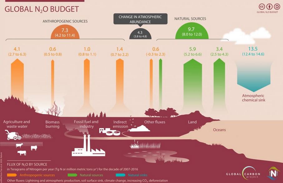
    • Greenhouse gases (GHG) such as carbon dioxide (CO2), methane and nitrous oxide play an important role in the atmosphere.
    • They absorb some of the sun’s heat and release it back in all directions, including back to the atmosphere.
    • Through this process, CO2 and other GHGs keep the atmosphere warmer than it would be without them.
    • However, fossil fuel-run industries and other human activities add GHGs to the atmosphere. This, in turn, increases atmospheric temperature, causing global warming.

    Assessing the carbon level

    • In 1958, American scientist Charles David Keeling calculated the amount of CO2 in our atmosphere.
    • When he started his measurements in 1958, the CO2 levels were around 315 parts per million (PPM).
    • When he died in 2005, the project was taken over by his son Ralph Keeling. By 2014, CO2 levels had increased to about 400 PPM.
    • With his systematic study of atmospheric CO2, Keeling became the first person to alert the world about the increasing levels of CO2 in the atmosphere.

    Reasons for rising CO2 levels

    • Scientists first argued that the increasing release of methane and CO2 was due to agriculture and livestock.
    • But, with the start of the Industrial Revolution in the 18th century, the use of fossil fuels and CO2 levels rose simultaneously.
    • Nations that underwent the Industrial Revolution used huge amounts of fossil fuels and became centres of high CO2 emissions, while nations with an agrarian economy emitted less GHGs.
    • Over the years, as CO2 levels increased, it sparked off debates and arguments between the GHG-emitting rich industrial nations and the victims of global warming — the poorer nations.
  • Species in news: Hilsa Fish

    Fishermen in West Bengal are in for a pleasant surprise amid the COVID-19 gloom as they have exuded hope of a bumper yield of Hilsa, known as “maacher rani” (queen of fish).

    Try this question from CSP 2019:

    Q. Consider the following pairs:

    Wildlife Naturally found in
    1. Blue-finned Mahseer Cauvery River
    2. Irrawaddy Dolphin Chambal River
    3. Rusty-spotted Cat Eastern Ghats

    Which of the pairs given above are correctly matched?

    a) 1 and 2 only

    b) 2 and 3 only

    c) 1 and 3 only

    d) 1, 2 and 3

    Hilsa Fish

    IUCN status: Least Concerned

    • The Hilsa is a species of fish related to the herring, in the family Clupeidae.
    • It is a very popular and sought-after food fish in the Indian Subcontinent.
    • It is the national fish of Bangladesh and state symbol in the Indian states of West Bengal and Tripura.
    • The fish contributes about 12% of the total fish production and about 1.15% of GDP in Bangladesh.

    What’s so special about Hilsa?

    • Hilsa has a history of migrating to Allahabad in the Ganga river system from Bangladesh.
    • Though it’s a saltwater fish, it migrates to sweet waters of the Ganges from the Bay of Bengal.
    • It travels upstream of the river during the mating seasons and returns to its natural abode after spawning.
  • Species in news: Pangolin

    China accorded the pangolin the highest level of protection and removed the scales of the endangered mammal from its list of approved traditional medicines amid links between wild meat and the transmission of the SARS-CoV-2 virus.

    Practice question for mains:

    Q. What are Zoonotic Diseases? Discuss the hazards of importing zoonotic diseases through wildlife trade.

    About Pangolin

    IUCN status: Endangered

    • India is home to two species of pangolin.
    • While the Chinese Pangolin (Manis pentadactyla) is found in northeastern India, the Indian Pangolin is distributed in other parts of the country as well as Sri Lanka, Bangladesh and Pakistan.
    • Both these species are protected and are listed under the Schedule I Part I of the Wild Life (Protection) Act, 1972 and under Appendix I of the Convention on International Trade in Endangered Species (CITES).
    • Commonly known as ‘scaly anteaters’, the toothless animals are unique, a result of millions of years of evolution.
    • Pangolins evolved scales as a means of protection. When threatened by big carnivores like lions or tigers they usually curl into a ball.
    • The scales defend them against dental attacks from the predators.

    Pangolin in China

    • Pangolin meat is considered a delicacy in China and Vietnam.
    • Their scales which are made of keratin, the same protein present in human nails — are believed to improve lactation, promote blood circulation, and remove blood stasis.
    • These so-called health benefits are so far unproven.

    What makes pangolins the most trafficked animals in the world?

    • Their alleged health benefits in traditional Chinese medicines prompted a booming illicit export of scales from Africa over the past decade.
    • Officials quote trafficking price of Pangolin and its scale anywhere between Rs 30,000 and Rs 1 crore for a single animal.
    • Conservation of pangolins received its first shot in the arm when the 2017 Convention on International Trade in Endangered Species (CITES) enforced an international trade ban.

    How will China’s decision impact pangolin trafficking?

    • The immediate impact would be pangolin scales losing their legitimacy in traditional Chinese medicines. However, the history of the ban on wildlife trade in China is not encouraging.
    • The continued availability of tiger bone wine — believed to cure a host of conditions ranging from dysentery to rheumatism — despite its ban on tiger products in 1993. The price of elephant ivory plummeted by two-thirds after China banned it.
    • India, where the trade largely remains local, has been registering a decline from before China’s ban.
    • The trade-in pangolin scales are already showing a decreasing trend in India and the only trade is the trade-in live animals by unorganised traders, who ask for a few crores for each live animal.
  • I-FLOWS: Mumbai Flood Management System

    Integrated Flood Warning System for Mumbai (I-FLOWS Mumbai), a state-of-the-art flood warning system has been developed for the city.

    Practice question for mains:

    Q. Urban floods in India are consequences of unplanned urbanization in India. Discuss with references to the frequent annual floods in Mumbai.

    What is IFLOWS-Mumbai?

    • IFLOWS is a monitoring and flood warning system that will be able to relay alerts of possible flood-prone areas anywhere between six to 72 hours in advance.
    • The Ministry of Earth Sciences (MoES) has developed the system with in-house expertise and coordination with the Brihanmumbai Municipal Corporation (BMC).
    • The system can provide all information regarding possible flood-prone areas, likely height the floodwater could attain location-wise problem areas across all 24 wards and calculate the vulnerability and risk of elements exposed to flood.
    • Mumbai is only the second city in the country after Chennai to get this system. Similar systems are being developed for Bengaluru and Kolkata.

    How will it work?

    • The primary source for the system is the amount of rainfall, but with Mumbai being a coastal city, the system also factors in tidal waves and storm tides for its flood assessments.
    • The system has provisions to capture the urban drainage within the city and predict the areas of flooding.
    • The system comprises seven modules- Data Assimilation, Flood, Inundation, Vulnerability, Risk, Dissemination Module and Decision Support System.

    Why was this system needed in Mumbai?

    • Mumbai, the financial capital of India, has been experiencing floods with increased periodicity.
    • Floods, especially the ones in 2005 and 2017, are etched in everyone’s memory.
    • Last year, post-monsoon and unseasonal rainfall as late as October, two tropical cyclones in the Arabian Sea had caught authorities off guard and left a trail of destruction.
    • The flood during 26th July 2005, when the city received a rainfall of 94 cm, a 100 year high in a span of 24 hours had paralyzed the city completely.
    • Urban flooding is common in the city from June to September, resulting in the crippling of traffic, railways and airlines.
    • As preparedness for floods before they occur, the system will help in warning the citizens so that they can be prepared in advance for flooding conditions.

    Benefits

    • IFLOWS-Mumbai will enhance the resilience of the city by providing early warning for flooding, especially during high rainfall events and cyclones.
    • Using this, it will be possible to have an estimate of the flood inundation three days in advance, along with immediate weather updates.
    • The Union Minister said the system was “one of the most advanced” ones and will help the city, which has been experiencing floods with increasing periodicity.
    • The hi-tech system will predict floods before they occur, therefore enabling Mumbaikars to take due precautions in advance.
  • Guidelines for Import of Exotic Species

    The Ministry of Environment Forest and Climate Change (MOEFCC) has issued an advisory saying people importing “exotic live species” will have to make a voluntary disclosure.

    Practice questions for mains:

    Q. What are Zoonotic Diseases? Discuss how the illicit trade in wildlife has resulted in the spread of zoonotic diseases of the scale of the ongoing COVID-19?

    What is the new Advisory?

    • According to the advisory, the phrase “exotic live species” includes “animals named under the Appendices I, II and III of the Convention of International Trade in Endangered Species of Wild Fauna and Flora”.
    • It does not include species from the Schedules of the Wildlife (Protection) Act 1972.
    • This will create a process where all imports will be screened.
    • As of now, the imports are being made through the Director-General of Foreign Trade and State Forest departments are not kept in the loop.
    • For new “exotic live species”, the importer should obtain a no-objection certificate from the Chief Wildlife Warden (CWLW) of the State.
    • For existing species, stocks shall be declared by the owner/ holder (stock, as on 1 January 2020) to the Chief Wildlife Warden (CWLW) of the concerned State or UT.

    Why need such advisory?

    • Many exotic species of birds, reptiles and amphibians are imported into India for commercial purposes.
    • Some of the most sought after exotic species in India are Ball python, Scarlet Macaw, sea turtles, sugar glider (Petaurus breviceps), marmoset and grey African parrots.
    • These imports were happening through the Director-General of Foreign Trade (DGFT), but they were beyond the purview of the forest departments and the chief wildlife wardens weren’t aware of them.
    • Wildlife experts have long been asking for stringent laws and guidelines to document and regulate numbers of exotic species being kept as pets by individuals and breeders in India.

    Significance

    • The move comes as the outbreak of coronavirus (COVID-19) has raised global concern about illegal wildlife trade and zoonotic diseases.
    • Often these species are illegally trafficked into the country to avoid lengthy documentation and scrutiny.

    Issues with guidelines

    • Matters such as the spread of invasive species as well as zoonotic diseases had not been taken care of in the advisory.
    • There is a growing domestic trade in exotic species of wildlife that is unfortunately not listed under the various appendices of CITES (such as sugar gliders, corn snakes).
    • Hence limiting the scope of the latest advisory to only those species covered under CITES drastically limits the scope of the advisory itself.
    • It does not have the force of law and could potentially incentivize illegal trade by offering a long amnesty period.

    Back2Basics: CITES

    • CITES stands for the Convention on International Trade in Endangered Species of Wild Fauna and Flora.
    • It is as an international agreement aimed at ensuring “that international trade in specimens of wild animals and plants does not threaten their survival”.
    • It was drafted after a resolution was adopted at a meeting of the members of the International Union for Conservation of Nature (IUCN) in 1963.
    • It entered into force on July 1, 1975, and now has 183 parties.
    • The Convention is legally binding on the Parties in the sense that they are committed to implementing it; however, it does not take the place of national laws.
    • India is a signatory to and has also ratified CITES convention in 1976.

    CITES Appendices

    • CITES works by subjecting international trade in specimens of selected species to certain controls.
    • All import, export, re-exports and introduction from the sea of species covered by the convention has to be authorized through a licensing system.

    It has three appendices:

    • Appendix I includes species threatened with extinction. Trade-in specimens of these species are permitted only in exceptional circumstances.
    • Appendix II provides a lower level of protection.
    • Appendix III contains species that are protected in at least one country, which has asked other CITES Parties for assistance in controlling trade.