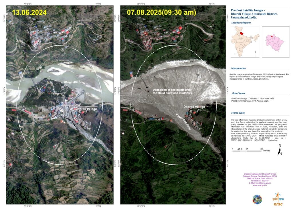
Why in the News
Researchers at the National Remote Sensing Centre have developed FlDepth, a new GIS based tool that measures floodwater depth from space in near real time.
What is FlDepth
- A satellite based flood depth estimation tool
- Developed by ISRO National Remote Sensing Centre
- Converts 2D satellite flood images into 3D flood depth maps
- Helps in disaster response and flood management
| [2019] For the measurement/estimation of which of the following are satellite images/remote sensing data used? 1 Chlorophyll content in the vegetation of a specific location 2 Greenhouse gas emissions from rice paddies of a specific location 3 Land surface temperatures of a specific location Select the correct answer using the code given below: (a) 1 only (b) 2 and 3 only (c) 3 only (d) 1, 2 and 3 |

