Why in the News
India’s indigenous navigation system NavIC has been weakened after the failure of the last atomic clock onboard the satellite IRNSS-1F.
This has reduced the number of fully functional satellites to below the required minimum, affecting navigation accuracy.
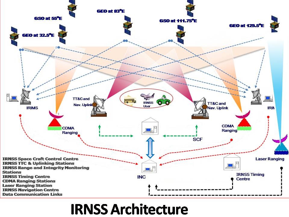
What is NavIC?
- Developed by ISRO.
- India’s regional alternative to GPS.
- Provides Position, Navigation, and Timing (PNT) services.
- Coverage: India + ~1500 km beyond its borders.
Role of Atomic Clocks
- Atomic clocks provide extremely precise time signals.
- Navigation works by measuring time delay of signals from satellites.
- Even a tiny error in time → large error in location.
- Hence, clock failure = loss of navigation capability.
What has happened?
- The last working atomic clock on IRNSS-1F failed (March 2026).
- Many earlier NavIC satellites had already lost their clocks.
- Now:
- Only 3 satellites are effectively usable
- Minimum 4 satellites needed for reliable navigation
Why is this a Concern?
- Weakens India’s GPS Alternative: NavIC is meant as a strategic backup to systems like GPS (Global Positioning System).
- Failure reduces self-reliance in critical sectors.
- Strategic & Security Implications: In conflicts, access to foreign systems may be restricted or denied.
- Weak NavIC leads to vulnerability in defence navigation.
- Impact on Civil Applications:
- Transport and logistics
- Disaster management
- Timing systems (banking, telecom)
Causes of the Problem
- Heavy reliance on imported atomic clocks (from foreign suppliers).
- Ageing satellites (many crossed 10-year design life).
- Earlier multiple clock failures across satellites.
Steps Taken by India
- Indigenous Atomic Clocks: New satellites use indigenously developed rubidium atomic clocks. Example: NVS-01
- Replacement Satellites: ISRO plans to launch at least 3 new satellites by 2026.
| [2018] With reference to the Indian Regional Navigation Satellite System (IRNSS), consider the following statements: IRNSS has three satellites in geostationary and four satellites in geosynchronous orbits. IRNSS covers entire India and about 5500 sq. km beyond its borders. India will have its own satellite navigation system with full global coverage by the middle of 2019. Select the correct answer using the code given below: (a) 1 only (b) 1 and 2 only (c) 2 and 3 only (d) None |