Why in the News?
The African Union (AU) has endorsed the Correct the Map campaign to replace the 16th-century Mercator projection with more accurate maps.
About the African Union (AU):
- Establishment: Formed in 2002, replacing the Organisation of African Unity (1963).
- Membership: 55 African countries.
- Headquarters: Addis Ababa, Ethiopia.
- Vision: “An Integrated, Prosperous, and Peaceful Africa, driven by its own citizens.”
- Agenda 2063: Blueprint for socio-economic growth and continental unity.
- Main Organs: Assembly, Executive Council, AU Commission, Peace and Security Council.
What is a Mercator Map?
- Creation: Designed in 1569 by Gerardus Mercator.
- Projection: Cylindrical map with straight longitude and latitude lines intersecting at 90°.
- Purpose: Enabled sailors to plot straight-line courses for compass navigation.
- Adoption: Became the standard map in schools, atlases, and wall charts by the 19th century.
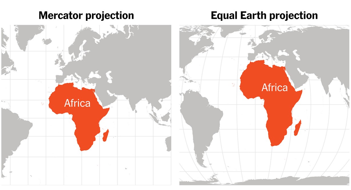
Issues with the Mercator Map:
- Distortion: Enlarges high-latitude regions (Europe, Russia, North America) while shrinking Africa and South America.
- Example: Greenland appears equal to Africa, though Africa is ~14 times larger.
- Colonial Bias: Reinforced Western dominance narratives and downplayed Africa’s size and importance.
- Impact: Supported marginalisation and exploitation during colonialism.
- Alternatives: Gall-Peters (1970s) and Equal Earth (2018) projections show continents in correct proportion.
- AU Stand: Advocates replacing Mercator maps to restore Africa’s rightful global image.
| [UPSC 2024] The longest border between any two countries in the world is between:
Options: (a) Canada and the USA * (b) Chile and Argentina (c) China and India (d) Kazakhstan and Russian Federation |