đŸ’„Join UPSC 2027,2028 Mentorship (July Batch) + XFactor Notes & Microthemes PDF

GS Paper: GS1

  • Bow Echo Storms

    Why in the News?

    New Delhi recently faced a severe thunderstorm with winds up to 100 kmph, forming a bow echo — a crescent-shaped pattern seen on weather radar.

    About Bow Echo:

    • What is it: A bow echo is a storm pattern on radar that looks like a curved bow, similar to an archer’s bow.
    • Storm Type: It forms inside a mesoscale convective system (MCS) — a large group of organised thunderstorms.
    • Origin of Term: The term was first used by Ted Fujita, who also created the Fujita scale for tornadoes.
    • How It Forms:
      • Heavy rain causes cool air to sink and spread out near the ground.
      • This cool air forms a gust front, which pushes warm, moist air upward, creating new storms.
      • A rear inflow jet — strong mid-level winds — pushes the storm forward, bending it into a bow shape.
      • Bookend vortices may form at both ends of the bow, and the northern end can sometimes generate tornadoes.

    Size, Impact, and Dangers:

    • Size and Duration: Bow echoes usually span 20 to 200 km and last 3 to 6 hours.
    • Wind Strength: They often produce straight-line winds over 100 km/h, like those seen in Delhi’s recent storm.
    • Derechos: In severe cases, bow echoes can grow into derechos, which are long-lasting and widespread windstorms.
    • Impacts:
      • Damaging Winds: Knock down trees, power lines, and damage buildings.
      • Brief Tornadoes: May form at the storm’s edges, especially at the northern end.
      • Microbursts and Downbursts: Intense short-lived wind blasts within the storm that cause local destruction.
    [UPSC 2013] During a thunderstorm, the thunder in the skies is produced by the-

    1. Meeting of cumulonimbus clouds in the sky 2. Lightning that separates the nimbus clouds 3. Violent upward movement of air and water particles.

    Select the correct answer using the codes given below.

    Options: (a) 1 only (b) 2 and 3 (c) 1 and 3 (d) None of the above produces the thunder*


  • What is Madden-Julian Oscillation (MJO)?

    Why in the News?

    Mumbai got heavy monsoon rains two weeks early because of a strong Madden-Julian Oscillation (MJO) — a weather pattern that boosts rainfall in the region.

    About the Madden-Julian Oscillation (MJO):

    • Definition: The MJO is a moving weather system of clouds, wind, rain, and pressure that travels eastward around the tropics.
    • Cycle Time: It takes 30 to 60 days to complete a full loop around the globe.
    • Discovery: It was discovered in the 1970s by Roland Madden and Paul Julian.
    • Two Phases:
      1. The enhanced convective phase brings heavy rain, storms, and clouds.
      2. The suppressed convective phase brings dry, clear weather.
    • Global Pattern: These phases move together — when one area gets rain, another gets dry weather.
    • MJO vs ENSO: Unlike El Niño, which lasts for months, the MJO changes every few weeks and affects short-term weather patterns.
    • Wider Impact: It influences monsoons, cyclones, jet streams, and weather in both tropical and non-tropical regions.
    • Phases: Scientists divide its movement into 8 phases, each showing where rain or dry weather will occur.

    MJO and the Early Monsoon of 2025:

    • Early Monsoon Trigger: The early arrival of the monsoon in May 2025 was largely due to a very active MJO.
    • IMD Observation: The India Meteorological Department noted that the MJO was in Phase 4 with high amplitude, which strongly affects Indian rainfall.
    • Rapid Monsoon Progress: It helped push extra moisture and clouds from the Indian Ocean, making the monsoon move from Kerala to Maharashtra in just two days.
    • Other Contributing Factors:
      • A strong cross-equatorial flow brought warm, moist air from the south.
      • A low-pressure system in the Arabian Sea brought pre-monsoon rains to Mumbai.
    • Record Rainfall: This resulted in Mumbai’s wettest May in over 100 years.
    • Why It Matters: The event showed how a tropical system like the MJO can suddenly change monsoon timing and rainfall patterns in India.
    [UPSC 2017] With reference to ‘Indian Ocean Dipole (IOD)’ sometimes mentioned in the news while forecasting Indian monsoon, which of the following statements is/are correct?

    1. IOD phenomenon is characterized by a difference in sea surface temperature between tropical Western Indian Ocean and tropical Eastern Pacific Ocean.

    2. An IOD phenomenon can influence an El Nino’s impact on the monsoon.

    Options: (a) 1 only (b) 2 only* (c) Both 1 and 2 (d) Neither 1 nor 2


  • What is Magnetic Flip-Flop?

    Why in the News?

    In 2024, a soundtrack was released inspired by the Laschamps event, a magnetic flip-flop that occurred 41,000 years ago when Earth’s magnetic field weakened to just 5% and the poles briefly reversed.

    What is Magnetic Flip-Flop?

    • Definition: A magnetic flip-flop is when Earth’s magnetic poles reverse, with the north and south poles switching places.
    • Magnetic Field Source: Earth’s magnetic field is generated by the movement of molten iron in the outer core, acting like a giant magnet.
    • Reversal Types:
      • A long-term change is called a geomagnetic reversal.
      • A short-lived, temporary switch is a geomagnetic excursion.
    • Field Behavior: During a reversal, the magnetic field weakens significantly and the direction of field lines flips.
    • Occurrence: These events are irregular and unpredictable.

    Recent Magnetic Reversals and Excursions:

    • Last Major Reversal: The Brunhes–Matuyama reversal occurred about 780,000 years ago.
    • Known Excursions:
      • Norwegian-Greenland Sea event (~64,500 years ago)
      • Laschamps excursion (~41,000 years ago), when field strength dropped to 5% of today’s level
      • Mono Lake excursion (~34,500 years ago)
    • Indian Evidence: Excursions found in Uttarakhand (Bagwalipokar), dated to 15,500–14,700 years and 8,000–2,850 years ago.
    • Pole Movement: Since 1831, the north magnetic pole has shifted 1,100 km toward Siberia and now moves at 35 km/year, while the south pole is more stable.

    Implications of Magnetic Flip-Flop:

    • Radiation Exposure: A weaker magnetic field during flip-flop allows more cosmic radiation, affecting:
      • Satellites and astronauts
      • Navigation and communication systems
      • Power grids and electronics
    • Protective Shield: Earth’s atmosphere still protects against harmful radiation even when the magnetic field is weak.
    • Climate & Ozone Effects: Events like Laschamps may have altered the ozone layer and climate, but no confirmed link to mass extinctions.
    • South Atlantic Anomaly: A current weak-field region affecting spacecraft over South America and South Africa.
    • Monitoring Tools: Scientists use satellites, ice cores, volcanic rocks, and geomagnetic observatories to track field changes.
    • Global Guidance: The World Magnetic Model, updated every 5 years, supports navigation systems worldwide.
    • Prediction Outlook: Though timing of future reversals is uncertain, computer models and cosmic data are improving forecasts.
    [UPSC 2017] Consider the following statements:

    1. The Earth’s magnetic field has reversed every few hundred thousand years.

    2. When the Earth was created more than 4000 million years ago, there was 54% oxygen and no carbon dioxide.

    3. When living organisms originated, they modified the early atmosphere of the Earth.

    Which of the statements given above is/are correct?

    Options: (a) 1 only (b) 2 and 3 only (c) 1 and 3 only * (d) 1, 2 and 3


  • [26th May 2025] The Hindu Op-ed: The maths of how India’s coastline lengthened without gaining land

    PYQ Relevance:

    [UPSC 2023] Comment on the resource potentials of the long coastline of India and highlight the status of natural hazard preparedness in these areas.

    Linkage: India’s geography and physical features, like its coastlines, are often discussed in terms of resources and natural hazards. This question is relevant as it pertains to India’s coastline and is categorized under the Geography subject in GS1.


    Mentor’s Comment: In December 2024, the Union Ministry of Home Affairs revised India’s coastline length from 7,516.6 km to 11,098.8 km, not due to any geographical change, but because of the use of advanced cartographic tools and improved measurement techniques. This revision, made nearly 50 years after the original measurement in the 1970s, demonstrates the coastline paradox — the idea that coastline length increases with more detailed measurement scales. The update has significant implications for maritime security, disaster preparedness, and exclusive economic zone delineation, showcasing how technology redefines our geographic understanding.

    Today’s editorial discusses the updated length of India’s coastline and its effects. This information is useful for GS Paper I (Geography), GS Paper II (Policy Making), and GS Paper III (Environment & Disaster Management).

    _

    Let’s learn!

    Why in the News?

    The Ministry of Home Affairs updated India’s coastline length to 11,099 km in its 2023–24 report, increasing it from the earlier measurement of 7,516.6 km.

    What caused the increase in India’s coastline length?

    • Use of High-Resolution Mapping Techniques: Earlier measurements (1970s) used low-resolution maps (1:4,500,000), missing finer features. The updated 2024 figure uses high-resolution charts (1:250,000), capturing detailed coastal geometry. Eg: Narrow tidal creeks and sandbars that were previously omitted are now included.
      • Features like estuaries, tidal flats, coastal ridges, and inlets are now accurately mapped. Eg: Island groups like Andaman & Nicobar and Lakshadweep, which were inadequately covered earlier, are now comprehensively included.

    Why is it hard to measure coastlines accurately?

    • Coastline Paradox (Dependence on Scale of Measurement): The measured length of a coastline changes based on the size of the measuring unit (“ruler”). Eg: Using a 200-km ruler smooths over small curves, but a 1-km ruler captures every inlet and estuary, increasing total length.
    • Irregular and Dynamic Coastal Features: Coastlines are shaped by natural features like creeks, deltas, estuaries, and shifting sediments, which are not fixed. Eg: River mouths may change shape over time due to erosion or sediment deposition, making boundaries unclear.
    • Influence of Tides and Sea-Level Changes: High and low tides alter visible land boundaries, affecting measurements at different times. Eg: Areas that are exposed during low tide but submerged at high tide (like mudflats) may or may not be counted depending on timing.

    Which tools were used to update the measurement?

    • Electronic Navigation Charts (ENCs): Provided detailed and accurate mapping at a finer scale (1:250,000). Eg: These charts helped capture small features like estuaries and creeks which were missed in older maps (1:4,500,000 scale).
    • Geographic Information Systems (GIS): Enabled spatial analysis and integration of various data layers for precise mapping. Eg: GIS combined data from satellites, surveys, and field measurements to create a more accurate coastline outline.
    • LIDAR-GPS and Satellite-Based Imaging: Laser-based LIDAR and GPS were used for high-resolution topographic mapping. Eg: Drones and satellite altimetry helped detect elevation and shoreline changes, especially in island regions like Andaman & Nicobar.

    How does the revised coastline length impact India’s maritime security and disaster preparedness?

    • Enhanced Maritime Surveillance and Border Security: A longer coastline means more area to monitor for smuggling, infiltration, and illegal fishing. Eg: The Indian Coast Guard may need more outposts, vessels, and patrol routes to guard the extended 11,099.8 km coastline.
    • Expansion of Exclusive Economic Zone (EEZ): The increased length helps in demarcating a wider EEZ, enabling better control over marine resources. Eg: India can assert rights over fisheries, oil, and gas exploration in a broader sea area.
    • Improved Disaster Preparedness and Early Warning: Better understanding of coastal geography aids in creating precise models for cyclones, tsunamis, and storm surges. Eg: Coastal States like Odisha and Tamil Nadu can now develop more accurate evacuation and shelter plans.
    • Refined Coastal Regulation and Zoning: Accurate coastline data supports zoning laws to restrict construction in vulnerable areas. Eg: Authorities can update Coastal Regulation Zone (CRZ) norms to better safeguard ecosystems and infrastructure.
    • Better Climate Resilience and Adaptation Planning: Updated coastline measurements help assess vulnerability to sea-level rise and erosion. Eg: Low-lying areas in Kerala and island regions like Lakshadweep can be prioritized for climate adaptation projects.

    What are the resource potentials of the long coastline of India?

    • Fisheries and Marine Biodiversity: India’s coastline supports a vast fishing industry, providing employment and food security. Eg: States like Gujarat and Tamil Nadu have thriving marine fishing sectors contributing to exports and coastal livelihoods.
    • Port Infrastructure and Trade: The long coastline facilitates maritime trade through major and minor ports. Eg: Ports like Mumbai, Chennai, and Visakhapatnam are crucial for imports, exports, and shipping connectivity under the Sagarmala Project.
    • Offshore Energy Resources: Coastal waters have potential for oil, natural gas, and renewable energy like offshore wind and tidal energy. Eg: Mumbai High is a major offshore oil field, while Gujarat and Tamil Nadu are exploring offshore wind energy projects.
    • Tourism and Blue Economy Development: Scenic beaches, islands, and marine ecosystems attract tourism and support the blue economy. Eg: Goa’s coastal tourism and the Andaman & Nicobar Islands’ ecotourism contribute significantly to local economies.
    • Aquaculture and Coastal Agriculture: Coastal zones are suitable for shrimp farming, seaweed cultivation, and salt production. Eg: Andhra Pradesh and West Bengal have developed large-scale shrimp aquaculture for domestic and export markets.

    What is the status of natural hazard preparedness in the coastal Area?

    • Improved Early Warning Systems: India has strengthened early warning capabilities for cyclones and tsunamis through institutions like the Indian National Centre for Ocean Information Services (INCOIS) and IMD. Eg: The Odisha government’s timely evacuation during Cyclone Fani (2019) saved thousands of lives.
    • Development of Coastal Infrastructure and Shelters: Construction of cyclone-resistant shelters, embankments, and flood control systems has improved disaster resilience. Eg: The National Cyclone Risk Mitigation Project (NCRMP) has led to the building of multi-purpose cyclone shelters in vulnerable states like Andhra Pradesh and West Bengal.
    • Community Awareness and Disaster Drills: Government and NGOs have promoted community-based disaster preparedness, training locals in evacuation procedures and first aid. Eg: Regular mock drills in coastal villages of Tamil Nadu and Kerala help improve response readiness.

    Way forward: 

    • Integrated Coastal Zone Management (ICZM) Expansion:Strengthen ICZM plans across all coastal states with real-time monitoring, climate-resilient infrastructure, and ecosystem-based approaches. Eg: Expand initiatives like ICZM Phase II to include mangrove restoration, sustainable livelihoods, and coastal erosion control in states like Kerala and Goa.
    • Technology-Driven Risk Mapping and Community-Centric Planning: Deploy AI-powered hazard models, geospatial mapping, and mobile-based alert systems to ensure last-mile connectivity. Eg: Use drone mapping for vulnerable areas in the Sundarbans, and integrate local communities into planning via participatory risk assessments.
  • A Good Monsoon

    Why in the News?

    This May has been unusually wet, with India getting 68.4% more rain than normal. Also, there have been no extreme temperatures or major heatwaves across most parts of the country.

    What caused the wet and cool May in India?

    • Above-Normal Rainfall: India received 68.4% more rainfall than usual for May, making it one of the wettest months in recent times. Eg: 27 out of 36 meteorological subdivisions saw over 20% surplus rain.
    • Frequent Moisture-Laden Winds: Western disturbances from the Mediterranean and incursions from the Bay of Bengal and Arabian Sea brought continuous showers. Eg: These weather systems caused intermittent thunderstorms across northern and eastern India.
    • Suppression of Heatwaves: Each thunderstorm cooled temperatures, preventing the buildup of heatwaves. Eg: No major heatwave was reported across central and north India during May.

    Why is the formation of heat lows over northwest India important for the monsoon?

    • Creates Suction for Moist Winds: Heat lows act like a vacuum, pulling moisture-laden southwesterly winds from the Indian Ocean into the Indian subcontinent. Eg: Strong heat lows over Rajasthan help trigger early monsoon onset over central India.
    • Drives Monsoon Circulation: These low-pressure areas initiate and sustain the monsoon trough, which is essential for widespread rainfall. Eg: Absence of heat lows can delay or weaken the monsoon across northwest and central India.
    • Influences Rainfall Intensity and Spread: Proper heat low development ensures uniform and timely rainfall, crucial for agriculture. Eg: Weak heat lows in 2015 contributed to a patchy and deficient monsoon season.

    How do El Niño and IOD affect the monsoon?

    • El Niño Weakens Monsoon Winds: El Niño leads to warmer Pacific Ocean waters, which suppresses the Indian monsoon by weakening the low-pressure system over the subcontinent. Eg: The 2015 El Niño caused a 14% rainfall deficit in India.
    • Positive IOD Strengthens Monsoon: A positive Indian Ocean Dipole (IOD) brings warmer waters near Africa and cooler waters near Indonesia, enhancing monsoon winds and rainfall over India. Eg: In 2019, a strong positive IOD offset El Niño’s impact, resulting in above-normal rainfall.

    What would be the impact of monsoon on food inflation? 

    • Good Monsoon Boosts Crop Yields: Adequate rainfall ensures timely sowing and healthy harvests, leading to better food availability and stable prices. Eg: A normal monsoon in 2022 helped moderate cereal price rise.
    • Reduces Dependency on Imports: Sufficient domestic production of staples like wheat and pulses lowers the need for costly imports, helping control food inflation. Eg: In 2024, surplus wheat stock due to good rainfall reduced price pressure.
    • Stabilises Rural Demand and Supply Chains: A healthy monsoon supports rural incomes, improving supply consistency and reducing volatility in food prices. Eg: Strong kharif output in 2021 led to a drop in vegetable prices.

    Way forward: 

    • Strengthen Climate-Responsive Agriculture: Promote drought- and flood-resistant crop varieties and expand irrigation to reduce dependence on erratic monsoons.
    • Enhance Weather Forecasting and Storage Infrastructure: Improve real-time weather alerts and expand warehousing to minimize post-harvest losses and stabilize food prices.

    Mains PYQ:

    [UPSC 2024] What are the causes of persistent high food inflation in India? Comment on the effectiveness of the monetary policy of the RBI to control this type of inflation.

    Linkage: Understanding the dynamics of food inflation, as required by this question, is essential for appreciating the significant positive economic contribution that a favorable monsoon can make by potentially increasing agricultural output and stabilizing food prices.

  • Rewriting the Keezhadi (Keeladi) Excavations Report

    Why in the News?

    The Archaeological Survey of India (ASI) has asked to resubmit his excavation report on the Keeladi site near Madurai after making necessary corrections.

    ASI’s Concerns with the Report:

    • The ASI asked for better scientific justification for the period of 8th century BCE to 5th century BCE.
    • It said the earliest period could be more accurately dated to pre-300 BCE.
    • The ASI said that depth data alone was not enough — each scientific date should also mention the layer number to allow for stratigraphic consistency.

    About Keezhadi Excavations:

    • Location: Keezhadi is a village in Sivaganga district, located about 12 km southeast of Madurai, along the Vaigai River in Tamil Nadu.
    • Excavations: Excavations began in 2014, led by archaeologist Amarnath Ramakrishna, to uncover urban signs from the Sangam Age.
    • Period Link: The site is associated with the Sangam period (3rd century BCE to 3rd century CE), and findings may push it back to 800 BCE.
    • Civilisation Context: Keezhadi is now seen as part of the Vaigai Valley Civilisation, with evidence of urbanisation, trade, and early literacy.

    Key Findings from Keezhadi:

    • Period: Charcoal samples dated to around 200 BCE; some artefacts range between the 6th century BCE and 1st century BCE using the Accelerator Mass Spectrometry (AMS) dating.
    • Tamil Brahmi Inscriptions: Over 120 potsherds with early Tamil Brahmi script indicate literacy during the Sangam period.
    • Pottery and Craftsmanship: Discovery of pottery, gold ornaments, copper tools, shell bangles, and ivory combs show local industry and artistic skill.
    • Trade and Imports: Agate and carnelian beads suggest access to imported materials and long-distance trade.
    • Recreational Items: Dice and game pieces were found, indicating leisure activities in the society.
    • Industrial Activity: Evidence of dyeing units and bead-making points to a flourishing economy.
    • Cultural Continuity: Artefacts show a transition from the Iron Age to the Early Historic Period.
    • Possible Indus Link: Some symbols on potsherds resemble Indus Valley signs, hinting at cultural connections, despite a 1,000-year gap.
    [UPSC 2013] Though not very useful from the point of view of a connected political history of South India, the Sangam literature portrays the social and economic conditions of its time with remarkable vividness. Comment.

    [UPSC 2023] Which one of the following explains the practice of Vattakirutal’ as mentioned in Sangam poems?

    Options: (a) Kings employing women bodyguards (b) Learned persons assembling in royal courts to discuss religious and philosophical matters (c) Young girls keeping watch over agricultural fields and driving away birds and animals (d) A king defeated in a battle committing ritual suicide by starving himself to death*


  • INSV Kaundinya

    Why in the News?

    The Indian Navy has formally inducted a traditional stitched sail ship, named INSV Kaundinya, at a ceremony held at the Naval Base in Karwar.

    INSV Kaundinya

    About INSV Kaundinya:

    • Induction: It is a newly inducted, stitched sail ship of the Indian Navy, formally inducted at Karwar Naval Base.
    • Design: The ship is based on a 5th-century design shown in a painting from the Ajanta Caves.
    • Construction Method: Built using ancient Indian shipbuilding techniques, including coconut fibre stitching, wooden joinery, coir ropes, natural resins, and cotton sails.
    • No Modern Additions: It has no metal parts, no modern rudder, and is powered by square sails and steering oars.
    • Cultural Symbols: Features include the Gandabherunda (two-headed eagle of the Kadamba dynasty), a Simha Yali on the bow, and a Harappan-style stone anchor.
    • Sail Plan: The vessel has 3 masts — the main mast, mizzen mast, and bowsprit mast.
    • Planned Voyage: A 15-member Indian Navy crew will sail it to Oman by late 2025, retracing ancient maritime trade routes.
    • Project Partners: This heritage revival project is supported by the Ministry of Culture, Indian Navy, and Hodi Innovations Pvt. Ltd.

    Legend of Kaundinya and Queen Soma:

    • Kaundinya is regarded as the first known Indian sailor to cross the seas over 2,000 years ago.
    • He is credited with founding the kingdom of Funan (in present-day Cambodia and South Vietnam) through a historic alliance with Queen Soma.
    • Their story is recorded in Cambodian, Vietnamese, and Chinese sources, though not in Indian texts.
    • Future dynasties like the Khmer and Cham traced their origins to this union.
    [UPSC 2003] Consider the following statements:

    1. The Cholas defeated Pandya and Chera rulers and established their domination over peninsular India in the early medieval times.

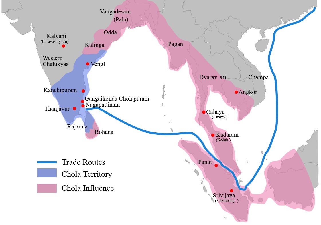
    2. The Cholas sent an expedition against Sailendra empire of South East Asia and conquered some of the areas.

    Which of these statements is/are correct?

    Options: (a) Only 1 (b) Only 2 (c) Both 1 and 2* (d) Neither 1 nor 2

    https://www.thehindu.com/news/national/navy-inducts-stitched-sail-ship-as-insv-kaundinya/article69601911.ece

  • 253rd birth anniversary of Raja Ram Mohan Roy

    One of the most influential social and religious reformers of the 19th century, Ram Mohan Roy, born on May 22, 1772 in what was then Bengal Presidency’s Radhanagar in Hooghly district, would have turned 253 years today.

    Raja Ram Mohan Roy (1772-1833)

    Early life

    • Born into a prosperous upper-caste Brahmin family, Roy grew up within the framework of orthodox caste practices of his time.
    • Child-marriage, polygamy and dowry were prevalent among the higher castes and he had himself been married more than once in his childhood.
    • The family’s affluence had also made the best in education accessible to him.
    • The waning of the Mughals and the ascendancy of the East India Company in Bengal towards the end of the 18th century was also the time when Roy was slowly coming into his own.

    Academics

    • Roy knew Bengali and Persian, but also Arabic, Sanskrit, and later, English.
    • His exposure to the literature and culture of each of these languages bred in him a scepticism towards religious dogmas and social strictures.
    • He spent considerable time studying the Vedas and the Upanishads, but also religious texts of Islam and Christianity.

    Religious belief

    • He was particularly intrigued by the Unitarian faction of Christianity and was drawn by the precepts of monotheism that, he believed, lay at the core of all religious texts.
    • He wrote extensive tracts on various matters of theology, polity and human rights, and translated and made accessible Sanskrit texts into Bengali.
    • Rammohun did not quite make a distinction between the religious and the secular. He believed religion to be the site of all fundamental changes.
    • What he fought was not religion but what he believed to be its perversion.

    Roy, the first among liberals

    • Even though British consolidation of power was still at a nascent stage in India at the time, Roy could sense that change was afoot.
    • Confident about the strength of his heritage and open to imbibing from other cultures what he believed were ameliorative practices, Roy was among India’s first liberals.
    • He was simultaneously interested in religion, politics, law and jurisprudence, commerce and agrarian enterprise, Constitutions and civic rights, the unjust treatment of women and the appalling condition of the Indian poor.

    Establishment of Atmiya Sabha

    • In 1814, he started the Atmiya Sabha (Society of Friends), to nurture philosophical discussions on the idea of monotheism in Vedanta.
    • It aimed to campaign against idolatry, casteism, child marriage and other social ills.
    • The Atmiya Sabha would make way for the Brahmo Sabha in 1828, set up with Debendranath Tagore, Rabindranath Tagore’s father.

    Abolition of Sati, educational and religious reforms

    • He campaigned for the modernisation of education, in particular the introduction of a Western curriculum, and started several educational institutions in the city.
    • In 1817, he collaborated with Scottish philanthropist David Hare to set up the Hindu College (now, Presidency University).
    • He followed it up with the Anglo-Hindu School in 1822 and, in 1830, assisted Alexander Duff to set up the General Assembly’s Institution, which later became the Scottish Church College.
    • It was his relentless advocacy alongside contemporaries such as Ishwar Chandra Vidyasagar that finally led to the abolition of Sati under the governor generalship of William Bentinck in 1829.
    • Roy argued for the property rights of women, and petitioned the British for freedom of the press (in 1829 and 1830).
    • His Brahmo Sabha, that later became the Brahmo Samaj, evolved as a reaction against the upper-caste stranglehold on social customs and rituals.

    Perils of non-conformism

    • Roy, who was given the title of Raja by the Mughal emperor Akbar II, was no exception to the societal enmity.
    • Roy was also often attacked by his own countrymen who felt threatened by his reformist agenda, and by British reformers and functionaries, whose views differed from his.

    Conclusion

    • Roy’s work in the sphere of women’s emancipation, modernising education and seeking changes to religious orthodoxy finds new relevance in this time.
    • He was among the first Indians to gain recognition in the UK and in America for his radical thoughts.
    • Roy was unquestionably the first person on the subcontinent to seriously engage with the challenges posed by modernity to traditional social structures and ways of being.
    • Rabindranath Tagore called him a ‘Bharatpathik’ by which he meant to say that Rammohun combined in his person the underlying spirit of Indic civilisation, its spirit of pluralism, tolerance and a cosmic respect for all forms of life.


    UPSC 2023 countdown has begun! Get your personal guidance plan now! (Click here)

  • World’s most powerful Solar Particle Storm struck Earth 14,300 years ago

    Why in the News?

    Scientists have discovered that a massive solar storm hit Earth around 12,350 BC, making it the most powerful solar event ever detected.

    What are Solar Particle Storms?

    • About: A solar storm is a disturbance caused by solar flares or coronal mass ejections that release charged particles into space.
    • Solar Particle Storm: It is a type of solar storm where high-energy particles travel toward Earth, producing cosmogenic isotopes like radiocarbon.
    • Detection: These isotope spikes are recorded in tree rings and are known as Miyake events, which act as cosmic timestamps.
    • Impact: Though rare, solar particle storms can severely affect satellites, communication systems, and power grids.
    • Historical Events: Major solar particle storms were identified in AD 994, 663 BC, 5259 BC, and 7176 BC.
    • Carrington Event (1859): This was a major solar storm, but not a particle storm—it resulted from a different solar mechanism.

    How was the ancient storm detected?

    • Methodology: A solar storm from 12,350 BC was discovered using tree-ring data from the French Alps.
    • Event Strength: This storm was over 500 times stronger than the 2005 solar storm, the largest in the satellite era.
    • What are its implications?
      • Significance: This is the first known extreme solar event before the Holocene, predating the last 12,000 years of stable climate.
      • Modern Relevance: The discovery highlights the risks of future extreme solar activity on Satellite infrastructure and Space Application.
      • Significance: Miyake events improve the precision of archaeological dating, helping better understand ancient human history.
    [UPSC 2022] If a major solar storm (solar flare) reaches the Earth, which of the following are the possible effects on the Earth?

    1. GPS and navigation systems could fail.

    2. Tsunamis could occur at equatorial regions.

    3. Power grids could be damaged.

    4.  Intense auroras could occur over much of the Earth.

    5. Forest fires could take place over much of the planet.

    6. Orbits of the satellites could be disturbed.

    7. Shortwave radio communication of the aircraft flying over polar regions could be interrupted.

    Select the correct answer using the code given below:

    Options: (a) 1 only (b) 2 and 3 only (c) 1 and 3 only (d) 1, 2, 3, 4, 6 and 7*

    Tap to know more about the answer.


  • [21st May 2025] The Hindu Op-ed: Scheme-based workers, the struggle for an identity


    PYQ Relevance:

    [UPSC 2021] Examine the role of ‘Gig Economy’ in the process of empowerment of women in India.

    Linkage: While the PYQ focuses on empowerment and women within the gig economy, it aligns with the broader theme of identity and status challenges faced by workers in non-traditional/precarious employment structures, a challenge explicitly highlighted for SBWs and then linked to gig workers in the article.


    Mentor’s Comment: The central government employs millions of regular and contract workers, including around 60 million in schemes like ICDS, NRHM, and mid-day meals. These workers—such as Anganwadi workers, helpers, ASHAs, and mid-day meal staff—support children, mothers, and nutrition. They connect communities with public health and help improve school enrollment and overall health.

    Today’s editorial talks about the problems faced by Scheme-Based Workers (SBWs). This content is useful for GS Paper I (Women’s Issues) and GS Paper II (Social Justice).

    _

    Let’s learn!

    Why in the News?

    The recent developments surrounding Scheme-Based Workers (SBWs)—particularly Anganwadi workers, ASHAs, and MDM workers—have reignited the debate on labour identity, social security, and worker rights in India.

    Who are scheme-based workers (SBWs)?

    •  Workers employed under various government social welfare schemes but not formally recognized as government employees. Around 60 million workers across government schemes. Eg: Anganwadi Workers (AWWs), Anganwadi Helpers (AWHs), Accredited Social Health Activists (ASHAs) and Mid-Day Meal Workers (MDMWs).
    • ICDS (since 1975), National Rural Health Mission (NRHM), and Mid-Day Meal Scheme.


    What roles do they perform?

    • Childcare and Nutrition Services: SBWs play a vital role in early childhood care by ensuring nutritional support, immunization, and preschool education. Eg: Anganwadi Workers (AWWs) under the ICDS scheme provide nutrition and basic health services to children and lactating mothers.
    • Public Health Outreach: They serve as a crucial link between the public health system and rural communities, improving health awareness and access. Eg: ASHAs under the National Rural Health Mission (NRHM) assist in maternal care, vaccination drives, and promote institutional deliveries.
    • Educational and Nutritional Support in Schools: They help enhance school enrollment and retention by providing mid-day meals, which also address child malnutrition. Eg: Mid-Day Meal Workers (MDMWs) prepare and distribute meals in schools under the Mid-Day Meal Scheme.

    What challenges do SBWs face in gaining formal recognition and benefits?

    • Lack of Worker Status: SBWs are often classified as “volunteers” or “honorary workers” rather than formal employees, denying them recognition as government workers. Eg: The Supreme Court in State of Karnataka vs Ameerbi (2006) ruled that Anganwadi workers are not state employees as they don’t hold statutory posts.
    • Absence of Minimum Wages: Most SBWs receive honorariums instead of wages, which are far below minimum wage standards. Eg: Anganwadi workers and helpers across states earn as low as â‚č4,500–â‚č9,000 per month, without alignment to state minimum wage norms.
    • No Social Security Benefits: SBWs are denied access to pensions, provident fund, maternity benefits, and health insurance. Eg: Despite working in public health, ASHAs are not covered under schemes like EPFO or ESI.
    • Policy Delay and Avoidance: Governments often cite financial burden or the need for long-term planning to delay regularisation. Eg: In 2016, the Labour Minister told Parliament that there’s no fixed timeline to implement ILC recommendations for SBWs.
    • Suppression of Collective Action: SBWs’ strikes are often met with state repression or legal barriers. Eg: Maharashtra invoked the Essential Services Maintenance Act (ESMA) in 2017 to curb Anganwadi workers’ right to strike.

    Why is the government reluctant to regularise SBWs?

    • Financial Burden: Regularising SBWs would significantly increase the government’s salary and welfare expenditure, making it fiscally unsustainable. Eg: The central government employs over 60 lakh SBWs, and converting them to regular employees would involve massive budgetary allocations for wages and benefits.
    • Policy Ambiguity: Successive governments delay decisions by citing the need for long-term policy formulation without committing to a timeline. Eg: In 2016, the Labour Minister told the Rajya Sabha that implementing Indian Labour Conference (ILC) recommendations requires indefinite planning.
    • Privatisation Push: The government aims to reduce its role in welfare delivery by promoting public-private partnerships, weakening the case for regularisation. Eg: There have been attempts to privatise the Integrated Child Development Services (ICDS), directly affecting the employment security of Anganwadi workers.

    How have trade unions and courts supported SBWs’ demands?

    • Union Mobilisation: Major trade unions have organised SBWs to demand minimum wages, worker status, and social security through strikes and negotiations. Eg: In March 2025, Anganwadi workers in Kerala ended a 13-day indefinite strike organised by unions like AITUC, BMS, and CITU demanding regularisation and fair pay.
    • Judicial Recognition: Courts have gradually recognised some labour rights of SBWs, even when earlier rulings were unfavourable. Eg: In Maniben Maganbhai Bhariya vs District Development Officer (2022), the Supreme Court ruled that Anganwadi workers are eligible for gratuity under the Payment of Gratuity Act.


    What are the policy implications of granting SBWs formal employee status?

    • Fiscal Burden: Recognising SBWs as formal employees would significantly increase the government’s expenditure on salaries, pensions, and social security. Eg: The central government is concerned about cost implications due to the growing number of SBWs (nearly 6 million), especially as population-linked schemes expand.
    • Policy Reorientation: Granting formal status would require new frameworks for recruitment, training, service conditions, and grievance redressal. Eg: The Gujarat High Court in 2024 directed the State and Centre to create a joint policy to regularise Anganwadi workers as Class III and IV employees.
    • Precedent for Other Informal Workers: Regularising SBWs could set a precedent for other informal or gig workers demanding similar recognition and protections. Eg: Like SBWs, gig workers (e.g., delivery partners) are also fighting for worker status and social security rights in courts and labour forums.

    Way forward: 

    • Enact Clear Policies: Governments should promptly create and implement policies to grant SBWs formal worker status with fair wages and social security benefits.
    • Strengthen Monitoring: Improve enforcement by regional bodies to ensure timely wage revisions, labour rights protection, and prevent exploitation of SBWs.