Why in the News?
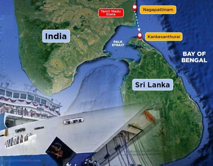
The Nagapattinam-Kankesanthurai ferry service has been resumed along the Palk Strait between India and Sri Lanka after 40 years.
About Palk Strait
| Location | Narrow water body separating Tamil Nadu, India, and Sri Lanka. |
| Name Origin | Named after Robert Palk, a British Raj-era Governor of Madras Presidency (1755-1763). |
| Geographic Boundaries | Southern boundaries include Pamban Island (India), Adam’s Bridge (shoals), Gulf of Mannar, and Mannar Island (Sri Lanka). |
| Connection | Connects the Bay of Bengal in the northeast with the Gulf of Mannar in the southwest. |
| Alternate Name | Southwestern part of the strait is known as Palk Bay. |
| Dimensions | Width varies from 64 to 137 km, length is approximately 137 km, and depth is less than 330 feet (100 meters). |
| River Inflows | Vaigai River in Tamil Nadu flow into the Palk Strait. |
| Historic Context |
|
| Present Significance | Supports regional trade, tourism, and people-to-people connections, while fostering economic development in both India and Sri Lanka. |

