Which of the following best explain(s) the rationale for protecting mangrove ecosystems in the context of climate resilience?
1. Mangroves reduce tidal energy and store freshwater, making them ideal sites for paddy cultivation in saline estuarine belts.
2. Their salt-sensitive roots filter seawater, making mangroves key to converting coastal land into freshwater aquaculture zones.
3. By withstanding tidal surges and offering biomass resources, mangroves function both as natural bio-shields and livelihood bases for rural communities.
Subject: Environment
-
Which of the following best explain(s) the rationale for protecting mangrove ecosystems in the context of climate resilience
-
With respect to the Western Hoolock Gibbons, which of the following statements is/are correct
With respect to the Western Hoolock Gibbons, which of the following statements is/are correct?
1. A Sanctuary in North-east India is home to this ape species listed as Endangered in the IUCN Red List.
2. They have specialized brachiation and can easily swing between trees.
3. They possess a strong and heavy build like gorillas, yet are remarkably agile tree climbers. -
Consider the following statements with reference to India’s response to climate change
Consider the following statements with reference to India’s response to climate change:
I. India’s LT-LEDS is a crucial tool for achieving net-zero emissions by 2070.
II. India’s BUR-4 (Dec 2024) recorded ~8% decrease in GHG emissions in 2020 over 2019.
III. Climate-resilient development necessarily depends on quick and short-term achievement of emission reduction targets.
Which of the following relationships is/are correct?
1. Statement I is empirically supported by statement II
2. Statement III contradicts the approach implicit in statement I
3. Statement I and statement III together establish the premise of long-term sustainability -
New Evergreen Tree Species Discovered in Kerala
Why in News?
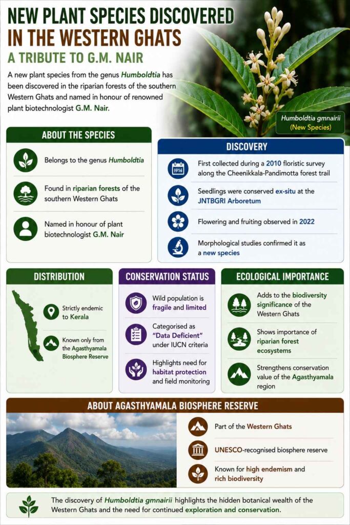
Scientists from Jawaharlal Nehru Tropical Botanic Garden and Research Institute discovered a new evergreen tree species, Humboldtia nairiana, in Shendurney Wildlife Sanctuary.
About the Species
- Belongs to the genus Humboldtia
- Found in riparian forests of the southern Western Ghats
- Named in honour of plant biotechnologist G.M. Nair
Discovery
- First collected during a 2010 floristic survey along the Cheenikkala-Pandimotta forest trail
- Seedlings were conserved ex-situ at the JNTBGRI Arboretum
- Flowering and fruiting observed in 2022
- Morphological studies confirmed it as a new species
Distribution
- Strictly endemic to Kerala
- Known only from the Agasthyamala Biosphere Reserve
Conservation Status
- Wild population is fragile and limited
- Categorised as “Data Deficient” under IUCN criteria
- Highlights need for habitat protection and field monitoring
Ecological Importance
- Adds to the biodiversity significance of the Western Ghats
- Shows importance of riparian forest ecosystems
- Strengthens conservation value of Agasthyamala region
About Agasthyamala Biosphere Reserve
- Part of the Western Ghats
- UNESCO-recognised biosphere reserve
- Known for high endemism and rich biodiversity
[2019] “Neyyar, Peppara and Shendurney Wildlife Sanctuaries” are part of which of the following?
[A] Agasthyamalai biosphere reserve
[B] Nilgiri biosphere reserve
[C] Seshachalam Hills
[D] Panna biosphere reserve
-
Long-tailed Duskhawker Rediscovered in Arunachal Pradesh
Why in News?
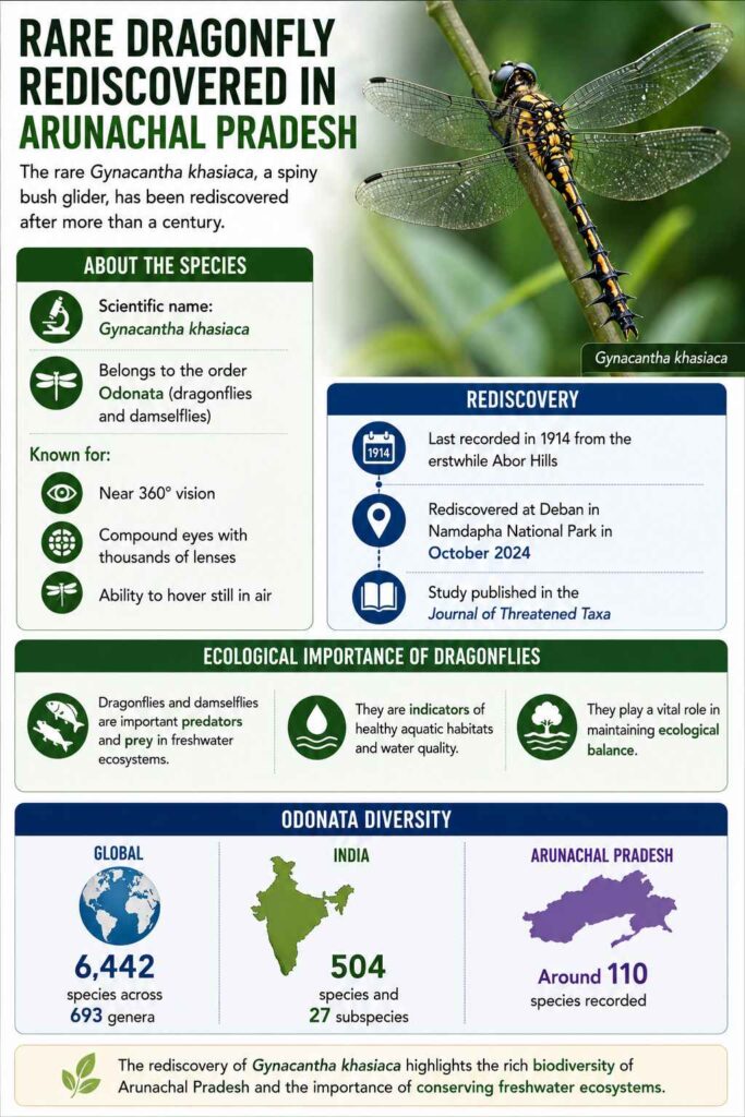
A rare dragonfly species, the Long-tailed Duskhawker, has been rediscovered in Arunachal Pradesh after 110 years in Namdapha National Park and Tiger Reserve.
About the Species
- Scientific name: Gynacantha khasiaca
- Belongs to the order Odonata (dragonflies and damselflies)
- Known for:
- Near 360° vision
- Compound eyes with thousands of lenses
- Ability to hover still in air
Rediscovery
- Last recorded in 1914 from the erstwhile Abor Hills
- Rediscovered at Deban in Namdapha National Park in October 2024
- Study published in the Journal of Threatened Taxa
Ecological Importance of Dragonflies
Dragonflies and damselflies are:
- Predators and prey in freshwater ecosystems
- Indicators of healthy aquatic habitats
- Important for ecological balance
Odonata Diversity
- Global: 6,442 species across 693 genera
- India: 504 species and 27 subspecies
- Arunachal Pradesh: Around 110 species recorded
Distribution of Long-tailed Duskhawker
Apart from Arunachal Pradesh, reported from:
- Assam
- Maharashtra
- Meghalaya
- Uttarakhand
- West Bengal
Significance of Rediscovery
- Highlights rich biodiversity of Northeast India
- Emphasises habitat protection and biodiversity monitoring
- Shows importance of citizen science in conservation
About Namdapha National Park
- Located in Changlang district, Arunachal Pradesh
- One of India’s largest protected areas
- Known for tropical rainforests and rich wildlife diversity
[2017] Due to some reasons, if there is a huge fall in the population of species of butterflies, what could be its likely consequence/consequences?
1. Pollination of some plants could be adversely affected.
2. There could be a drastic increase in the fungal infections of some cultivated plants.
3. It could lead to a fall in the population of some species of wasps, spiders and birds.
Select the correct using the code given below:[A] 1 only
[B] 2 and 3 only
[C] 1 and 3 only
[D] 1, 2 and 3
-
Vembanad Lake
Why in the news?
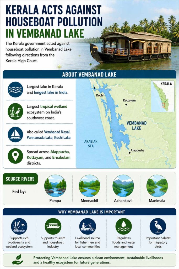
The Kerala government acted against houseboat pollution in Vembanad Lake following directions from the Kerala High Court.
About Vembanad Lake
- Largest lake in Kerala and longest lake in India
- Largest tropical wetland ecosystem on India’s southwest coast
- Also called Vembanad Kayal, Punnamada Lake, Kochi Lake
- Spread across Alappuzha, Kottayam, and Ernakulam districts
Source Rivers
Fed by:
- Pampa
- Meenachil
- Achankovil
- Manimala
Ecological Importance
- Ramsar Site since 2002
- Supports fisheries, biodiversity, flood control, and groundwater recharge
- Part of National Wetlands Conservation Programme
Agriculture
- Famous for below sea-level farming in the Kuttanad region
Tourism and Culture
- Major part of Kerala backwaters tourism
- Known for houseboats and inland water transport
- Hosts Nehru Trophy Snake Boat Race in August
[2022] Consider the following pairs : Wetland/Lake Location
1. Hokera Wetland: Punjab
2. Renuka Wetland: Himachal Pradesh
3. Rudrasagar Lake: Tripura
4. Sasthamkotta Lake: Tamil Nadu
How many pairs given above are correctly matched?[A] Only one pair
[B] Only two pairs
[C] Only three pairs
[D] All four pairs
-
First National Report on the Nagoya Protocol on ABS
Why in the News?
The Ministry of Environment, Forest and Climate Change released insights from India’s first national report on the Nagoya Protocol related to Access and Benefit Sharing (ABS), highlighting India’s progress in ensuring equitable sharing of benefits arising from biological resources.
About the Nagoya Protocol
- Adopted Under: Convention on Biological Diversity (CBD)
- Objective: To ensure Fair and equitable sharing of benefits arising from the utilisation of genetic resources and associated traditional knowledge.
What is Access and Benefit Sharing (ABS)?
- ABS means: Users of biological resources must share benefits with:
- Local communities
- Indigenous groups
- Traditional knowledge holders
- Benefits can include:
- Monetary compensation
- Technology transfer
- Community development
- Conservation support
Key Findings of the Report
- Large-Scale Implementation Between 2017 and 2025: 12,830 ABS approvals granted.
- India’s Global Contribution
- India issued:
- 3,556 Internationally Recognised Certificates of Compliance (IRCCs)
- Around 60% of global issuance.
- Revenue Generated: ₹216.31 crore realised by: National Biodiversity Authority (NBA)
- Community Benefit: ₹139.69 crore disbursed to benefit claimers and local communities.
[2023] Consider the following statements:
1. In Biodiversity the India, Management Committees are key to the realization of the objectives of the Nagoya Protocol.
2. The Biodiversity Management Committees have important functions in determining access and benefit sharing, including the power to levy collection fees on the access of biological resources within its jurisdiction.
Which of the statements given above is/are correct?[A] 1 only
[B] 2 only
[C] Both 1 and 2
[D] Neither 1 nor 2
-
4-letter word everyone in Delhi needs to know: dust
Why in the News?
Delhi’s road dust has come under renewed scrutiny after scientific studies and a CAQM-appointed committee identified it as a persistent and major source of particulate pollution, particularly PM10.
What is Road Dust?
- Road dust is a mixture of solid particles, including soil, sand, brake/tire wear, and construction debris, that settles on road surfaces and becomes airborne.
- It is a major, often unregulated source of urban air pollution and harmful heavy metals (such as Zinc and Copper)
- It becomes airborne through vehicle movement and wind action.
- In Delhi, road dust has emerged as a persistent urban pollutant source, contributing significantly to PM10 and PM2.5 levels.
- It has implications for respiratory health, urban planning, and environmental governance.
How does road dust emerge as a major source of air pollution in Delhi?
- Road Surface Deposits: Dust accumulates from soil, debris, road wear, tyre-brake friction, and construction material, becoming airborne through vehicular movement.
- Primary Pollutant Source: CAQM classified road dust as a primary emission source, unlike point-source pollution from construction sites.
- Vehicular Resuspension: Heavy traffic movement repeatedly lifts deposited particles into the air, particularly during dry weather.
- Construction Spillover: Transport of construction and demolition (C&D) waste spreads loose particles along roads, increasing dust loading.
- Dust-Carrying Corridors: Delhi’s roads function as linear pollution corridors, where contamination spreads continuously rather than remaining site-specific.
How does road dust threaten public health?
- PM10 and PM2.5 Exposure: Fine particles penetrate the lungs and bloodstream, causing chronic inflammation.
- Respiratory Diseases: Increases risk of asthma, chronic obstructive pulmonary disease (COPD), persistent coughing, and wheezing.
- Cancer Risk: Studies identified toxic elements in roadside soil and dust linked to carcinogenic outcomes.
- Childhood Vulnerability: Weakens lung growth and respiratory development in children.
- Premature Mortality: Long-term PM2.5 exposure contributes to temperature-linked deaths and cardiovascular complications.
Why does road dust persist despite repeated cleaning measures?
- Continuous Deposition: Dust reaccumulates due to poor road conditions, inadequate maintenance, and unregulated roadside dumping.
- Unpaved Medians and Shoulders: Loose soil from unpaved stretches frequently disperses during wind events.
- Poor Irrigation Practices: Leaking water pipes used for median watering dry later and convert into dust-generating surfaces.
- Encroachments and Parking: Unauthorized parking and roadside encroachments obstruct mechanised sweeping and cleaning.
- Maintenance Deficit: Local roads and secondary streets lack regular upkeep, causing prolonged dust retention.
- Seasonal Conditions: Dry summers, dust storms, low rainfall, and loose alluvial soil create natural predisposition for dust formation.
- Aravalli Degradation: Weakening of the Aravalli ecological barrier allows higher entry of wind-blown dust into Delhi.
What do scientific studies reveal about the scale of Delhi’s road dust problem?
- IIT Kanpur (2016):
- PM10 Emissions: Estimated at 79,626 kg/day from road dust.
- PM2.5 Emissions: Estimated at 22,165 kg/day.
- Hotspots: Identified North, North-East, and parts of North-West Delhi as major resuspension zones.
- Overlap with Weak Cleaning: Areas such as Narela, Shahdara North, and Civil Lines showed poor mechanised sweeping despite high pollution.
- Better Performing Areas: Shahdara South, Rohini, and Keshavpuram recorded lower dust levels due to higher sweeping coverage.
- IIT Delhi-TERI-IIT Kanpur Report (2023):
- Road Silt Load: Measured between 2-12.5 g/m².
- Recommended Standard: Suggested reducing silt load below 2 g/m² through frequent vacuum sweeping.
- NEERI-CRRI Study (2025):
- PM10 Concentration: Road stretches reported up to 1700 µg/m³, compared with permissible 100 µg/m³ (24-hour limit).
- Influencing Factors: Linked pollution to road design, poor maintenance, and limited dust management.
- Delhi Silt Load (2023):
- Average Road Dust: Around 14.47 g/m², among the highest across surveyed cities.
- IIT Madras (2020):
- Construction Zones: Dust load near construction sites reached 40 g/m², considered extremely high for urban roads.
- City-Wide Variation: Across 32 cities, silt loads ranged from 0.2-111.2 g/m², with Delhi among the highest.
- Road-Level Estimate: A 1-km × 10-m road stretch can contain nearly 144.7 kg of road dust.
Why are conventional anti-pollution measures proving inadequate?
- Anti-Smog Guns: Provide temporary suppression, but dust becomes airborne again once surfaces dry.
- Water Sprinkling: Offers short-term settlement, without addressing root causes of dust generation.
- Mechanical Sweeping Constraints: MCD deployed 57,000 sanitation workers and mechanical road sweepers, yet narrow roads remain inaccessible.
- Selective Use Recommendation: CAQM committee suggested anti-smog guns only in high-priority locations or emergencies, not routine deployment.
- Absence of Scientific Protocols: Lack of standard operating procedures (SOPs) for dust suppression limits efficiency.
What structural solutions can reduce Delhi’s road dust burden?
- Vacuum Sweeping: Ensures regular removal of deposited silt, especially on major roads.
- Roadside Greening: Vegetation acts as a natural dust trap, reducing airborne particles.
- Drought-Resistant Plant Species: Strengthens soil retention better than wide-canopy decorative plants.
- Median Design Reform: Maintaining an 8-12 inch soil depression below kerbs reduces soil displacement during strong winds.
- Road Engineering Improvements: Better road paving, shoulder management, and drainage systems reduce dust generation.
- Drip Irrigation Systems: Prevents soil displacement from leaking watering systems.
- Loose Soil Stabilisation: Ensures dust control near metro infrastructure and tree plantations.
- Scientific Monitoring: Supports particle-size analysis and effectiveness assessment of interventions.
Conclusion
Delhi’s road dust crisis reveals that air pollution is not solely a combustion problem but also an urban maintenance and ecological governance challenge. Sustainable mitigation requires moving beyond temporary suppression measures toward scientific road engineering, ecological restoration, mechanised cleaning, and institutional coordination. Without structural reforms, road dust will continue to undermine gains achieved through vehicle and industrial emission control.
Value Addition:CAQM (Commission for Air Quality Management): Coordinates air pollution mitigation across NCR and adjoining regions.
NEERI (National Environmental Engineering Research Institute): Conducts environmental pollution assessment and mitigation research.
CRRI (Central Road Research Institute): Specialises in road infrastructure and transport-related studies.
TERI (The Energy and Resources Institute): Works on sustainability and environmental policy.Important Terms/Concepts
PM10: Particulate matter with diameter below 10 microns, enters the respiratory tract.
PM2.5: Fine particulate matter below 2.5 microns, penetrates the bloodstream.
Resuspension: Re-entry of deposited particles into air through traffic or wind.
Urban Ecological Barrier: Natural landscapes such as Aravallis that reduce dust transport.PYQ Relevance
[UPSC 2020] What are the key features of the National Clean Air Programme (NCAP) initiated by the Government of India?
Linkage: UPSC frequently asks questions on institutional and policy responses to environmental pollution, especially air quality governance and mitigation frameworks. The article shows that road dust is a major but underestimated PM10/PM2.5 source, highlighting why NCAP needs targeted urban dust-control measures beyond conventional emission control.
-
Centre Opposes New Hydel Projects in Upper Ganga Basin
Why in the News?
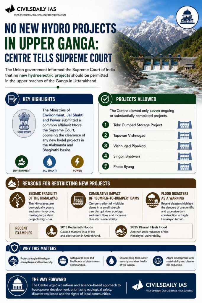
The Union government informed the Supreme Court of India that no new hydroelectric projects should be permitted in the upper reaches of the Ganga in Uttarakhand.
Key Highlights
- Ministries of:
- Environment
- Jal Shakti
- Power
- Submitted a common affidavit opposing new hydel projects in the Alaknanda and Bhagirathi basins.
Projects Allowed
The Centre allowed only seven ongoing or substantially completed projects, including:
- Tehri Pumped Storage Project
- Tapovan Vishnugad
- Vishnugad Pipalkoti
- Singoli Bhatwari
- Phata Byung
Reasons for Restricting New Projects
The government cited:
- Seismic fragility of the Himalayas
- Cumulative impact of “bumper-to-bumper” dams
- Flood disasters such as:
- 2013 Kedarnath floods
- 2025 Dharali flash flood
Background
- The case originated after the 2013 Kedarnath disaster.
- The Supreme Court had asked expert committees to study the impact of hydropower projects in Uttarakhand.
[2009] The Dul Hasti Power Station is based on which one of the following rivers?
(a) Beas
(b) Chenab
(c) Ravi
(d) Sutlej
- Ministries of:
-
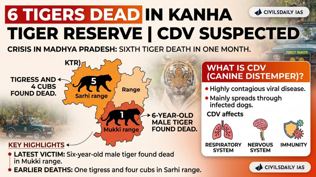
Tiger Deaths in Kanha Tiger Reserve Raise CDV Concerns
Why in the News?
A sixth tiger has died in Madhya Pradesh’s Kanha Tiger Reserve within a month, with authorities suspecting infection by the Canine Distemper Virus (CDV).
Key Highlights
- Latest victim:
- Six-year-old male tiger
- Found dead in Mukki range of KTR
- Earlier deaths: One tigress and four cubs in Sarhi range
What is CDV (Canine Distemper)?
- Highly contagious viral disease.
- Mainly spreads through infected dogs.
- Affects:
- Respiratory system
- Nervous system
- Immune system
Why is it a Concern?
- Virus may be spreading across different ranges of the reserve.
- Stray dogs entering buffer and core forest areas are suspected carriers.
Role of Authorities
- The National Tiger Conservation Authority (NTCA) and Union government have sought reports from State officials regarding the tiger deaths.
About Kanha Tiger Reserve
- Located in Madhya Pradesh.
- One of India’s major tiger reserves.
- Part of the Project Tiger network.
Consider the following statements about National Tiger Conservation Authority (NTCA):
1.It was constituted under Biodiversity act, 2002.
2.It is a statutory authority to implement Project Tiger.
Which of the statements given above is/are correct?
[A] 1 only [B] 2 only [C] Both 1 and 2 [D] Neither 1 nor 2 - Latest victim: