Officials of the Directorate of Revenue Intelligence (DRI) seized two live Indian Red Sand Boa snakes in Warangal, Telangana, during an operation against illegal wildlife trade.
Key Highlights
The operation was conducted by the Hyderabad zonal unit of DRI.
Officials acted on intelligence regarding illegal sale of live snakes in the grey market.
Two live snakes were recovered from the suspect’s bag during an undercover decoy operation.
About Indian Red Sand Boa
Scientific name: Eryx johnii
Non-venomous burrowing snake species found in India.
Often targeted in illegal wildlife trade due to superstitions and false medicinal beliefs.
Legal Protection
The species is protected under: Schedule I of the Wild Life (Protection) Act, 1972
Significance of Schedule I
Provides the highest level of legal protection.
Hunting, possession, and trade are prohibited.
Action Taken
The snakes and accused were handed over to the Forest Range Officer, Warangal.
Further investigation is underway to identify possible wildlife trafficking networks.
[2017] In India, if a species of tortoise is declared protected under Schedule I of the Wildlife (Protection) Act, 1972, what does it imply? [A] It enjoys the same level of protection as the tiger. [B] It no longer exists in the wild, a few individuals are under captive protection; and not it is impossible to prevent its extinction. [C] It is endemic to a particular region of India. [D] Both (b) and (c) stated above are correct in this context.
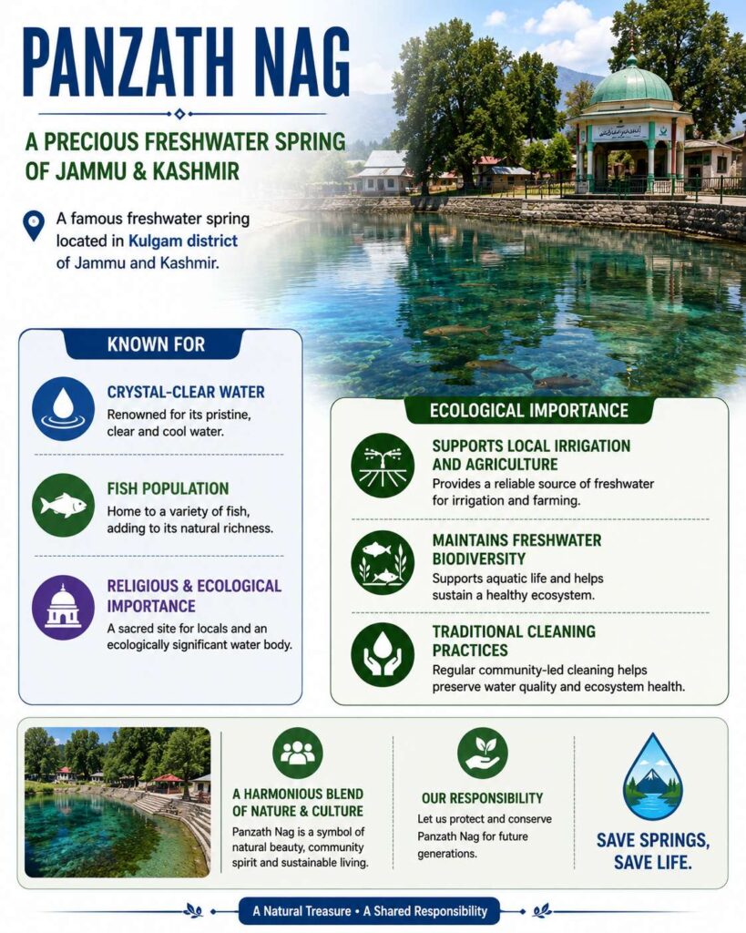
Hundreds of people participated in the traditional fishing and spring-cleaning festival at Panzath Nag in Kashmir.
About Panzath Nag
A famous freshwater spring located in Kulgam district of Jammu and Kashmir.
Known for:
Crystal-clear water
Fish population
Religious and ecological importance
Ecological Importance
Supports local irrigation and agriculture.
Maintains freshwater biodiversity.
Traditional cleaning helps preserve water quality and ecosystem health.
[2014] Every year, a month-long ecologically important campaign/festival is held during which certain communities/tribes plant samplings of fruit-bearing trees. Which of the following are such communities/tribes? (a) Bhutia and Lepcha (b) Gond and Korku (c) Irula and Toda (d) Sahariya and Agariya
India’s first satellite-tagged Ganges soft-shell turtle was released in Kaziranga National Park, Assam, coinciding with Endangered Species Day.
Key Highlights
The turtle was released in the 1,302 sq. km Kaziranga National Park and Tiger Reserve.
The project aims to study:
Seasonal movement patterns
Home range
Nesting and breeding habitats
Conducted by the Wildlife Institute of India in collaboration with:
Kaziranga National Park authorities
Assam Forest Department
Funded by the National Geographic Society.
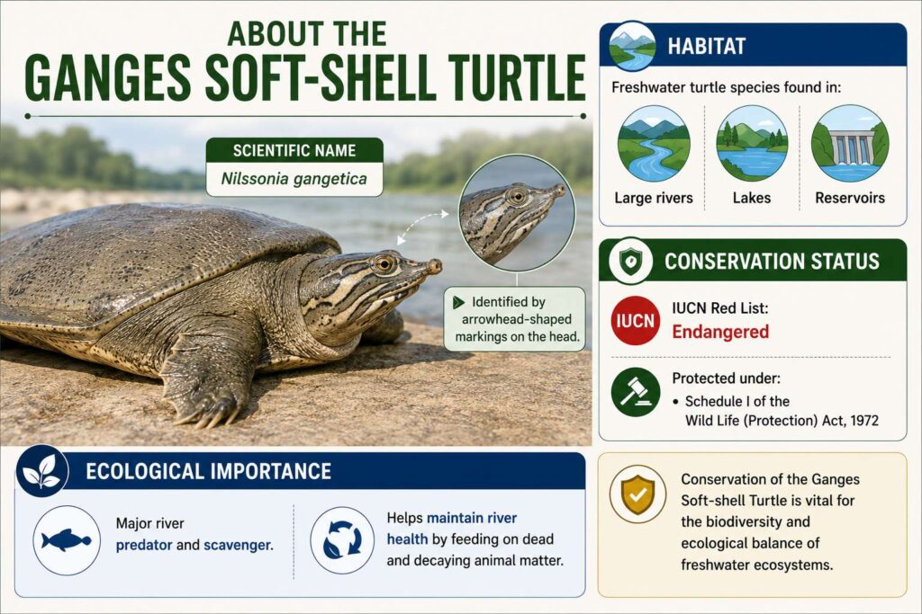
About the Ganges Soft-shell Turtle
Scientific name: Nilssonia gangetica
Freshwater turtle species found in:
Large rivers
Lakes
Reservoirs
Identified by arrowhead-shaped markings on the head.
Conservation Status
IUCN Red List: Endangered
Protected under:
Schedule I of the Wild Life (Protection) Act, 1972
Ecological Importance
Major river predator and scavenger.
Helps maintain river health by feeding on dead and decaying animal matter.
Assam and Turtle Conservation
Assam is a priority region for freshwater turtle conservation.
Out of eight soft-shell turtle species found in India, five occur in the Kaziranga landscape.
[2019] Consider the following statements: 1. Some species of turtles are herbivores. 2. Some species of fish are herbivores. 3. Some species of marine mammals are herbivores. 4. Some species of snakes are viviparous. Which of the statements given above are correct? [A] 1 and 3 only [B] 2, 3 and 4 only [C] 2 and 4 only [D] 1, 2, 3 and 4
PYQ Relevance[UPSC 2018] How does biodiversity vary in India? How is the Biological Diversity Act, 2002 helpful in conservation of flora and fauna?Linkage: The PYQ tests understanding of biodiversity conservation, habitat protection, and institutional mechanisms for ecological sustainability. Human-wildlife conflict arises from habitat fragmentation and biodiversity loss; coexistence strategies require stronger ecological conservation and legal protection frameworks like the Biological Diversity Act.
Mentor’s comment
Human-wildlife conflict (HWC) has emerged as a major conservation and governance challenge. This is because habitat fragmentation, infrastructure expansion, climate stress, and shrinking ecological corridors intensify encounters between humans and wildlife. India reports hundreds of human deaths annually due to elephant encounters, while crop damage and livestock predation continue to affect livelihoods.
Why is human-wildlife conflict increasing globally and in India?
Habitat Fragmentation: Roads, railways, dams, mining, and urbanisation disrupt migratory routes and ecological corridors. Elephants and large mammals increasingly move through agricultural landscapes.
Case Study (India): The Siliguri-Alipurduar railway track in North Bengal acts as a barrier, causing frequent train-elephant collisions.
Agricultural Expansion: Cultivation near forest fringes increases overlap between biodiversity-rich habitats and settlements.
Case Study (India): In the Western Ghats (Kerala, Karnataka, Tamil Nadu), the expansion of tea, coffee, and banana plantations adjacent to protected areas has severely disrupted elephant movement. This has resulted in high crop raiding in districts like Coimbatore and Wynad.
Ecological Imbalance: Decline in natural prey and food sources pushes wildlife towards human settlements.
Case Study (India): In Manas National Park, Assam, the degradation of traditional fodder habitats has led to increased crop raiding. Furthermore, the substitution of native trees with commercial monoculture like Eucalyptus has reduced natural grazing, forcing herds into villages.
Climate Change: Alters vegetation and water availability, intensifying competition for resources.
Case Study (India): During intense summers, elephants in the state of Odisha and in the Kaziranga-Karbi Anglong landscape have been observed moving into human settlements looking for water and raiding paddy fields.
Population Pressure: Expands human settlements near forests and ecologically sensitive regions.
Case Study (India): In Karnataka’s Kodagu region, rapidly growing population and land conversion into ginger and coffee farms have shrunk elephant corridors, forcing them into intense competition with locals for space.
India’s Vulnerability: Elephant encounters, livestock depredation, and crop raiding impose significant economic and social costs.
Livestock Depredation: In Hemis National Park, Ladakh, Snow Leopards preying on sheep and goats are a major source of conflict, with a study finding that they are responsible for 31% of livestock predation in some valleys.
How does ecological imbalance shape human-wildlife conflict?
Why are education and awareness central to coexistence?
Behavioural Change: Reduces retaliatory actions against wildlife.
Risk Awareness: Promotes safer responses in conflict-prone regions.
Climate Adaptation: Builds preparedness for ecological stress.
Community Partnership: Reframes local populations as conservation stakeholders.
What should be India’s future strategy for managing human-wildlife conflict?
Habitat Restoration: Improves prey availability and ecosystem resilience.
Ecological Connectivity: Secures wildlife corridors to reduce accidental encounters.
Scientific Land-Use Planning: Integrates biodiversity concerns into development projects.
Rapid Compensation: Strengthens trust among affected communities.
Data-Based Governance: Uses GIS mapping and wildlife monitoring for prevention.
Participatory Conservation: Ensures community involvement and benefit-sharing.
Conclusion
Human-wildlife conflict reflects a deeper ecological imbalance rather than isolated wildlife aggression. Sustainable coexistence requires integrating conservation with local livelihoods through habitat restoration, ecological corridors, participatory governance, and scientific planning. India’s long-term success will depend on shifting from reactive mitigation to coexistence-centred conservation.
India’s water governance architecture has come into focus amid rising concerns over groundwater depletion, urban water stress, declining per-capita water availability, and climate-induced hydrological variability. The debate has gained significance because India supports nearly one-fifth of the global population with only around 4% of global freshwaterresources. At the same time, nearly 600 million people face high to extreme water stress.
Why is India facing a water paradox despite substantial rainfall?
Hydrological Abundance: India receives nearly 4,000 BCM of annual rainfall, yet only about 1,100 BCM is considered usable, due to storage constraints and uneven distribution.
Population Pressure: India supports nearly 20% of the world’s population while possessing only around 4% of global freshwater resources, intensifying stress.
Uneven Distribution: Rainfall remains spatially and temporally concentrated, creating regional imbalances between water-rich and water-scarce regions.
Storage Deficit: Limited reservoir capacity and weak rainwater harvesting reduce effective utilization of precipitation.
Ecological Constraints: River degradation, catchment destruction, and wetland loss reduce water retention capacity.
Wetland Degradation & Encroachment: The destruction of crucial wetlands like the Pallikaranai marshland in Chennai or the deepor Beel in Guwahati, used for urban infrastructure projects; This prevents natural rainwater storage, turning potential recharge areas into urban floodplains.
River Degradation and Pollution: Rapid industrialization has severely polluted critical rivers like the Yamuna (Delhi/Agra segment) and Ganga (near Varanasi/Kanpur); This renders the surface water unfit for consumption and requiring higher water treatment costs, making the available water unusable.
Catchment Destruction and Deforestation: Deforestation in the Himalayan catchment areas of the Ganga has accelerated soil erosion and reduced groundwater infiltration.
Over-extraction Leading to Aquifer Degradation: Unsustainable groundwater pumping in states like Punjab and Haryana is depleting aquifers. This reduces the natural storage capacity of the soil, making the region more vulnerable to drought.
How severe is India’s water stress and what trends indicate growing vulnerability?
Water Stress: Around 600 million people face high to extreme water stress, indicating large-scale vulnerability.
Declining Per Capita Availability: Annual per-capita water availability has declined from over 5,000 cubic metres after independence to nearly 1,400 cubic metres, approaching water stress thresholds.
Groundwater Dependence: India has become the world’s largest groundwater extractor, accounting for nearly 25% of global groundwater extraction.
Agricultural Pressure: Agriculture consumes the majority of freshwater resources, especially through inefficient flood irrigation.
Total Supply Share: Agriculture consumes approximately 80% to 84% of India’s total available freshwater.
Groundwater Depletion: The sector sucks up 89% of all extracted groundwater in the country. India pumps more groundwater annually than the US and the EU combined.
Annual Extraction Volume: Out of nearly 239 BCM of total groundwater extracted, 208.5 BCM goes solely to agricultural activities.
Urban Water Crisis: Rapid urbanization increases dependence on distant water sources, groundwater extraction, and tanker economies.
How is India’s institutional framework governing water resources structured?
Multi-Level Governance: Water governance operates through Union government, State governments, and local bodies, creating a federal framework.
Ministry of Jal Shakti: Functions as the nodal authority for water resources, drinking water, and sanitation.
Central Water Commission (CWC): Ensures surface water planning, river basin development, and flood management.
Central Ground Water Board (CGWB): Supports groundwater assessment, aquifer mapping, and scientific management.
NITI Aayog: Strengthens competitive federalism through Composite Water Management Index, improving accountability and evidence-based policymaking.
State Jurisdiction: Irrigation, groundwater management, and local water supply largely remain State subjects, creating coordination challenges.
How are national missions strengthening water governance in India?
Jal Jeevan Mission (2019)
Household Connectivity: Expands functional household tap water connections in rural areas.
Implementation Model: Aligns central funding with state execution, improving last-mile delivery.
Universal Coverage: Mission extension until 2028 supports universal access.
Atal Bhujal Yojana
Groundwater Sustainability: Strengthens community-based groundwater budgeting and monitoring in water-stressed regions.
Participatory Governance: Encourages local stakeholder involvement in aquifer management.
Pradhan Mantri Krishi Sinchayee Yojana (PMKSY)
Micro-Irrigation: Improves water-use efficiency through drip and sprinkler irrigation.
Agricultural Productivity: Supports higher productivity with lower freshwater consumption.
AMRUT Mission
Urban Water Infrastructure: Expands water supply networks, sewerage systems, and wastewater treatment in cities.
Namami Gange Programme
River Basin Restoration: Integrates pollution control, sewage treatment, ecological restoration, and river rejuvenation in the Ganga basin.
Why does India’s federal water governance face coordination challenges?
Constitutional Fragmentation: Water remains primarily a State subject, while river basins transcend political boundaries.
Can a circular water economy transform India’s water future?
A circular water economy is an economic and environmental framework that replaces the traditional, linear “take-make-dispose” approach with a closed-loop system. Instead of extracting freshwater, using it once, and discharging it as waste, a circular model focuses on reducing freshwater withdrawals, recycling wastewater, and recovering valuable by-products to keep water in circulation as long as possible.
River Basin Approach: Encourages integrated watershed and river management.
Community Participation: Improves accountability through decentralized governance.
Climate Resilience: Strengthens adaptation to changing rainfall patterns and droughts.
Case studies for circular water economy
Wastewater Reuse: Recycling treated municipal sewage for industrial and civic purposes directly preserves premium drinking-quality freshwater for human consumption.
The Chennai Metrowater Model: High-tech plants treat sewage into industrial-grade water. This recycled water is sold directly to major automotive and petrochemical clusters, saving millions of litres of freshwater daily.
Surat Municipal Corporation: Surat treats domestic sewage to tertiary standards and pumps it directly to textile and diamond processing industrial areas, generating municipal revenue while ensuring a reliable water supply.
Efficient Irrigation: Transitioning from wasteful flood irrigation to closed-loop, precision systems maximizes crop yield per drop of water.
Gujarat Green Revolution Company: The state heavily subsidized drip and sprinkler networks. In semi-arid regions like Saurashtra, this allowed farmers to cultivate cotton and groundnuts without collapsing local water tables.
Kaleshwaram Lift Irrigation Zone (Telangana): Instead of using open, evaporative canals, water is piped directly to fields and applied via automated drip lines, reducing agricultural water waste by over 40%.
Technological Innovation: Deploying IoT sensors, automated meters, and data analytics cuts down on systemic water losses and illegal extraction.
Bengaluru’s IoT Water Metering: Tech startups have deployed smart water meters in residential and corporate hubs. These track real-time consumption and flag leaks, reducing apartment water wastage by 20% to 35%.
National Aquifer Mapping Program (NAQUIM): Advanced heliborne geophysical surveys map subsurface aquifers nationwide. This allows districts to precisely calculate sustainable extraction limits and prevent groundwater over-pumping.
River Basin & Watershed Approach: Treating entire river basins and landscapes as single interconnected hydrological units prevents upstream degradation from destroying downstream supply.
Hiware Bazar Transformation (Maharashtra): This drought-prone village banned water-guzzling sugarcane and deep borewells. By implementing contour trenches and bunds, they raised the local groundwater table to create a self-sustaining economy.
Neeranchal National Watershed Project: Backed by the World Bank, this project applies integrated watershed frameworks across multiple states to reduce soil erosion and improve rainfall retention in natural catchments.
Community Participation: Shifting water governance from centralized government bodies to local communities ensures accountability, long-term asset maintenance, and equitable sharing.
Mission Kakatiya (Telangana): This program engaged village communities to de-silt and restore centuries-old traditional tanks. Local farmers used the nutrient-rich silt on their lands, boosting both crop yields and local water storage.
Pani Panchayats (Odisha & Maharashtra): Democratically elected, community-led water user associations legally empower local farmers to distribute canal water equitably, resolve disputes, and maintain local infrastructure.
Climate Resilience: Circular water systems insulate urban and rural populations from the unpredictable weather patterns, erratic monsoons, and prolonged droughts driven by climate change.
Delhi Amrit Sarovar Initiative: The city is restoring over 250 urban lakes and water bodies. By routing treated wastewater into them, these spaces act as natural “sponges” that absorb heavy monsoon floods and recharge dry aquifers for summer use.
Global Best Practices
Israel: Demonstrates large-scale wastewater recycling and drip irrigation.
Singapore: Ensures urban water resilience through NEWater recycled water systems.
Australia (Murray-Darling Basin): Strengthens integrated river basin governance.
Conclusion
India’s water challenge increasingly reflects a governance deficit rather than absolute scarcity. Sustainable water security requires stronger federal coordination, groundwater regulation, wastewater reuse, river basin management, and community participation. Scientific planning, technological integration, and institutional accountability remain essential to transform India from a water-stressed economy into a water-secure society.
PYQ Relevance
[UPSC 2024] The groundwater potential of the Gangetic Valley is on a serious decline. How may it affect the food security of India?
Linkage: The question examines the link between groundwater depletion, agriculture, and food security. It helps build analytical linkage between water governance and long-term agricultural resilience.
The forest department has launched a comprehensive scientific wildlife census in Binsar Wildlife Sanctuary to assess the population status and movement patterns of major wildlife species.
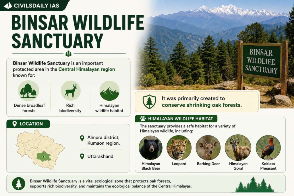
About Binsar Wildlife Sanctuary
Binsar Wildlife Sanctuary is an important protected area in the Central Himalayan region known for:
Dense broadleaf forests
Rich biodiversity
Himalayan wildlife habitat
It was primarily created to conserve shrinking oak forests.
Location: Almora district, Kumaon region, and Uttarakhand.
[2014] If you travel through the Himalayas, you are Iikely to see which of the following plants naturally growing there? 1. Oak 2. Rhododendron 3. Sandalwood Select the correct answer using the code given below [A] 1 and 2 only [B] 3 only [C] 1 and 3 only [D] 1, 2 and 3
Noise pollution has returned to focus after post-election celebrations in Tamil Nadu witnessed large-scale use of loud “whistle pods” and public processions. This has revived concerns over India’s weakest enforced environmental problem. The issue is significant because India continues to normalise excessive noise despite clear legal limits. The scale of the problem is striking: over 80% of monitoring stations under the National Ambient Noise Monitoring Network (NANMN) recorded violations in 2019.
What are the Noise Pollution Rules in India?
Noise pollution in India is primarily regulated by the Noise Pollution (Regulation and Control) Rules, 2000, framed under the Environment Protection Act, 1986. These rules define permissible sound levels based on the time of day and the category of the area.
Permissible Noise Levels (in dB)
The Central Pollution Control Board (CPCB) divides areas into four zones with specific decibel limits:
Category of Area/Zone
Day Time (6 AM – 10 PM)
Night Time (10 PM – 6 AM)
Industrial Area
75 dB
70 dB
Commercial Area
65 dB
55 dB
Residential Area
55 dB
45 dB
Silence Zone (Silence Zones include areas within 100 metres of hospitals, educational institutions, and courts)
50 dB
40 dB
Why does noise pollution remain socially tolerated despite being a major environmental hazard?
Social Normalisation: Indian society treats excessive sound during celebrations, elections, festivals, weddings, and sporting events as culturally acceptable behaviour.
Political Incentives: Political parties often avoid restraining supporters due to fear of electoral backlash during rallies and victory celebrations.
Cultural Accommodation: State governments permit loudspeakers and nighttime exemptions for religious and cultural occasions for up to 15 days annually.
Weak Public Awareness: Noise pollution receives less public attention than air pollution despite comparable health implications.
Illustrative Example: Tamil Nadu witnessed large-scale use of “whistle pods” during cricket matches and political celebrations after TVK’s Assembly election performance.
How severe is the noise pollution problem in India?
NANMN Data: Over 80% of recording stations under the National Ambient Noise Monitoring Network reported violations of prescribed limits during both daytime and nighttime in 2019.
Residential Violations: All 10 monitoring stations in Chennai exceeded residential nighttime thresholds of 45 decibels.
Global Comparison: A 2022 UN Environment Programme report identified Moradabad (Uttar Pradesh) among the world’s highest noise-affected cities.
Inadequate Monitoring: NANMN operates only 70 stations across seven metros, reflecting insufficient monitoring capacity.
Urban Concentration: Higher exposure persists near airports, arterial roads, industrial areas, and dense urban settlements.
What are the major drivers of excessive noise pollution in Indian cities?
Urbanisation: Rapid expansion of cities increases vehicular traffic, construction activity, and commercial congestion.
Construction Activity: Construction often continues through nighttime due to poor enforcement and unchecked permissions.
Traffic Density: High traffic volume and poor urban planning increase ambient noise.
Administrative Weakness: Weak policing and low institutional responsiveness reduce compliance with legal limits.
Political Celebrations: Election victories, processions, and rallies frequently generate noise beyond permissible levels.
Sporting Culture: Public celebrations during cricket and football events amplify temporary but intense noise exposure.
Example: The vuvuzelas during the 2010 FIFA World Cup became globally criticised for rendering commentary inaudible.
What are the public health consequences of excessive noise exposure?
Occupational Impact: World Health Organisation (WHO) attributes 16% of disabling hearing loss among adults to occupational noise exposure.
Indian Burden: Approximately 6.3 crore Indians experience some degree of impaired hearing.
Construction Sector Vulnerability: A Puducherry survey of 500 construction workers reported hearing impairment prevalence ranging from 13% to 49%, supported by meta-analysis of industrial workers.
Cardiovascular Risks: Noise exposure elevates cortisol levels, increases endothelial dysfunction, and contributes to stress-related illnesses.
Cognitive Effects: Children near airports and arterial roads face impaired cognition and learning outcomes.
European Evidence: Traffic noise contributes to the loss of approximately 16 lakh healthy life years annually in Western Europe.
How effective is India’s legal and institutional framework against noise pollution?
Noise Pollution (Regulation and Control) Rules, 2000 prescribe area-specific decibel limits and regulate loudspeaker use.
Zonal Classification: Rules classify areas into industrial, commercial, residential, and silence zones.
Silence Zone Protection: Areas around hospitals, educational institutions, and courts receive stricter regulation.
CPCB Oversight: The Central Pollution Control Board (CPCB) monitors compliance and recently proposed stronger financial penalties.
Judicial Recognition: Courts have repeatedly linked excessive noise to Article 21, recognising the right to peaceful sleep and quality life.
Implementation Deficit: Enforcement remains weak due to political interference, social acceptance, and poor local monitoring.
Why does implementation remain India’s biggest challenge in tackling noise pollution?
Enforcement Deficit: Local authorities rarely impose penalties despite repeated violations.
Political Reluctance: Governments hesitate to regulate politically sensitive events, festivals, and public celebrations.
Monitoring Gaps: Limited monitoring infrastructure restricts real-time detection and accountability.
Behavioural Resistance: Public acceptance of loud celebrations weakens voluntary compliance.
Institutional Fragmentation: Responsibility remains dispersed among police, municipal bodies, pollution boards, and district administrations.
What measures can strengthen India’s response to noise pollution?
Stronger Enforcement: Ensures strict penalties for repeated violations and unauthorised loudspeaker use.
Technology-Based Monitoring: Facilitates real-time decibel tracking through AI-enabled sound sensors.
Urban Planning: Strengthens sound-buffer zones around residential and silence areas.
Behavioural Change: Encourages public awareness campaigns to alter social acceptance of loud noise.
Political Accountability: Ensures equal application of rules during election campaigns and celebrations.
Community Participation: Enables citizen reporting through grievance portals and mobile applications.
Conclusion
Noise pollution reflects a wider governance deficit where legal frameworks exist but enforcement remains weak. India requires a shift from social tolerance of excessive sound towards rights-based environmental governance that protects health, productivity, and quality of life. Effective regulation, behavioural change, and political neutrality in enforcement remain essential for ensuring citizens’ right to work, rest, and sleep in peace.
PYQ Relevance
[UPSC 2024] Industrial pollution of river water is a significant environmental issue in India. Discuss the various mitigation measures to deal with this problem and also the government’s initiatives in this regard.
Linkage: This PYQ reflects UPSC’s focus on environmental pollution as a governance and public health issue, not merely an ecological problem. The present article extends the same logic to noise pollution, highlighting health impacts, regulatory failure, mitigation measures, and enforcement gaps in India.
Two cheetahs brought from Botswana were released into the wild at Kuno National Park (MP) after completing quarantine and acclimatisation. With this, India’s total cheetah population has increased to 57, including cubs born in India.
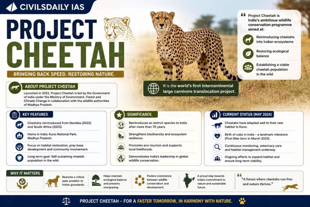
About Project Cheetah
Project Cheetah is India’s ambitious wildlife conservation programme aimed at:
Reintroducing cheetahs into Indian ecosystems
Restoring ecological balance
Establishing a viable cheetah population in the wild
It is the world’s first intercontinental large carnivore translocation project.
Launch of the Project
The project was launched in September 2022 by Narendra Modi at Kuno National Park
Background
Extinction in India: The Asiatic cheetah became extinct in India in 1952
Main reasons: Hunting, Habitat loss, and Decline in prey base
India declared the cheetah extinct officially in 1952.
Source Countries of Cheetahs
Namibia: 8 cheetahs brought in September 2022
South Africa: 12 cheetahs brought in 2023
Botswana: 9 cheetahs brought in 2026
[2024] Consider the following statements: 1. Lions do not have a particular breeding season. 2. Unlike most other big cats, cheetahs do not roar. 3. Unlike male lions, male leopards do not proclaim their territory by scent marking. Which of the statements given above are correct? [A] 1 and 2 only [B] 2 and 3 only [C] 1 and 3 only [D] 1,2 and 3
Researchers from Annamalai University discovered a new plant species named Cyphostemma annamalaii in the southern Eastern Ghats of Tamil Nadu.
About Cyphostemma annamalaii
Newly discovered plant species belonging to: Vitaceae (grape family)
Found in: Tropical dry forests of the southern Eastern Ghats
Habitat:
Open scrubby vegetation
Dry forest ecosystems
About the Vitaceae Family
Vitaceae
Commonly known as: Grape family
Includes climbing plants and vines
Economically important due to grape cultivation
About Eastern Ghats
Discontinuous mountain range along eastern India
Passes through:
Odisha
Andhra Pradesh
Telangana
Karnataka
Tamil Nadu
Known for rich biodiversity and endemic species
[2016] With reference to ‘Red Sanders’, sometimes seen in the news, consider the following statements: 1. It is a tree species found in a part of South India. 2. It is one of the most important trees in the tropical rainforest areas of South India. Which of the statements given above is/are correct? a) 1 only b) 2 only c) Both 1 and 2 d) Neither 1 nor 2
A study published in Nature has found that oak trees in temperate forests delay budburst and leaf emergence after heavy caterpillar infestation to reduce insect damage.
Key Findings of the Study
Oak trees delayed spring leaf emergence by about:
Three days after severe caterpillar attacks
Study conducted across:
60 oak forest sites
Over 2,400 km
During 2017 to 2021
What is Budburst
Stage when tree buds open and new leaves emerge during spring
Why Trees Delay Leafing
Caterpillars depend on soft fresh leaves immediately after hatching
Delayed leaf emergence creates temporary food shortage for insects
Result:
Reduced caterpillar survival
Lower leaf damage
Major Outcomes
Leaf damage reduced by nearly: 55%
Delayed leafing found more energy efficient than chemical defence mechanisms
[2022] If you travel through the Himalayas, you are likely to see which of the following plants naturally growing there? 1. Oak 2. Rhododendron 3. Sandal wood Select the correct answer using the code given below: a) 1 and 2 only b) 3 only c) 1 and 3 only d) 1, 2 and 3