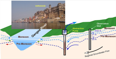
| [UPSC 2024] The groundwater potential of the Gangetic Valley is on a serious decline. How may it affect the food security of India? (Answer in 250 words) |
The Ganga River Basin, spread across 11 states, covers about 26% of India’s geographical area and supports over 40% of India’s population (~520 million people, 2011 Census).
Distribution and Density Pattern
- Upper Ganga Basin (Uttarakhand, Himachal Pradesh)
- Low density due to rugged relief, narrow valleys, and limited cultivable land.
- Settlements concentrated in valleys (Haridwar, Dehradun).
- Middle Ganga Basin (Uttar Pradesh, Bihar)
- Very high density (800–1100 persons/km²).
- Extensive alluvial plains, fertile soils, and perennial water availability.
- Cities like Kanpur, Lucknow, Patna show urban-industrial concentration.
- Lower Ganga Basin (West Bengal)
- Extremely high density (>1000 persons/km²), especially in the deltaic plains.
- Fertile deltaic alluvium, abundant water for irrigation, and proximity to ports (Kolkata, Howrah).
Role of Land, Soil, and Water Resources
Land Resources
- Extensive Alluvial Plains – Flat, fertile Indo-Gangetic plains provide ideal conditions for dense settlement.
- Favorable Relief – Gently sloping terrain encourages agriculture, irrigation, and transport networks.
- Deltaic Land Advantage – supports rice cultivation, jute, and fisheries. Eg– West Bengal (Kolkata–Howrah region).
Soil Resources
- Highly Fertile Alluvium – Soils rich in nutrients, renewed annually by floods, support intensive agriculture. Eg– Bihar’s Sone–Gandak plains known as India’s “granary belt.
- Diverse Soil Types – Khadar (new alluvium) supports rice, wheat, sugarcane; Bhangar (old alluvium) sustains orchards and pulses.
- High Agricultural Productivity – Fertility allows multiple cropping, sustaining high rural density. Eg– Rice–wheat belt in eastern UP and Bihar.
Water Resources
- Perennial River Network – Ganga and tributaries (Yamuna, Ghaghara, Gandak, Kosi) ensure year-round water supply.
- Irrigation Infrastructure – Canals (Upper & Lower Ganga Canal), tube-wells, and pumps enable irrigated farming.
- Groundwater Abundance – Shallow water table supports irrigation and drinking water. Eg– Punjab & western UP use intensive groundwater irrigation.
- Fisheries and Inland Navigation – Rivers support livelihood diversification beyond farming.
- Hydropower and Urban Water Supply – Eg– Tehri Dam in Uttarakhand; Kolkata draws water from Hooghly.
The Ganga River Basin is India’s “population heartland”. Ensuring sustainable resource management is vital to balance livelihood security with ecological health.


