Why in the News?
The Umngot River, celebrated for its crystal-clear waters and tourist appeal at Dawki and Shnongpdeng, has turned murky and opaque.
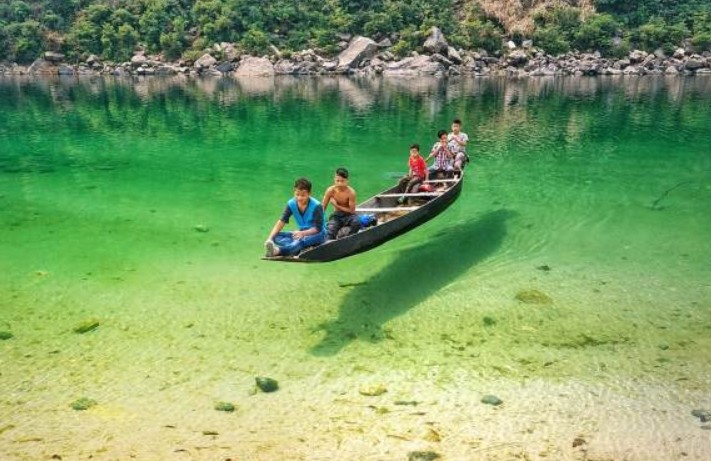
About Umngot River:
- Location: Flows through West Jaintia Hills district, Meghalaya, close to the India–Bangladesh border.
- Origin: Arises from the Jaintia Hills, traversing limestone-rich terrain that naturally filters impurities and maintains clarity.
- Distinct Appearance: Known for its crystal-clear waters that create the illusion of boats floating on air, earning it global recognition.
- Length & Course: Flows southward to Dawki town, where it merges with Bangladesh’s Piyain River.
- Ecological Features: Possesses high dissolved oxygen levels, preventing algal growth and supporting diverse aquatic biodiversity.
- Tourism Hub: Popular at Dawki and Shnongpdeng for boating, fishing, camping, and eco-tourism, drawing thousands of visitors annually.
- Infrastructure Landmark: The Dawki Suspension Bridge (1932) is a heritage structure spanning the river and serving as a trade route link.
- Economic Role: Sustains cross-border trade, local fishing, and tourism-driven livelihoods vital to Meghalaya’s rural economy.
- Cultural Boundary: Serves as a natural divider between Ri Pnar (Jaintia Hills) and Hima Khyrim (Khasi Hills).
Cause of Discoloration:
- Primary Cause: Linked to Shillong–Dawki road-widening project upgrading it to a two-lane highway with a 400 m bridge at Dawki.
- Pollution Source: Hill-cutting, excavation, and soil dumping along sites near Umtyngar and Dawki caused heavy sediment runoff.
- Inspection Findings: The Meghalaya State Pollution Control Board (MSPCB) detected uncontained debris and sliding soil entering the river, reducing water transparency.
| [UPSC 2021] Consider the following rivers:
1. Brahmani 2. Nagavali 3. Subarnarekha 4. Vamsadhara Which of the above rise from the Eastern Ghats? Options: (a) 1 and 2 (b) 2 and 4* (c) 3 and 4 (d) 1 and 3 |