💥Join UPSC 2027,2028 Mentorship (August Batch) + XFactor Notes & Microthemes PDF

China completes first stage of ‘military base’ at disputed South China Sea reef

Why in the News

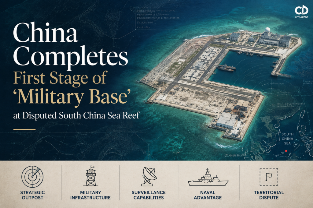
China has completed the first phase of construction on Antelope Reef in the Paracels archipelago, building a man-made island in the disputed South China Sea that analysts say will form part of its largest military base. The tension it exposes is that Chinese state media describe the feature as serving civilian needs such as weather forecasting and scientific research, while satellite imagery shows a wharf, a deep water harbour, a helicopter pad and the first excavation for a runway.

What has China built on Antelope Reef?

  1. The feature: Antelope Reef is a reef in the Paracels archipelago in the northern South China Sea, now reclaimed into a man-made island.
  2. The stage reached: The first phase of construction is complete, with barges and dredgers having left after at least six months of work in the waterway.
  3. What is visible: Satellite images reviewed by Reuters show the reclaimed feature in outline for the first time, with building work started in the southeast corner including a helicopter pad.
  4. The imagery source: The images showing the southeast corner construction were taken on 19 July by Vantor, a commercial provider of satellite images.

What is the Paracels archipelago?

  1. What it is: The Paracels are a group of islands, reefs and banks in the northern South China Sea, distinct from the Spratlys archipelago further south.
  2. Who holds them: China has occupied all the Paracels since 1974, when it forced off the navy of the former South Vietnam, and Vietnam claims the entire grouping as its own.

What is a naval bastion?

  1. The concept: A bastion is a protected ocean area close to home ports within which a navy shields its nuclear-armed ballistic missile submarines from rival attack.
  2. Why it matters here: Antelope could help support any Chinese bid to create bastions in the South China Sea, avoiding the need to send submarines out into the western Pacific where they are exposed.

What do the satellite images actually show?

  1. Island dimensions: The reclaimed island is nearly 6 km long, with a straight line of coast longer than 3 km that some analysts see as a potential runway.
  2. Runway work under way: A study published this week by the Washington-based Center for Strategic and International Studies (CSIS) found that the first excavation work for a new runway appeared to have already started.
  3. Harbour infrastructure: A wharf stretching 680 m fronts a deep water harbour, with one satellite image showing a coast guard ship alongside.
  4. Aviation infrastructure: Construction of buildings has started in the southeast corner of the island, including a helicopter pad.
  5. The timeline of the work: An open source intelligence tracker first highlighted dredging at the reef in early January and reported spotting initial signs of work in December, with dredgers and barges departing after at least six months.
  6. Official silence: China's defence ministry did not immediately respond to a request for comment, and China has yet to acknowledge construction of a new military base.

Why is the northern South China Sea strategically different from the Spratlys?

  1. The Taiwan linkage: The northern part of the South China Sea would be particularly important in a Taiwan conflict scenario, which places Antelope Reef in an ideal position.
  2. Command priority raised: The importance of the South China Sea and of the Southern Theater Command has been elevated in the last year by the Central Military Commission, China's top military panel, largely in relation to Taiwan.
  3. Defensibility: Antelope could prove one of the Chinese military's most important features in the South China Sea, larger than neighbouring Woody Island and easier to defend than the network of bases further south in the Spratlys.
  4. Basing for strategic assets: Chinese military planners might prefer to keep weapons such as H-6 strategic bombers in the Paracels and closer to the Chinese mainland rather than on the Spratlys.
  5. The existing Paracels network: Woody Island has served as the traditional administrative centre for China in the South China Sea and has at times housed jet fighters and surface-to-air missiles, while Triton Island, also in the Paracels, hosts extensive long-range surveillance devices.

What does the build-up mean for submarine operations and nuclear deterrence?

  1. The bastion function: Antelope could support Chinese efforts to create protected ocean areas in the South China Sea to defend its nuclear-armed ballistic missile submarines.
  2. The protection logic: Bastions close to home ports shield submarines from exposure to rival attack, removing the need to send them into the western Pacific.
  3. The surveillance role: The island build-up is likely to house extensive surveillance equipment.
  4. The effect on rivals: That surveillance could complicate submarine operations by the United States and Vietnam, both of which are active in the area.
  5. The escalation implication: A feature that protects a second-strike capability changes the risk calculus of any confrontation, since attacking it touches nuclear deterrence rather than only conventional assets.

Why do China's stated purpose and the observed build-out point in different directions?

  1. The official account: Chinese state media have said Antelope will serve civilian needs such as weather forecasting and scientific research.
  2. The scholarly framing: A Chinese South China Sea scholar described the construction work as "modest" in an opinion piece published in the official China Daily in June, arguing that rather than militarisation the purpose is peaceful and constructive, making the waters safer for everyone who depends on them.
  3. The precedent for that framing: The same explanation mirrors China's previous accounts of its build-up in the Spratlys, in waters also claimed by Vietnam, the Philippines, Malaysia, Taiwan and Brunei.
  4. The professional reading: Regional security analysts and military attaches say the feature is more likely to strengthen China's military hold on the northern part of the vital waterway.
  5. What the physical evidence supports: A 680 m wharf on a deep water harbour, a helicopter pad, a 3 km straight coastline and runway excavation are assets of military utility, not of weather forecasting.
  6. The unresolved point: China has not acknowledged constructing a military base, so the gap between the stated purpose and the observed capability remains formally unclosed.

Which states contest these waters and on what basis?

  1. Vietnam, the Paracels claim: Vietnam claims the entire Paracels grouping as its own, and China took full control of the group in 1974 by forcing off the navy of the former South Vietnam.
  2. Vietnam, the specific protest: Vietnam's Foreign Ministry has previously asserted its sovereignty claim to Antelope, saying in March that it resolutely opposes such actions and has made representations.
  3. Vietnam, the counter build-up: Vietnam has moved in recent years to expand its own network of bases in the Spratlys archipelago.
  4. The Philippines, Malaysia, Taiwan and Brunei: All four join Vietnam in claiming waters in the Spratlys where China has previously built up features.
  5. The United States, the outside actor: The completion shows the South China Sea as an increasingly militarised arena of contest between China and the United States and its allies, as both jostle for advantages that could prove critical in any future conflict over Taiwan.

Conclusion

The completion of the first construction phase on Antelope Reef marks the conversion of a submerged reef into a 6 km island with harbour, aviation and probable runway infrastructure in the northern South China Sea. China has not acknowledged the feature as a military base, and construction of buildings and runway excavation continue in its southeast corner. The next stage to watch is whether the 3 km straight coastline is completed as an operational runway, which would confirm the feature as part of the largest Chinese military base in the waterway.

The South China Sea Dispute: An Overview

  1. What it is: The South China Sea is a marginal sea of the western Pacific bounded by China, Taiwan, the Philippines, Malaysia, Brunei, Indonesia and Vietnam, and its islands, reefs and banks are subject to overlapping sovereignty claims.
  2. The principal groupings: The main contested features are the Paracels in the north, occupied entirely by China since 1974, and the Spratlys in the south, where features are held by China, Vietnam, the Philippines, Malaysia and Taiwan.
  3. Scale of the trade stake: The waterway carries a very large share of global seaborne trade and is the principal route between the Indian Ocean and Northeast Asia through the Strait of Malacca.
  4. Resource stake: The seabed holds hydrocarbon deposits and the waters support fisheries that are a primary protein source for the littoral populations.
  5. The Chinese claim line: China asserts historic rights within a broad dashed line encompassing most of the sea, a claim not defined by coordinates and not grounded in the maritime zones of the law of the sea.
  6. The mode of contest: The dispute is conducted principally through island building, coast guard and maritime militia presence and survey activity, rather than through declared naval action.
  7. India's stake: India's trade and energy flows transit the region, Indian public sector exploration blocks lie off Vietnam, and India has consistently supported freedom of navigation and settlement in accordance with the law of the sea.

Laws and Instruments Governing the South China Sea

  1. United Nations Convention on the Law of the Sea, 1982 (UNCLOS): The framework treaty defining the territorial sea, contiguous zone, exclusive economic zone, continental shelf and high seas, and establishing the dispute settlement machinery under which claims are adjudicated.
  2. Article 121 distinguishes an island, which generates a full exclusive economic zone and continental shelf, from a rock that cannot sustain human habitation or economic life, which generates only a territorial sea.
  3. Article 60 provides that artificial islands, installations and structures do not possess the status of islands and generate no territorial sea of their own.
  4. Annex VII provides for arbitral tribunals, the route under which the Philippines brought its 2013 case.
  5. Declaration on the Conduct of Parties in the South China Sea, 2002: A political declaration between the Association of Southeast Asian Nations and China committing parties to exercise self-restraint and refrain from actions that complicate disputes, without binding legal force.
  6. Code of Conduct in the South China Sea: The successor instrument under negotiation since 2002 between the Association of Southeast Asian Nations and China, intended to be binding, still not concluded.
  7. International Code for Ships Operating in Polar Waters and other International Maritime Organization instruments: Govern safety of navigation and pollution prevention for shipping transiting the waterway.

China's Wider Maritime Expansion and India's Response

Source: Backgrounder, Indian_Ocean_Blue_Economy.docx

  1. String of Pearls: Chinese ports and bases at Gwadar in Pakistan, Hambantota in Sri Lanka, Chittagong in Bangladesh, and Sittwe and the Coco Islands in Myanmar, plus a military base in Djibouti.
  2. Naval expansion: The Chinese People's Liberation Army Navy had over 340 battle force ships by 2021, surpassing the United States fleet in numbers.
  3. Connectivity instrument: The Maritime Silk Road under the Belt and Road Initiative extends Chinese commercial and strategic influence across the Indian Ocean Region.
  4. Survey presence: Chinese research vessels such as Shi Yan 6 and Yuan Wang 5 have conducted surveillance activity near India.
  5. India's counter architecture, Necklace of Diamonds: India has developed naval access at Chabahar in Iran, Duqm in Oman, Changi in Singapore, Sabang in Indonesia, Assumption Island in Seychelles and Agalega in Mauritius.
  6. SAGAR, 2015: Security and Growth for All in the Region, launched in 2015, rests on five pillars covering safety and security of Indian territories, deepening cooperation with maritime neighbours, collective action against traditional and non-traditional threats, sustainable development, and regional primary responsibility for regional stability.
  7. MAHASAGAR, 2025: Mutual and Holistic Advancement for Security and Growth Across Regions, announced in March 2025, expands SAGAR from the Indian Ocean Region to the broader Global South across three pillars of trade for development, capacity building and mutual security.
  8. Indo-Pacific Oceans Initiative, 2019: Launched by India at the East Asia Summit in Bangkok in 2019, structured around seven pillars including maritime security, maritime ecology, maritime resources, capacity building, disaster risk reduction, science and technology cooperation, and trade connectivity and maritime transport.

Back2Basics: The South China Sea Arbitration, 2016

  1. The case: The Philippines instituted arbitration against China in 2013 under Annex VII of the United Nations Convention on the Law of the Sea, 1982.
  2. The forum: The tribunal was constituted under Annex VII and administered by the Permanent Court of Arbitration at The Hague.
  3. The award date: The tribunal issued its award in July 2016.
  4. Core finding on the claim line: The tribunal held that China's claim to historic rights within the dashed line had no legal basis under the Convention, since any such rights were extinguished where incompatible with the exclusive economic zone regime.
  5. Finding on features: It held that none of the Spratly features generated an exclusive economic zone or continental shelf, since none qualified as an island capable of sustaining human habitation or economic life of its own.
  6. Finding on construction: It found that China's island building had caused severe harm to the coral reef environment and violated obligations to preserve and protect the marine environment.
  7. Compliance position: China did not participate in the proceedings and has rejected the award as null and void, and the Convention provides no enforcement mechanism against a non-complying party.

Key Facts about the South China Sea

  1. Principal archipelagos: The Paracels, the Spratlys, Scarborough Shoal and the Pratas Islands are the four main contested groupings.
  2. Chinese administrative seat: Woody Island in the Paracels serves as China's traditional administrative centre in the South China Sea.
  3. Choke point: The Strait of Malacca connects the South China Sea to the Indian Ocean and is one of the world's busiest shipping choke points.
  4. The Paracels takeover: China has occupied all the Paracels since 1974, following the Battle of the Paracel Islands against the navy of the former South Vietnam.
  5. Claimant states: China, Taiwan, Vietnam, the Philippines, Malaysia and Brunei maintain overlapping claims, with Indonesia contesting Chinese claims in waters off the Natuna Islands.
  6. The 2002 and pending instruments: The Declaration on the Conduct of Parties dates to 2002 and the binding Code of Conduct has been under negotiation ever since.
  7. Freedom of navigation operations: The United States conducts freedom of navigation operations in the waterway to contest excessive maritime claims.

Challenges to Maritime Order in the South China Sea

  1. No enforcement of adjudicated outcomes: A binding award carries no enforcement machinery against a permanent Security Council member, e.g. China rejected the 2016 arbitral award and has continued reclamation since.
  2. Reclamation creates facts that law cannot reverse: Physical occupation and construction alter the situation on the ground faster than any legal or diplomatic process, e.g. the completion of a nearly 6 km island on Antelope Reef within about six months of dredging.
  3. The Code of Conduct remains unconcluded: The binding instrument intended to restrain conduct has been negotiated without result for over two decades, e.g. the Declaration on the Conduct of Parties of 2002 has still not been converted into a Code.
  4. Divided claimant positions: Claimant states cannot present a unified position because several have bilateral economic dependence on China, e.g. the Association of Southeast Asian Nations has repeatedly failed to issue a joint communique naming Chinese actions.
  5. Grey zone coercion below the threshold of conflict: Coast guard and maritime militia vessels are used in ways that avoid triggering an armed conflict response, e.g. water cannon and blocking actions against Philippine resupply missions at Second Thomas Shoal.
  6. Civilian framing of military assets: Dual-use construction blurs the legal category of a feature, e.g. Antelope Reef is officially described as serving weather forecasting and scientific research while carrying a helicopter pad and a 680 m wharf.
  7. Nuclear dimension raising escalation risk: Bastion construction ties a local territorial dispute to strategic deterrence, e.g. protected areas for nuclear-armed ballistic missile submarines make any confrontation at sea harder to contain.
  8. Environmental destruction with no remedy: Reclamation destroys reef systems permanently and no restitution mechanism exists, e.g. the 2016 tribunal found severe harm to the coral reef environment with no consequent remediation.

Way Forward

  1. Conclude a binding Code of Conduct: Convert the 2002 Declaration into a legally binding Code with dispute settlement provisions, so restraint rests on obligation rather than on declaration.
  2. Institutionalise transparency: Expand shared maritime domain awareness and public release of satellite imagery, so that construction cannot proceed unobserved and civilian framings can be tested against evidence.
  3. Insist on the Convention as the reference framework: Maintain that all claims and activities must conform to the United Nations Convention on the Law of the Sea, 1982, including its treatment of artificial islands and of rocks.
  4. Strengthen claimant coordination: Support capacity building for smaller claimant coast guards so that individual states are not left to face grey zone pressure alone.
  5. Sustain freedom of navigation: Continue routine transits and joint exercises by extra-regional powers that use the waterway, so that excessive claims are not consolidated by acquiescence.
  6. Advance India's own maritime architecture: Continue the SAGAR and MAHASAGAR agenda and the Indo-Pacific Oceans Initiative, so that India's stake in a rules-based maritime order is backed by capability and partnerships rather than by statement alone.

Matching Previous Year Question

“[2022] Which one of the following statements best reflects the issue with Senkaku Islands, sometimes mentioned in the news? (a) It is generally believed that they are artificial islands made by a country around South China Sea. (b) China and Japan engage in maritime disputes over these islands in East China Sea. (c) A permanent American military base has been set up there to help Taiwan to increase its defence capabilities. (d) Though International Court of Justice declared them as no man's land, some South-East Asian countries claim them. Answer: (b)”


Join the Community

Join us across Social Media platforms.