💥Join UPSC 2027,2028 Mentorship (July Batch) + XFactor Notes & Microthemes PDF

GS Paper: GS1

  • What are hurricanes, their types?    

    Why in the news?

    Due to Hurricane Beryl sweeping through the Windward Islands, the Indian Men’s cricket team, victorious in the T20 World Cup, finds itself stranded in Barbados.

    What do we know about Hurricane Beryl?

    • Early Category 4 Storm: Hurricane Beryl is the earliest category 4 storm of the Atlantic hurricane season, sustaining winds of at least 130 miles per hour (209 kilometres per hour).
    • Location and Impact: It is currently affecting the Windward Islands in the southern part of the Lesser Antilles, including Barbados, Grenada, and Trinidad and Tobago.
    • Forecast: The National Hurricane Centre has issued warnings for life-threatening winds and storm surges in the affected islands, with the potential for violent winds and flash flooding.
    • Preparations: Local authorities in Barbados have suspended school classes and taken other precautions, such as shutting down the water supply, in anticipation of the hurricane’s impact.
    • Historical Context: Hurricane Beryl is noted as the strongest storm to impact the Windward Islands since Hurricane Ivan in September 2004.

    What are hurricanes and how do they form?

    • Formation: Hurricanes form over warm ocean waters near the equator where warm, moist air rises from the ocean’s surface, creating low air pressure.
    • Fuel: They are fueled by the heat and moisture evaporating from the ocean, forming clouds and spinning due to the Earth’s rotation.
    • Eye Formation: As the storm system intensifies, an eye forms at its centre, with storms rotating counterclockwise north of the equator and clockwise south of it.
    • Impact of Warming World: Warmer sea surface temperatures due to climate change may lead to slower decay of hurricanes upon landfall, potentially increasing their severity.

    Are hurricanes becoming more severe now?

    • Research Findings: Studies suggest that warmer sea surface temperatures contribute to the slower decay of hurricanes, potentially prolonging their destructive impacts inland.
    • Record-Breaking Seasons: The 2020 Atlantic Hurricane season has seen a record number of named storms, indicating a trend towards more frequent and intense hurricane activity.

    What is the difference between a hurricane and a tropical storm?

    • No Fundamental Difference: Hurricanes, typhoons, and cyclones are all types of tropical cyclones, named differently based on their location:
    • Hurricanes: Form over the Atlantic Ocean and the eastern Pacific Ocean.
    • Typhoons: Form in the Northwest Pacific Ocean.
    • Cyclones: Form in the Bay of Bengal and the Arabian Sea.
    • Naming Conventions: The different names signify regional differences but refer to the same meteorological phenomenon of tropical cyclones.

    Way forward: 

    • Implementation of Advanced Forecasting Technologies: Invest in state-of-the-art meteorological tools and satellite technology to enhance the accuracy and lead time of hurricane forecasts.
    • Community Preparedness Programs: Establish comprehensive community outreach programs to educate residents about hurricane risks, evacuation procedures, and emergency shelter locations.

    Mains PYQ:

    Q Discuss the meaning of colour-coded weather warnings for cyclone prone areas given by India Meteorological Department. (UPSC IAS/2014)

  • Kozhikode awarded ‘City of Literature’ at UNESCO Creative Cities Network Conference

    Why in the News?

    • “Kozhikode” was awarded the title of ‘City of Literature’ at the 16th annual conference of the UNESCO Creative Cities Network (UCCN) in Braga, Portugal.
      • The theme of this year’s UCCN conference is ‘Bringing youth to the table for the next decade’.

    About UNESCO Creative Cities Network

    Purpose To promote cooperation among cities for cultural and creative industry development
    Initiation Established by UNESCO in 2004
    Seven Categories/Criteria
    • Sector-Specific Excellence: Prominence in one of the seven creative fields: Craft and Folk Art, Media Arts, Film, Design, Gastronomy, Literature, or Music.
    • Commitment to Creativity: Long-term dedication to creativity and culture as key drivers for urban development.
    • Supportive Infrastructure: Established cultural institutions, educational programs, and events promoting creativity.
    • Alignment with SDG 11: Initiatives supporting the 2030 Agenda for Sustainable Development.
    • Inclusivity: Ensuring creative activities are inclusive and accessible to all societal segments.
    Member Cities Over 250 cities from around the world
    Objectives Foster innovation, cultural diversity, and sustainable urban development
    Activities Collaborative projects, cultural events, and initiatives
    Selection Process Cities apply and are designated by UNESCO based on criteria related to creativity
    Network Coordination UNESCO provides coordination and support
    Impact Enhances cities’ cultural identity, economy, and international visibility
    Other Indian Cities in UCCN
    • Gwalior – Music Category (2023)
    • Srinagar– Crafts and Folk Arts (2022)
    • Jaipur– Crafts and Folk Arts (2015)
    • Varanasi– Creative City of Music (2015)
    • Chennai– Creative City of Music (2017)
    • Mumbai– Film (2019)
    • Hyderabad– Gastronomy/Food (2019)

    Reasons for Kozhikode’s Selection

    • Rich Literary Tradition: Kozhikode has a deep and rich literary heritage that spans centuries, contributing significantly to the cultural and intellectual life of the region.
    • Prominent Literary Figures: The city has been home to many renowned authors, poets, and scholars who have significantly contributed to Malayalam literature.
    • Cultural Festivals and Events: Kozhikode hosts various literary festivals, book fairs, and cultural events that promote literature and reading among the community.
    • Educational Institutions: The presence of several prestigious educational institutions that emphasise literature and the arts played a crucial role in its selection.
    • Community Engagement: Active involvement of local communities in promoting and preserving literary culture through libraries, reading clubs, and literary societies.
    • Literary Infrastructure: Well-established libraries, publishing houses, and bookshops that support and nurture the scholarly ecosystem.

    Historic Contributions of Kozhikode

    • Malayalam Literature: Kozhikode has been a centre for Malayalam literature and scholarly activities. It has produced notable literary figures and is a hub for literary festivals and cultural events.
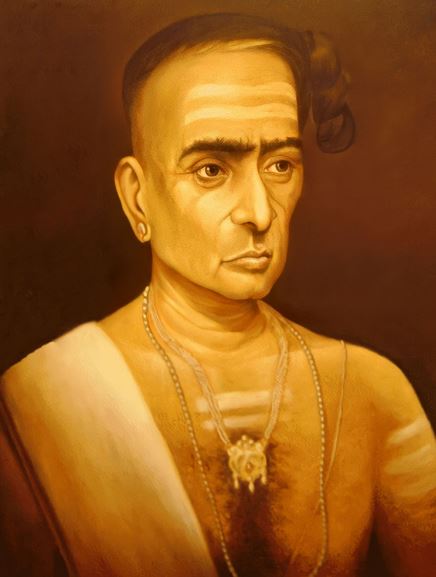
    • Astronomy and Mathematics: The region, under the patronage of the Zamorins, was a centre for advancements in astronomy and mathematics, contributing significantly to the fields through scholars like the 14th-century mathematician and astronomer Madhava of Sangamagrama.
  • In news: Santhal Hul of 1855 

    Why in the News?

    • The Santhal Revolt of 1855 was a revolt against imperialism led by four brothers, Sidho, Kanho, Chand, and Bhairav Murmu, along with sisters Phulo and Jhano.
      • June 30 marks the 169th anniversary of the beginning of the revolt.

    About Santhal Hul

    • The Santhal people revolted against the British East India Company and the Zamindari system, also known as the Santhal Rebellion or Santhal Hul.
    • The rebellion began on June 30, 1855.
    • Martial Law was imposed on November 10, 1855, by the East India Company, lasting until January 3, 1856, when the rebellion was suppressed.

    Who are the Santhals?

    • Santhals were agricultural people living in the Rajmahal Hills of Bihar.
    • Ol Chiki (Ol Chemet) is the writing script of Santhals.
    • The British asked them to clear forests for agriculture to increase revenue.
    • Damin-i-Koh (1832) was created as a designated area for Santhals, now known as Santhal Pargana.
    • Over time, the British began exploiting the Santhals, leading to the Santhal Rebellion.

    What makes the revolt so unique?

    • Marginalized Indigenous Community: Led by the Santhal tribe, a marginalized indigenous community in mid-19th century India.
    • Agrarian Uprising: Primarily a fight against exploitative land laws, high taxes, and forced labor rather than political or religious issues.
    • Tribal Unity and Guerrilla Tactics: Characterized by a strong sense of tribal unity and guerrilla warfare tactics, making it unique and significant.

    Causes of the Santhal Revolt:

    • Permanent Settlement System (1793): Introduced by the British East India Company, giving Zamindars long-lasting property rights.
    • Oppression by Zamindars: Zamindars misused their power to oppress and enslave peasants, leading to resentment.
    • Exploitation and Debt: Santhals faced exploitation through high-interest loans and lost their land and freedom.
    • Violent Suppressions: British police supported Zamindars and moneylenders in evicting Santhals violently.
    • Disruption of Traditional Structures: Traditional social and political structures of the Santhals were disrupted, pushing them into debt and poverty.
    • Economic Hardship: Led to the Santhals revolting against the British and Zamindars to escape their predicament.

    About the Santhal Pargana Tenancy Act (1876) and Chhotanagpur Tenancy Act (1908)

    • Santhal Pargana Tenancy Act (1876): Enacted by the British as a result of the Hul.
      • Land Inheritance: Prohibits the transfer of Adivasi lands to non-Adivasis and allows land to be inherited only as per the Act.
      • Self-Governance: Retains the rights of Santhals to self-govern their land.
    • Chhotanagpur Tenancy Act (1908): Result of the Birsa Movement.
      • Land Transfer Restrictions: Allows land transfers within the same caste and geographical areas with District Collector’s approval.
      • Protection of Adivasi and Dalit Land: Restricts the sale of Adivasi and Dalit land but allows transfers within the same community.

    PYQ:

    [2018] After the Santhal Uprising subsided, what was/were the measure/measures taken by the colonial government?

    1. The territories called `Santhal Parganas’ were created.
    2. It became illegal for a Santhal to transfer land to a non-Santhal.

    Select the correct answer using the code given below:

    (a) 1 only

    (b) 2 only

    (c) Both 1 and 2

    (d) Neither 1 nor 2

  • In news: Shyok River

    Why in the News?

    Five soldiers lost their lives when a tank was drowned away by powerful water currents in the Shyok River during a military training exercise in Ladakh.

    About Shyok River

    • The Shyok River is a significant river flowing through the Ladakh region of India and the Gilgit-Baltistan region of Pakistan.
    • It is a tributary of the Indus River and is known for its length and the rugged terrain it traverses.
    • The Shyok River spans approximately 550 kilometres in length.
    • It has a drainage basin covering parts of both India and Pakistan, making it an essential water source for the regions it traverses.

    Source and Course:

    • The river originates from the Rimo Glacier, located to the southeast of the Karakoram Pass.
    • It flows northwest to enter the Nubra Valley in Ladakh, a region known for its picturesque landscapes and sand dunes.
    • The river then turns southwest and flows through the disputed region of Gilgit-Baltistan, eventually joins the Indus River near Skardu.

    Tributaries:

    • The Shyok River has several tributaries, the most notable being the Nubra River, which flows through the Nubra Valley.
    • Other significant tributaries include the Saltoro River, originating from the Siachen Glacier region.

    Cultural and Historical Significance:

    • The river flows through that have been part of ancient trade routes between Central Asia and South Asia.
    • The Nubra Valley, through which the Shyok flows, is also known for its ancient monasteries and the Bactrian camels, which were used for trade along the Silk Route.

    Geographical significance of Shyok River 

    • Strategic Location: The Shyok River flows through the Ladakh region of India and serves as a vital geographical feature due to its proximity to the Line of Actual Control (LAC) between India and China. Its strategic location influences military deployments and infrastructure development in the region, particularly in the context of border disputes and security concerns.
    • Glacial Melt and Water Resources: Originating from the Rimo Glacier and fed by numerous tributaries, the Shyok River contributes significantly to the water resources of the region. Its flow is crucial for agriculture, hydroelectric power generation, and sustenance of local ecosystems, impacting the livelihoods and socio-economic activities of communities along its banks.

    PYQ:

    [2020] Siachen Glacier is situated to the

    (a) East of Aksai Chin

    (b) East of Leh

    (c) North of Gilgit

    (d) North of Nubra Valley

  • Nouka Baich: Boat Race festival of Bengal   

    Why in the News?

    With the southwest monsoon gradually setting in, Nouka Baich boat races will soon commence in West Bengal and Bangladesh.

    About Nouka Baich

    • Nouka Baich is the traditional boat race of Bengal.
    • It is predominantly held in the rural pockets of West Bengal, including Murshidabad, Nadia, North 24 Parganas, and South 24 Parganas.
    • Historically male-dominated, recent years have seen increasing participation by women.
    • Timing and Duration:
      • Monsoon Season: The races commence with the onset of the south-west monsoon, usually starting in the middle of the rainy season.
      • Extended Period: The events continue until September, with some races extending into October and November, depending on the region.

    Types of Boats Used:

    • Diverse Fleet: Unlike Kerala’s boat races, which typically feature a single type of boat, Bengal’s races use various traditional boats.
    • Common Boat Types: Chhip, Kaile Bachhari, Chande Bachhari, Chitoi, Sorpi, and Sorengi are commonly used in the races.
    • Unique Features: Each boat type has unique design features and historical significance, with some boats like the Sorengi being over 90 feet long and designed to mimic natural forms.

    Similar festivals celebrated in other parts that highlight cultural similarities in India:

    Location Occasion Highlights
    Nehru Trophy Boat Race Punnamada Lake, Alappuzha, Kerala Second Saturday of August Named after Jawaharlal Nehru; features snake boats (Chundan Vallams) accommodating over 100 rowers.
    Champakulam Moolam Boat Race Pampa River, Alappuzha, Kerala June or July One of the oldest boat races, commemorates the installation of Lord Krishna’s idol at Ambalappuzha Temple.
    Aranmula Uthrattadi Vallamkali Pampa River, Aranmula, Kerala Onam (August or September) Features Palliyodams (large snake boats); significant for the Parthasarathy Temple.
    Payippad Jalotsavam Payippad Lake, Alappuzha, Kerala Onam (August or September) Celebrates the installation of deity at Subramanya Swamy Temple; features snake boats and canoes.
    Indira Gandhi Boat Race Ernakulam, Kochi, Kerala Last week of December Part of Cochin Carnival; attracts tourists, named after Indira Gandhi.
    Pongal Boat Race Bhuvanagiri, Tamil Nadu Pongal festival (January) Vibrant cultural displays; local fishermen participate.
    Hiyang Tannaba Manipur Lai Haraoba festival Traditional boat race with long narrow boats, reflecting the Meitei community’s traditions.
    Sithargal Boat Race Chennai, Tamil Nadu Pongal festival Highlights the maritime culture of the region; attracts numerous participants and spectators.
  • UNESCO World Heritage Site of Somanathapura

    Why in the News?

    • Karnataka’s Tourism Department plans to highlight Somanathapura Temple, part of the Hoysala temples, in the Mysuru tourism circuit ahead of Dasara, leveraging its UNESCO World Heritage status.
    Note: There are 42 World Heritage Sites in India. Out of these, 34 are cultural, seven are natural, and one, Khangchendzonga National Park, is of mixed type.

    About Keshava Temple, Somanathapura

    • The Keshava Temple is considered one of the last grand structures built by the Hoysala dynasty.
    • This Trikuta (three-shrined) temple is dedicated to Lord Krishna and is represented in three forms: Janardhana, Keshava, and Venugopala. 
    • The main Keshava idol is missing, and the Janardhana and Venugopala idols are damaged.

    Historical Background:

    • The Keshava Temple was constructed by Somanatha, a commander of the Hoysala Army, during the reign of Hoysala King Narasimha III.
    • Somanatha, who had established a town named Somanathapura after himself, sought the king’s permission and resources to build this grand temple.
    • With the king’s blessing, construction commenced and was completed in 1268 AD.
    • An inscription in old Kannada on a stone slab in the temple provides details of its construction and consecration.
    • After demolitions by invaders, it no longer serves as a place of worship.

    Architecture:

    • The temple is constructed from soapstone, which allows for the fine detailing seen in the carvings.
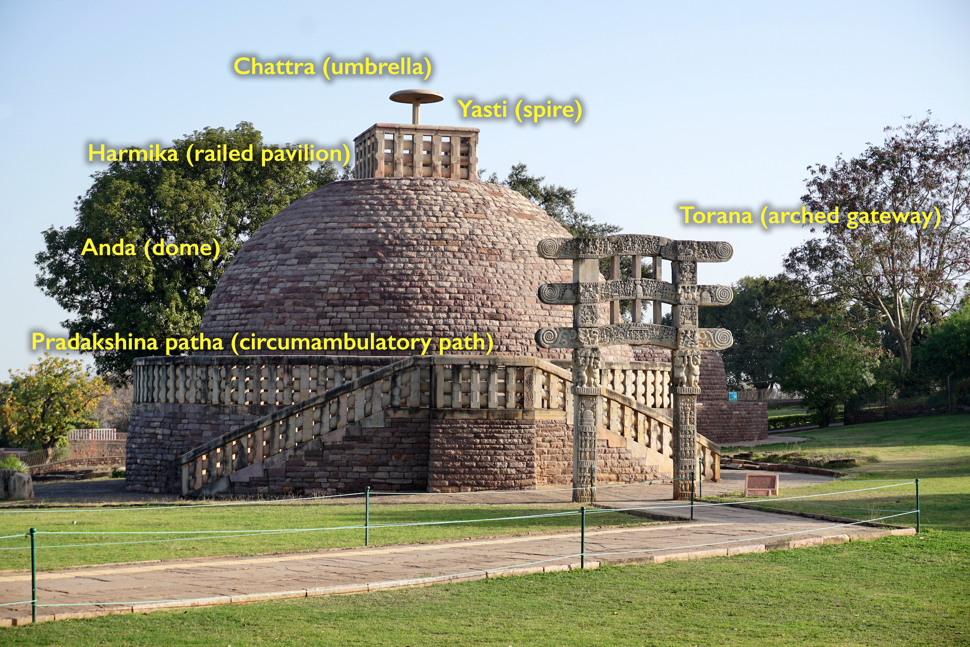
    • It is built on a raised platform with an outer Pradakshina pathway, allowing devotees to circum-ambulate the sanctum.
    • The temple features a stellar (star-shaped) plan, which creates multiple corners and niches, providing numerous canvases for the sculptors to showcase their intricate work.
    • The temple has three shrines, each crowned with a Vimana (tower).
    • The Hoysala emblem, depicting a warrior fighting a lion, is prominently displayed.
    • The walls of the temple are adorned with beautiful friezes depicting scenes from Hindu epics, figures of elephants, and battle scenes with cavalry.

    Tap to read more about:

    UNESCO Heritage Status for Hoysala Temples in Karnataka

    PYQ:

    [2019] Building ‘Kalyana Mandapas’ was a notable feature in the temple construction in the kingdom of

    (a) Chalukya

    (b) Chandela

    (c) Rashtrakuta

    (d) Vijayanagara

    [2012] The Nagara, the Dravida and the Vesara are the:

    (a) three main racial groups of the Indian subcontinent

    (b) three main linguistic divisions into which the languages of India can be classified

    (c) three main styles of Indian temple architecture

    (d) three main musical Gharanas prevalent in India

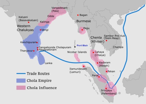
    [2013] Chola architecture represents a high watermark in the evolution of temple architecture. Discuss.

  • Controversy over Sengol in Lok Sabha 

    Why in the News?

    • An opposition parliamentarian has demanded the removal of the Sengol from the Lok Sabha, calling it a symbol of “rajdand/rajtantra (monarchy)”.This demand has become a point of contention between the government and the Opposition.

    What is a Sengol?

    • A sengol (or chenkol) is a royal sceptre symbolizing kingship, righteousness, justice, and authority.
    • It is a traditional Chola-era symbol of authority and governance, originally from Tamil Nadu.
    • It is a golden sceptre, richly adorned and crafted with intricate designs, reflecting the grandeur of ancient Tamil culture.
    • Among the Madurai Nayakas, the sengol was placed before the goddess Meenakshi in the temple and then transferred to the throne room, representing the king’s role as a divine agent.

    Significance in the present context: 

    • Accountability and Legitimacy: Just as the Sengol legitimized ancient rulers by holding them accountable to higher moral standards, the institutions and practices in a parliamentary democracy ensure that elected representatives are accountable to the constitution and the people.
    • Ethical Leadership: Leaders in a democracy are expected to uphold justice, integrity, and the rule of law, much like the dharmic kings of the past.
    • Symbolic Representation: The Sengol, as a symbol of righteous rule, parallels the symbolic importance of democratic institutions that represent the will and welfare of the people.
    1947 Sengol Ceremony Involving Nehru

    • Government’s Claim: The government claims C Rajagopalachari suggested the ceremony to Nehru.
      • This claim is debated, as there is little contemporary evidence to support the Sengol being a key symbol of power transfer in 1947.
    • Lack of Comprehensive Records: There are limited records about the ceremony where Nehru was reportedly handed a sengol by Hindu leaders from Tamil Nadu.
    • Undocumented: The event is not widely documented, and claims of Lord Mountbatten handing it over ceremonially seem exaggerated.
    • No Symbolization: Nehru accepted the Sengol as a mark of honor, but it was later placed in a museum, indicating it was not central to the transfer of power.
  • Read the rocks to improve India’s geological literacy


    PYQ Relevance: 

    Q Safeguarding the Indian art heritage is the need of the moment. Comment (10) (UPSC IAS/2018)

    Q Do you agree that regionalism in India appears to be a consequence of rising cultural assertiveness? Argue. (UPSC IAS/2020)

    Mentors’ comment: India, with its landscapes ranging from the world’s highest peaks to low-lying coastal plains, showcases a diverse morphology that has evolved over billions of years. Numerous locations feature a variety of rocks, minerals, and distinctive fossil assemblages. These geological features and landscapes reveal spectacular ‘origin’ stories based on scientific interpretations rather than mythology. India’s tumultuous geological past is etched in its rocks and terrains and should be regarded as part of our non-cultural heritage. The country offers many such examples. Geo-heritage sites serve as educational spaces where people can gain much-needed geological literacy, especially given India’s generally poor regard for this legacy.

    Let’s learn!

    Why in the news?

    India’s turbulent geological history is captured in its rocks and landscapes and should be regarded as part of our non-cultural heritage.

    Scant Traction in India:

    • Lack of Awareness and Importance: Despite international advancements in geological conservation, India has not prioritized geo-conservation, with many fossil-bearing sites destroyed due to development and real estate growth.
    • Destructive Activities: Stone mining activities, covering more than 10% of India’s total area, have led to significant destruction of geological sites, undermining the preservation of these natural laboratories.
    • Neglect of Geological Heritage: There is a paradox in India’s approach—seeking evidence of early life on Mars while destroying crucial geological evidence within its own territory, such as the little-known Dhala meteoritic impact crater.
    • Absence of Legislation: India lacks specific legislation or policies to protect geo-heritage, despite being a signatory to international agreements advocating geological conservation.

    Half-hearted Measures:

    • Abandoned Legislation Attempts: In 2009, a Bill to constitute a National Commission for Heritage Sites was introduced but later withdrawn, indicating a lack of commitment to geo-heritage conservation.
    • Ineffective Notification by GSI: The Geological Survey of India (GSI) has notified 34 geological monuments but lacks regulatory power to enforce preservation measures, leading to threats against these sites.
    • Draft Bill with No Progress: In 2022, the Ministry of Mines drafted a Bill for the preservation and maintenance of geo-heritage sites, but there has been no further progress, reflecting a lack of urgency and follow-through.
    • Recent Cliff Demolition Example: The demolition of part of the Varkala cliff, a designated geological heritage site, by the district administration citing landslide hazards highlights the inadequate protection and respect for such sites.

    Impact:

    • Loss of Scientific Knowledge: The destruction of fossil-bearing sites and other geological features due to development, real estate growth, and stone mining activities results in the permanent loss of invaluable scientific data. This hampers the understanding of India’s geological history and reduces opportunities for education and research in earth sciences.
    • Erosion of Cultural and Natural Heritage: Neglecting geological conservation undermines India’s rich natural heritage, which is integral to the country’s identity. The demolition of sites like the Varkala Cliff demonstrates a disregard for preserving unique geological formations that are part of India’s natural legacy.
    • Missed Economic Opportunities: Geo-heritage sites have the potential to attract tourism, contributing to local and national economies. The lack of legislative protection and promotion of these sites means missed opportunities for sustainable tourism development, which could generate income and create jobs while educating the public about the importance of geological conservation.

    Way forward: 

    • Legislative Framework for Geo-Conservation: Enact specific legislation to protect and conserve geo-heritage sites, similar to the Biological Diversity Act, 2002. This legislation should establish clear guidelines for the preservation, management, and sustainable use of geo-heritage sites, ensuring they are protected from destructive activities and development pressures.
    • National Geo-Conservation Authority: Establish a National Geo-Conservation Authority to oversee the identification, protection, and promotion of geo-heritage sites.  
    • Promotion of Geo-Tourism: Develop and promote geo-heritage sites as sustainable tourism destinations. This includes investing in infrastructure, providing educational resources, and marketing these sites to attract both domestic and international tourists.  
  • Why the Thar Desert on the borders of India and Pakistan is getting greener?

    Why in the news?

    Rajasthan’s barren Thar Desert may turn green, says a recent study in the journal Earth’s Future.  

    About Thar Desert

    • The Thar Desert is the 18th largest subtropical desert globally and is one of the most densely populated deserts.
    • Approximately 40% of the human population in Rajasthan resides in the Thar Desert.
    • It extends from the Sutlej River and is bounded by the Rann of Kutch, the Aravalli Mountains, and the Indus River.
    • About 85% of the Thar Desert is located in India, with the remainder in Pakistan. 
    • In India, it spans across Rajasthan, Gujarat, Haryana, and Punjab as well.
    • Civilizations are believed to have thrived in the Thar region around 50,000 years ago across the extinct Saraswati River.
    • The Desert National Park (home to the endangered Great Indian Bustard, desert fox, desert cat, blackbuck, and Indian gazelle) is situated in the Thar Desert in the northwest Indian state of Rajasthan.

    Why the thar desert getting greener?

    • Climate Change Effects:
        • Alteration of Weather Patterns: Climate change is causing shifts in rainfall distribution in the thar desert area.
        • Potential for Vegetation Growth: The increased precipitation could provide favorable conditions for vegetation growth, contributing to the greening of the desert.
    • Indian Monsoon Dynamics:
        • Westward Extension of Indian Monsoon: The Indian monsoon, known for bringing heavy rainfall to eastern India, is now extending further westward into regions like the Thar Desert.
        • Impact on Moisture and Rainfall: This change in monsoon dynamics could lead to increased moisture and rainfall in the desert region, facilitating the growth of vegetation.
    • Expansion of Indian Ocean Warm Pool (IOWP):
        • Influence on Monsoon Patterns: The Indian Ocean Warm Pool (IOWP) influences monsoon patterns and rainfall distribution over the Indian subcontinent.
        • Westward Expansion due to Climate Change: Climate change is causing the IOWP to expand westward, potentially resulting in increased rainfall over semi-arid regions like the Thar Desert and promoting greening.
    • Water Management Practices:
        • Contribution to Greening: Effective water management practices, such as rainwater harvesting and irrigation techniques like johad, kuis, and kunds, may be playing a role in the greening of the Thar Desert.
        • Utilization of Water Resources: By harnessing and efficiently utilizing available water resources, local communities and authorities can support vegetation growth and ecosystem restoration efforts in the desert.
    • Introduction of Irrigation  
      • Commercial Cropping: Irrigation was introduced during British colonial rule in the 19th and 20th centuries to convert arid and semi-arid ecosystems into cropland.
      • Restrictions on Grazing: The right to graze animals was restricted to landowners who cultivated crops, leading to the transformation of nomadic pastoralists into sedentary agropastoralists.
    Sustainability of this transformation

    • Recent greening activities, largely on arid scrub savannahs, have threatened species adapted to such climates and have been linked to locust outbreaks.
    • The Indira Gandhi Canal project in the 1980s led to extensive crop cover in the Thar Desert, resulting in areas becoming infertile due to waterlogging and salinity.
    • Planting invasive species, such as prosopis juliflora and acacia tortilis, has led to habitat degradation and biodiversity loss.


    PYQ:

    [2018] Which of the following leaf modifications occur(s) in the desert areas to inhibit water loss?

    1. Hard and waxy leaves
    2. Tiny leaves
    3. Thorns instead of leaves

    Select the correct answer using the code given below:

    (a) 2 and 3 only

    (b) 2 only

    (c) 3 only

    (d) 1, 2 and 3

    [2020] The process of desertification does not have climate boundaries. Justify with examples.

    [2013] Major hot deserts in northern hemisphere are located between 20-30 degree north and on the western side of the continents. Why?  


  • Sucheta Kripalani (1908-1974): India’s first woman Chief Minister

    Why in the News?

    June 25 is the birth anniversary of “Sucheta Kripalani”, India’s first woman Chief Minister.

    Who was Sucheta Kripalani?

    • Sucheta Kripalani was born on June 25, 1908, in Ambala, Punjab. Daughter of S. N. Majumdar, a government surgeon. She studied at Indraprastha College for Women and St. Stephen’s College, University of Delhi.
    • She married J. B. Kripalani, a former Congress president and Gandhian, in April 1936 against familial and Mahatma Gandhi’s wishes.

    Political Journey and Chief Ministership

    • Early Career: Joined BHU to teach Constitutional History in 1929, participated in Satyagraha, and was imprisoned in 1940.
    • Congress Role: Organized the foreign affairs wing of AICC and later founded the All India Mahila Congress.
      • She won by a margin of 99 votes over Kamalapati Tripathi and was sworn in as CM on October 2, 1963.

    Contributions and Achievements

    • Educational Reforms: Waived school fees for girls up to Class 10 from January 1965. Established Meerut University and Kanpur University.
    • Social Reforms: Increased reservation for SCs in government jobs to 24% in Group C and 45% in Group D until the 18% target was achieved.
    • Infrastructure Developments: Established a Sainik School in Ghorakhal, a new medical college in Meerut, and the UP Awas Vikas Parishad. She created the post of agriculture production commissioner.
    • Crime Control: Neutralized many dacoits in the Chambal Valley with the help of the Police Radio Unit.
    • Anti-Corruption Stance: Emphasized the need to tackle growing corruption in public services, supporting the Union government’s initiative to appoint a vigilance commission.
    • Multifaceted Contributions: Involved in relief activities for the 1934 Bihar earthquake, Noakhali riots, Tibetan refugee rehabilitation, and the Indo-Pak War of 1971.
      • Criticism and Response: Faced criticism for being influenced by English, despite being a staunch supporter of Hindi. Advocated for creating an atmosphere for Hindi in governance.

    Later Life and Legacy

    • Post-CM Career: Served as Lok Sabha MP until 1971.
    • Impact: Her tenure as CM and various social contributions left a lasting impact on Indian politics and society, especially in terms of women’s leadership and social reforms.

    PYQ:

    [2011] With reference to the Indian freedom struggle, Usha Mehta is well-known for:

    (a) Running the secret Congress Radio in the wake of the Quit India Movement

    (b) Participating in the Second Round Table Conference

    (c) Leading a contingent of the Indian National Army

    (d) Assisting in the formation of Interim Government under Pandit Jawaharlal Nehru