💥Mains Ready By December. Smash Mains & Smash PYQ Admissions Open

Subject: Disaster Management

  • Wind plus heat: The triggers for deadly UP storm

    Why in the News?

    More than 100 deaths in Uttar Pradesh due to pre-monsoon thunderstorms have brought renewed attention to India’s growing vulnerability to compound weather events. In such events, multiple meteorological factors combine to intensify disasters. The event stood out because of its unusual intensity, wider geographic spread, and exceptionally high wind speeds. Several districts recorded winds above 100 kmph and touching 130 kmph, far exceeding normal pre-monsoon conditions.

    Why did the Uttar Pradesh thunderstorm become unusually deadly this year?

    1. Higher Fatality Burden: More than 100 deaths were reported, making it one of the deadliest thunderstorm events in recent years in northern India.
    2. Geographical Spread: The destruction was more widespread than usual, affecting multiple districts rather than isolated pockets.
    3. Extreme Wind Speeds: At least eight districts recorded wind speeds exceeding 100 kmph. Some locations witnessed gusts of nearly 130 kmph, substantially above the normal 40-60 kmph range associated with pre-monsoon storms.
    4. Infrastructure Vulnerability: Walls collapsed, electricity poles were uprooted, hoardings fell, and loose objects became projectiles, increasing casualties and injuries.
    5. Lightning Risk: Lightning strikes contributed to deaths, consistent with India’s recurring vulnerability to thunderstorm-associated lightning fatalities.

    How do pre-monsoon thunderstorms normally develop over northern India?

    1. Seasonality: Pre-monsoon thunderstorms are common during April and May, sometimes extending into July, particularly in northern India.
    2. Surface Heating: Intense land heating raises surface temperatures, creating unstable atmospheric conditions conducive to thunderstorm formation.
    3. Moisture Inflow: Moist southeasterly winds from the Bay of Bengal transport humidity inland, providing the moisture required for cloud formation.
    4. Atmospheric Instability: Warm moist air near the surface rises rapidly, generating cumulonimbus clouds associated with thunder, lightning, rainfall, hail, and gusty winds.
    5. Global Occurrence: Such storms are not unique to India and frequently occur in arid and semi-arid regions globally.

    What meteorological conditions intensified the storm beyond normal levels?

    1. Extreme Heat Conditions: Temperatures crossing 45°C across several regions increased surface heating and strengthened convective activity.
    2. Strong Southeasterly Winds: Persistent moisture transport from the Bay of Bengal extended unusually far inland, reportedly reaching even northwestern Uttar Pradesh.
    3. Western Disturbances: Rain-bearing systems originating beyond Iran introduced cool, dry air in the upper atmosphere, creating a sharp contrast with the warm, moist lower atmosphere.
    4. Thermal Contrast: Cool upper air interacting with hot lower air created severe instability, a classic condition for powerful thunderstorms.
    5. Compound Interaction: The storm emerged not from one factor but from the coincidence of multiple meteorological triggers operating simultaneously.

    Why are strong winds during thunderstorms particularly destructive in northern India?

    1. Wind Intensity: Normal thunderstorm winds range between 40-60 kmph, but speeds above 90 kmph are sufficient to uproot trees and damage structures.
    2. Urban Exposure: Billboards, electricity poles, weak infrastructure, and informal settlements increase disaster exposure.
    3. Flying Debris: Loose construction materials and roadside objects transform into dangerous projectiles during high-speed winds.
    4. Agricultural Losses: Standing crops, orchards, and rural infrastructure remain vulnerable during pre-monsoon storm episodes.
    5. High Population Density: The densely populated Gangetic plain amplifies human and economic losses from weather extreme.

    Why was forecasting unable to fully anticipate the scale of destruction?

    1. Forecast Availability: The India Meteorological Department (IMD) had already issued weather bulletins and warnings regarding thunderstorms.
    2. Underestimation of Wind Speed: Initial IMD forecasts predicted winds of up to 60 kmph, later revised to 70 kmph.
    3. Real-Time Escalation: Nowcast systems later indicated potential winds of 80-90 kmph, yet several districts experienced speeds exceeding 100 kmph.
    4. Forecasting Complexity: Thunderstorms are highly localised and dynamic phenomena, making precise prediction of intensity difficult.
    5. Evacuation Constraints: Unlike cyclones, thunderstorms lack a clear directional pathway, limiting targeted evacuation measures.

    How does this event compare with earlier extreme thunderstorm episodes?

    1. Historical Similarity: The meteorological pattern resembled 2018, when a similar thunderstorm event caused over 100 deaths in northern India.
    2. Recurring Hazard: Northern India experiences dozens of deaths annually from thunderstorms of varying intensity.
    3. Changing Risk Profile: Recent events indicate increasing concern regarding high-intensity short-duration weather extremes, potentially linked to broader climate variability.

    What governance and disaster-management lessons emerge from the Uttar Pradesh storm?

    1. Forecast Modernisation: Strengthens the need for high-resolution local forecasting systems and improved nowcasting capacity.
    2. Infrastructure Resilience: Ensures storm-resistant electricity networks, urban signage regulation, and structural safety standards.
    3. Early Warning Dissemination: Facilitates last-mile communication through SMS alerts, local administration, and community networks.
    4. Lightning Preparedness: Supports expansion of lightning detection systems and public advisories, especially in rural regions.
    5. Climate Adaptation: Reinforces the need for district-level climate-risk planning for compound extreme events.

    Conclusion

    The Uttar Pradesh thunderstorm demonstrates how heat stress, moisture transport, and upper-atmospheric disturbances can combine to produce severe local disasters. The event highlights the limits of conventional forecasting and reinforces the need for hyperlocal warning systems, resilient infrastructure, and climate-adaptive disaster planning. This has to be done to manage increasingly volatile pre-monsoon weather.

    PYQ Relevance

    [UPSC 2024] What is the phenomenon of ‘cloudbursts’? Explain

    Linkage: The PYQ tests conceptual understanding of extreme atmospheric phenomena, weather instability, and disaster geography. Both thunderstorms and cloudbursts involve intense atmospheric instability caused by heat, moisture, and upper-air interactions.
  • Indian National Centre for Ocean Information Services and ‘Kallakkadal’ Monitoring

    Why in the News

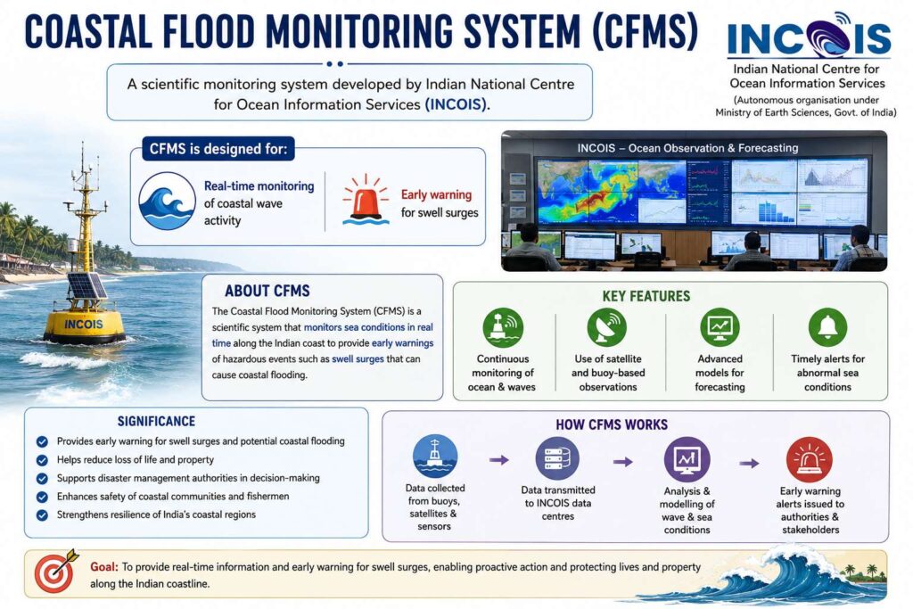
    Indian National Centre for Ocean Information Services (INCOIS) has installed a second Coastal Flood Monitoring System (CFMS) near Kollam Harbour to improve forecasting of ‘Kallakkadal’ or swell surge events along India’s southwest coast.

    What is ‘Kallakkadal’?

    • “Kallakkadal” is a Malayalam term meaning: “Sea that comes stealthily”
    • It refers to:
      • Sudden high-energy swell surges
      • Coastal flooding without local storms or rainfall

    Purpose

    • Improve accuracy of coastal flood forecasts
    • Study nearshore wave transformation
    • Build better early warning systems

    About Coastal Flood Monitoring System (CFMS)

    • A scientific monitoring system developed by Indian National Centre for Ocean Information Services for:
      • Real-time monitoring of coastal wave activity
      • Early warning for swell surges

    Components of CFMS

    • The system integrates:
      • Coastal Automatic Weather Station
      • Four high-frequency pressure sensors
    • Installed at: Shallow depths of 3 to 7 metres

    Why Kollam?

    • Kollam Harbour was selected because:
      • Kerala’s southwest coast frequently experiences swell surges
      • Fishing communities are highly vulnerable
    [2017] At one of the place in India, if you stand on the seashore and watch the sea, ‘you will find that the sea water recedes from the shore line a few kilometers and comes back to the shore, twice a day, and you can actually walk on the seafloor when the water recedes. This unique phenomenon is seen at 
    a. Bhavnagar 
    b. Bheemunipatnam 
    c. Chandipur 
    d. Nagapattinam 
  • [1st April 2026] The Hindu Oped: Counting people is not counting disaster risk

    PYQ Relevance[UPSC 2019] Vulnerability is an essential element for defining disaster impacts and its threat to people. How and in what ways can vulnerability to disasters be characterized? Discuss different types of vulnerability with reference to disasters.Linkage: The PYQ tests core concepts of vulnerability, exposure, and disaster risk assessment, which form the foundation of GS-3 Disaster Management. The article directly critiques flawed vulnerability measurement (income-based proxy), reinforcing the need for multidimensional vulnerability assessment as demanded in the PYQ.

    Mentor’s Comment

    There is a critical flaw in India’s disaster financing architecture, the shift from risk-based assessment to population-based allocation. The issue is in the news due to concerns over the 16th Finance Commission’s disaster risk funding formula, which paradoxically allocates higher funds to States with larger populations rather than those with greater disaster exposure. This marks a sharp departure from earlier approaches and undermines decades of progress in disaster preparedness. The scale of the problem is significant, States like Odisha, with the highest hazard score (12), receive less effective consideration than States like Bihar (224.2) and Uttar Pradesh (413.2) due to population weighting.

    What structural flaw exists in the disaster funding formula?

    1. Multiplicative Risk Formula: Uses Disaster Risk Index (DRI = Hazard × Exposure × Vulnerability), but distorts outcomes due to flawed exposure metrics.
    2. Population-Based Exposure: Defines exposure as total population (scaled 1-25), ignoring actual hazard-prone zones.
    3. Bias Toward Larger States: Ensures States like Uttar Pradesh receive higher weight despite lower hazard intensity.
    4. Departure from Previous Approach: Replaces additive model of 15th Finance Commission, which treated hazard and vulnerability separately.
    5. Outcome Distortion: Rewards demographic size rather than disaster risk, contradicting risk-based allocation principles.

    Why is ‘exposure’ measurement scientifically flawed?

    1. Incorrect Definition: Uses total population instead of hazard-zone population.
    2. IPCC Standard Ignored: Defines exposure as people in hazard-prone areas, not administrative boundaries.
    3. Misleading Comparisons: Inland plateau populations treated equal to cyclone-prone coastal populations.
    4. Example: Odisha’s high-risk coastline equated with safer inland regions in other States.
    5. Result: Artificial inflation of exposure scores for populous but less vulnerable States.

    How does vulnerability measurement misrepresent actual risk?

    1. Income-Based Proxy: Uses per capita NSDP, which measures fiscal capacity, not vulnerability.
    2. Multidimensional Nature Ignored: Overlooks housing quality, health infrastructure, and early warning access.
    3. Kerala Case Study: Despite ₹31,000 crore flood damages (2018), receives low vulnerability score (1.073).
    4. Hidden Inequality: Average income masks intra-state disparities and disaster susceptibility.
    5. Outcome: Underestimates real vulnerability in disaster-prone but relatively richer States.

    Why does the formula penalize disaster-prone States?

    1. Population Bias: Prioritizes demographic size over risk intensity.
    2. Funding Paradox: Odisha (highest hazard score) loses out due to lower population score.
    3. Disproportionate Allocation: Bihar (224.2) and UP (413.2) overshadow Odisha despite lower hazard exposure.
    4. Kerala’s Loss: Loses 0.78 percentage points despite high vulnerability ranking.
    5. Systemic Inequity: Smaller, disaster-prone States receive inadequate fiscal support.

    What are the implications for disaster governance in India?

    1. Misallocation of Resources: Funds diverted away from high-risk zones.
    2. Reduced Preparedness: States with higher hazard exposure face fiscal constraints.
    3. Climate Risk Escalation: Cyclones, floods, and droughts increasing in intensity and frequency.
    4. Regional Inequality: Coastal and northeastern States disproportionately affected.
    5. Policy Credibility Issue: Undermines objective of risk-based disaster financing.

    What reforms are required in disaster risk assessment?

    1. Hazard-Zone Mapping: Measures exposure based on population in disaster-prone areas.
    2. Composite Vulnerability Index: Includes housing, health, agriculture, and infrastructure indicators.
    3. Use of Data Systems: Integrates Building Materials and Technology Promotion Council (BMTPC) Vulnerability Atlas, National Family Health Survey-5 (NFHS-5), Pradhan Mantri Fasal Bima Yojana (PMFBY) database, National Health Mission (NHM) facility surveys, and India Meteorological Department (IMD) monitoring records. 
    4. Institutional Mechanism: Mandates NDMA to publish annual State Disaster Vulnerability Index.
    5. Policy Continuity: Institutionalizes methodology across Finance Commissions. 

    Conclusion

    A population-based approach to disaster funding undermines the principle of risk-sensitive governance. A shift toward hazard-specific exposure mapping and multidimensional vulnerability assessment is essential to ensure equitable and effective disaster resilience in India.

  • [12th March 2026] The Hindu OpED: A seismic decision: On revision to India’s earthquake zoning, rollback 

    PYQ Relevance[UPSC 2021] Discuss about the vulnerability of India to earthquake related hazards. Give examples including the salient features of major disasters caused by earthquakes in different parts of India during the last three decades.Linkage: It highlights India’s seismic vulnerability and the need for accurate hazard assessment. The revision of the earthquake zoning framework and adoption of probabilistic seismic hazard assessment strengthen disaster preparedness and risk mapping.

    Mentor’s Comment

    The rollback of the Bureau of Indian Standards (BIS) revision of India’s earthquake zoning framework has revived debate over seismic risk assessment. The proposed revision sought to replace the simplified fixed seismic zoning model with probabilistic seismic hazard assessment, a method widely used globally. It also introduced a new high-risk Zone VI covering vulnerable regions such as Kashmir and the Himalayan belt. However, stricter zoning raised economic concerns, as construction costs could increase by about 20% with a one-zone rise and nearly one-third with two zones

    Why does India require a revised earthquake zoning framework?

    1. Urban Expansion and Risk Exposure: Rapid urbanisation increases population and infrastructure in seismically vulnerable areas. Large infrastructure such as metro systems, dams, highways, and power stations require updated seismic design standards.
    2. Disaster Preparedness: Accurate zoning enables safer city planning, infrastructure design, and disaster management strategies. It reduces casualties and economic losses during earthquakes.
    3. Climate and Disaster Resilience: Earthquake-resilient infrastructure contributes to broader climate-resilient development and sustainable cities.
    4. Infrastructure Protection: Critical infrastructure projects must incorporate seismic design standards to prevent catastrophic failure during earthquakes.

    What is the current earthquake zoning system in India?

    1. Fixed Zoning Model: India currently uses a simplified seismic zoning map, dividing the country into fixed categories based on historical seismic activity.
    2. Seismic Zones: India’s seismic classification includes Zones II, III, IV and V, with Zone V representing the highest risk areas.
    3. Limitations of Fixed Zoning: Fixed zones rely heavily on past earthquake records and may not fully capture future seismic probabilities or micro-level risk variations.
    4. Urban Planning Integration: These zones influence building codes, infrastructure design standards, and urban planning guidelines.

    What changes were proposed in the BIS revision?

    1. Probabilistic Seismic Hazard Assessment (PSHA): Introduces probability-based simulations to estimate earthquake intensity and frequency rather than relying solely on historical data.
    2. Introduction of Zone VI: Adds a new highest-risk seismic zone, covering Kashmir, parts of the Himalayan belt, Kutch in Gujarat, and the northeast.
    3. Improved Risk Modelling: Uses dynamic modelling of ground motion probabilities to improve earthquake preparedness.
    4. Alignment with Global Practice: Aligns India’s seismic risk assessment methodology with advanced economies and seismically active regions worldwide.

    Why did the proposed revision face opposition?

    1. Economic Cost: Construction costs could rise significantly.
      1. One-zone increase: Costs may rise by around 20%.
      2. Two-zone increase: Costs may rise by nearly one-third.
    2. Infrastructure Cost Escalation: High-value projects such as metro systems, dams, and power stations may face substantially higher structural design costs.
    3. Development Concerns: Urban planners fear stricter zoning could slow infrastructure development in economically fragile regions.
    4. Housing Informality: Nearly 80% of India’s housing stock lies in the informal sector, raising concerns that stricter regulations may increase unregulated construction.

    What are the broader governance and policy challenges?

    1. Institutional Coordination: The proposal faced resistance from multiple agencies including Ministry of Housing and Urban Affairs, Home Affairs, Central Water Commission, and National Dam Safety Authority.
    2. Policy Consultation Gap: Large regulatory changes require extensive consultation across government agencies, industry stakeholders, and technical experts.
    3. Balancing Safety and Affordability: Stricter building standards improve safety but increase construction costs and housing affordability pressures.
    4. Implementation Capacity: Enforcement challenges remain significant due to informal housing markets and limited regulatory capacity.

    How does the debate intersect with climate and sustainability goals?

    1. Construction Sector Emissions: The construction sector is among the largest dispersed sources of carbon emissions in India.
    2. Infrastructure Lifecycle: Seismic-resilient structures reduce the need for reconstruction after disasters, lowering long-term carbon and economic costs.
    3. Resilient Urban Development: Disaster-proof infrastructure supports climate adaptation strategies and sustainable urbanisation.

    Conclusion

    Revising India’s earthquake zoning framework remains essential for ensuring disaster-resilient urban growth and infrastructure safety. However, scientific improvements must be accompanied by broad institutional consultation, economic feasibility assessments, and strong implementation mechanisms. A balanced framework that integrates advanced risk modelling with practical governance capacity is critical for strengthening India’s long-term disaster resilience.

  • NDMA’s first ever guidelines for identification of disaster victims

    Why in the News

    The National Disaster Management Authority (NDMA) has issued India’s first Standard Operating Procedures for Disaster Victim Identification. This comes after several recent mass fatality incidents such as the Air India plane crash in Ahmedabad, the chemical factory explosion in Sanand, floods in Dharali, and the Balrampur earthquake.

    Earlier, India did not have a uniform national system to identify disaster victims. Identification was often ad hoc, poorly coordinated, and slow, causing logistical problems and long delays for families. The new guidelines shift India from fragmented local practices to a standardised, scientific, and dignity-based national framework for handling disaster victims.

    Why were Disaster Victim Identification Guidelines Needed?

    1. Absence of Standardisation: Lack of a national protocol resulted in inconsistent identification methods across States.
    2. Operational Gaps: Shortage of forensic experts, poor inter-agency coordination, and logistical constraints delayed identification.
    3. Humanitarian Deficit: Families faced prolonged uncertainty due to delayed or incorrect identification of remains.
    4. Rising Mass Fatality Events: Increase in industrial accidents, floods, fires, earthquakes, and aviation disasters heightened systemic risk.

    What is the Scope of the NDMA Guidelines?

    1. Applicability: Covers identification of victims in mass fatality incidents across natural and man-made disasters.
    2. Geographical Reach: Designed for uniform adoption across States, districts, and local administrations.
    3. Lifecycle Coverage: Extends from disaster site management to final handover of identified remains to families.

    What Forensic and Scientific Methods are Prescribed?

    1. Forensic Archaeology: Supports recovery and documentation of remains at disaster sites.
    2. Forensic Odontology: Enables identification through dental records.
    3. DNA Profiling: Facilitates identification when bodies are fragmented or decomposed.
    4. Anthropology and Pathology: Assists in age, sex, and injury profiling.
    5. Medical Records Integration: Enables cross-verification using antemortem data.

    How do the Guidelines Address Operational Challenges?

    1. Inter-Agency Coordination: Defines roles of police, forensic teams, health authorities, and district administration.
    2. Logistical Planning: Addresses gaps in storage, transport, and preservation of remains.
    3. Administrative Clarity: Reduces jurisdictional overlaps between local, State, and Central agencies.
    4. Capacity Constraints: Acknowledges shortage of forensic branches and specialists across States.

    How is Sensitivity Towards Victims’ Families Ensured?

    1. Cultural Sensitivity: Mandates respect for community customs during handling of remains.
    2. Counselling Support: Emphasises emotional support for affected families.
    3. Transparent Communication: Ensures timely and accurate dissemination of identification status.
    4. Dignified Handling: Treats victim identification as both a technical and humanitarian exercise.

    Who Drafted the Guidelines and How Were They Developed?

    1. Institutional Leadership: Drafted under NDMA’s Joint Advisor.
    2. Expert Committee: Included specialists in forensics, archaeology, odontology, and pathology.
    3. Learning from Past Disasters: Incorporated lessons from earthquakes, floods, industrial accidents, and aviation crashes.
    4. Consultative Process: Involved State governments and central agencies over multiple years.

    Conclusion

    The NDMA’s Disaster Victim Identification guidelines institutionalise scientific rigour, administrative clarity, and humanitarian ethics in post-disaster management. By standardising procedures nationwide, they strengthen disaster governance, enhance public trust, and ensure dignity and closure for affected families.

    PYQ Relevance 

    [UPSC 2018] Describe various measures taken in India for Disaster Risk Reduction (DRR) before and after signing ‘Sendai Framework for DRR (2015-2030)’. How is this framework different from ‘ Hyogo Framework for Action, 2005’?

    Linkage: The question relates to GS-III disaster management, highlighting India’s shift from relief-based response under Hyogo to risk reduction and institutional accountability under the Sendai Framework. Sendai embeds ethics in disaster governance by stressing human dignity, compassion, and state responsibility in disaster response.

  • Disaster Victim Identification (DVI) Guidelines 

    Why in the News?

    India has released its first ever national guidelines and Standard Operating Procedures for Disaster Victim Identification (DVI) to address long standing gaps in identifying victims of mass fatality disasters.

    What is Disaster Victim Identification (DVI)?

    • A scientific and systematic process to identify deceased persons in mass fatality incidents
    • Used in air crashes, earthquakes, floods, fires, industrial accidents and terror attacks
    • Ensures accurate identification and dignified handover of remains to families

    Organisations Involved

    • National Disaster Management Authority as nodal agency
    • National Forensic Sciences University for technical and drafting support
    • State police, health departments, forensic laboratories and emergency responders
    • Aligned with global best practices of Interpol DVI framework

    Aim of the Guidelines

    • Ensure accurate identification and legal certification of deaths
    • Create a uniform national protocol for mass fatality management
    • Integrate modern forensic science and digital tools into disaster response
    [2014] Consider the following statements: 1. Animal Welfare Board of India is established under the Environment (Protection) Act, 1986. 

    2. National Tiger Conservation Authority is a statutory body. 

    3. National Ganga River Basin Authority is chaired by the Prime Minister. 

    Which of the statements given above is/are correct? 

    (a) 1 only (b) 2 and 3 only (c) 2 only (d) 1, 2 and 3

  • NDMA’s first ever guidelines for identification of disaster victims

    Why in the News

    The National Disaster Management Authority (NDMA) has issued India’s first Standard Operating Procedures for Disaster Victim Identification. This comes after several recent mass fatality incidents such as the Air India plane crash in Ahmedabad, the chemical factory explosion in Sanand, floods in Dharali, and the Balrampur earthquake.

    Earlier, India did not have a uniform national system to identify disaster victims. Identification was often ad hoc, poorly coordinated, and slow, causing logistical problems and long delays for families. The new guidelines shift India from fragmented local practices to a standardised, scientific, and dignity-based national framework for handling disaster victims.

    Why were Disaster Victim Identification Guidelines Needed?

    1. Absence of Standardisation: Lack of a national protocol resulted in inconsistent identification methods across States.
    2. Operational Gaps: Shortage of forensic experts, poor inter-agency coordination, and logistical constraints delayed identification.
    3. Humanitarian Deficit: Families faced prolonged uncertainty due to delayed or incorrect identification of remains.
    4. Rising Mass Fatality Events: Increase in industrial accidents, floods, fires, earthquakes, and aviation disasters heightened systemic risk.

    What is the Scope of the NDMA Guidelines?

    1. Applicability: Covers identification of victims in mass fatality incidents across natural and man-made disasters.
    2. Geographical Reach: Designed for uniform adoption across States, districts, and local administrations.
    3. Lifecycle Coverage: Extends from disaster site management to final handover of identified remains to families.

    What Forensic and Scientific Methods are Prescribed?

    1. Forensic Archaeology: Supports recovery and documentation of remains at disaster sites.
    2. Forensic Odontology: Enables identification through dental records.
    3. DNA Profiling: Facilitates identification when bodies are fragmented or decomposed.
    4. Anthropology and Pathology: Assists in age, sex, and injury profiling.
    5. Medical Records Integration: Enables cross-verification using antemortem data.

    How do the Guidelines Address Operational Challenges?

    1. Inter-Agency Coordination: Defines roles of police, forensic teams, health authorities, and district administration.
    2. Logistical Planning: Addresses gaps in storage, transport, and preservation of remains.
    3. Administrative Clarity: Reduces jurisdictional overlaps between local, State, and Central agencies.
    4. Capacity Constraints: Acknowledges shortage of forensic branches and specialists across States.

    How is Sensitivity Towards Victims’ Families Ensured?

    1. Cultural Sensitivity: Mandates respect for community customs during handling of remains.
    2. Counselling Support: Emphasises emotional support for affected families.
    3. Transparent Communication: Ensures timely and accurate dissemination of identification status.
    4. Dignified Handling: Treats victim identification as both a technical and humanitarian exercise.

    Who Drafted the Guidelines and How Were They Developed?

    1. Institutional Leadership: Drafted under NDMA’s Joint Advisor.
    2. Expert Committee: Included specialists in forensics, archaeology, odontology, and pathology.
    3. Learning from Past Disasters: Incorporated lessons from earthquakes, floods, industrial accidents, and aviation crashes.
    4. Consultative Process: Involved State governments and central agencies over multiple years.

    Conclusion

    The NDMA’s Disaster Victim Identification guidelines institutionalise scientific rigour, administrative clarity, and humanitarian ethics in post-disaster management. By standardising procedures nationwide, they strengthen disaster governance, enhance public trust, and ensure dignity and closure for affected families.

    PYQ Relevance 

    [UPSC 2018] Describe various measures taken in India for Disaster Risk Reduction (DRR) before and after signing ‘Sendai Framework for DRR (2015-2030)’. How is this framework different from ‘ Hyogo Framework for Action, 2005’?

    Linkage: The question relates to GS-III disaster management, highlighting India’s shift from relief-based response under Hyogo to risk reduction and institutional accountability under the Sendai Framework. Sendai embeds ethics in disaster governance by stressing human dignity, compassion, and state responsibility in disaster response.

  • India’s disaster response, a slippery slope for federalism

    Introduction

    The Wayanad tragedy of July 2024, claiming nearly 300 lives and destroying thousands of homes, revealed deep weaknesses in India’s disaster financing structure. Though Kerala estimated losses at ₹20,820 crore, the Union approved only ₹260 crore, signalling a widening disconnect between State needs and Union allocations. As climate disasters intensify, India’s disaster-risk financing model shows visible drift, raising questions on fiscal federalism, institutional design, and equity.

    Why in the news

    The Wayanad landslides (July 2024) brought focus to an unprecedented gap between State-estimated losses (₹20,820 crore) and Union-approved relief (₹260 crore). For the first time, the mismatch was so steep that the State sought a special memorandum to claim recovery support. This experience, mirroring similar delays in Himachal, Uttarakhand, Assam, and Odisha, highlights growing centralisation of disaster financing, outdated relief norms, and procedural bottlenecks that slow down urgent aid.

    Where is the drift in India’s disaster financing framework?

    1. Two-tier structure: SDRF (shared) and NDRF (Union-funded) forms the legal basis under Disaster Management Act, 2005; however, practice diverges from cooperative design.
    2. Outdated norms: Relief amounts, like ₹6 lakh for death and ₹1.2 lakh for fully damaged houses, have not kept pace with current needs.
    3. Limited use flexibility: States face constraints using SDRF funds beyond notified categories, leaving gaps during reconstruction needs.
    4. Delayed releases: Sequential approvals (State-Centre-High-level committees) slow down disbursal even during severe calamities.

    Why does classification and discretion weaken the system?

    1. Ambiguous disaster definition: The Act gives no clarity on what qualifies as a ‘severe’ disaster for NDRF aid, leaving room for variable central discretion.
    2. Procedural-not automatic triggers: India relies on approvals; unlike global practices using rainfall thresholds, satellite data, or actuarial triggers.
    3. Bias in allocations: Finance Commission criteria use population and geography proxies; actual vulnerability (poverty, hazard exposure) gets underestimated.

    How did the Wayanad episode reveal institutional deficiencies?

    1. Unspent SDRF balances: Kerala had ₹780 crore in SDRF and earlier deposits but faced constraints using them due to rigid rules.
    2. Cuts in interest support: ₹529 crore Centre interest-free support was withdrawn, reducing flexibility.
    3. Mismatch in severity classification: Landslides treated as “severe disaster” only after delays, reducing timely access to NDRF.
    4. Comparative delays: Similar underfunding seen in Himachal, Uttarakhand, Assam, Nagaland, and Karnataka after recent floods.

    How can global models inform India’s reforms?

    1. US FEMA: Catastrophe declarations based on clear, measurable thresholds; faster releases.
    2. Mexico FONDEN: Automatic fund release beyond rainfall limits; rules-based framework.
    3. Philippines model: Quick-response funds tied to rainfall-fatality indices.
    4. Australia: Funds tied to State expenditure and accountability.
    5. African/Caribbean insurance pools: Satellite-data triggers reduce discretion and delays.

    What is needed to restore India’s federal spirit?

    1. Sixteenth Finance Commission: Expected to overhaul financing architecture, align relief norms to actual costs, revise allocation formulas, and integrate vulnerability indicators.
    2. Unified disaster authority: A national, airshed-like authority beyond NCR to manage transboundary disaster risks.
    3. Stable fiscal autonomy: Allow States greater control over disaster funds without excessive approvals.
    4. Rules-based financing: Objective, measurable triggers (rainfall intensity, satellite data, loss-to-GSDP ratio) to reduce delays.

    Conclusion

    India’s disaster-response financing, originally structured for cooperative federalism, has shifted toward centralised discretion, resulting in mismatches between actual losses and approved relief. The Wayanad landslides demonstrate the urgent need for rules-based, automatic, and scientifically triggered fund release mechanisms. Strengthening fiscal autonomy, updating norms, and adopting global best practices are essential for a resilient, federal, and future-ready disaster management system.

    PYQ Relevance

    [UPSC 2020] Discuss the recent measures initiated in disaster management by the Government of India departing from the earlier reactive approach.

    Linkage: The question aligns with the article’s focus on outdated, reactive SDRF-NDRF procedures and delays exposed during the Wayanad disaster. It reinforces the need for proactive, rules-based, science-triggered disaster financing and stronger federal coordination.


  • Low-Pressure Area in Bay of Bengal (November 2025) 

    Why in the news?

    According to the India Meteorological Department (IMD), a low-pressure area formed over the Bay of Bengal on November 22, 2025. It is expected to intensify into a depression by November 24 and move west-northwestwards.

    What Has the IMD Reported?  

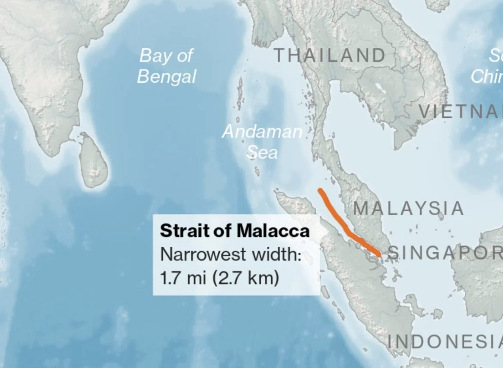
    a) Formation: Low-pressure area formed near the Malacca Strait over the South Andaman Sea. It arose due to a cyclonic circulation.

    b) Likely Path: Expected to move west-northwestwards. Likely to intensify into a depression over southeast Bay of Bengal & adjoining south Andaman Sea by November 24.

    c) Further IntensificationCould intensify further over the southwest Bay of Bengal within 48 hours after formation. IMD is uncertain whether it will develop into a cyclonic storm.

    d) State Impact (Odisha & Coastal Areas): System is far from Odisha coastdry weather Farmers in coastal and southern regions have started harvesting mature paddy in anticipation of possible heavy rains. The State Agriculture Department has not yet issued advisories.

    (2015) In the South Atlantic and South-Eastern Pacific regions in tropical latitudes, cyclone does not originate. What is the reason? 

    (a) Sea surface temperatures are low 

    (b) Inter-Tropical Convergence Zone seldom occurs 

    (c) Coriolis force is too weak 

    (d) Absence of land in those regions