💥Join UPSC 2027,2028 Mentorship (August Batch) + XFactor Notes & Microthemes PDF

Subject: Environment

  • Freshwater Sponge

    Why in the News?

    • Scientists from Bose Institute studied freshwater sponges from the Sundarban delta
    • Identified their potential role as bioindicators of toxic metal pollution

    About Freshwater Sponges

    • Among the earliest multicellular eukaryotes
    • Play a key role in maintaining aquatic ecosystem health
    • Found in clean streams, lakes, rivers, and estuarine systems
    • Grow on sturdy submerged objects
    • Are filter feeders, filtering large volumes of water
    • Obtain food from water flow through the body and symbiotic algae

    Physical Features

    • Often appear green in colour
    • Green colour due to symbiotic algae living within sponge tissues

    Reproduction

    Sexual reproduction
    Asexual reproduction by fragmentation
    • Formation of gemmules
    Tiny, resistant reproductive bodies
    Can survive unfavourable conditions
    Germinate later to form new sponges

    Ecological Role and Significance

    • Act as bioindicators of water quality
    • Absorb toxic heavy metals such as arsenic, lead, and cadmium
    • Useful in monitoring pollution levels in freshwater and estuarine ecosystems
    • Show potential for bioremediation of polluted water bodies

    Which one of the following is a filter feeder? (2021)

    (a) Catfish 

    (b) Octopus 

    (c) Oyster 

    (d) Pelican

  • How is the Aravalli range to be protected

    Introduction

    The Aravalli range, among the world’s oldest mountain systems, functions as a critical ecological barrier preventing desertification of the Indo-Gangetic plains. Stretching over 650 km from Gujarat to Delhi, the range plays a central role in climate moderation, groundwater recharge, and biodiversity conservation. However, decades of inconsistent definitions, regulatory violations, and mining pressures have degraded large tracts, necessitating renewed judicial intervention.

    Why in the News

    The Supreme Court, in a recent order, settled on a uniform definition of the Aravalli hills and ranges, paused the grant of fresh mining leases, and directed preparation of a Sustainable Mining Management Plan (SMMP). This marks a decisive shift from fragmented state-level interpretations that previously enabled unregulated mining. The intervention is significant as it directly addresses regulatory dilution, illegal extraction, and ecological degradation across Delhi-NCR, Haryana, Rajasthan, and Gujarat.

    Ecological and Strategic Significance of the Aravalli Range

    1. Ecological Barrier: Prevents eastward expansion of the Thar Desert into Haryana, Rajasthan, and western Uttar Pradesh.
    2. Climate Regulation: Supports regional climate stability and moderates extreme temperatures.
    3. Groundwater Recharge: Functions as a major recharge system for aquifers supplying urban and rural settlements.
    4. River Systems Support: Acts as a source region for rivers such as Chambal, Sabarmati, and Luni.
    5. Biodiversity Reservoir: Hosts diverse flora and fauna across forested and semi-arid ecosystems.
    6. Mineral Endowment: Contains limestone, marble, granite, zinc, copper, gold, and tungsten-driving extraction pressures.

    Historical Mining Pressure and Regulatory Failure

    1. Mining Legacy: Stone and sand mining persisted for decades due to mineral richness.
    2. Environmental Degradation: Caused air pollution, groundwater depletion, and ecosystem fragmentation.
    3. Legal Non-Compliance: Mining frequently operated without valid environmental clearances.
    4. International Commitments: Violates India’s obligations under the UN Convention to Combat Desertification.
    5. Judicial Trigger: Supreme Court intervention followed systemic regulatory failure at state levels.

    Early Executive and Judicial Interventions

    1. MoEF Restrictions (1990s): Issued mining restrictions across the Aravallis.
    2. Persistent Violations: State-level enforcement failures undermined restrictions.
    3. Supreme Court Ban (2009): Imposed a blanket ban on mining in Faridabad, Gurgaon, and Mewat.
    4. Fresh Mining Leases: Prohibited new leases and renewals pending comprehensive assessment.
    5. CEC Mandate: Central Empowered Committee tasked with examining mining impacts.

    Central Empowered Committee Findings and Recommendations

    1. Landscape-Level Assessment: Recommended macro-level environmental impact assessment.
    2. Mining Prohibition Zones: Advised bans in ecologically sensitive areas.
    3. Water Protection: Highlighted risks to recharge zones and water bodies.
    4. Strict Regulation: Suggested prohibition of mining until proper mapping and impact studies.
    5. Implementation Timeline: Recommendations placed before the Court after delayed compliance.

    Need for a Uniform Definition of the Aravallis

    1. State Inconsistencies: Different criteria used by states to identify Aravalli land.
    2. FSI Criteria (2010):
      1. Slope ≥ 3°
      2. Hill Height ≥ 100 m
      3. Valley Width ≥ 500 m
      4. Enclosed Area Criteria
    3. Regulatory Loopholes: Narrow definitions enabled mining below 100 m height.
    4. Scientific Objections: CEC flagged exclusion of slopes and foothills as ecologically flawed.
    5. Judicial Resolution: Supreme Court approved a nationally consistent definition.

    Supreme Court Directions on Mining Governance

    1. Sustainable Mining Management Plan: Directed preparation of SMMP for Aravalli-NCR.
    2. Absolute Prohibition: Banned mining in highly sensitive zones.
    3. Conditional Permissions: Allowed limited mining under strict regulatory oversight.
    4. Carrying Capacity Assessment: Mandated ecological thresholds before approvals.
    5. Restoration Measures: Required rehabilitation and restoration planning.

    Green Wall Project and Landscape Restoration

    1. Project Launch (June 2025): Centre initiated the Aravalli “Green Wall”.
    2. Geographic Scope: 5-km buffer across 29 districts in Gujarat, Rajasthan, Haryana, and Delhi.
    3. Restoration Target: 26 million hectares of degraded land by 2030.
    4. Climate Co-Benefits: Enhances carbon sequestration and desertification control.
    5. Policy Integration: Aligns with land degradation neutrality goals.

    Why Mining Has Not Been Completely Banned

    1. Past Experience: Total bans encouraged illegal syndicates and violent extraction.
    2. Regulatory Vacuum: Blanket prohibitions weakened oversight mechanisms.
    3. Calibrated Approach:
      1. Existing legal mines regulated stringently.
      2. Ecologically sensitive zones declared no-go areas.
    4. Governance Focus: Emphasis on enforceable regulation rather than prohibition.

    Conclusion:

    Protecting the Aravalli range is essential not only for conserving an ancient geomorphic system but also for safeguarding north India from accelerating desertification, groundwater decline, and ecological instability. The Supreme Court’s insistence on a uniform definition, regulated mining, and landscape restoration marks a shift from fragmented governance to science-based environmental stewardship.

    PYQ Relevance

    [UPSC 2020] The process of desertification does not have climatic boundaries. Justify with examples.

    Linkage: The question examines the role of physiographic features and human interventions in driving desertification beyond climatic boundaries under GS-1. The Aravalli range functions as a natural barrier against desert spread, and its degradation demonstrates how desertification can advance into non-arid regions.

  • Channa bhoi

    Why in the News?

    Scientists have discovered a new species of snakehead fish named Channa bhoi from the state of Meghalaya, adding to India’s freshwater biodiversity.

    About Channa Bhoi

    • Newly identified species of snakehead fish
    • Discovered from a small mountain stream near Iewmawlong village
    • Location: Ri Bhoi district, Meghalaya
    • Named after the Bhoi people, an indigenous group of the Khasi tribe inhabiting the region

    Taxonomic and Ecological Details

    • Belongs to the Gachua group of snakehead fishes
    • The Gachua group is known for high species diversity in the Eastern Himalayan region
    • Phylogenetic analysis shows it is a sister species to Channa bipuli, found in Northeast India

    Distinctive Physical Features

    Bluish grey body colour
    • Each scale has minute black spots
    • Spots form eight to nine horizontal rows of broken lines along the body
    Distinctive banding patterns on the pectoral fins
    • Unique colour pattern differentiates it from closely related species

    Significance of the Discovery

    • Highlights the rich freshwater biodiversity of Northeast India
    • Emphasises the importance of mountain stream ecosystems
    • Reflects ongoing discoveries in the Eastern Himalayan biodiversity hotspot

    Key Prelims Fact

    • With this discovery, the total number of Channa species recorded in India has increased to 26

    In a particular region in India, the local people train the roots of living trees into robust bridges across the streams. As the time passes, these bridges become stronger. These unique ‘living root bridges’ are found in (2015)

    (a) Meghalaya 

    (b) Himachal Pradesh 

    (c) Jharkhand 

    (d) Tamil Nadu

  • Climate change, deforestation worsened impact of SE Asia cyclones

    Introduction

    Rising global temperatures, deforestation, and rapid urbanisation have significantly intensified the flood impacts of tropical cyclones across Sri Lanka, Malaysia, Indonesia, and Thailand. Recent cyclones such as Dithawru and Senyar produced rainfall and flooding far exceeding historical norms, marking a shift from cyclical monsoon flooding to extreme, compound climate disasters.

    Why in the News

    A new attribution study by the World Weather Attribution (WWA) group establishes that climate change, land-use change, and urban expansion together amplified cyclone-induced floods in Southeast Asia to unprecedented levels. Cyclone Senyar made landfall in Indonesia and Malaysia on November 26-27, while Dithawru struck Sri Lanka earlier in November, causing extensive damage and over 1,600 deaths. The study highlights rainfall intensities rising up to 160% in Sri Lanka and 50% in Malaysia compared to pre-industrial baselines, underscoring a structural climate shift rather than isolated weather anomalies.

    Escalating Cyclone Rainfall in a Warming Climate

    1. Global Temperature Rise: Increases atmospheric moisture-holding capacity as temperatures have risen by 1.3°C since the mid-1800s.
    2. Moisture Amplification: Each 1°C rise enables the atmosphere to hold 7% more moisture, intensifying rainfall.
    3. Cyclone Energy Supply: Elevated sea surface temperatures in the North Indian Ocean provided additional latent heat for cyclone formation.
    4. Rainfall Extremes: Five-day rainfall events in Sri Lanka intensified by 160%, while extreme rainfall in Malaysia increased by 50%.

    Sea Surface Temperature Anomalies and Storm Intensification

    1. Above-Normal SSTs: Sea surface temperatures during Cyclone Senyar were 0.2°C higher than the 1991-2020 average.
    2. Storm Development: Warmer oceans increased evaporation rates, strengthening storm systems and prolonging rainfall duration.
    3. Frequency Shift: The study identifies a rise in extreme rainfall frequency rather than mere intensity spikes.

    Deforestation as a Flood Multiplier

    1. Forest Cover Decline: Sri Lanka lost 90% of forest cover between 1900 and 2020.
    2. Hydrological Impact: Reduced infiltration and increased surface runoff amplified landslides and flash floods.
    3. Human Impact: Rainfall-induced landslides in Sri Lanka caused over 600 deaths.
    4. Indonesia Case: Nearly 25% of old-growth forests on palm oil plantations were cleared between 1991 and 2020, reducing natural flood buffers.

    Rapid Urbanisation and Exposure Expansion

    1. Population Exposure: Rising numbers of people reside in high-intensity flood-risk zones across Sri Lanka and Indonesia.
    2. Infrastructure Stress: Roads, railways, and cropland expansion increased surface sealing and runoff velocity.
    3. Flood Pathways: Inadequate drainage and altered land gradients intensified urban flooding during Cyclone Senyar.

    Flood Impacts Beyond Rainfall

    1. Economic Losses: Sustained economic losses estimated between $6-7 billion, equivalent to 3-5% of GDP in affected regions.
    2. Agricultural Damage: More than 137,000 acres of agricultural land damaged due to floods and infrastructure failures.
    3. Secondary Hazards: Flooding triggered dam breaches, canal destruction, and landslides, compounding disaster severity.

    Attribution Science and Policy Significance

    1. Event Attribution: Confirms climate change as a decisive factor in amplifying rainfall and flood impacts.
    2. Shift in Disaster Pattern: Floods no longer limited to monsoon cycles but increasingly driven by short-duration extreme events.
    3. Policy Gap: Highlights inadequate land-use planning and ecosystem protection in climate adaptation strategies.

    Conclusion

    The study establishes that cyclone disasters in Southeast Asia are no longer episodic weather events but outcomes of sustained climate warming, ecological degradation, and unplanned urban growth. Addressing future flood risks requires integrating climate mitigation, forest conservation, and land-use planning into disaster governance frameworks.

    PYQ Relevance

    [UPSC 2023] The Intergovernmental Panel on Climate Change (IPCC) has predicted a global sea level rise of about one metre by AD 2100. What would be its impact in India and the other countries in the Indian Ocean region? 

    Linkage: The article reinforces IPCC projections by showing how warming oceans and climate change amplify coastal flooding risks in the Indian Ocean region. Sea-level rise acts as a risk multiplier, intensifying cyclone impacts, floods, and ecosystem loss in India and neighbouring countries.

  • Kerala’s Butterfly Diversity 

    Why in the News?

    A new monograph published in ENTOMON journal affirms that Kerala hosts the highest butterfly diversity among Indian States along the Western Ghats.

    Source of Study

    • Title: The Butterflies (Lepidoptera, Rhopalocera) of Kerala: Status and Distribution
    • Journal: ENTOMON, open access quarterly journal
    • Published by: Association for Advancement of Entomology
    • Lead researcher: Kalesh Sadasivan

    Key Findings

    • Kerala records 328 butterfly species.
    • Includes 41 species endemic to the Western Ghats.
    • Western Ghats as a whole support 337 butterfly species, most of which are found in Kerala.

    Butterfly Families in Kerala

    Nymphalidae: 97 species, Lycaenidae: 96 species, Hesperiidae: 82 species and Other families: Papilionidae, Pieridae, Riodinidae

    Migratory Species

    36 migratory butterfly species documented. Highlights Kerala as a key migratory corridor for seasonal butterfly movement.

    • Conservation Status
    • 22 species from Kerala listed in the IUCN Red List.
    • Most are Least Concern.
    • 2 species classified as Near Threatened.

    Legal Protection in India

    • 70 butterfly species protected under the Wildlife Protection Act, 1972
    • 4 species under Schedule I. Majority under Schedule II.

    Larval Host Plant Diversity

    • Over 1,800 larval feeding records documented.
    • Includes 350 plus new field observations.
    • Covers nearly 800 plant species.
    • One of the largest region specific host plant compilations in India.
    Due to some reasons, if there is a huge fall in the population of species of butterflies, what could be its likely consequence/consequences? (2017)

    1. Pollination of some plants could be adversely affected. 

    2. There could be a drastic increase in the fungal infections of some cultivated plants. 

    3. It could lead to a fall in the population of some species of wasps, spiders and birds. 

    Select the correct answer using the code given below: 

    (a) 1 only (b) 2 and 3 only (c) 1 and 3 only (d) 1, 2 and 3

  • Wildlife Smuggling at Kempegowda International Airport (KIA)

    Why in the News?

    Customs officials at Kempegowda International Airport, Bengaluru, intercepted a wildlife smuggling attempt involving endangered primates brought from Bangkok.

    Key Details

    • Two red shanked douc monkeys were recovered from a passenger arriving on flight TG 325 from Bangkok.
    • The animals were concealed inside check in baggage.
    • The passenger was arrested under provisions of the Wildlife Protection Act, 1972 and the Customs Act, 1962.
    • The rescued primates were handed over to animal welfare authorities for rehabilitation.
    • Further investigation is ongoing.

    About Red Shanked Douc Monkey

    • Scientific name: Pygathrix nemaeus
    • Habitat: Tropical forests of Vietnam, Laos and Cambodia
    • IUCN Status: Critically Endangered
    • Listed under CITES Appendix I
    • Known for distinctive red lower limbs and colourful facial markings

    Legal and International Framework

    • Wildlife Protection Act, 1972 provides legal protection to endangered species in India.
    • CITES regulates international trade in endangered species of wild fauna and flora.
    • Appendix I species face the strictest trade restrictions.

    Prelims Pointers

    • Airports are major transit points for wildlife trafficking.
    • Smuggling of CITES listed species is a serious international offence.
    • India is a signatory to CITES and enforces it through domestic laws.
    • Wildlife trafficking is among the top illegal trades globally after drugs and arms.
    In India, if a species of tortoise is declared protected under Schedule I of the Wildlife (Protection) Act, 1972, what does it imply? (2017)

    (a) It enjoys the same level of protection as the tiger. 

    (b) It no longer exists in the wild, a few individuals are under captive protection; and how it is impossible to prevent its extinction. 

    (c) It is endemic to a particular region of India. 

    (d) Both (b) and (c) stated above are correct in this context.

  • Are methane emissions in India being missed?

    Introduction

    Methane is a short-lived but highly potent greenhouse gas, with 84-86 times the warming impact of CO₂ over 20 years. India is among the world’s largest methane emitters, primarily from waste, agriculture, and fossil fuel systems. However, weak monitoring systems, infrequent data updates, and reliance on modelling assumptions have led to substantial underestimation of actual emissions.

    Why in the News?

    Satellite datasets have, for the first time, revealed that methane emissions from Indian landfills, oil and gas infrastructure, and urban waste sites are significantly underreported, sometimes by a factor of ten. This challenges long-standing inventory-based estimates and highlights a systemic gap between ground reporting and atmospheric reality, making methane a missed but high-impact climate mitigation opportunity.

    Why is methane a critical climate concern for India?

    1. High Global Warming Potential: Methane traps significantly more heat than carbon dioxide in the short term, accelerating near-term warming.
    2. Multi-sectoral Sources: Emissions arise from landfills, wastewater, oil and gas leaks, and organic waste decomposition.
    3. Urban Climate Impact: Large cities generate concentrated methane hotspots due to unmanaged solid waste.
    4. Policy Leverage: Rapid methane reduction delivers faster climate benefits than long-term CO₂ mitigation.

    How have satellite observations changed methane assessment?

    1. Independent Measurement: Satellites measure atmospheric methane directly, bypassing assumptions used in inventories.
    2. High Spatial Resolution: New platforms identify emissions down to individual landfills and infrastructure sites.
    3. First-of-its-Kind Evidence: Indian sites show emissions up to 10x higher than reported estimates.
    4. Comparative Accuracy: Satellite data highlights discrepancies between national inventories and real emissions.

    What gaps exist in India’s current methane inventories?

    1. Model-Based Estimates: Inventories rely on default emission factors and outdated waste generation data.
    2. Infrequent Updates: Sector-wise methane data is updated irregularly at national and state levels.
    3. Source Aggregation: Individual hotspots are masked under regional averages.
    4. Limited Ground Validation: Physical measurement is rare due to cost, logistics, and technical complexity.

    What do case studies from Indian cities reveal?

    1. Delhi (Bhalswa Landfill): Satellite data showed emissions nearly 10 times higher than older estimates.
    2. Mumbai: Emissions from urban waste approached ~0.96 million tonnes, far exceeding theoretical calculations.
    3. Ahmedabad: State estimates at 0.73 million tonnes, with Pirana landfill alone emitting ~0.60 million tonnes.
    4. City-Specific Variability: Differences driven by landfill design, waste composition, and management practices.

    Why is landfill methane particularly underestimated?

    1. Waste Heterogeneity: Indian landfills mix organic, plastic, and industrial waste.
    2. Unengineered Dumps: Most sites lack liners, gas capture systems, or leachate control.
    3. Invisible Emissions: Methane leaks remain undetected without advanced monitoring.
    4. Urban Scale: Mega-cities generate continuous methane flows, not episodic spikes.

    What are the limits of satellite-only monitoring?

    1. Attribution Challenges: Satellites detect plumes but not exact causes.
    2. Complex Urban Signals: Dense cities create overlapping emission sources.
    3. Limited Temporal Coverage: Some emissions remain intermittent or weather-dependent.
    4. Need for Integration: Satellite data requires ground verification for enforcement.

    How does integrated monitoring improve governance outcomes?

    1. Targeted Enforcement: Identifies precise leak points for corrective action.
    2. Policy Feedback Loop: Enables rapid response instead of delayed reporting cycles.
    3. Institutional Coordination: Links urban bodies, pollution boards, and climate agencies.
    4. Cost Efficiency: Directs resources toward highest-impact mitigation sites.

    Conclusion

    Methane emissions in India are not merely underestimated but structurally obscured by outdated inventories and weak monitoring frameworks. Satellite detection has exposed a significant mitigation opportunity, particularly in urban waste systems. Integrating satellite data with ground-level governance can transform methane control into one of India’s fastest climate gains.

    PYQ Relevance

    [UPSC 2022]  Discuss global warming and mention its effects on global climate. Explain the control measures to bring down the level of greenhouse gasses which cause global warming in the light of the Kyoto Protocol 1997. 

    Linkage: This PYQ directly links to methane as a high-impact greenhouse gas and tests understanding of non-CO₂ mitigation, where the article highlights systematic underestimation of methane emissions in India and the need for improved monitoring to achieve climate control commitments.

  • New Ramsar Sites in India

    Why in the News?

    Siliserh Lake in Rajasthan and Kopra Jalashay in Chhattisgarh have been designated as Ramsar Sites, recognising their international importance as wetlands.

    Siliserh Lake

    Location: Alwar district, Rajasthan
    Type: Human made lake
    Setting: Located within the buffer zone of Sariska Tiger Reserve
    History: Constructed in 1845 by Maharaja Vinay Singh to supply drinking water to Alwar city
    Climate Zone: Semi arid region
    Ecological Significance:
    • Important water source in a dry landscape
    • Supports diverse wetland and terrestrial biodiversity

    Fauna:

    • Around 149 bird species
    • 17 mammal species
    • Vulnerable species: River tern
    • Endangered species: Tiger
    • Supports more than 1 percent of the biogeographic population of Black Stork (Ciconia nigra)

    Kopra Jalashay

    Location: Bilaspur district, Chhattisgarh
    Type: Reservoir
    River System: Upper catchment of the Mahanadi River
    Hydrological Importance:
    • Strong hydrological and ecological connectivity
    • Creates a mosaic of wetland habitats

    Avifaunal Importance:

    • Supports over 60 migratory bird species
    • Used for nesting, feeding and as a stopover site

    Fauna:

    • Vulnerable species: Greater Spotted Eagle (Aquila clanga)
    • Endangered species: Egyptian Vulture (Neophron percnopterus)

    Ramsar Convention Key Point for Prelims

    • Ramsar Convention is an international treaty for conservation and wise use of wetlands
      • Adopted in 1971 at Ramsar, Iran
      • India is a contracting party since 1982
    If a wetland of international importance is brought under the ‘Montreux Record’, what does it imply? (2014)

    (a) Changes in ecological character have occurred, are occurring or are likely to occur in the wetland as a result of human interference. 

    (b) The country in which the wetland is located should enact a law to prohibit any human activity within five kilometres from the edge of the wetland. 

    (c) The survival of the wetland depends on the cultural practices and traditions of certain communities living in its vicinity and therefore the cultural diversity therein should not be destroyed. 

    (d) It is given the status of ‘World Heritage Site’

  • India is focusing on PM10 but PM 2.5 is the real threat

    Introduction

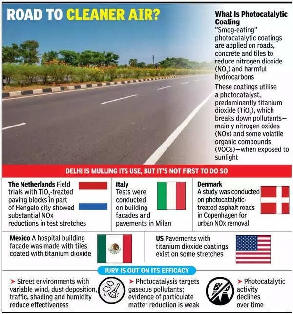
    Air pollution in India is no longer episodic or seasonal; it is a structural public health emergency. While global best practices increasingly rely on health-based air quality standards, India’s regulatory architecture continues to emphasise coarser particulate matter (PM10) due to administrative convenience and visible enforcement outcomes. This regulatory bias weakens India’s ability to reduce disease burden, undermines scientific policymaking, and distorts progress assessment under the National Clean Air Programme (NCAP).

    Why in the News?

    A new comparative study by the Sustainable Futures Collaborative (SFC) highlights that India’s air pollution control framework remains disproportionately focused on PM10, while PM2.5, responsible for deeper health damage. remains inadequately addressed. The report is significant because it systematically contrasts India’s regulatory pathway with countries such as China, Mexico, Brazil, Poland, South Korea, and Germany, revealing a structural mismatch between India’s monitoring priorities and the actual toxicity of pollutants. 

    The Scientific Hierarchy of Harm in Particulate Matter

    1. PM2.5 Toxicity: Penetrates deep into the lungs and bloodstream, causing cardiovascular and respiratory diseases.
    2. PM10 Characteristics: Larger particles with lower systemic penetration and comparatively lesser health impact.
    3. Policy Mismatch: Regulatory attention remains fixed on PM10 despite PM2.5 being the primary health risk.
    4. Outcome: Misalignment between pollution control metrics and actual disease burden.

    Regulatory Bias Towards PM10 in India

    1. Monitoring Focus: NCAP progress is measured primarily through PM10 reductions.
    2. Administrative Ease: PM10 reductions are easier to demonstrate through visible actions like road sweeping and construction controls.
    3. Institutional Incentives: City authorities prefer pollutants that show quicker compliance outcomes.
    4. Policy Consequence: PM2.5 mitigation receives limited planning, funding, and enforcement priority.

    Geography and Urban Form as Pollution Amplifiers

    1. Delhi’s Topography: Located on a plateau surrounded by mountains, restricting pollutant dispersion.
    2. Atmospheric Stagnation: Winter inversion traps pollutants close to the ground.
    3. Regional Inflows: Pollutants from surrounding regions add to local emissions.
    4. Result: Structural accumulation of PM2.5 beyond city-level control measures.

    International Regulatory Pathways Compared

    1. China: Transitioned from PM10 to PM2.5 standards after public health pressure; implemented national emission standards and fuel quality upgrades.
    2. Mexico: Introduced health-based air quality standards following judicial and civil society intervention.
    3. Poland: Adopted EU emission norms after civil resistance and local political change.
    4. Common Feature: Strong national regulation, judicial pressure, and health-based standards.
    5. Indian Contrast: Fragmented authority, weak enforcement, and delayed regulatory evolution.

    Institutional Capacity Constraints in India

    1. State Pollution Control Boards (SPCBs): Resource-poor and understaffed.
    2. Monitoring Load: Engineers responsible for air, water, and waste compliance simultaneously.
    3. Outsourcing Dependence: Compliance monitoring outsourced to private agencies, creating conflicts of interest.
    4. Regulatory Gap: Limited accountability and weak on-ground enforcement.

    Monitoring Deficit and Data Blindness

    1. Ground Monitoring: Insufficient real-time PM2.5 monitoring infrastructure.
    2. Compliance Illusion: Cities meet PM10 reduction targets while PM2.5 levels remain hazardous.
    3. NCAP Limitation: PM2.5 reduction not central to non-attainment city evaluation.
    4. Outcome: Policy success measured through incomplete indicators.

    Policy Instruments and Their Limitations

    1. Smog Guns: Symbolic interventions with minimal impact on PM2.5.
    2. Construction Controls: Effective for PM10, marginal for PM2.5.
    3. Road Dust Management: Visibility-driven policy with limited health outcomes.
    4. Structural Failure: Absence of emission source targeting for fine particulates.

    Conclusion

    India’s air pollution strategy suffers not from lack of intent, but from misaligned priorities and weak institutional design. By privileging PM10 over PM2.5, policymakers risk managing visibility rather than mortality. Without a decisive shift towards health-based air quality standards, strengthened monitoring capacity, and PM2.5-centric regulation, India’s pollution control efforts will continue to underperform despite visible compliance gains.

    PYQ Relevance

    [UPSC 2021] Describe the key point of the revised Global Air Quality Guidelines [AQGs] recently released by the World Health Organisation [WHO].How are these different from its last update in 2005? What changes in India’s National Clean Air Programme are required to achieve these revised standards ?

    Linkage: This PYQ directly aligns with the article’s core argument that India’s NCAP remains PM10-centric, whereas WHO AQGs prioritise PM2.5 due to higher health risks. The article provides analytical grounding to argue why India’s air quality framework requires a shift to health-based PM2.5 standards rather than visibility-based PM10 compliance.

  • Pallas’s Gull 

    Why in the News?

    The rare migratory Pallas’s Gull was recently sighted at Udhwa Bird Sanctuary in Jharkhand, marking its return after nearly a decade.

    About Pallas’s Gull

    • Also known as the Great Black headed Gull
    • One of the largest gull species in the world
    • World’s largest black headed gull and third largest gull overall
    • Family: Laridae
    • Scientific name: Ichthyaetus ichthyaetus

    Conservation Status: IUCN Red List: Least Concern

    Distribution and Migration

    • Breeds in colonies across marshes and islands of southern Russia, Kazakhstan, and Mongolia
    • Migratory species
    • Winters in the Mediterranean region, Arabian Peninsula, and Indian subcontinent.

    Prelims Pointers

    • Pallas’s Gull is a migratory wetland dependent bird
    • Associated with Central Asian Flyway
    • Udhwa is Jharkhand’s only bird sanctuary and a Ramsar Site
    • Species belongs to the Laridae family
    Which of the following National Parks is unique in being a swamp with floating vegetation that supports a rich biodiversity? (2015)

    (a) Bhitarkanika National Park 

    (b) Keibul Lamjao National Park 

    (c) Keoladeo Ghana National Park 

    (d) Sultanpur National Park