💥Mains Ready By December. Smash Mains & Smash PYQ Admissions Open

GS Paper: GS3-19.Disaster and Disaster Management.

  • SC ruling on post-facto clearances sets environmental law back by decades

    Introduction

    The Environmental Impact Assessment (EIA) is a preventive system requiring environmental clearance before a project begins. In 2025, the Supreme Court’s Vanashakti judgment banned all post-facto clearances as unconstitutional. In a new 2:1 ruling, the Court has now recalled that decision, warning that continuing the ban would cause “devastating” consequences and jeopardise major public investments. This marks a clear shift away from earlier strictures on environmental approvals.

    Why in the news?

    The Supreme Court’s recent endorsement of post-facto environmental clearances marks a sharp break from earlier rulings where such permissions were held illegal. For the first time, industries operating without prior approval may regularise their violations by paying penalties. This undermines the preventive purpose of Environmental Impact Assessments (EIAs), weakens compliance in a country already facing severe pollution challenges. The ruling enables violators to bypass mandatory safeguards like public hearings and ecological assessments, allowing large-scale industries to operate first and seek approval later.

    Understanding Ex Post Facto Environmental Clearances

    Meaning and Basic Idea

    • Retrospective approvals: Permissions granted after a project has already started construction, expansion, or operation without the mandatory prior Environmental Clearance (EC).
    • Departure from preventive logic: Converts a forward-looking safeguard into a mechanism to regularise completed violations.

    Intended Purpose: Rare exceptions: Initially justified only for unusual situations where procedural lapses occurred without deliberate violation.

    Actual Use: Regularisation tool: Gradually used to “legalise” ongoing or completed activities that had bypassed due environmental scrutiny.

    Legal Context

    1. EPA, 1986 as foundation: The Environment (Protection) Act establishes prior approval as the norm for activities affecting the environment.
    2. EIA 1994 & 2006 notifications: Both frameworks emphasise that major projects, industrial, mining, construction, must undergo assessment before commencement.

    Supreme Court’s Stand in the Vanashakti Judgment (2025)

    Key Findings

    1. Invalidation of government provisions: Struck down specific notifications and office memoranda that enabled retrospective clearances.
    2. Violation of environmental principles: Held that such clearances contradict the precautionary principle, which seeks to prevent harm at the outset.

    Judicial Observations

    1. Labelled as serious illegality: The Court stated that post-facto approvals erode environmental rule of law.
    2. Restriction on future permissions: Directed that no further mechanisms be created to enable or replicate retrospective ECs. 

    How Does the Ruling Change India’s Environmental Safeguards?

    1. Shift from Prevention to Regularisation: India’s environmental law is built on prior approval, but the ruling legitimises post-violation approvals. This weakens deterrence and changes the core architecture of environmental governance.
    2. Dilution of Public Hearings: Many industrial activities will now bypass public consultations, one of the most important safeguards under the EIA process.
    3. Weakening of the No-Fault Liability Principle: Earlier, industries operating without clearance faced closure; now they may continue operating after paying monetary penalties.
    4. Increased Environmental Risk: Projects threatening forests, rivers, and air quality gain legal pathways to operate retrospectively, exacerbating existing ecological crises.

    How Has Policy Drift in Recent Years Enabled Post-Facto Approvals?

    1. Draft EIA Notification 2020: Attempted to institutionalise post-facto approvals and reduce public participation, an approach the ruling now indirectly validates.
    2. Forest Conservation Act Amendments (2023): Redefined “forests” to exclude large tracts of land, enabling diversion without scrutiny and bypassing earlier safeguards.
    3. Coastal Regulation Zone (CRZ) Dilution (2018): Relaxed no-development zones and allowed extensive construction in vulnerable coastal areas.
    4. Expansion of Exemptions: Over 45 industrial categories have been exempted from prior clearances in the past decade.
    5. Legalisation of Violations: Historical decisions like TN Godavaraman protected forests strictly, but recent changes enable easier diversion and commercial use.

    Why Is the Ruling Especially Concerning for India’s Current Environmental Crisis?

    1. Extreme Pollution Levels: With 83 of the world’s 100 most polluted cities in India, any weakening of safeguards directly harms public health.
    2. Children’s Health Impact: Delhi’s children lose up to 10 years of lung function, highlighting the urgency of strict compliance.
    3. Carcinogenic Exposure: Farmers in Punjab and Haryana inhale toxic particulates every winter, worsening respiratory health.
    4. Hospital Overload: Urban hospitals deal with chronic respiratory disease surges every winter.
    5. Climate-Driven Disasters: Cyclones, erosion, and floods already strain ecosystems; weaker laws increase vulnerability.

    How Does the Ruling Affect Democratic Accountability?

    1. Reduced Public Participation: By enabling post-facto approvals, the ruling sidelines communities, especially those in pollution-affected regions.
    2. Bypassing Transparency: Industries may avoid public hearings and statutory scrutiny.
    3. Weakening of Citizen Rights: The apex court’s earlier stance held the environment as part of Article 21’s right to life; this shift undermines that framework.
    4. Centralisation of Power: State-level mechanisms become redundant if industries secure clearances retrospectively.

    What Long-Term Risks Does the Judgment Create?

    1. Systematic Legal Erosion: A decade-long pattern of exempting industries and diluting norms is now legitimised judicially.
    2. Encouragement of Violations: Industries may prefer paying a penalty over compliance, cheaper and faster.
    3. Increased Ecological Degradation: Forests, rivers, coasts, and air quality may deteriorate further due to weakened oversight.
    4. Regulatory Capture: Industries gain disproportionate influence over environmental decision-making.
    5. Undermining Global Climate Commitments: India’s commitments under the Paris Agreement require stronger, not weaker, compliance frameworks.

    Conclusion

    The Supreme Court’s endorsement of post-facto clearances marks a turning point in India’s environmental jurisprudence. While the ruling attempts to balance economic development and compliance, it risks normalising illegality and weakening safeguards that exist to protect public health, ecological integrity, and constitutional rights. At a time of worsening pollution and climate vulnerability, India needs stronger, not diluted, environmental governance.

    PYQ Relevance

    [UPSC 2014] What role do environmental NGOs and activists play in influencing Environmental Impact Assessment (EIA) outcomes for major projects in India? Cite four examples with all important details.

    Linkage: With post-facto clearances weakening formal EIA safeguards, NGOs become vital watchdogs ensuring accountability. This topic links directly to environmental governance, EIA dilution, and current judicial-policy debates.

  • India’s disaster response, a slippery slope for federalism

    Introduction

    The Wayanad tragedy of July 2024, claiming nearly 300 lives and destroying thousands of homes, revealed deep weaknesses in India’s disaster financing structure. Though Kerala estimated losses at ₹20,820 crore, the Union approved only ₹260 crore, signalling a widening disconnect between State needs and Union allocations. As climate disasters intensify, India’s disaster-risk financing model shows visible drift, raising questions on fiscal federalism, institutional design, and equity.

    Why in the news

    The Wayanad landslides (July 2024) brought focus to an unprecedented gap between State-estimated losses (₹20,820 crore) and Union-approved relief (₹260 crore). For the first time, the mismatch was so steep that the State sought a special memorandum to claim recovery support. This experience, mirroring similar delays in Himachal, Uttarakhand, Assam, and Odisha, highlights growing centralisation of disaster financing, outdated relief norms, and procedural bottlenecks that slow down urgent aid.

    Where is the drift in India’s disaster financing framework?

    1. Two-tier structure: SDRF (shared) and NDRF (Union-funded) forms the legal basis under Disaster Management Act, 2005; however, practice diverges from cooperative design.
    2. Outdated norms: Relief amounts, like ₹6 lakh for death and ₹1.2 lakh for fully damaged houses, have not kept pace with current needs.
    3. Limited use flexibility: States face constraints using SDRF funds beyond notified categories, leaving gaps during reconstruction needs.
    4. Delayed releases: Sequential approvals (State-Centre-High-level committees) slow down disbursal even during severe calamities.

    Why does classification and discretion weaken the system?

    1. Ambiguous disaster definition: The Act gives no clarity on what qualifies as a ‘severe’ disaster for NDRF aid, leaving room for variable central discretion.
    2. Procedural-not automatic triggers: India relies on approvals; unlike global practices using rainfall thresholds, satellite data, or actuarial triggers.
    3. Bias in allocations: Finance Commission criteria use population and geography proxies; actual vulnerability (poverty, hazard exposure) gets underestimated.

    How did the Wayanad episode reveal institutional deficiencies?

    1. Unspent SDRF balances: Kerala had ₹780 crore in SDRF and earlier deposits but faced constraints using them due to rigid rules.
    2. Cuts in interest support: ₹529 crore Centre interest-free support was withdrawn, reducing flexibility.
    3. Mismatch in severity classification: Landslides treated as “severe disaster” only after delays, reducing timely access to NDRF.
    4. Comparative delays: Similar underfunding seen in Himachal, Uttarakhand, Assam, Nagaland, and Karnataka after recent floods.

    How can global models inform India’s reforms?

    1. US FEMA: Catastrophe declarations based on clear, measurable thresholds; faster releases.
    2. Mexico FONDEN: Automatic fund release beyond rainfall limits; rules-based framework.
    3. Philippines model: Quick-response funds tied to rainfall-fatality indices.
    4. Australia: Funds tied to State expenditure and accountability.
    5. African/Caribbean insurance pools: Satellite-data triggers reduce discretion and delays.

    What is needed to restore India’s federal spirit?

    1. Sixteenth Finance Commission: Expected to overhaul financing architecture, align relief norms to actual costs, revise allocation formulas, and integrate vulnerability indicators.
    2. Unified disaster authority: A national, airshed-like authority beyond NCR to manage transboundary disaster risks.
    3. Stable fiscal autonomy: Allow States greater control over disaster funds without excessive approvals.
    4. Rules-based financing: Objective, measurable triggers (rainfall intensity, satellite data, loss-to-GSDP ratio) to reduce delays.

    Conclusion

    India’s disaster-response financing, originally structured for cooperative federalism, has shifted toward centralised discretion, resulting in mismatches between actual losses and approved relief. The Wayanad landslides demonstrate the urgent need for rules-based, automatic, and scientifically triggered fund release mechanisms. Strengthening fiscal autonomy, updating norms, and adopting global best practices are essential for a resilient, federal, and future-ready disaster management system.

    PYQ Relevance

    [UPSC 2020] Discuss the recent measures initiated in disaster management by the Government of India departing from the earlier reactive approach.

    Linkage: The question aligns with the article’s focus on outdated, reactive SDRF-NDRF procedures and delays exposed during the Wayanad disaster. It reinforces the need for proactive, rules-based, science-triggered disaster financing and stronger federal coordination.


  • Low-Pressure Area in Bay of Bengal (November 2025) 

    Why in the news?

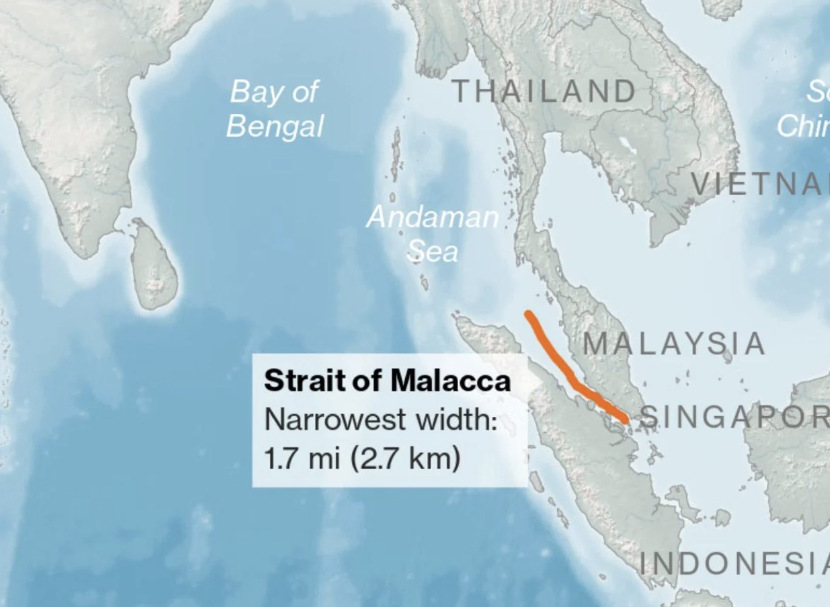
    According to the India Meteorological Department (IMD), a low-pressure area formed over the Bay of Bengal on November 22, 2025. It is expected to intensify into a depression by November 24 and move west-northwestwards.

    What Has the IMD Reported?  

    a) Formation: Low-pressure area formed near the Malacca Strait over the South Andaman Sea. It arose due to a cyclonic circulation.

    b) Likely Path: Expected to move west-northwestwards. Likely to intensify into a depression over southeast Bay of Bengal & adjoining south Andaman Sea by November 24.

    c) Further IntensificationCould intensify further over the southwest Bay of Bengal within 48 hours after formation. IMD is uncertain whether it will develop into a cyclonic storm.

    d) State Impact (Odisha & Coastal Areas): System is far from Odisha coastdry weather Farmers in coastal and southern regions have started harvesting mature paddy in anticipation of possible heavy rains. The State Agriculture Department has not yet issued advisories.

    (2015) In the South Atlantic and South-Eastern Pacific regions in tropical latitudes, cyclone does not originate. What is the reason? 

    (a) Sea surface temperatures are low 

    (b) Inter-Tropical Convergence Zone seldom occurs 

    (c) Coriolis force is too weak 

    (d) Absence of land in those regions

  • Setting up an early warning system for the Himalayas poses unique challenges

    Introduction

    The recent rise in Himalayan disasters highlights the urgent need for early warning systems. The 2024 Down To Earth report shows that between 1900 and 2022, India recorded 687 disasters, with 240 in the Himalayan region alone. Disasters include glacial lake outbursts, flash floods, landslides, wildfires, and earthquakes. What was once a region of five disasters between 1902–1962 now witnesses a major event almost every month.

    The combination of climate change, infrastructure expansion, and data inaccessibility has created a perfect storm for recurring disasters.

    Why in the News?

    In October 2025, Mount Everest’s Tibetan side witnessed a sudden blizzard and heavy snowfall, trapping climbers and villagers, a scene that epitomized the Himalayan fragility. At the same time, floods and landslides in Nepal and Darjeeling killed dozens. These incidents are part of an alarming rise in Himalayan disasters, making early warning systems a national security and developmental priority. Unlike coastal or plain regions, setting up Early Warning Systems (EWS) in the Himalayas poses terrain-specific, logistical, and data-related hurdles, which the government and scientists are now racing to overcome.

    Why Are the Himalayas Experiencing So Many Disasters?

    1. Climate Change Impact: Rapid glacier retreat, erratic precipitation, and temperature rise have increased frequency of floods and glacial lake outbursts.
    2. Unregulated Development: Road expansion, hydropower tunnels, and tourism infrastructure disturb fragile slopes.
    3. Population Pressure: Rising habitation and migration to high-altitude zones expose more people to risk.
    4. Data Scarcity: Sparse weather stations and inaccessible terrain reduce real-time monitoring.
    5. Cascading Disasters: Earthquakes trigger landslides that block rivers, leading to floods and dam bursts.

    Why Are Early Warning Systems Hard to Establish in the Himalayas?

    1. Topographic Challenge: Remote valleys, deep gorges, and shifting glaciers hinder sensor installation and data transmission.
    2. Energy & Connectivity Gaps: Lack of stable power and internet networks limit continuous monitoring.
    3. Institutional Fragmentation: Multiple agencies, IMD, NDMA, SASE, and state authorities, work in silos.
    4. High Cost of Equipment: Advanced sensors and AI-based models require large funding, which is often project-based, not permanent.
    5. Local Integration Issues: Absence of local awareness and training hinders EWS adoption and response effectiveness.

    What Have Been the Major Successes or Promising Models?

    1. Swiss Alps Example: In Switzerland’s Blatten village, an EWS prevented a glacial lake collapse by alerting authorities, saving hundreds of lives.
    2. China’s EWS (2022): The Chinese Academy of Sciences created a Himalayan EWS using satellite and AI-based modeling to forecast flash floods and glacial lake outbursts.
    3. Indian Precedents:
      1. IMD and ISRO collaboration on satellite-based flood forecasting.
      2. Uttarakhand’s Rainfall & Landslide Monitoring Network under NDMA.
      3. AI-based predictive systems being piloted by IIT Roorkee for early landslide alerts.

    What Are the Key Steps Needed for India’s Himalayan EWS Framework?

    1. Integration with National Data Systems: Unify IMD, ISRO, NDMA, and local data into a National Himalayan EWS Grid.
    2. Local Capacity Building: Train local panchayats, mountain police, and disaster volunteers in EWS interpretation.
    3. AI & Drone-Based Monitoring: Employ machine learning to analyze terrain shifts and use drones for data relay.
    4. Community Ownership: Encourage “Last-Mile Ownership”, enabling communities to maintain sensors and report anomalies.
    5. Cross-Border Cooperation: Engage with Nepal, Bhutan, and China under the HKH (Hindu Kush Himalaya) framework for data sharing.

    Relevant Policy and Institutional Frameworks

    1. Sendai Framework for Disaster Risk Reduction (2015–2030): Calls for risk-informed, multi-hazard early warning systems.
    2. National Disaster Management Plan (2019): Prioritizes mountain-specific disaster risk management.
    3. National Mission for Sustaining the Himalayan Ecosystem (NMSHE): Focuses on climate-resilient planning for mountain ecology.
    4. NITI Aayog Report on Himalayan States (2018): Advocates “mountain-centric” governance and monitoring systems.

    Conclusion

    Himalayan resilience is India’s climate frontier. Without an integrated and accessible early warning system, each new disaster deepens ecological and social fragility. Establishing a rugged, community-driven, AI-supported Himalayan EWS is not just a scientific necessity, it is a moral and developmental imperative. Science, policy, and local wisdom must converge to safeguard India’s “Water Tower of Asia.”


  • Cyclone Montha makes landfall in AP

    Why in the News?

    Cyclone Montha, classified as a severe cyclonic storm, has made landfall near Kakinada (Andhra Pradesh) on October 28.

    Back2Basics: Tropical Cyclones

    • What is it: Large low-pressure systems over warm oceans, marked by rotating winds, heavy rain, and storm surges.
    • Conditions: Form when ocean temps >27°C, with moist rising air releasing latent heat to fuel convection.
    • Rotation: Driven by the Coriolis force – anticlockwise in Northern Hemisphere, clockwise in Southern.
    • Structure: Eye (calm), Eyewall (violent winds/rains), Rainbands (widespread showers).
    • Regional Names: Typhoons (Pacific), Hurricanes (Atlantic/Caribbean), Cyclones (Indian Ocean).
    • Drivers & Frequency: Common in Southeast Asia due to warm Pacific waters, El Niño/La Niña cycles, and climate change.
    • Impacts: Loss of life, property damage, flooding, soil salinisation, displacement, and disease outbreaks.
    • Climate Change Link: Global warming is making tropical cyclones stronger, less predictable, and more frequent, raising risks for coastal populations.

    What is the Landfall of a Cyclone?

    • Overview: A tropical cyclone is said to make landfall when its centre (eye) crosses the coastline from sea to land.
    • Not the Same as a Direct Hit:
      • Landfall = when the eye crosses the coast.
      • Direct hit = when the eyewall (zone of strongest winds) impacts the coast, even if the centre remains offshore.
    • Duration: Landfall usually lasts a few hours, depending on wind speed and storm size.
    • Post-Landfall Behaviour: Cyclones lose intensity rapidly after landfall due to loss of oceanic moisture and increased land friction.

    Behind the Naming of Cyclones:

    • Overview: Cyclones in the North Indian Ocean are named under the World Meteorological Organization (WMO) / United Nations Economic and Social Commission for Asia and the Pacific (ESCAP) Panel on Tropical Cyclones (since 2004).
    • Naming Authority: Regional Specialized Meteorological Centre (RSMC), New Delhi, operated by IMD.
    • 13 Member Countries: Bangladesh, India, Maldives, Myanmar, Oman, Pakistan, Sri Lanka, Thailand, Yemen, Iran, Qatar, Saudi Arabia, and UAE.
    • Submission of names: Each country submits 13 culturally neutral, gender-neutral names, forming a 169-name rotating list.
    • Non-repetition: Names are used sequentially and not repeated after one use.
    • “Montha”: It was suggested by Thailand, meaning “beautiful” or “fragrant flower.”
    • Significance: Naming helps public communication, ensures clarity in warnings, and avoids confusion during multiple simultaneous storms.
    • Current sequence: Shakthi (Sri Lanka) → Montha (Thailand) → Senyar (UAE) → Ditwah (Yemen) → Arnab (Bangladesh) → Murasu (India).
    [UPSC 2020] Consider the following statements:

    1. Jet streams occur in the Northern Hemisphere only.

    2. Only some cyclones develop an eye.

    3. The temperature inside the eye of a cyclone is nearly 10°C lesser than that of the surroundings.

    Which of the statements given above is/are correct?

    (a) 1 only (b) 2 and 3 only (c) 2 only* (d) 1 and 3 only


  • India’s direction for disaster resilience

    Introduction

    India’s approach to disaster management has entered a new phase, one that focuses not only on response and recovery but equally on risk reduction, preparedness, and resilience. With climate change intensifying heat waves, floods, and landslides, the country’s policy architecture, led by the Ministry of Home Affairs (MHA) and the National Disaster Management Authority (NDMA), has embraced a multi-hazard, multi-stakeholder, and science-backed model. The guiding compass remains the Prime Minister’s Ten-Point Agenda on Disaster Risk Reduction (2016), now reinforced by major financial and institutional reforms.

    Why in the News

    For the first time, India’s disaster management strategy has been fully integrated into public finance planning, through the 15th Finance Commission’s ₹2.28 lakh crore allocation for disaster risk reduction over five years. This is a paradigm shift: from ad hoc post-disaster relief to structured, science-driven, and nature-based risk mitigation. With new funding for fire safety, glacial risk monitoring, and bioengineering-led landslide prevention, the government’s efforts represent a bold move towards building a climate-resilient India. The initiative is also significant because it establishes clear budget-to-project chains, accountability mechanisms, and cross-institutional linkages, something missing in previous regimes.

    India’s Evolving Disaster Management Framework

    1. Multi-hazard nation: India faces diverse risks, floods, droughts, landslides, heat waves, cyclones, necessitating a multi-faceted approach.
    2. Shift in focus: Earlier systems were relief-centric; now, they integrate prevention, mitigation, capacity building, and sustainable reconstruction.
    3. Institutional leadership: The MHA and NDMA lead both pre- and post-disaster phases, ensuring coordination across States and institutions.
    4. Guiding vision: The Prime Minister’s Ten-Point Agenda (2016) promotes risk-informed investments, community participation, and technology integration.

    How the 15th Finance Commission Redefined Disaster Financing

    • Historic allocation: ₹2.28 lakh crore ($30 billion) allocated over five years, a landmark in linking public finance with disaster resilience.
    • Segmented approach:
      • Preparedness and Capacity Building – 10%
      • Mitigation – 20%
      • Response – 40%
      • Reconstruction – 30%
    • End of debt dependency: Earlier, post-disaster reconstruction relied on multilateral loans; now, domestic fiscal mechanisms fill that gap.
    • Five priority reforms:
      1. Evaluate multi-hazard risks and prioritize them.
      2. Integrate scientific mitigation models into fiscal systems.
      3. Avoid duplication with other schemes.
      4. Enhance Centre-State and institutional synergy.
      5. Ensure light-touch regulation for flexibility and speed.

    Investing in Pre-Disaster Preparedness and Capacity Building

    1. Fire safety modernization: ₹5,000 crore earmarked for upgrading urban and rural fire infrastructure.
    2. Community-based volunteers: Apda Mitra and Yuva Apda Mitra programs train 2.5 lakh volunteers to act as first responders.
    3. Strengthening institutions:
      1. National Institute of Disaster Management (NIDM) given a central role with geo-spatial training labs and action-based research.
      2. 36 streams of disaster management courses were introduced to mainstream DRR down to the panchayat level.
    4. Outcome: Shift from theoretical to practical, localised risk management.

    Nature-Based Solutions and Climate Adaptation

    1. ₹10,000 crore mitigation projects across States emphasize nature-based, long-term solutions.
    2. Bioengineering for landslides: Stabilizing slopes in Himalayan regions using vegetation and soil binding.
    3. Urban flood control: Revitalizing water bodies and green spaces to restore natural drainage.
    4. Glacial lake monitoring: Remote sensing and automated stations for real-time surveillance.
    5. Forest fire prevention: Creating break lines, rejuvenating water bodies, and fuel evacuation corridors.
    6. Brahmaputra beels rejuvenation: Ecological restoration to mitigate monsoon flooding.
    7. Precursor success: National Cyclone Mitigation Programme (2011–22): ₹5,000 crore initiative, drastically reduced coastal vulnerability through shelters, embankments, and early warnings.

    Building Technological and Institutional Resilience

    1. Advanced early warning systems: Multi-hazard platforms with seven-day lead time for cyclones.
    2. Common Alerting Protocol: Delivers region-specific alerts in local languages via multi-media.
    3. Human resource development:
      • Training at NIDM, NDRF Academy, and National Fire Service College for hundreds of officers annually.
      • Mock drills, school safety programmes, and local awareness drives improve community response.
      • Network of 327 universities: Build research and innovation pipelines for disaster science and policy.

    India’s Global Leadership in Disaster Resilience

    1. Coalition for Disaster Resilient Infrastructure (CDRI): India-led global initiative for climate-resilient infrastructure systems.
    2. Active participation: G-20, SCO, BIMSTEC, and IORA platforms for sharing best practices.
    3. Knowledge exchange: India’s experience in nature-based DRR and community-driven risk management now shaping global policy dialogues.

    Conclusion

    India’s journey from disaster relief to disaster resilience marks a tectonic policy evolution. With fiscal integration, scientific innovation, and community participation, the nation is shifting from reactive recovery to proactive risk management. The emerging focus on nature-based, sustainable, and locally-driven mitigation reflects India’s understanding that resilience is not built after a disaster, it is cultivated every day, across every sector.

    PYQ Relevance

    [UPSC 2024] What is disaster resilience? How is it determined? Describe various elements of a resilience framework. Also mention the global targets of Sendai Framework for Disaster Risk Reduction (2015-2030).

    Linkage: This PYQ is directly linked as the article highlights India’s evolving resilience framework under NDMA and the 15th Finance Commission, reflecting Sendai-aligned efforts to mainstream disaster risk reduction into national policy and finance.

  • Cyclone Shakhti forms over Arabian Sea

    Why in the News?

    The India Meteorological Department (IMD) confirmed the formation of Cyclone Shakthi (named by Sri Lanka) over the northeast Arabian Sea.

    About Cyclogenesis in the Arabian Sea:

    • Overview: Cyclogenesis is the formation and intensification of tropical cyclones under favourable oceanic and atmospheric conditions.
    • Seasonality: Most active during pre-monsoon (Apr–Jun) and post-monsoon (Oct–Dec) periods, when sea surface temperatures (SSTs) exceed 27 °C, moist convection intensifies, and the Coriolis effect induces rotation.
    • Formation Process: Warm moist air rises forming low pressure; latent heat of condensation deepens the system; upper-level outflow and low vertical wind shear sustain vertical growth, producing a warm eye with spiral rainbands.
    • Historical Pattern: The Arabian Sea was once less cyclone-prone than the Bay of Bengal due to cooler waters, dry winds, and high wind shear. Limited basin size and monsoon winds restricted cyclone growth.
    • Recent Change: Ocean warming and climate change have sharply increased cyclonic activity, making the region far more active in the last decade.
    • Rapid Intensification Trend: Short-term surges in wind speed (< 24 hrs) are now common, linked to warmer SSTs, Indian Ocean Dipole (IOD) shifts, and monsoon wind variability.
    • Oceanic–Climatic Drivers:
      • Indonesian Throughflow imports warm Pacific waters, raising SSTs.
      • Southern Ocean inflow brings cooler deep water, stabilising lower layers.
      • Dual cyclone seasons arise from monsoon wind reversal unique to the region.
    • Climate Change Impact:
      • IMD data show a 52 % rise in Arabian Sea cyclones in two decades, while Bay of Bengal activity slightly declined.
      • The Indian Ocean is among the fastest-warming oceans, increasing heat-moisture availability, altering global weather, and heightening coastal risks to life and infrastructure.

    Recent Examples:

    • Tauktae (2021) – winds > 185 km/h, heavy damage along Gujarat–Konkan.
    • Biparjoy (2023) – lasted 13 days, fed by SSTs ~31 °C.
    • Tej (2023) – hit Oman & Yemen, showing cross-basin movement.
    • Shakthi (2025) – latest late-season, fast-intensifying cyclone.

    Back2Basics: Tropical Cyclones

    • What is it: Large low-pressure systems over warm oceans, marked by rotating winds, heavy rain, and storm surges.
    • Conditions: Form when ocean temps >27°C, with moist rising air releasing latent heat to fuel convection.
    • Rotation: Driven by the Coriolis force – anticlockwise in Northern Hemisphere, clockwise in Southern.
    • Structure: Eye (calm), Eyewall (violent winds/rains), Rainbands (widespread showers).
    • Regional Names: Typhoons (Pacific), Hurricanes (Atlantic/Caribbean), Cyclones (Indian Ocean).
    • Drivers & Frequency: Common in Southeast Asia due to warm Pacific waters, El Niño/La Niña cycles, and climate change.
    • Impacts: Loss of life, property damage, flooding, soil salinisation, displacement, and disease outbreaks.
    • Climate Change Link: Global warming is making tropical cyclones stronger, less predictable, and more frequent, raising risks for coastal populations.


    [UPSC 2020] Consider the following statements:

    1. Jet streams occur in the Northern Hemisphere only.

    2. Only some cyclones develop an eye.

    3. The temperature inside the eye of a cyclone is nearly 10°C lesser than that of the surroundings.

    Which of the statements given above is/are correct?

    (a) 1 only (b) 2 and 3 only (c) 2 only* (d) 1 and 3 only


  • [25th September 2025] The Hindu Op-ed: Follow the rains, not the calendar to fight floods

    PYQ Relevance

    [UPSC 2016] The frequency of urban floods due to high-intensity rainfall is increasing over the years. Discussing the reasons for urban floods, highlight the mechanisms for preparedness to reduce the risk during such events.

    Linkage: This PYQ is directly linked to the article as both focus on increasing urban floods due to high-intensity, untimely rainfall and the need for better preparedness. It is important for UPSC as it tests understanding of climate change impacts, urban governance, and disaster management, all of which the article highlights through outdated drainage design, rainfall compression, and the need to “follow the rains, not the calendar.

    Mentor’s Comment

    Urban floods are no longer seasonal accidents; they are recurring crises that expose the mismatch between traditional planning calendars and the realities of a changing climate. This article unpacks the failures of outdated urban flood management and suggests a roadmap for building resilient cities. Aspirants must note its direct relevance to GS 1 (urbanisation), GS 2 (governance), GS 3 (disaster management, environment), and GS 4 (ethics in governance).

    Introduction

    Every monsoon, India’s cities brace for floods with desilting of drains, deploying contractors, and activating emergency protocols. Yet, reality unfolds differently, roads submerge, homes flood, and transport grinds to a halt. The core problem lies not only in the intensity and unpredictability of rainfall but also in city systems designed for a climate that no longer exists. Urban resilience now demands shifting from “seasonal schedules” to real-time rainfall preparedness.

    Why in the News?

    This year, northern states like Punjab (all 23 districts), Delhi, and Gurugram witnessed severe floods in September, well beyond the traditional monsoon period. Uttarakhand and Himachal Pradesh saw frequent cloudbursts, while Kolkata faced torrential rains. Such untimely, intense, and regionally widespread flooding marks a sharp departure from past rainfall behaviour. With single floods now causing damages worth ₹8,700 crore, the urgency to rethink urban flood management cannot be overstated.

    Understanding Changing Rainfall Patterns

    1. Shift in Timing: Mumbai recorded 135.4 mm rainfall in May (normally a pre-monsoon month), followed by 161.9 mm the next day. Delhi saw 81 mm fall in a few hours, overwhelming drains.
    2. Rise in Frequency: CEEW analysis shows 64% of tehsils across states like Maharashtra, Tamil Nadu, Gujarat, and Karnataka have seen heavy rainfall days increase by 1–15 days.
    3. Compression of Rainfall: Rainfall that earlier spanned a day is now compressed into hours, intensifying floods.

    Why are Indian Cities Flooding so Frequently?

    1. Outdated Drainage Design: Systems still rely on seasonal averages rather than short-duration, high-intensity rain data.
    2. Unmanaged Waste: Plastic and debris block drains; even after desilting, poor waste collection leads to quick clogging.
    3. Poor Coordination: Storm water, sanitation, and municipal waste departments work in silos, creating gaps in preparedness.
    4. Static Planning: Drainage infrastructure often relies on rainfall data decades old, ignoring evolving IDF (Intensity-Duration-Frequency) curves.

    What Solutions are Proposed?

    1. Sub-daily Rainfall Analysis: Municipalities must adopt rainfall data in smaller time frames (1–3 hours) to plan drainage.
    2. Drainage-Waste Synchronisation: Waste collection and drain cleaning must be coordinated; rainfall alerts should trigger joint drives.
    3. Updating IDF Curves: Curves must be revised every 5–10 years; new drainage should factor in topography and micro-catchments.
    4. Infrastructure Upgradation: Example – BMC’s plan to widen drains to handle 120 mm/hour rainfall and prepare a new drainage master plan.
    5. Separate Sewerage and Stormwater Networks: To prevent overload and improve efficiency.

    Broader Implications for Urban Planning

    1. Disaster Management: Floods are now the leading cause of life and property loss among natural disasters in India.
    2. Economic Impact: Each major flood inflicts damages of nearly ₹8,700 crore.
    3. Climate Resilience: Cities must adapt to “rain already falling” instead of waiting for calendar-based monsoon onset.

    Conclusion

    India is not losing to rain, but to outdated assumptions about rain. The fight against urban floods requires breaking the illusion of a uniform monsoon season. By following the rain, not the calendar, cities can design adaptive infrastructure, improve inter-departmental coordination, and protect citizens’ lives and livelihoods.

    Value Addition

    Case Study: Vijayawada’s Monsoon Response Teams

    • Integrated approach: The city administration created special monsoon response teams that brought together officials from the sanitation, engineering, and planning departments to work in coordination during high-risk rainy periods.
    • Real-time action: Instead of relying on rigid seasonal schedules, these teams responded dynamically to rainfall alerts and forecasts, immediately conducting joint sanitation drives and drain inspections.
    • Drainage & waste sync: Garbage clearance and storm water drain cleaning were aligned, preventing freshly desilted drains from being blocked again by unmanaged waste.
    • Impact: This reduced waterlogging and urban flooding, improved road accessibility, and lessened health risks for residents during monsoons.
    • Learning: Vijayawada shows how inter-departmental coordination, proactive planning, and rainfall-triggered response systems can make cities more resilient to changing monsoon patterns.

    Global Context in Urban Flood Management

    Rotterdam, Netherlands – “Room for the River” approach

    • Idea: Instead of resisting water, the city creates water plazas that double as playgrounds during dry weather and hold excess rainwater during storms.
    • Infrastructure: Underground reservoirs, widened canals, and lowered floodplains to absorb water.
    • Learning: Shows the importance of adaptive urban design that accommodates rainfall variability.

    Copenhagen, Denmark – Cloudburst Management Plan

    • Trigger: After a massive cloudburst in 2011 caused $1 billion in damages.
    • Action: Developed over 300 projects including green roofs, permeable pavements, detention basins, and blue-green corridors that store and channel stormwater.
    • Learning: Proactive planning with a mix of nature-based and engineered solutions.

    New York City, USA – Green Infrastructure Plan

    • Focus: Reduce stormwater runoff that overwhelms combined sewer systems.
    • Measures: Rain gardens, bioswales, green roofs, permeable streets to capture rainfall locally.
    • Learning: Urban flooding is not just a drainage issue but requires land-use and design-based solutions.

    Singapore – ABC Waters Programme (Active, Beautiful, Clean)

    • Approach: Transforms canals, rivers, and drains into multifunctional spaces.
    • Measures: Retention ponds, vegetated swales, rain gardens integrated with urban landscapes.
    • Learning: Integrates aesthetics, ecology, and flood management, showing flood resilience can coexist with urban beauty.

    Tokyo, Japan – Underground Flood Tunnels (G-Cans Project)

    • Infrastructure: World’s largest underground floodwater diversion facility with 6.5 km tunnels and giant silos to store stormwater.
    • Impact: Protects Tokyo’s dense urban areas from typhoon rains and river overflow.
    • Learning: Mega-engineering projects can be effective in high-density megacities with extreme rainfall.


  • Why Punjab keeps flooding

    Introduction

    Punjab, often called the “food bowl of India,” is paradoxically one of the most flood-prone states in the country. Drained by three perennial rivers, the Ravi, Beas, and Sutlej, along with seasonal tributaries and hill streams, Punjab has historically thrived on its fertile floodplains. Yet, the very rivers that make its land abundant also bring recurring devastation. The 2025 floods, among the worst in recent memory, have once again underlined the dual challenge of geography and governance. With 3.8 lakh people affected, 11.7 lakh hectares of farmland destroyed, and 43 lives lost, the floods highlight not just natural vulnerability but also systemic mismanagement.

    Why Punjab’s Floods Are Back in the Spotlight

    Punjab is currently experiencing one of the most destructive floods in decades, with unprecedented rainfall in Himachal Pradesh, J&K, and Punjab itself swelling rivers beyond capacity. What makes this year’s floods significant is the scale: all 23 districts have been declared flood-hit, and the breach of Madhopur barrage gates has worsened devastation. While heavy rains are not new, institutional failures, especially in dam management by the Bhakra Beas Management Board (BBMB), and delayed warnings have amplified the crisis, making the situation worse than previous floods of 1955, 1988, 1993, 2019, and 2023.

    Rivers as Both Boon and Bane

    1. Three perennial rivers – Ravi, Beas, and Sutlej traverse Punjab, carrying immense alluvium and making the state highly fertile.
    2. Seasonal rivers and choes – Rivers like Ghaggar and hill streams add to Punjab’s complex hydrology.
    3. Agricultural abundance – Punjab produces nearly 20% of India’s wheat and 12% of its rice, despite occupying only 1.5% of landmass.
    4. Recurring floods – Heavy monsoons, particularly in upstream catchments (Himachal and J&K), frequently overwhelm dhussi bundhs (earthen embankments), as seen in 1955, 1988, 1993, 2019, 2023, and now 2025.

    Why Do Dams Intensify Flooding

    1. Upstream damsBhakra (Sutlej), Pong (Beas), and Thein/Ranjit Sagar (Ravi) play a central role in regulating river flow.
    2. Rule curve dilemma – The BBMB maintains high reservoir levels in July–August for irrigation and power, leaving little cushion for sudden heavy inflows.
    3. Sudden releases – Emergency releases during extreme rainfall cause flash floods downstream, as seen with Pong dam’s unprecedented 20% higher inflows than 2023.
    4. Governance issue – Punjab feels marginalized in BBMB decisions, especially after 2022 rule changes allowing all-India officers to head the Board.

    Human Factors Worsening the Crisis

    1. Barrage failures – On August 26, two gates of the Madhopur barrage collapsed after Thein dam releases, flooding Pathankot, Gurdaspur, and Amritsar.
    2. Weak embankmentsIllegal mining has eroded dhussi bundhs, reducing their ability to withstand pressure.
    3. Poor coordination – Lack of communication between upstream and downstream departments delayed gate operations.
    4. Neglected desilting – Experts estimate that ₹4,000–5,000 crore investment in desilting and embankment strengthening could prevent far greater losses.

    Larger Governance Failures

    1. BBMB’s narrow mandate – Prioritizes irrigation and power, neglecting flood management.
    2. Delayed warnings – Punjab officials allege sudden releases with little time for evacuation.
    3. Political tensions – Punjab’s Water Resources Minister accused the Centre of ignoring Punjab’s plight.
    4. Environmentalists’ view – Experts stress that flood cushions, transparent decision-making, and scientific dam operations are essential to prevent repeated tragedies.

    Conclusion

    Punjab’s floods are not just a story of heavy rain but of fragile governance structures. Nature may trigger floods, but poor dam management, illegal mining, weak embankments, and lack of timely communication convert them into disasters. Strengthening embankments, enforcing transparent dam operations, and giving Punjab a greater role in BBMB are urgent needs. Unless governance catches up with geography, Punjab will continue to oscillate between abundance and devastation.

    UPSC Relevance

    [UPSC 2024] Flooding in urban areas is an emerging climate-induced disaster. Discuss the causes of this disaster. Mention the features of two such major floods in the last two decades in India. Describe the policies and frameworks in India that aim at tackling such floods.

    Linkage: The Punjab floods of 2025 mirror the challenges of urban floods like Mumbai (2005) and Chennai (2015), where extreme rainfall combined with poor drainage, unplanned construction, and dam mismanagement turned heavy rain into catastrophe. Frameworks like the Disaster Management Act, 2005, the Sendai Framework (2015–30), and National Disaster Management Plan (2019) provide guiding structures, yet governance lapses and weak local preparedness continue to make both rural and urban areas equally vulnerable to flooding.