💥UPSC 2026, 2027 UAP Mentorship September Batch

Climate Change Impact on India and World – International Reports, Key Observations, etc.

Climate Models and Their Accuracy

Why in the News?

The US President Donald Trump called climate change the “greatest con job ever,” disgusted with the predictions based on climate models central to climate science.

Climate Models and Their Accuracy

What are Climate Models?

  • Overview: Climate models are computer simulations using mathematical equations to represent the Earth’s climate system, including the atmosphere, oceans, land surface, and ice.
  • Basis: Built on physics, chemistry, and biology, they simulate interactions among Earth’s components.
  • Purpose: Forecast temperature, rainfall, humidity, sea-level rise, and extreme weather under scenarios like high greenhouse gas emissions.
  • Difference from Weather Models: Weather models predict short-term local events, while climate models analyze long-term regional and global patterns.

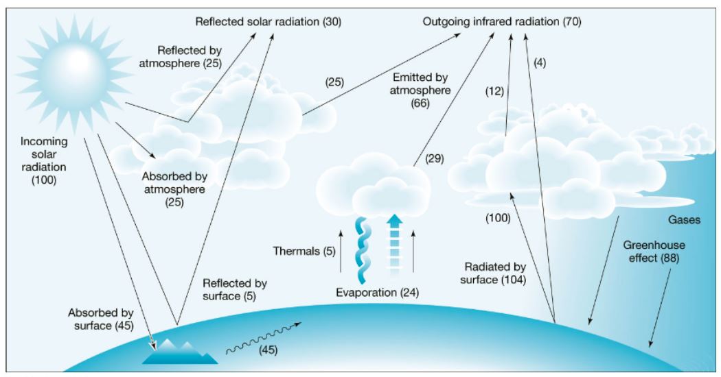
How do Climate Models work?

  • Grid System: Earth divided into a 3D grid of cells across land, atmosphere, and oceans.
  • Equations: Each cell governed by equations on energy movement, air, ice, and land processes.
  • Data Input: Observational data (greenhouse gases, ocean conditions, land use) fed into the model.
  • Interactions: Equations simulate changes in each cell and their effects on neighboring cells.
  • Outputs: Provide projections for temperature, precipitation, sea levels, ice cover, and extreme climate events.

Evolution of Climate Models:

Model Type What is it? Strengths Limitations
Energy Balance Models (EBMs) 

(1960s)

  • The earliest climate models.
  • They treat Earth like a single box system, calculating surface temperature by balancing incoming solar radiation vs outgoing infrared radiation.
  • Essentially, they answer: “How warm should Earth be if X amount of energy comes in and Y amount goes out?”
  • Very simple; first to link CO₂ emissions with global warming.
  • Computationally inexpensive.
  • Oversimplified — ignores atmosphere, oceans, and circulation.
  • Cannot simulate rainfall, winds, or regional climate.
Radiative Convective Models (RCMs) 

(1960s–70s)

  • Introduced the vertical structure of the atmosphere.
  • They divide the atmosphere into layers and simulate how radiation (solar + infrared) and convection move heat upward and downward.
  • Show how greenhouse gases trap heat and alter temperatures at different heights.
  • Capture greenhouse effect more realistically;
  • Explain vertical temperature profiles;
  • Useful for studying stratospheric cooling.
  • Still ignore oceans and global circulation;
  • Cannot project regional variations or weather patterns.
General Circulation Models (GCMs) (Global Climate Models)

(1970s onwards)

  • The first 3D models of Earth’s climate.
  • Divide the planet into grid cells (100–250 km), each with equations for atmosphere, oceans, ice, and land.
  • Simulate winds, currents, rainfall, temperature, and pressure by solving physical equations of motion, energy, and mass.
  • Comprehensive representation of climate;
  • Simulate monsoon, El Niño, ocean currents; reproduce past climate trends.
  • Very resource-intensive; grid too coarse to capture local detail (cities, villages);
  • Uncertainty in clouds and aerosols.
Earth System Models (ESMs)

(1990s–present)

  • Advanced GCMs that integrate biogeochemical cycles (carbon cycle, vegetation, ocean chemistry, aerosols, land-use changes).
  • Show how human activities (deforestation, fossil fuels, pollution) interact with natural systems, feedback loops, and long-term climate.
  • Holistic view of climate–biosphere interactions;
  • Essential for IPCC reports and policy projections.
  • Extremely complex;
  • Uncertainties in carbon feedbacks, aerosols, and long-term ecological processes.
Regional Climate Models (RCMs)

(1990s–present)

  • High-resolution versions of GCMs, zoomed into specific regions (25–50 km grids).
  • Use downscaling techniques to provide localised forecasts of rainfall, temperature, droughts, and monsoons.
  • Useful for city- or country-level policy (flood risk, agriculture, urban heat);
  • Capture Indian monsoon and Himalayan glaciers better.
  • Dependent on GCM input;
  • Projections limited to chosen region;
  • Computationally intensive.

How accurate are Climate Models?

  • Strengths: Modern models predict sea-level rise, polar ice loss, temperature increases, and rainfall trends with high accuracy.
  • Validation: Predictions are compared with historical climate records to confirm reliability.
  • Limitations:

    • Lack of precise data on clouds, volcanic activity, El Niño events.
    • Limited accuracy for regional variations (e.g., urban floods, Indian monsoon extremes).
    • Less accuracy in Global South due to data scarcity and complex climate systems.
    • Grid resolution (100–250 km per cell) causes oversimplification of land–atmosphere interactions.
[UPSC 2025] The World Bank warned that India could become one of the first places where wet-bulb temperatures routinely exceed 35°C. Which of the following statements best reflect(s) the implication of the above-said report?

I. Peninsular India will most likely suffer from flooding, tropical cyclones and droughts.

II. The survival of animals including humans will be affected as shedding of their body heat through perspiration becomes difficult.

Select the correct answer using the code given below:

(a) I only      (b) II only      (c) Both I and II      (d) Neither I nor II


Get an IAS/IPS ranker as your 1: 1 personal mentor for UPSC 2024

Attend Now

Subscribe
Notify of
0 Comments
Oldest
Newest Most Voted
Inline Feedbacks
View all comments

JOIN THE COMMUNITY

Join us across Social Media platforms.