Five years after the Supreme Court’s five-judge Bench under then CJI J.S. Khehar invalidated instant triple talaq in August 2017, the women petitioners continue to live a life of half-divorcees.
What is triple talaq?
‘Triple Talaq’ is a procedure of divorce under the Sharia Law which is a body of the Islamic law.
Under this, a husband can divorce his wife by pronouncing ‘Talaq’ thrice.
The Supreme Court invalidated instant triple talaq in the Shayara Bano versus the Union of India case while refraining from commenting on the state of their marriages directly.
What was the issue all about?
The case dates back to 2016 when the Supreme Court had sought assistance from the then Attorney General Mukul Rohatgi on pleas challenging the constitutional validity of “triple talaq”.
The hearing also included cases of “nikah halala” and “polygamy”, to assess whether Muslim women face gender discrimination in cases of divorce.
The issue gained political momentum on March 2017 when the Personal Law Board (AIMPLB) told the Supreme Court that the issue of triple talaq falls outside the judiciary’s realm.
However, on August 22, the Supreme Court set aside the decade-old practice of instant triple talaq saying it wasviolative of Article 14 and 21 of the Indian Constitution.
Why was triple talaq abolished?
In spite of protests by Muslim women and activists world-wide the procedure was most prevalent throughout the country.
There are several instances where ‘triple talaq’ has enabled husbands to divorce arbitrarily, devoid of any substantiation.
Oral talaq or ‘triple talaq’ delivered through social media platforms like Skype, text messages, email and WhatsApp have become an increasing cause of worry for the community.
The ‘triple talaq’ has been abolished in 21 countries including Pakistan, but is still prevalent in India.
The Centre reasons that these practices are against constitutional principles such as gender equality, secularism, international laws etc.
When these practices are banned in Islamic theocratic countries, the practices could have absolutely no base in religion and are only prevalent to permit the dominance of men over women.
Why in news now?
Half-divorce: Technically still married, practically divorced, they enjoy no conjugal rights nor receive any regular maintenance from the estranged husbands.
Cannot remarry: Practically abandoned, the women cannot remarry in the absence of a legally valid divorce.
No legal action: After the verdict, none of the men were visited by law enforcement bodies and told to take back their wives.
No legal implementation: Further, no arrests could be made for giving instant triple as the Muslim Women (Protection of Rights on Marriage) Act, 2019 came into force long after the pronouncement of instant talaq.
This week, the Comptroller and Auditor General (CAG) of India tabled a report in Parliament on whether steps taken by the Union Environment Ministry to conserve India’s coastal ecosystems have been successful.
Why in news?
The CAG frequently undertakes ‘performance audits’ of government programmes and ministries.
Centre’s obligations on conserving the coastline
The government has issued notifications under the Environment Protection Act, 1986, to regulate activities along India’s coasts particularly regarding construction.
The Coastal Regulation Zone Notification (CRZ), 2019 implemented by the Ministry, classifies the coastal area into different zones to manage infrastructure activities and regulate them.
The three institutions responsible for the implementation of the CRZ are:
National Coastal Zone Management Authority (NCZMA) at the Centre,
State/Union Territory Coastal Zone Management Authorities (SCZMAs/UTCZMAs) in every coastal State and Union Territory
District Level Committees (DLCs) in every district that has a coastal stretch and where the CRZ notification is applicable
Functions under CRZ rules
These bodies examine if CRZ clearances granted by the government are as per procedure, if project developers are once given the go-ahead are complying with conditions and if the project development objectives under the Integrated Coastal Zone Management Programme (ICZMP) are successful.
They also evaluate the measures taken up by the government towards achieving the targets under Sustainable Development Goals.
Why did the CAG undertake this audit?
The CAG has a constitutional mandate to investigate and report on publicly funded programmes.
The CAG conducted “pre-audit studies” and found that there were large-scale CRZ violations in the coastal stretches.
Incidences of illegal construction activities (reducing coastal space) and effluent discharges from local bodies, industries and aquaculture farms had been reported by the media and this prompted it to undertake a detailed investigation.
What did the recent audit find?
The audit pointed out various categories of violations.
There were instances of the Expert Appraisal Committees —who evaluate the feasibility of an infrastructure project and its environmental consequences — not being present during project deliberations.
There were also instances of the members of the EAC being fewer than half of the total strength during the deliberations.
The SCZMA had not been reconstituted in Karnataka and there was delayed reconstitution in the States of Goa, Odisha and West Bengal.
The DLCs of Tamil Nadu lacked participation from local traditional communities. In Andhra Pradesh, DLCs were not even established.
There were instances of projects being approved despite inadequacies in the Environment Impact Assessment (EIA) reports.
What problems did the CAG find in the States?
Lack of strategy: Tamil Nadu didn’t have a strategy in place to conserve the Gulf of Mannar Islands.
Lack of monitoring: In Goa, there was no system for monitoring coral reefs and no management plans to conserve turtle nesting sites.
No scientific oversight: In Gujarat, instruments procured to study the physiochemical parameters of soil and water of the inertial area of the Gulf of Kutch weren’t used.
Monitoring issues: Sea patrolling in Gahirmatha Sanctuary, in Kendrapara, Odisha did not happen.
No information in public domain: There was no website to disseminate the information related to the NCZMA, the CAG found, which is a clear violation of the mandated requirements of the Authority.
What lies ahead?
These reports are placed before the Standing Committees of Parliament, which select those findings and recommendations that they judge to be the most critical to public interest and arrange hearings on them.
In this case, the Environment Ministry is expected to explain omissions pointed out by the CAG and make amends.
Back2Basics: Comptroller and Auditor General (CAG) of India
The CAG is the Constitutional Authority, established under Article 148 of the Constitution of India.
They are empowered to Audit all receipts and expenditure of the GoI and the State Governments, including those of autonomous bodies and corporations substantially financed by the Government.
The CAG is also the statutory auditor of Government-owned corporations.
It conducts supplementary audit of government companies in which the Government has an equity share of at least 51 per cent or subsidiary companies of existing government companies.
The reports of the CAG are laid before the Parliament/Legislatures and are being taken up for discussion by the Public Accounts Committees (PACs) and Committees on Public Undertakings (COPUs).
A report recently tabled on “Review of Guardianship and Adoption Laws” in Parliament has stated that- India despite a country with millions of orphans, there are only 2,430 children available for adoption.
What is the news?
There are many enthusiastic parents who are ready to adopt children.
To address this paradox, a Parliamentary panel has recommended district-level surveys to proactively identify orphaned and abandoned children.
According to the report, there were 27,939 prospective parents registered with the Child Adoption Resource Authority (CARA) as on December 2021, up from nearly 18,000 in 2017.
What is CARA?
Central Adoption Resource Authority (CARA) is an autonomous and statutory body of the Ministry of Women and Child Development. It was set up in 1990.
It functions as the nodal body for the adoption of Indian children and is mandated to monitor and regulate in-country and inter-country adoptions.
CARA is designated as the Central Authority to deal with inter-country adoptions in accordance with the provisions of the 1993 Hague Convention on Inter-country Adoption, ratified India in 2003.
It primarily deals with the adoption of orphaned, abandoned and surrendered children through its associated and recognized adoption agencies.
Adoption Process
The eligibility of prospective adoptive parents living in India, duly registered on the Child Adoption Resource Information and Guidance System (CARINGS), irrespective of marital status and religion, is Procedure for adoption adjudged by specialised adoption agencies preparing home study reports.
The specialized adoption agency then secures court orders approving the adoption.
All non-resident persons approach authorized adoption agencies in their foreign country of residence for registration under CARINGS.
Their eligibility is adjudged by authorised foreign adoption agencies through home study reports.
CARA then issues a pre-adoption ‘no objection’ certificate for foster care, followed by a court adoption order.
A final ‘no objection’ certificate from CARA or a conformity certificate under the adoption convention is mandatory for a passport and visa to leave India.
What else regulates child adoption?
The Juvenile Justice (Care and Protection of Children) Act, 2015 permits the adoption of same-sex children, allowing biological or adopted parents to adopt a child of the same gender.
A single or divorced person can adopt under the JJ Act, but a single male cannot adopt a girl child.
According the Hindu Adoption and Maintenance Act, 1956 (HAMA), a Hindu parent or guardian can place a child for adoption with another Hindu parent under the Act.
A prospective parent can also adopt a male child if he has no other male children or grandchildren, or a female child if he has no other female children or grandchildren.
Issues with child adoption in India
Parent-centrism: The current adoption approach is very parent-centred, but parents must make it child-centred.
Age of child: Most Indian parents also want a child between the ages of zero and two, believing that this is when the parent-child bond is formed.
Institutional issues: Because the ratio of abandoned children to children in institutionalised care is lopsided, there are not enough children available for adoption.
Lineage discrimination: Most Indians have a distorted view of adoption because they want their genes, blood, and lineage to be passed down to their children.
Red-tapism: Child adoption is also not so easy task after the Juvenile Justice Rules of 2016 and the Adoption Regulations of 2017 were launched.
The Gadgil Wada of Pune was recently lighted into tricolour for the 75th anniversary of Independence.
Gadgil Wada was where plans for the reconstitution of the socialist Rashtra Seva Dal took place in early 1940s, with socialists like S.M. Joshi, N.G. Gore, Shirubhau Limaye and Kakasaheb in the lead.
Kakasaheb Gadgil
Gadgil was an Indian freedom fighter and politician from Maharashtra, India.
He was also a writer. He wrote in both Marathi and English.
Gadgil graduated from Fergusson College in Pune in 1918, and obtained a degree in Law in 1920.
In India’s pre-independence days, freedom fighters Lokmanya Tilak, Mahatma Gandhi, Jawaharlal Nehru, and Vallabhbhai Patel influenced Gadgil.
He joined the Indian National Congress in 1920, immediately after obtaining his law degree and started his active participation in the national freedom movement.
He suffered imprisonment from the ruling British government eight times for the participation.
Notable work during freedom struggle
In India’s pre-independence days, Gadgil served as the secretary of Poona District Congress Committee (1921–25), the president of Maharashtra Pradesh Congress Committee (1937–45).
He was elected to the central Legislative Assembly in 1934.
Gadgil was a pioneer in social reform movements in Maharashtra in the 1930s.
During the Civil Disobedience Movement, which began in 1930, Gadgil was listed as a leader for the Maharashtra Civil Disobedience Committee and the Pune War Council.
He was associated with several public associations and institutions, including Sarvajanik Sabha, Pune; Young Men’s Association, Pune; Maharashtra Youth League, Bombay; Pune Central Cooperative Bank; and Pune Municipality.
Service after India’s independence
Between 1947 and 1952 Gadgil served as a minister in the first central cabinet of independent India.
He held the portfolios of Public Works, and Mines and Power.
In his first year in the central Cabinet, he initiated the project of building a military-caliber road from Pathankot to Srinagar via Jammu in Kashmir as a part of India’s activities in the 1947 Indo-Pakistan War.
As a cabinet minister, he also initiated the important development projects pertaining to Bhakra, Koyna, and Hirakund dams.
He was a member of the Congress Working Committee from 1952 to 1955.
His son Vitthalrao Gadgil was a veteran congressman and MP from Pune Lok Sabha constituency, and his grandson Anant Gadgil is currently spokesman for Maharashtra Pradesh Congress Committee.
Authorship
Gadgil wrote several books and articles on politics, economics, law, and history.
Amid reports that several samples of basmati rice contained the residue of certain pesticides above the maximum residue level (MRL), the Punjab government has decided to ban the use of 10 formulations.
Which are the chemicals banned?
The State government believed that the sale, stock distribution, and use of Acephate, Buprofezin, Chloropyriphos, Methamidophos, Propiconazole, Thiamethoxam, Profenofos, Isoprothiolane, Carbendazim, and Tricyclazole was not in the interest of basmati rice growers.
It is said that there is a risk of breaching the MRL fixed by the competent authority for basmati rice.
What is the Maximum Residue Limit (MRL)?
MRL is the highest level of pesticide residue that is legally tolerated in or on food or feed when pesticides are applied correctly in accordance with Good Agricultural Practice promulgated by Food and Agriculture Organization (FAO).
The MRL is usually determined by repeated (on the order of 10) field trials at an appropriate pre-harvest interval or withholding period has elapsed.
For many pesticides, this is set at the Limit of determination (LOD) – since only major pesticides have been evaluated and understanding of acceptable daily intake (ADI) is incomplete.
In his Independence Day address to the nation the Prime Minister paid tributes to women freedom fighters for showing the world the true meaning of India’s “nari shakti”. A look at the women he named in his speech:
Rani Laxmibai
The queen of the princely state of Jhansi, Rani Laxmibai is known for her role in the First War of India’s Independence in 1857.
Born Manikarnika Tambe in 1835, she married the king of Jhansi.
The couple adopted a son before the king’s death, which the British East India Company refused to accept as the legal heir and decided to annex Jhansi.
Refusing to cede her territory, the queen decided to rule on behalf of the heir, and later joined the uprising against the British in 1857.
Cornered by the British, she escaped from Jhansi fort. She was wounded in combat near Gwalior’s Phool Bagh, where she later died.
Sir Hugh Rose, who was commanding the British army, is known to have described her as “personable, clever…and one of the most dangerous Indian leaders”.
Jhalkari Bai
A soldier in Rani Laxmibai’s women’s army, Durga Dal, she rose to become one of the queen’s most trusted advisers.
She is known for putting her own life at risk to keep the queen out of harm’s way.
Till date, the story of her valour is recalled by the people of Bundelkhand, and she is often presented as a representative of Bundeli identity.
According to Ministry of Culture’s Amrit Mahotsav website, “Many Dalit communities of the region look up to her as an incarnation of God and also celebrate Jhalkaribai Jayanti every year in her honour.”
Durga Bhabhi
Durgawati Devi, who was popularly known as Durga Bhabhi, was a revolutionary who joined the armed struggle against colonial rule.
A member of the Naujawan Bharat Sabha, she helped Bhagat Singh escape in disguise from Lahore after the 1928 killing of British police officer John P Saunders.
During the train journey that followed, Durgawati and Bhagat Singh posed as a couple, and Rajguru as their servant.
Later, as revenge for the hanging of Bhagat Singh, Rajguru, and Sukhdev, she made an unsuccessful attempt to kill the former Punjab Governor, Lord Hailey.
Born in Allahabad in 1907 and married to Hindustan Socialist Republican Association (HSRA) member Bhagwati Charan Vohra, Durgawati, along with other revolutionaries, also ran a bomb factory in Delhi.
Rani Gaidinliu
Born in 1915 in present-day Manipur, Rani Gaidinliu was a Naga spiritual and political leader who fought the British.
She joined the Heraka religious movement which later became a movement to drive out the British. She rebelled against the Empire, and refused to pay taxes, asking people to do the same.
The British launched a manhunt, but she evaded arrest, moving from village to village.
Gaidinliu was finally arrested in 1932 when she was just 16, and later sentenced for life. She was released in 1947.
Then PM Nehru described Gaidinliu as the “daughter of the hills”, and gave her the title of ‘Rani’ for her courage.
Rani Chennamma
The queen of Kittur, Rani Chennamma, was among the first rulers to lead an armed rebellion against British rule.
Kittur was a princely state in present-day Karnataka.
She fought back against the attempt to control her dominion in 1824 after the death of her young son. She had lost her husband, Raja Mallasarja, in 1816.
She is seen among the few rulers of the time who understood the colonial designs of the British.
Rani Chennamma defeated the British in her first revolt, but was captured and imprisoned during the second assault by the East India Company.
Begum Hazrat Mahal
After her husband, Nawab of Awadh Wajid Ali Shah, was exiled after the 1857 revolt, Begum Hazrat Mahal, along with her supporters, took on the British and wrested control of Lucknow.
She was forced into a retreat after the colonial rulers recaptured the area.
Velu Nachiyar
Many years before the revolt of 1857, Velu Nachiyar waged a war against the British and emerged victorious. Born in Ramanathapuram in 1780, she was married to the king of Sivagangai.
After her husband was killed in battle with the East India Company, she entered the conflict, and won with support of neighbouring kings.
She went on to produce the first human bomb as well as establish the first army of trained women soldiers in the late 1700s.
Her army commander Kuyili is believed to have set herself ablaze and walked into a British ammunition dump.
She was succeeded by her daughter in 1790, and died a few years later in 1796.
The 75th Independence Day coincides with another milestone in the country’s history — it was on August 15, 1972, that the Postal Index Number (PIN) was introduced in India.
As the PIN code turns 50 on Monday, we look at its history and evolution.
Why was the PIN code introduced?
According to the Department of Posts, there were 23,344 post offices, primarily in urban areas, in India at the time of Independence.
But, the country was growing rapidly and the postal network had to keep pace.
The PIN code was meant to ease the process of mail sorting and delivery in a country where different places, often, have the same or similar names, and letters are written in a wide variety of languages.
How does the PIN code work?
The PIN is made up of six digits.
The first number indicates the postal region — Northern, Eastern, Western, Southern; and number 9, which signifies the Army Postal Service.
The second number denotes a sub-region, and the third represents the sorting district.
The remaining numbers narrow the geography further to the specific post office making the delivery.
Who was the person behind the initiative?
The person behind the initiative was Shriram Bhikaji Velankar, additional secretary in the Union Ministry of Communications and a senior member of the Posts and Telegraphs Board.
Velankar was also a Sanskrit poet of eminence who had been conferred the President’s Award for Sanskrit in 1996, three years before he died in Mumbai.
He had set up a cultural group in Mumbai, called the Dev Vani Mandiram, which worked to create awareness about Sanskrit in India and foreign countries.
Velankar was also the chairman of the World Philatelic Exhibition, called Indipex, which was held in New Delhi in 1973 and featured 120 countries.
He retired from his government service on December 31, 1973.
What are some parallel systems followed world over?
Globally, in the US, the Zone Improvement Plan (ZIP) code was introduced July 1, 1963, under the aegis of the Postal Service Nationwide Improved Mail Service plan to improve the speed of mail delivery.
Under the old system letters went through about 17 sorting stops – the new system was going to be considerably less time-consuming utilizing newer, more mechanical systems.
Is the PIN code still relevant?
With the spread of the Internet, when people are sending fewer letters, it is easy to question the relevance of the PIN code.
But try to order food delivery or a parcel over online shopping and the importance of Velankar’s work in India will become evident.
Procrastination is the act of unnecessarily delaying or postponing decisions or actions. For a UPSC aspirant, it is a sure-shot killer of their IAS dream.
A certain UPSC dream killer.
You decide to study a particular topic or write answers for the day – You get distracted or are lazy or simply confused- You put off these for later and promise to do them tomorrow – That tomorrow never comes – You realize that you have wasted your time – You regret – You are sad the whole day thinking about it – You waste the whole day mourning your wasted time – You realize you have wasted another day – Days turn to weeks and weeks to months. And it is yet another wasted attempt.
Procrastination is often detrimental to people’s ability to successfully pursue their goals.
It also results in anxiety, low self-esteem, demotivation, low confidence, stress, and at times depression. A good chunk of UPSC aspirants face these issues.
CivilsDaily’s mentorship ensured Working Professional aspirants like Mourya, AIR 28 made the best use of the time they have. Click and Talk to Mourya’s mentor
We need to understand why we procrastinate
After talking to thousands of aspirants and Rankers from CivilsDaily we came to a conclusion that almost 99% of the aspirants procrastinate, to varying degrees. You are not alone. There are several reasons for putting things off for a later time:
1. Fear of failure, or performing badly in the initial stages of preparation is one of the chief reasons. Aspirants often feel underconfident and not prepared to start writing answers, or attempting a Prelims Mock.
2. Overthinking, mostly about irrelevant things – due to ignorance, excess of information. Most of the IAS aspirants waste a lot of time thinking a lot on the best resources, reading a lot of irrelevant books, discussing and fantasizing about various political concepts, etc. You gotta stop it.
3. Perfectionismor waiting for the most appropriate time– 95% is not good as 100%. But its a lot better than zero
It’s tempting to want the best UPSC resources, collect the finest of the notes, try to memorize every concept before you start writing your first answer, or attempt your first IAS Prelims mock.
Don’t wait till you have covered the whole GS syllabus to write your first Essay or first answer. Writing daily answers, even if they are not of UPSC standard will take you a long way to actually writing UPSC level answers in the actual UPSC Mains exam hall.
4. Fear of the wrong choice- any decision is better than no decision. But when a lot of time (attempts), finances, and efforts are at stake the informed decision is the best. Talk to a senior mentor to decide on optional, when, and how to start writing answers, when to start attempting the mock tests, and other important decisions.
5. Boring topics, culture, geography, CSAT, writing long essays. You can’t delegate here, and nor can you leave it, especially when you have time. Talk to some senior, mentor, or teacher who will point out important topics, will help make it a fun activity, or chart out a plan to cover the ‘boring topics’.
You need to understand the reasons why you are procrastinating before you can begin to tackle it.
Aspirants and people, in general, shy away from routines, timetables, systems, and processes because they want to have “freedom” or maybe due to ignorance. But in order to get things done, you need a process, bound by certain rules. It will include:
Breaking down the whole syllabus into small chunks (chapters and sections).
Setting a clear plan of action for the coming week and months, daily targets which are flexible as per your time requirement, and considering other factors. Click here to get a timetable made by UPSC Ranker
Make yourself accountable to the process or mentor so that you are executing (covering the syllabus, giving tests, etc.) on a daily basis.
Measuring your progress on a regular basis. This is best done by a senior or someone experienced who can evaluate your progress based on the tests, and answer writing.
Not fearing bad performance, but instead understanding where you went wrong and how to improve.
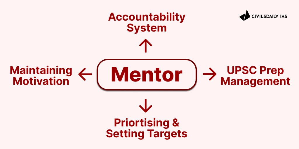
Why do you need a mentor to help you fight procrastination?
1. Setting an accountability system in place: If you make yourself accountable to someone else, you’re far more likely to achieve your goals. Ask them to check in on your progress from time to time.
2. Setting your own deadlines never works. We rarely respect self-imposed deadlines because we don’t feel too bad about breaking promises we’ve made to ourselves. But we do respect promises we make to others.
Introducing three layers of Mentorship with IAS/UPSC Ranker as your mentor.
3. Prioritising and target setting: A experienced mentor will help you prioritize topics beforehand and set targets. At times aspirants leave topics or subjects like Ethics, Optional till the post-prelims preparation phase. A mentor will integrate these into your preparation from the start.
4. Maintaining motivation and emotional self-control: Not always you will be in a jolly mood or motivated. UPSC prep is a long journey and there will be bouts of lows. An experienced mentor who has gone through the same journey helps in maintaining sanity during the UPSC process.
Mentoring UPSC aspirants like an elder brother.
How does Samanvaya Mentorship work? Introducing 3 layers of mentorship: Get IAS or UPSC ranker as your mentor
1. 1st step starts with this Samanvayacall: Once you fill in the form, we get on a 30-40 minute call with you to understand your prep level, working/ study constraints, and current strategies and create a step-by-step plan for the next week, next month and so on.
2. You are directed and given access to relevant resources and invite-only platform, Habitat where you can ask your daily doubts, discuss your test-prep questions and have real-time, live sessions on news and op-eds, and find your optional groups.
Daily target monitoring.
3. The third and the most personalized tier is the 1 on 1 mentor allotment who stays with you through the course of your UPSC preparation – always-on chat and on scheduled calls to help you assess, evaluate, and chart the next milestone of your IAS 2023-23 journey.
We will also connect you to a UPSC ranker or IAS, who will mentor you in this journey.
Layer 1: You will be assigned a dedicated in-house mentor who will keep track of our progress from start till your final interview.
Layer 2: Sajal Singh sir and the team will be constantly with you through various programs like Samachar Manthan, Prelims, Essay, etc.
Layer 3: A UPSC IAS ranker (one who has cleared this exam) will be supervising your progress as your super mentor.
Who are you?
Working Junta? If you are preparing for IAS 2023-24 and working simultaneously, we can help you design a timetable that fits right in your hectic schedule.
First-time prep? If you are in the last year of college or thinking of dropping a year and preparing for IAS 2023-24 full-time, we can help you pick the right books and craft a practical & personal strategy.
In our interaction with almost 12,000 working professional aspirants (those with a full-time job and preparing for UPSC CSE) over the past couple of months it was revealed that Time management and consistency were the major issue to their preparation.
This is something you aspirants can’t avoid and move on. This Sunday we conducted another power-packed FREE Masterclass session with an IPS officer.
Dilpreet Singh was a CivilsDaily’s mentorship and Samachar Manthan student. He was a Mechanical Engineer who cleared PCS twice and was a working professional at the time of his UPSC attempt which landed him an AIR 237 and IPS.
Why time management?
Time management with the help of a mentor makes your preparation effective.
Time management is a #UPSCskill that tops all other skills in this long journey. Moreover, the complexity and vastness of the syllabus, unpredictability and ever-changing pattern of the UPSC exam, and cut-throat competition necessitate you to invest your time wisely.
Over that, if you are a working professional, college student, or homemaker, and preparing for this exam, and if you don’t have a workable timetable, you won’t be able to stay consistent and your preparation will suffer.
There is no consistency and discipline without time-management. You need guidance for that.
Consistency is the key
Masterclass details
Dilpreet took up an interactive session (1-1 questions) from the aspirants on time management, timetable, and staying consistent. This session in particular is a must for UPSC aspirants who are working professionals and in general, for all aspirants with a serious time crunch.
Other than the points mentioned above we will be discussing the following issues as well.
Management of Priorities – UPSC, family, life, and work.
Reducing time on non-priorities and maintaining focus on daily and weekly targets.
Planning ahead, making targets, staying consistent w.r.t targets and your UPSC preparation.
How should the syllabus be approached to complete it 2 months before UPSC Prelims?
Balancing prelims-mains on one hand and GS-current affairs on the other.
How to determine the primary focus areas of the Prelims, Mains, and Personality tests?
How to apply bookish as well as classroom knowledge to the exam?
As we celebrate the nation @75 , we must also reflect on the mixed nature of our democracy
Definition of democracy
“Government of the people, by the people and for the people” were the words used by Abraham Lincoln in the year 1863 while talking about democracy.
Purpose of democracy
Cornerstones of democracy include freedom of assembly, association, property rights, freedom of religion and speech, inclusiveness and equality, citizenship, consent of the governed, voting rights, freedom from unwarranted governmental deprivation of the right to life and liberty, and minority rights.
Background
India is a parliamentary democratic secular republic in which the president of India is the head of state & first citizen of India and the prime minister of India is the head of government.
It is based on the federal structure of government, although the word is not used in the Constitution itself.
How it has performed
(1)Political front
India is the world’s the largest democracy proved success in accommodation of group and regional demands in a complex, quasi-federal, polity.
During the first general election in the 1951 India had 54 political parties and now it has grown up to 464 in the 2014 general election as an evident of deepening of the democratic process.
In the first General election 1951, 173 million citizens were given right to vote.
In the 16th general election in 2014, the size of the electorate had increased to 814 million.
(2) Social front
The democratic process has brought about a shift of political power from the middle and higher castes and classes of urban society to backward classes who are now the politically most influential ones in the country.
They have won reservations for themselves in legislatures and government services as were accorded to the Scheduled Castes and Scheduled Tribes after independence through Constitutional provisions.
(3) Economic Front
These include strategic affairs and security, politico-legal democratic governance as well as society and economy.
India has been able to emerge as a regional power in Asia and super power in south Asia backed by its economic, military and nuclear capabilities.
Contradictions in democracy
Performance of Bureaucracy: Dishonest officials to protect themselves from the consequences of their wrong-doings have largely exploited constitutional protection for the Services under Article 311.
Administration of Justice: Judicial system has not been able to meet even the modest expectations of the society. Its delays and costs are frustrating, its processes slow and uncertain. People are pushed to seek recourse to Extra-legal methods for relief. Trial system both on the civil and criminal side has utterly broken down.
Areas of Concern: There is a fundamental breach of the constitutional faith on the part of the Governments and their method of governance lies in the neglect of the people who are the ultimate source of all political authority.
Regionalism: Issues of national integrity and security have not received adequate and thoughtful attention. Mechanisms for the assessment of early warning symptoms of social unrest are absent.
Corruption: The increasing instability of elected governments is attributable to opportunistic politics and unprincipled defections.
Some positive suggestions to government
Feedback: The Government should hear criticism rather than rejecting it outrightly. Suggestions on eroding democratic values need a thoughtful, and respectful response.
Freedom of press: The press and the judiciary which are considered the pillars of India’s Democracy, require to be independent of any executive interference.
Opposition: strong democracy requires strong opposition. Without an alternative choice, the very objective of election to provide a check on arbitrary power gets defeated.
Way forward
The institutionalization of constitutional democracy has helped the people of India realize the importance of democracy and inculcate democratic sensibilities among them.
At the same time, it is important that all the government organs work in harmony to uphold the trust people of the country have held in them and ensure the objectives of true democracy.
Mains question
Q.We are celebrating Azadi ka amrit mahotsav India @75, trace the journey of democracy critically by providing some suggestions for robust democracy.