💥Join UPSC 2027,2028 Mentorship (July Batch) + XFactor Notes & Microthemes PDF

Subject: Disaster Management

  • What is Post-Disaster Needs Assessment (PDNA)?

    pdna

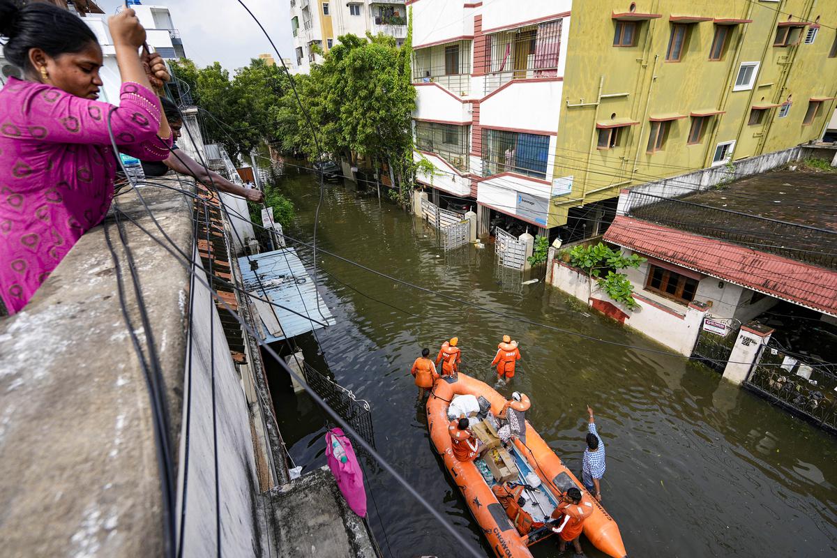
    Post-Disaster Needs Assessment (PDNA) is now being done simultaneously in Assam, Himachal Pradesh, Gujarat, Karnataka, Jharkhand, Maharashtra, Odisha and Meghalaya.

    Why in news?

    • PDNA is now being used to evaluate the financial and social cost of local disasters in eight states in India.
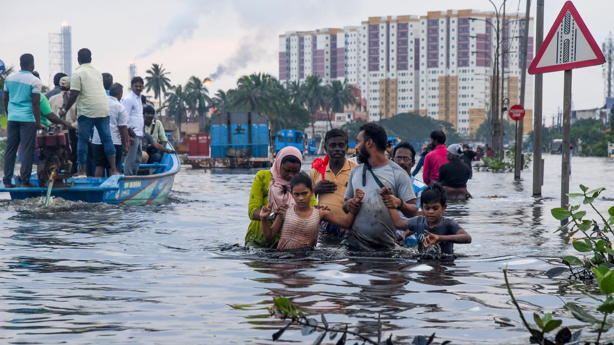
    • These states all experienced severe flooding in the last few months.
    • The results of these assessments are likely to come out next month.

    What is PDNA?

    • PDNA is an internationally accepted methodology for determining the physical damages, economic losses, and costs of meeting recovery needs after a natural disaster through a government-led process.
    • It is an international framework for assessing losses and damages in the aftermath of a disaster.
    • The framework helps get recovery and reconstruction efforts right following a disaster.
    • Globally, of the 55 PDNAs conducted worldwide since 2008, only two droughts — one in Malawi and the other Marshall Islands in 2016 — were of slow-onset disasters.

    Components of PDNA

    • PDNA includes a calculation of the disaster’s impact on Gross Domestic Product, the balance of payment and fiscal budget.
    • Secondly, how this affects the flow of revenue to multiple sectors is evaluated.
    • For example, the number of farmers’ income affected per damaged acre of land and the livelihoods lost.
    • Overall, a quantitative assessment is additionally done on the social and environmental impact of the disaster.

    History of PDNA in India

    • This is not the first time PDNA has been conducted in India.
    • It was first adopted during the Kerala floods of 2018 and again during the cyclone in Odisha in 2019, both unprecedented disasters.
    • Until now, the assessment was only limited to massive disasters that required international funding from the World Bank, the Asian Development Bank and the United Nations.

    15th Finance Commission provision

    • The 15th finance commission report of 2021, for the first time, made a provision for recovery and reconstruction in the national disaster management budget, which is at the core of the PDNA.
    • The states did not receive international funding to do the current ongoing PDNAs, as they are expected to take the money from the budget.


    UPSC 2023 countdown has begun! Get your personal guidance plan now! (Click here)

  • Urban Challenge, Problems and Solutions

    Context

    • After flooding of major metropolitan cities of Bengaluru, Gurgaon and Delhi following heavy rainfall, the Centre has pointed to two cities – Davanagere and Agartala – as successful examples of cities that have curbed urban flooding.

    Why cities are  so important in India?

    • Drivers of Growth: Urbanisation has played and will continue to play a critical role in India’s growth story in the 21st century.
    • Cities are seen as GDP multipliers: By some estimates, Indian cities already contribute up to 70% of the country’s GDP. Yet, depending on which official estimates you use, India is just 26% or 31% urban. But there is growing evidence that India is more urban than is officially recognized.
    • Cities have more productivity: Well-functioning and diverse cities allow for the sharing and cross-pollination of ideas, which in turn drive greater productivity.

    Urban

    What are the Urban challenges?

    • Lack of Planning: current urban planning policies and practice have led to suboptimal use of land in Indian cities. This has multiple consequences. There is not enough floor space for accommodating migrants in search of economic opportunities; they make space for themselves in informal settlements. There is also not enough land in the public domain for developing adequate open spaces or augmenting infrastructure capacities.
    • Lack of Housing:The pandemic revealed that the cities’ economies rely on migrant populations in the formal and informal sectors. Workers in both markets move from rural to urban and urban to urban areas as they find better opportunities; they are mobile and need adequate rental options. Today, in most Indian cities, this demand is not met and leads to unaffordable options, pushing the poorer sections out to slums and other informal settlements.
    • Lack of Transport: Indian cities are infamous for their road congestion; three of them rank in the 10 most congested in the world according to the 2020 TomTom Travel Index with Mumbai ranking second. The existing public transportation systems are already overcrowded and of poor quality.
    • Lack of Public health: Like other health crises, the COVID-19 pandemic revealed the need to ensure adequate healthcare services and sanitation infrastructure for a healthy population in cities. In the initial months of the outbreak, the focus of health services shifted entirely towards addressing the novel coronavirus, leaving other health issues unaddressed and shutting down routine care services.
    • Impact on Environment: The causes for low air quality are multiple; vehicular movement and on-road congestion are major contributors. A safe and clean environment is key to good public health.
    • Problems faced by vulnerable sections: The economic shock and work from home guidelines changed migration patterns; workers in cities returned to their home towns and villages. Slum dwellers, with limited access to adequate infrastructure, and migrant workers, disenfranchised from social protection systems or daily wagers, were more vulnerable to this shock. In the medium and long term, it is difficult to predict what the job market will be in cities.

    Urban

    What can be done to address the urban challenges?

    • Future planning is necessary: Manage the spatial growth of cities and allow them to build more planned road networks for future horizontal expansion and revoke faulty policies that constrain the use of floor space to build vertically.
    • Housing for all scheme is important: Focus on providing public housing for the poor; India can learn from successful models in Singapore or Hong Kong and understand the strategic challenges of other international examples such as Mexico. India can also work toenable efficient rental markets
    • Holistic transport should be focused: Integrate formal and informal modes of transportation into holistic transportation strategies to ensure seamless mobility, as well as first and last mile connectivity.
    • Increasing funds to Cities: Decentralise fiscal powers to the local level and train city authorities so that they can make more strategic decisions in health expenditures or public health infrastructure, as well as gain the capacity to raise their own resources.
    • Need of a healthy Environment: Increase the number of open spaces in the public domain, maintain them and monitor their use. Prepare for disasters with robust framework of physical infrastructures, road networks and large open spaces. Build adequate infrastructure to support the sustainable development of emerging Tier-2 and Tier 3 towns.
    • More attention to vulnerable: Develop more systematic identification mechanisms of the urban poor to ameliorate the delivery of public services and social protection. Collect accurate data on migrant population and capture their socio-economic diversity to better address their needs. Monitor access to services, housing and jobs of the vulnerable communities in real time.

    Urban

    Conclusion

    • Urban infrastructure is crumbling day by day. In the next 25 years, cities will have more population than rural areas. Indian cities need urgent reform in order to unlock their economic potential and transform quality of life.

    Mains Question

    Q.Discuss the urban infrastructure challenges? What are the governments scheme and actions to address the urbanization challenges?

    UPSC 2023 countdown has begun! Get your personal guidance plan now! (Click here)

  • Transboundary Flood Disasters

    Transboundary Flood Disasters

    Context

    • Pakistan experiencing devastation, with a spread of diseases and severe shortage of potable water after intense flooding. In June this year Assam experienced one of its worst floods in which it affected over 30 districts. Assam and Bihar frequently suffer from transboundary flood disasters.

    What is transboundary flood?

    • Floods that are originate in upper riparian state crosses the international boundary and also affects the lower riparian state. For example, river Brahmaputra causes flood both in China and India simultaneously.

    Transboundary Flood DisastersHow the transboundary floods are difficult to manage than normal floods?

    • Flooding is still considered to be a natural phenomenon that cannot be entirely prevented. But it is compounded by the lack of transparency in the sharing of hydrological information and also information relating to activities (such as by one riparian state) that are transboundary in their effect (affecting other riparian states), thus serving as an obstacle in understanding the magnitude of flooding.

    Transboundary Flood DisastersWhat is a riparian state?

    • A riparian state is state (or country) located alongside a river.

    What are the International laws governing transboundary waters?

    There are at two international treaties that governs the transboundary water

    • UNWC:
    • United Nations Convention on the Law of the Non-Navigational Use of International Watercourses (UNWC) 1997.UNWC contains a direct reference to floods, which covers harmful conditions and the emergency situations.
    • Article 27 of the Convention says, Watercourse States shall individually and, where appropriate, jointly, take all appropriate measures to prevent or mitigate conditions that may be harmful to other watercourse States, whether resulting from natural causes or human conduct or desertification.
    • Environmental Impact Assessment:
    • The International Court of Justice (ICJ), in the Pulp Mills on the River Uruguay (Argentina vs Uruguay) case of 2010, upheld that conducting a transboundary environmental impact assessment (TEIA) of a planned measure or projects on the shared water course is part of customary international law.
    • In fact, the ICJ noted that the acting state must notify the affected party of the results of TEIA for assessment of its own damages that are likely to occur.
    • UNECE: United Nations Economic Commission for Europe (UNECE) on the Protection and Use of Transboundary Watercourses and International Lakes 1992 (Water Convention).

    Transboundary Flood DisastersHow India manages transboundary flood?

    • Note:Neither India nor China are signatory to UNWC or UNCEC.
    • River Brahmaputra: India has signed the memorandum of understanding (MoU) with China in 2013 with a view to sharing hydrological information during the flood season (June to September). The MoU does not allow India access to urbanisation and deforestation activities on the Chinese side of the river basin.
    • Rivers Gandak and kosi: Floods are also a recurrent problem in the Kosi and Gandak river basins that are shared by India and Nepal.
    • The India-Nepal Kosi agreement 1954: Agreement aimed at reducing devastating flooding in the river basin. The treaty-based joint bodies have also tried to refine the early warning systems for flood forecasting.

    What are the suggestions?

    • Signing the treaty: Expert suggests, India by becoming a party to either the UNWC and the Water Convention could lay the groundwork for a bilateral treaty on the Brahmaputra but subject to the reservation that it should not insist on the insertion of a dispute settlement mechanism provision.
    • Information exchange: In contravention of procedural customary international law obligation, India considers data on transboundary rivers as classified information, which is one of the key challenges in developing cross-border flood warning systems. India needs to share the hydrological and river information for its own sake.

    Conclusion

    • Climate change has accelerated the frequency and intensity of floods across the world. with Changing climate India should also change its strategy to protect its people, to preserve the soil and to save its resources from the scourge of floods.

    Mains Questions

    Q.Climate change has created a more difficult challenge in flood management. In this context, what measures can be taken to deal with frequent transboundary floods in India. Discuss.

    UPSC 2022 countdown has begun! Get your personal guidance plan now! (Click here)

  • The heavy rainfall and the crazy Banglore flood: A case to study

    floodContext

    • The recent events of heavy downpours in short period of time and the recent example of Banglore flood, highlights how cities in India and elsewhere need to adapt to climate change as it brings more extreme rainfall in the future.

    What is heavy downpour?

    • A downpour or cloudburst is a sudden and unexpected heavy fall of rain.
    • It is usually local in nature and of brief duration. Most so-called cloudbursts occur in connection with thunderstorms.
    • Heavy downpour in short period causes flood, damage to buildings and infrastructure can disrupt transport, communications and connectivity, loss of crops and livestock.

    The heavy rainfall and the Banglore flood causes

    • Rise in built up area: Lakes and natural depressions may not always fill up during many monsoons so the people who are unaware of hydrology tempts to build and buy in the catchment areas of water-bodies, which will be disastrous when it rains heavily as there is rise in the quantity.
    • Water-logging: rainwater and sewage water are forced to build up, which results in water-logging. The highway acts as a dam for the water ,Garbage frequently clogs drains, which limits the flow of sewage, and they are too small to support the weight of the expanding population.
    • Physical shrinkage of water-bodies: Destruction of lakes is a major issue .lakes can store the excess water and regulate the flow of water however the pollution of natural water bodies and converting them for development purposes has increased the risks of floods. Unplanned growth, Rise in population, rise in the built up areas along streams, canals, around the lakes, leaving no storage capacity.
    • Compromised runoff potential and health hazards: Choked and encroached drains and lakes, ill designed infrastructure and missing pipes compromising run off potential. Not only the physical quantity of the runoff that poses a hazard. When polluted drains and lakes overflow, the flood can pose a health hazard especially to vulnerable and exposed marginal communities living in informal settlements.
    • Zero or limited ability to allow infiltration of water: Encroachments in and around wetlands and green lands harming the natural way of water infiltration and ground water recharge.
    • Lack of vision in rain water harvesting: Ignorance towards the tradition rain water harvesting techniques and no or limited vision for creating new systems of rain water harvesting. Exceptionally heavy monsoon rains have been exacerbated by poor urban planning in the Indian tech hub, showing the need for improved water systems.

    floodWhat are the reasons behind the frequent floods in urban areas?

    • Meteorological factors: change in the weather patterns, increase in the temperature leading to heavy rainfall, sudden downpour, cloudburst, thunderstorms, hailstorms etc.
    • Hydrological factors: Natural surface infiltration rate, soil moisture level, presence or absence of Overbank flows, Presence of impervious cover, the occurrence of high tides impeding the drainage in coastal cities.
    • Man-Made factors:
      • Unplanned urbanization: Unplanned settlement is one of the main cause of urban flooding. Blocking of natural drainage pathways through construction activity and encroachment on catchment areas, streams, rivers, lakebeds. Reduced infiltration and ground water recharge of water, destruction of lakes, Land-use changes (e.g. surface sealing due to urbanization, deforestation) increase runoff and sedimentation. Inefficiency or non-maintenance of infrastructure etc.
      • Outdated Drainage systems: The old and ill-maintained drainage system is one of the main factor making cities in India vulnerable to flooding
      • Encroachments on and around water-bodies: Illegal Habitations started growing into towns and cities alongside rivers and watercourses. As a result of this, the capacity of the natural drains has decreased, resulting in flooding.
      • Climate Change: Climate change due to various anthropogenic events has led to extreme weather events, increasing temperature which resulting in heavy rainfall in one part while drought and dry spells in other.
      • Poor Solid Waste Management System: Indiscriminate disposal of solid waste, poor waste management system, clogging drains because of accumulation of non-biodegradable wastes are major concerns. Domestic, commercial and industrial waste and dumping of it into the drains also contribute significantly to reducing their capacities.
      • Reduced Seepage: use of hard and non-porous construction material making the soil impervious, reducing the seepage capability in no of cities in India.
      • Weak Implementation and lack of awareness:Even with provisions of rainwater harvesting, sustainable urban drainage systems, etc, in regulatory mechanisms like the Environmental Impact Assessment (EIA), adoption at user end as well as enforcement agencies remains weak.
      • No Community Participation:Flood control measures planned without participation of the affected community are unsustainable as they do not meet the needs of relevant stakeholders.

    What can be done to prevent the urban floods and prevent losses?

    • Developing climate Resilient Infrastructure: using permeable material for roads and pavement, green roofs and harvesting systems in buildings. To reduce the burden of road infrastructure in cities Outer Ring Road should be explored. Innovative approaches like Sponge Cities wetland restoration, flushing systems using collected rooftop water, public spaces as flexible water retention facilities can be applied to Indian urban areas.
    • Use of technology in Early Warning Systems and Communication: Early-warning systems using sensors across waterbodies and drains, and a network of communication for hotspots of emerging flood risk in the wet-season should be put in place. Providing real-time data where traditional systems fail. Tools such as predictive precipitation modelingcan help do that and are also able to link it with the adaptive capacity of urban land use.
    • Proper management and regular upgrade of Urban Drainage System: drains need to be cleaned on a regular basis to permit the free flow of water .Proper management of the drainage system is necessary to ensure that the water does not get stored in one place. Watershed management and emergency drainage plan should be clearly enunciated in policy.
    • Rainwater Harvesting: It will serve the twin purposes of lowering the peak runoff and raising the groundwater table. Many municipal corporations in India have already made rainwater harvesting compulsory
    • Conservation of Water Bodies: Urban water bodies like lakes, tanks, and ponds also play a very important role in the management of urban flooding by reducing the flood water run-off by capturing it.
    • Holistic approach: Improved monitoring, forecasting, and decision-support systems. Find out the different method for improving the preparedness for urban flooding.
    • Responsibility on every stakeholder: Locally, citizens, local ward officials and staff will need to work together to minimize dumping of solid waste and garbage in storm-water drains. As this is a socio –political problem, public participation awareness and responsibility of citizen is the need of the hour. To develop a long-lasting solution, all parties must acknowledge the issues and adopt a thorough strategy.

    What we as citizens can do on a personal level to prevent the urban environment?

    • Raising voice at all available forums and platforms
    • Making politicians and bureaucrats accountable
    • Refuse to buy a house in the encroached lands.
    • Applying methods of rain water harvesting on individual level.

    Way ahead

    • Exceptionally heavy monsoon rains have been exacerbated by poor urban planning in the Indian tech hub, showing the need for improved water systems.
    • Urbanization is a global and inevitable process, and with cities as engines of the economy, built-up areas will continue to grow. But we need to draw upon these experiences and the growing perils of climate change and extreme rain events and change course.
    • According to UN projections, by 2050 more than 68% of the world’s population could be concentrated in urban areas.
    • In this context, resilience-based strategies should be adopted to improve the capacity to handle the crisis arising out of climate change.
    • Wetlands are the kidneys of the earth, let’s keep it healthy.


    Mains Question

    Q. What are the factors causing flood in the urban cities? What are the measures to prevent the urban flooding keeping in mind the sustainable development? Discuss.


    UPSC 2023 countdown has begun! Get your personal guidance plan now! (Click here)


  • Urban floods mitigation

    floods
    Context

    • Bengaluru floods are alarming us to go for robust disaster management strategies.

    What is flood?

    • Floods are the most frequent type of natural disaster and occur when an overflow of water submerges land that is usually dry. Floods are often caused by heavy rainfall, rapid snowmelt or a storm surge from a tropical cyclone or tsunami in coastal areas.

    Causes of frequent urban floods

    Natural

    • Meteorological Factors:Heavy rainfall, cyclonic storms and thunderstorms causes water to flow quickly through paved urban areas and impound in low lying areas.
    • Hydrological Factors: Overbank flow channel networks, occurrence of high tides impeding the drainage in coastal cities.
    • Climate Change: Climate change due to various anthropogenic events has led to extreme weather events.

    Anthropological

    • Unplanned Urbanization:Unplanned Urbanization is the key cause of urban flooding. A major concern is blocking of natural drainage pathways through construction activity and encroachment on catchment areas, riverbeds and lakebeds.
    • Destruction of lakes: A major issue in India cities. Lakes can store the excess water and regulate the flow of water. However, pollution of natural urban water bodies and converting them for development purposes has increased risk of floods.
    • Unauthorised colonies and excess construction: Reduced infiltration due paving of surfaces which decreases ground absorption and increases the speed and amount of surface flow
    • Poor Solid Waste Management System: Improper waste management system and clogging of storm-water drains because of silting, accumulation of non-biodegradable wastes and construction debris.
    • Drainage System:Old and ill maintained drainage system is another factor making cities in India vulnerable to flooding.
    • Irresponsible steps: Lack of attention to natural hydrological system and lack of flood control measures.

    floodsImpact of the devastation due to floods:

    • On economy: Damage to infrastructure, roads and settlements, industrial production, basic supplies, post disaster rehabilitation difficulties etc.
    • On human population and wildlife:Trauma, loss of life, injuries and disease outbreak, contamination of water etc.
    • On environment:Loss of habitat, tree and forest cover, biodiversity loss and large scale greenery recovery failure.
    • On transport and communication: Increased traffic congestion, disruption in rail services, disruption in communication- on telephone, internet cables causing massive public inconvenience.

    Solutions for effective flood management

    • Improved flood warning systems: effective flood warning systems can help take timely action during natural calamities and can save lives. Pre-planning can significantly reduce the effects of floods, giving people time to migrate to safer locations and stock up essentials.
    • Building flood-resilient housing systems: concreting floors can be very useful during floods. Houses should be water proofed and electric sockets should be placed at higher levels up the walls to reduce the chances of shocks.
    • Constructing buildings above flood levels: buildings should be constructed a metre above from the ground to prevent flood damage and evacuation during floods.
    • Resilience to Climate change: drastic climate changes have increased the frequency of natural disasters in many parts of the world. Governments should bring about environment-friendly policy level changes and eliminate the ones hazardous to the environment to tackle the problem of global warming.
    • Create wetlands and encourage reforestation: creating more and more wetlands can help soak up excessive moisture since wetlands act as sponges. Wooded areas can also slow down heavy water flow, minimizing the effects of floods. Reforesting upstream regions can significantly reduce the effects of flood damage.
    • Improve soil conditions: improper soil management, animal hooves, and machinery can make soil compacted. As a result, instead of holding water in and absorbing moisture, the water runs off immediately. Properly drained soil can absorb large amounts of rainwater and can prevent it from flowing into the rivers.
    • Installing flood barriers: these are flood gates designed to prevent the area behind the barrier from flooding. They can also be kept around buildings to keep floodwaters outside the boundary created.
    • Development of GIS– Geographical Information System (GIS) based National Database: for disaster management. GIS is an effective tool for emergency responders to access information in terms of crucial parameters for disaster-affected areas.
    • Developing a Federal flood management plan: with responsibilities of union and state clearly defined.
    • Creation of 2nd flood commission: (Rashtriya Barh Aayog, created in 1976) to study the flood situation in India under rising challenges of climate change and propose a national-level flood resilience and management plan.

    Way forward

    • Resilience of people: The rapid transformation in rainfall characteristics and flooding patterns demand building people’s resilience.
    • Reconsider projects: Construction projects that impede the movement of water and sediment across the floodplain must be reconsidered.
    • Use of technology: At the same time, climate-imposed exigencies demand new paradigms of early-warning and response systems and securing livelihoods and economies.

    Conclusion

    • We can learn to live with nature, we can regulate human conduct through the state and we can strategically design where we build. We need to urgently rebuild our cities such that they have the sponginess to absorb and release water without causing so much misery and so much damage to the most vulnerable of our citizens.

    Mains question

    Q. We need to urgently rebuild our cities such that they have the sponginess to absorb and release water. Discuss the statement in context of urban flood management strategy in India.

    UPSC 2023 countdown has begun! Get your personal guidance plan now! (Click here)

  • Forest fire management for positive sustainable forest growth

    forest fireContext

    • Forest fires are becoming more common and wildfires are destroying nearly twice as much tree cover globally as they did in 2001.

    Why in news?

    • Climate change is driving more intense and widespread forest fire by fuelling more extreme heat and deepening drought, which dries out forests.

    How to define forest fire?

    • A wildfire, forest fire, bushfire, wildland fire or rural fire is an unplanned, uncontrolled and unpredictable fire in an area of combustible vegetation starting in rural and urban areas.

    What causes forest fires?

    • Human activities: Forest fires can be caused by a number of natural causes, but officials say many major fires in India are triggered mainly by human activities.
    • Climate change: Emerging studies link climate change to rising instances of fires globally, especially the massive fires of the Amazon forests in Brazil and in Australia in the last two years. Fires of longer duration, increasing intensity, higher frequency and highly inflammable nature are all being linked to climate change.
    • Season: In India, wildfires are most commonly reported during March and April, when the ground has large quantities of dry wood, logs, dead leaves, stumps, dry grass and weeds that can make forests easily go up in flames if there is a trigger.
    • Natural reasons: Under natural circumstances, extreme heat and dryness, friction created by rubbing of branches with each other also have been known to initiate fire.

    forest fire

    Key fact

    7.4 million acres of forest are getting burnt annually now an area roughly the size of Belgium.

    What factors make forest fires a concern?

    • Carbon emission: They act as a sink, reservoir and source of carbon.
    • Livelihood loss: In India, with 1.70 lakh villages in close proximity to forests (Census 2011), the livelihood of several crores of people is dependent on fuelwood, bamboo, fodder, and small timber.
    • Destruction of animals’ habitat: Heat generated during the fire destroys animal habitats. Soil quality decreases with the alteration in their compositions.
    • Soil degradation: Soil moisture and fertility, too, is affected. Thus forests can shrink in size. The trees that survive fire often remain stunted and growth is severely affected.

    Measures to curb Forest fires

    1) National Action Plan on wild fires

    • The MoEFCC has prepared a National Action Plan on wild fire in 2018 after several rounds of consultation with all states and UTs.
    • The objective of this plan is to minimize forest fires by informing, enabling and empowering forest fringe communities and incentivizing them to work in tandem with the State Forest Departments.
    • The plan also intends to substantially reduce the vulnerability of forests across diverse forest ecosystems in the country against fire hazards, enhance capabilities of forest personnel and institutions in fighting fires and swift recovery subsequent to fire incidents.

    2) Forest Fire Prevention and Management scheme

    • The MoEFCC provides wildfire prevention and management measures under the Centrally Sponsored Forest Fire Prevention and Management (FPM) scheme.
    • The FPM is the only centrally funded program specifically dedicated to assist the states in dealing with forest fires.
    • The FPM replaced the Intensification of Forest Management Scheme (IFMS) in 2017. By revamping the IFMS, the FPM has increased the amount dedicated for forest fire work.
    • Funds allocated under the FPM are according to the 90:10 ratio of central to state funding in the Northeast and Western Himalayan regions and 60:40 ratio for all other states.
    • Nodal officers for forest fire prevention and control have been appointed in each state.

    forest fireWay forward

    • Awareness should be created among the villagers residing near the forests with respect to the long-term ill effects of forest fires.
    • Measures to prevent wildfires have to be taken before summer season when fires are prevalent.
    • Local people should be given skills to use online portals or mobile apps in order to monitor the forests for fires and inform forest authorities regarding the same.

    Mains question

    Q. Climate change is driving more intense and widespread forest fires by fueling more extreme heat and deepening drought. Why forest fires are cause of concern? Discuss our preparedness level for the same in the above context.

    UPSC 2023 countdown has begun! Get your personal guidance plan now! (Click here)

  • Dam safety bill for sustainable water management

    dam safety billContext

    • Integrated risk assessment of dam safety required to prevent human-made disasters: Experts

    Why in news?

    • The recent floods in the Mahanadi basin in Odisha have brought to the fore, the faulty management of dam safety, which were built to mitigate floods and not be the cause of them.

    What is a dam?

    • A dam is a barrier that stops the flow of water and results in the creation of a reservoir. Dams are mainly built in order to produce electricity by using water. This form of electricity is known as hydroelectricity.
    • Reservoirs created by dams not only suppress floods but also provide water for activities such as irrigation, human consumption, industrial use, aquaculture, and navigability.

    Key facts

    India has 5,745 large dams according to the National Register of Large Dams, 2019, prepared by the Central Water Commission. Some 5,334 of them are operational and the remaining 411 are under construction.

    What is the Dam Safety Act, 2021?

    • The Act comprehensively postulates for surveillance, inspection, operation and maintenance of dams to prevent disasters.

    Features

    • National Committee on Dam Safety (NCDS): It will be constituted and will be chaired by the chairperson, Central Water Commission. Its’ functions will include formulating policies and regulations regarding dam safety standards and prevention of dam failures, analyzing the causes of major dam failures, and suggesting changes in dam safety practices.
    • National Dam Safety Authority (NDSA): It will be headed by an officer, not below the rank of an Additional Secretary, to be appointed by the central government. The main task of this authority includes implementing the policies formulated by the NCD, resolving issues between State Dam Safety Organisations (SDSOs), or between an SDSO and any dam owner in that state, specifying regulations for inspection and investigation of dams.
    • State Dam Safety Organisation (SDSO): Its functions will be to keep perpetual surveillance, inspection, monitoring the operation and maintenance of dams, keeping a database of all dams, and recommending safety measures to owners of dams.
    • Dam Safety Unit: The owners of the specified dams are required to provide a dam safety unit in each dam. This unit will inspect the dams before and after the monsoon session, and during and after any calamity or sign of distress.
    • Emergency Action Plan: Dam owners will be required to prepare an emergency action plan, and carry out risk assessment studies for each dam at specified regular intervals.
    • Certain offences: The act provides for two types of offences – obstructing a person in the discharge of his functions, and refusing to comply with directions issued under the proposed law.

    dam safetyDam rehabilitation and improvement programme DRIP

    • Government of India, with financial assistance from the World Bank initiated Dam Rehabilitation and Improvement Project (DRIP) in April 2012 with an objective to improve the safety and operational performance of selected existing dams along with dam safety institutional strengthening with system wide management approach. It was a State Sector Scheme with Central component.

    Do you know?

    Four dams — Mullaperiyar, Parambikulam, Thunakkadavu and Peruvaripallam — located in Kerala but owned, operated and maintained by the Tamil Nadu Government.

    Conclusion

    • The bill aims to help all States and Union Territories to adopt uniform dam safety procedures which will ensure safety of dams and safeguard benefits from such dams. In order to iron out the differences and issues in the bill, central government should take the state governments into consideration and hold talks with all the stakeholders. This will go a long way in ensuring the safety of dams in India, which ranks third in the world in terms of number of large dams.

    Mains question

    Q. India, which ranks third in the world in terms of number of large dams. Ageing dams poses several challenges for India. In this context discuss the importance of dam safety bill 2021.


    UPSC 2023 countdown has begun! Get your personal guidance plan now! (Click here)

  • What are Tetrapods?

    In Mumbai, the unusual vibrations (like earthquakes), coinciding with high-tide times, were the result of the relocation of tetrapods as part of the ongoing Coastal Road Project (MCRP).

    What are tetrapods?

    • Tetra pod in Greek means four-legged.
    • These are four-legged concrete structures that are placed along coastlines to prevent erosion and water damage.
    • Tetrapods were first used in France in the late 1940s to protect the shore from the sea.
    • They are typically placed together to form an interlocking but porous barrier that dissipates the power of waves and currents.
    • These are large structures, sometimes weighing up to 10 tonnes, and interlocked tetra pods act as a barrier that remains stable against the rocks when buffeted by waves.
    • Tetrapods, each weighing about 2 tonnes, were placed along Marine Drive in the late 1990s to break and dissipate waves and maintain the reclaimed shoreline in South Mumbai.

    How do we know that the removal of the tetrapods was responsible?

    • The BMC has provided vibration monitoring instruments at the site to study the impact of the phenomenon.
    • While the corporation has not officially stated that the removal of the tetrapods caused the vibrations, it has agreed to re-install the structures.
    • They would be put back over the next two-three days during low tide.


    UPSC 2023 countdown has begun! Get your personal guidance plan now! (Click here)

  • [pib] Coalition for Disaster Resilient Infrastructure (CDRI)

    The Union Cabinet has approved the categorization of the Coalition for Disaster Resilient Infrastructure (CDRI) as an ‘International Organization’.

    What is the news?

    • The cabinet also signed as the Headquarters Agreement (HQA) with CDRI for granting it the exemptions, immunities and privileges as contemplated under the United Nations (Privileges & Immunities) Act, 1947.
    • This will provide CDRI an independent and international legal persona so that it can efficiently and effectively carry out its functions internationally.

    What is CDRI?

    • The CDRI is an international coalition of countries, UN agencies, multilateral development banks, the private sector, and academic institutions that aim to promote disaster-resilient infrastructure.
    • Its objective is to promote research and knowledge sharing in the fields of infrastructure risk management, standards, financing, and recovery mechanisms.
    • It was launched by the Indian PM Narendra Modi at the 2019 UN Climate Action Summit in September 2019.
    • CDRI’s initial focus is on developing disaster-resilience in ecological, social, and economic infrastructure.
    • It aims to achieve substantial changes in member countries’ policy frameworks and future infrastructure investments, along with a major decrease in the economic losses suffered due to disasters.

    Its inception

    • PM Modi’s experience in dealing with the aftermath of the 2001 Gujarat earthquake” as the chief minister led him to the idea.
    • The CDRI was later conceptualized in the first and second edition of the International Workshop on Disaster Resilient Infrastructure (IWDRI) in 2018-19.
    • It was organized by the National Disaster Management Authority (NDMA), in partnership with the UN Office for Disaster Risk Reduction (UNDRR), the UN Development Programme, the World Bank, and the Global Commission on Adaptation.

    Its diplomatic significance

    • The CDRI is the second major coalition launched by India outside of the UN, the first being the International Solar Alliance.
    • Both of them are seen as India’s attempts to obtain a global leadership role in climate change matters and were termed as part of India’s stronger branding.
    • India can use the CDRI to provide a safer alternative to China’s Belt and Road Initiative (BRI) as well.

    Why designated as International Organization?

    • Deputing experts to other countries
    • Deploying funds globally and receive contributions from member countries
    • Making available technical expertise to assist countries
    • Imparting assistance to countries in adopting appropriate risk governance arrangements and strategies for resilient infrastructure
    • Aligning with the Sustainable Development Goals (SDGs), the Paris Climate Agreement and the Sendai Framework for Disaster Risk Reduction
    • Leveraging international engagement to foster disaster-resilient infrastructure at home; and,
    • Providing Indian scientific and technical institution as well as infrastructure developers an opportunity to interact with global experts.

    Try this PYQ:

    Q.Consider the following statements:

    1. Climate and Clean Air Coalition (CCAC) to Reduce Short Lived Climate Pollutants is a unique initiative of G20 group of countries
    2. The CCAC focuses on methane, black carbon and hydrofluorocarbons.

    Which of the above statements is/are correct?

    (a) 1 only

    (b) 2 only

    (c) Both 1 and 2

    (d) Neither 1 nor 2


    [wpdiscuz-feedback id=”g1rfo9e6dp” question=”Please leave a feedback on this” opened=”1″]Post your answers here.[/wpdiscuz-feedback]


    UPSC 2023 countdown has begun! Get your personal guidance plan now! (Click here)

  • Why Assam gets flooded every year

    Disaster struck Dima Hasao, central Assam’s hill district, in mid-May after incessant heavy rainfall.

    Impacts of the disaster

    • The 170 km railway line connecting Lumding in the Brahmaputra Valley’s Hojai district and Badarpur in the Barak Valley’s Karimganj district was severely affected.
    • The Assam government and Railway Ministry’s assessments said the district suffered a loss of more than ₹1,000 crore, but ecologists say the damage could be irreversibly higher.

    How severe has the rain been in Assam?

    • Assam is used to floods, sometimes even four times a year, resultant landslides and erosion.
    • But the pre-monsoon showers this year have been particularly severe on Dima Hasao, one of three hill districts in the State.
    • Landslips have claimed four lives and damaged roads.
    • The impact has been most severe on the arterial railway, which was breached at 58 locations leaving the track hanging in several places.
    • The disruption of train services, unlikely to be restored soon, has cut off the flood-hit Barak Valley, parts of Manipur, Mizoram and Tripura.

    Why is the railway in focus post-disaster?

    • Dima Hasao straddles the Barail, a tertiary mountain range between the Brahmaputra and Barak River basins.
    • The district is on the Dauki fault (the prone-to-earthquakes geological fractures between two blocks of rocks) straddling Bangladesh and parts of the northeast.
    • British engineers were said to have factored in the fragility of the hills to build the railway line over 16 years by 1899.
    • The end result was an engineering marvel 221 km long over several bridges and through 37 tunnels, laid along the safer sections of the hills.

    A faulty experiment

    • A project to convert the metre gauge track to broad gauge was undertaken in 1996 but the work was completed only by March 2015 because of geotechnical constraints and extremist groups.
    • The broad-gauge track was realigned to be straighter, but a 2009-10 audit report revealed that the project had been undertaken without proper planning and visualisation of the soil strata behaviour.
    • The report gave the example of the disaster-prone Tunnel 10 on the realigned track that was pegged 8 meters below the bed of a nearby stream.

    Is only the railway at fault?

    • There is a general consensus that other factors have contributed to the situation Dima Hasao is in today.
    • Roads in the district, specifically the four-lane Saurashtra-Silchar (largest Barak Valley town) East-West Corridor, have been realigned or deviated from the old ones that were planned around rivers and largely weathered the conditions.
    • The arterial roads build over the past 20 years often cave in and get washed away by floods or blocked by landslides.
    • Shortened cycles of jhum or shifting cultivation on the hill slopes and unregulated mining have accentuated the “man-made disaster”.
    • Massive extraction of river stone, illegal mining of coal and smuggling of forest timbe has led to the disaster.
    • These activities have increased water current besides weakening either side of riverbanks.

    How vital are the rail and highway through Dima Hasao?

    • Meghalaya aside, Dima Hasao is the geographical link to a vast region comprising southern Assam’s Barak Valley, parts of Manipur, Mizoram and Tripura.
    • Moreover, this track is vital for India’s Look East policy that envisages shipping goods to and from Bangladesh’s Chittagong port via Tripura’s border points at Akhaura and Sabroom.
    • These are the last railway station near the Feni River that serves as the India-Bangladesh border.


    UPSC 2023 countdown has begun! Get your personal guidance plan now! (Click here)