A rare August cyclone, named ‘Asna’, currently positioned off the Kutch coast is even more remarkable for having originated over land.
Why was there a lot of excitement over Asna?
“Asna” is notable because it’s the first cyclone in August in the North Indian Ocean since 1981. August is typically not part of the cyclone season in this region.
The cyclone began as a land-born depression that intensified as it moved over the warm waters of the Arabian Sea. It formed from a rare strong low-pressure system that grew unusually powerful over land.
Asna’s formation is linked to the broader context of rapid warming over the Arabian Sea, influenced by climate change. The northward shift of the low-level jet stream due to warming over West Asia contributed to its development.
Why does the North Indian Ocean have two cyclone seasons?
The North Indian Ocean has two distinct cyclone seasons due to the unique monsoonal circulation patterns in the region:
Pre-monsoon season (March-May): The Arabian Sea warms rapidly during this time as the sun crosses over to the Northern Hemisphere. The Bay of Bengal is relatively warmer and begins producing atmospheric convection and rainfall. This leads to cyclogenesis in both the Arabian Sea and the Bay of Bengal.
Post-monsoon season (October-December): This is the northeast monsoon season for India. The Arabian Sea cools due to the strong southwesterly winds and mixing of cold subsurface waters. However, the Bay of Bengal remains favourable for cyclogenesis. The post-monsoon season is the major cyclone season in the North Indian Ocean
How is climate change affecting the region?
Warming of the Indian Ocean: Climate change is amplifying the warming of the Indian Ocean, with more heat being transferred from the Pacific Ocean and Southern Ocean. This increases the overall sea surface temperature (SST), crucial for cyclone formation.
Monsoon and cyclones: The warming affects the monsoon patterns and has the potential to change cyclone intensity. More heat and moisture from the warming seas lead to more energy available for cyclones.
Impact on global ocean circulation: The warming of the Indian Ocean is also affecting global ocean currents, impacting heat uptake by the Pacific Ocean and water sinking in the North Atlantic. The Indian Ocean is playing a central role in global climate change processes.
Way forward:
Strengthening Early Warning Systems: Enhance real-time monitoring and forecasting of cyclones, particularly in the pre- and post-monsoon seasons, using satellite data and advanced models.
Building Climate Resilience: Implement climate adaptation strategies, especially for coastal communities, by improving infrastructure and disaster preparedness to cope with increasing cyclone intensity due to climate change.
Mains PYQ:
Q Discuss the meaning of colour-coded weather warnings for cyclone prone areas given by India Meteorological Department. (UPSC IAS/2022)
Q Discuss the recent measures initiated in disaster management by the Government of India departing from the earlier reactive approach. (UPSC IAS/2020)
Q Describe various measures taken in India for Disaster Risk Reduction (DRR) before and after signing ‘Sendai Framework for DRR (2015-2030)’. How is this framework different from ‘Hyogo Framework for Action, 2005’? (UPSC IAS/2018)
Q How important are vulnerability and risk assessment for pre-disaster management? As an administrator, what are key areas that you would focus on in a Disaster Management System? (UPSC IAS/2013)
Q Disaster preparedness is the first step in any disaster management process. Explain how hazard zonation mapping will help disaster mitigation in the case of landslides. (UPSC IAS/2019)
Mentor comment: On August 1, 2024, the Indian government introduced the Disaster Management (Amendment) Bill in the Lok Sabha, aiming to amend the Disaster Management Act of 2005. The Bill centralized disaster management further by granting statutory status to existing bodies like the National Crisis Management Committee and establishing an Urban Disaster Management Authority for major cities. While it seeks to empower the National and State Disaster Management Authorities to prepare disaster plans and create a national disaster database, critics argue it complicates the disaster response framework and could delay actions during emergencies, undermining the Act’s original intent.
_
Let’s learn!
Why in the News?
The Disaster Management (Amendment) Bill 2024 introduced recently complicates the disaster response framework and could delay actions during emergencies, undermining the Act’s original intent
What are the key highlights/features of this Bill?
Statutory Recognition for Existing Bodies: Grants statutory status to pre-existing organizations such as the National Crisis Management Committee (NCMC) and the High-Level Committee (HLC), enhancing their roles in managing major disasters.
Regulatory Powers: Empowers the NDMA to make regulations under the Act with prior approval from the central government, allowing for greater flexibility in disaster management.
Disaster Database: Mandates the creation of a disaster database at both national and state levels, which will include information on disaster assessments, fund allocations, expenditures, preparedness and mitigation plans, and risk registers.
Empowerment of National and State Authorities: The Bill empowers the National Disaster Management Authority (NDMA) and State Disaster Management Authorities (SDMAs) to directly prepare disaster management plans, replacing the previous role of the National and State Executive Committees.
It also establishes UDMAs (Urban Disaster Management Authorities) for state capitals and large cities with municipal corporations, excluding Delhi and Chandigarh.
State Disaster Response Force (SDRF): Provides for the constitution of SDRFs by state governments, which will be responsible for disaster response at the state level. The Bill allows states to define the functions and terms of service for these forces.
Focus on Disaster Risk Reduction (DRR): Expands the definition of disaster management to include disaster risk reduction, emphasizing proactive measures to reduce vulnerability and enhance preparedness.
Penalties for Non-compliance: Introduces provisions allowing the central and state governments to direct individuals to take necessary actions or refrain from actions to mitigate disaster impacts, with penalties for non-compliance capped at ₹10,000.
Critics around the Disaster Management (Amendment) Bill, 2024:
Centralization of Decision-Making: The Bill dilutes the NDRF’s purpose by removing specific uses for the fund, which has historically led to delays in aid distribution during severe disasters, as seen in the delayed response to Tamil Nadu’s needs compared to Karnataka’s.
This centralization may hinder prompt action in urgent situations.
Restricted Definition of ‘Disaster’: The Bill does not classify ‘heatwaves’ as a notified disaster, despite their increasing frequency and severity in India. This restrictive approach limits the scope for addressing emerging climate-induced challenges effectively.
Conclusion:
There is a need to re-visit the Centre’s efforts in addressing the issue of financial preparedness when it comes to the management of and response to disasters. The decision should avoid the single most event of the Wayanad Disaster and needs to have a broader view. After all, a blame game will only move away from realizing the true spirit of cooperative federalism.
Gujarat and parts of Rajasthan are facing severe flooding caused by a land-based deep depression.
The unusual formation of this deep depression over land was intensified by moisture influx from soils or the Bay of Bengal and the Arabian Sea.
What is Land-Based Deep Depression?
A land-based deep depression is a type of cyclonic system characterized by a significant drop in atmospheric pressure leading to sustained wind and significant weather impact.
They form and intensify over land, which is relatively rare due to the limited availability of moisture.
Characteristics:
It forms over land or water.
Wind Speed ranges from 51 to 62 km/h, just below the threshold for a tropical cyclone (62-88 km/h).
Relies on moisture from soilandsurrounding environments rather than oceanic sources.
It often has an unpredictable path and can cause significant rainfall and localized flooding.
Implications of Land-Based Deep Depressions
These systems can bring prolonged and intense rainfall, leading to widespread flooding, especially in regions unaccustomed to high levels of precipitation.
Heavy rainfall can lead to significant soil erosion, affecting agricultural productivity and altering landscapes.
Prolonged flooding can cause waterlogging in agricultural fields, leading to soil salinization and reduced fertility.
PYQ:
[2012] Consider the following statements:
1. The duration of the monsoon decreases from southern India to northern India.
2. The amount of annual rainfall in the northern plains of India decreases from east to west.
Which of the statements given above is/are correct?
India and Russia signed the working plan of the Joint Russian-Indian Commission on Cooperation in the Field of Emergency Management for 2025-2026.
Background of the Cooperation:
The meeting held in Moscow aimed to strategize the execution of previous agreements between India and Russia, including:
The Inter-Governmental Agreement (IGA) for cooperation in the field of Emergency Management was signed in December 2010.
The regulation was established in 2013 to create the Indo-Russian Joint Commission for Cooperation in the prevention and elimination of emergency situations.
The first meeting of this commission was held in New Delhi in 2016.
About the Joint Commission on the Cooperation in the Field of Emergency Management for 2025-2026
It is an initiative aimed at enhancing collaboration between India and Russia in the area of disaster management and emergency response.
The plan covers a two-year period from 2025 to 2026 and focuses on several key areas:
Use of Space Monitoring Technologies: To improve risk forecasting and emergency response capabilities.
Exchange of Experiences: On responding to large-scale disasters to enhance preparedness and response strategies.
Training of Specialists: In fire and rescue operations to build a robust capacity for emergency management.
The next meeting is scheduled to be held in India in 2026 to facilitate cooperation and strategic planning in emergency management.
About the Indo-Russian Joint Commission for Cooperation
Established in 2013, it seeks to formalize and enhance cooperation between India and Russia in the prevention and elimination of emergency situations.
It was formed under the framework of the Inter-Governmental Agreement (IGA) for Cooperation in the Field of Emergency Management, signed in December 2010.
The commission serves as a platform for India and Russia to collaborate on various aspects of disaster management, including:
Prevention and Preparedness: Developing strategies and sharing expertise to prevent and prepare for potential disasters.
Response and Recovery: Coordinating efforts to respond to emergencies and support recovery efforts following disasters.
Capacity Building: Enhancing the skills and knowledge of personnel involved in emergency management through joint training programs and knowledge exchange.
It facilitates a structured approach to managing disasters by leveraging the strengths and resources of both countries.
The Union Ministry of Jal Shakti has launched Version 2.0 of the ‘FloodWatch India’ mobile application.
About FloodWatch India Version 2.0
FloodWatch India Version 2.0 is a mobile application developed by Central Water Commission (CWC) under the Union Ministry of Jal Shakti.
The app provides real-time information and forecasts related to flood situations across India.
It now covers 592 flood monitoring stations, up from 200 in the previous version, offering a more comprehensive overview of flood conditions.
The app includes information on the storage positions of 150 major reservoirs in India, aiding in flood management.
Key features include:
It provides real-time river flow data and flood forecasts up to 7 days in advance.
Users can view state-wise and basin-wise flood forecasts and advisories.
The app uses satellite data analysis, mathematical modelling, and real-time monitoring to ensure accurate and timely flood information.
The app is available in English and Hindi and offers both readable and audio broadcast formats.
PYQ:
[2016] The frequency of urban floods due to high intensity rainfall is increasing over the years. Discussing the reasons for urban floods, highlight the mechanisms for preparedness to reduce the risk during such events.
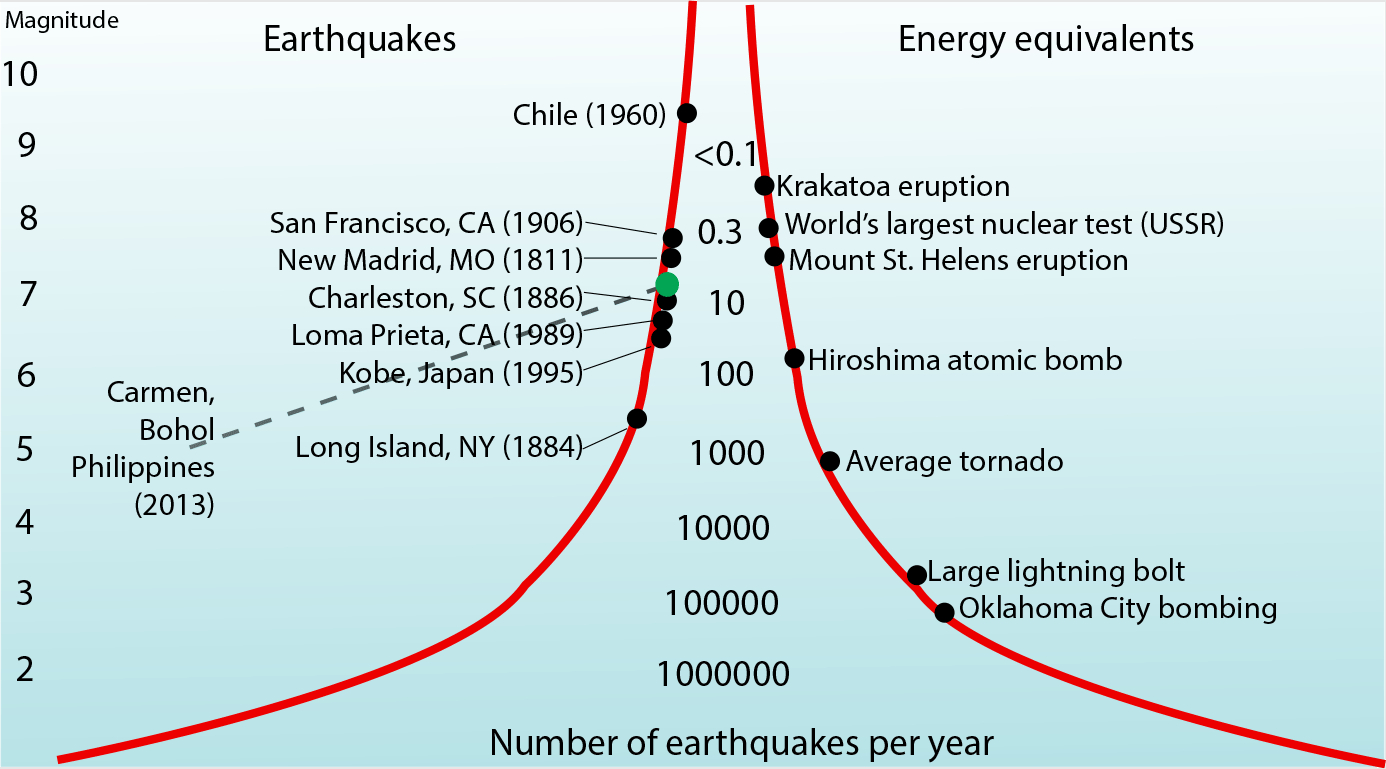
Japanese authorities have warned its citizens of a ‘megaquake’ and large tsunamis along the Nankai Trough.
What is the Nankai Trough?
The Nankai Trough is an extensive subduction zone, nearly 900 km long.
It is the place of collision of the Eurasian Plate over the Philippine Sea Plate.
This trough has a history of producing large earthquakes approximately every 100 to 150 years.
The most recent Nankai Trough quake happened in 1946 with magnitude 8.0 tremor and 6.9 metre tsunami, killing 1,330 people.
Potential for a Megaquake:
Japan’s researchers estimated in January 2022 that there is a roughly 70% chance of a magnitude 8-9 megaquake striking the Nankai Trough within next 30 years.
Such a quake could affect a vast region stretching from central Shizuoka, about 150 km south of Tokyo, to southwestern Miyazaki.
PYQ:
[2014] Explain the formation of thousands of islands in Indonesian and Philippines archipelagos.
The Central government is considering the legality of declaring the landslide a national disaster.
Wayanad Landslide: Destruction and Casualties
The landslide, triggered by heavy rain, devastated at least three villages.
Kerala’s official death toll stands at 221, with over 200 people still missing.
Rescue workers continue to retrieve bodies and body parts from the mud and debris.
Approximately 9,000 people displaced by the disaster have taken refuge in government-run relief camps in Wayanad.
Defining a Disaster:
A naturaldisaster includes natural events like earthquakes, floods, landslides, cyclones, tsunamis, urban floods, and heatwaves.
Man-made disasters can include nuclear, biological, and chemical incidents.
According to the Disaster Management Act, 2005, a disaster is defined as:
A catastrophe, mishap, calamity, or grave occurrence in any area arising from natural or man-made causes.
It results in substantial loss of life or human suffering, damage to or destruction of property, or environmental degradation.
The damage must be of such a nature or magnitude that it is beyond the coping capacity of the affected community.
Is there any provision to declare a ‘National Disaster/Calamity’?
There is NO provision under the existing guidelines to declare any disaster, including floods, as a national calamity.
The guidelinesdo NOT contemplate declaring a disaster as a National Calamity.
Attempts to Define National Calamity:
National Committee (2001):
Chaired by the then Prime Minister, the committee was tasked with defining parameters for a national calamity.
The committee did not suggest any fixed criteria for such a declaration.
10th Finance Commission (1995-2000):
It proposed that a disaster be termed “a national calamity of rarest severity” if it affects one-third of a state’s population.
It did not define “calamity of rare severity” but suggested that each case be adjudged individually.
Response to such calamities in India
When a calamity is declared as such, support is provided at the national level.
The Centre considers additional assistance from the NDRF.
A Calamity Relief Fund (CRF) is established, with the corpus shared 3:1 between the Centre and the state.
If resources in the CRF are insufficient, additional assistance is considered from the National Calamity Contingency Fund (NCCF), funded entirely by the Centre.
Relief measures can include the repayment of loans or the provision of fresh loans to affected individuals on concessional terms.
PYQ:
[2020] Discuss the recent measures initiated in disaster management by the Government of India departing from the earlier reactive approach.
[2019] Vulnerability is an essential element for defining disaster impacts and its threat to people. How and in what ways can vulnerability to disasters be characterized? Discuss different types of vulnerability with reference to disasters.
In July, the Odisha government approved a proposal to plant 1.9 million palm trees to mitigate deaths caused by lightning strikes, which were declared a state-specific disaster in 2015.
How many people have lost their lives to lightning in Odisha?
Over the last 11 years, a total of 3,790 people have lost their lives due to lightning strikes in Odisha.
In the previous three fiscal years, 791 fatalities were reported, indicating an increasing frequency of lightning strikes.
On September 2, 2023, Odisha recorded 61,000 lightning strikes in a two-hour period, resulting in the deaths of at least 12 people.
Why are Lightning strikes of particular concern in Odisha?
Odisha is located in a tropical zone and experiences a hot, dry climate that creates ideal conditions for lightning strikes.
The state has the highest number of cloud-to-ground lightning strikes in eastern and central India. The Annual Lightning Report 2023-2024 indicates a significant concentration of lightning activity in this region.
Research indicates that climate change exacerbates lightning activity, with a 10% increase in lightning occurrences for every degree Celsius of warming. This is particularly relevant in Odisha, where climatic factors contribute to frequent lightning events.
With 96% of lightning strikes occurring in rural areas, the most affected populations include farmers and daily wage earners who work outdoors, making them particularly vulnerable during peak agricultural seasons.
How can Odisha defend Itself against lightning strikes?
Planting Palm Trees: The Odisha government has approved a proposal to plant 19 lakh palm trees as a natural defense against lightning strikes. Palm trees are considered effective conductors of lightning due to their height and moisture content, which can absorb lightning and mitigate its impact on the ground.
Financial Commitment: The state has allocated Rs 7 crore for the palm tree plantation initiative and has banned the felling of existing palm trees to enhance this strategy.
Public Awareness and Early Warning Systems: While the state has implemented early warning systems to forecast lightning strikes, experts emphasize the need for widespread public education on safety measures during lightning events.
Concerns: Experts have raised concerns about the effectiveness of palm trees as a long-term solution, noting that it takes 15 to 20 years for them to reach a height where they can effectively mitigate lightning strikes.
NDMA Guidelines for Lightning
Preparation and Awareness: The Local government should educate the communities about lightning safety and the risks associated with thunderstorms.
Seek Shelter: During a thunderstorm, individuals should seek shelter in a fully enclosed building or a hard-topped metal vehicle. Open vehicles and structures such as metal sheds or under-construction buildings are unsafe.
Avoid Trees: Taking shelter under trees is discouraged, as they can attract lightning. If in a wooded area, find the shortest trees for shelter.
Crouching Position: If no shelter is available, crouch down with heels touching and head between the knees to minimize height and reduce risk.
30-30 Rule: After seeing lightning, start counting to 30. If you hear thunder before reaching 30, go indoors. This rule helps assess the distance of the storm.
Way forward:
Installation of Lightning Rods and Conductors: The government should invest in the widespread installation of lightning rods and conductors in rural and vulnerable areas. These devices can provide immediate protection to critical infrastructure, homes, and open fields where farmers and workers are most at risk.
Advanced Early Warning Systems: Need to enhance the existing early warning systems with more accurate, real-time data and ensure these warnings are disseminated quickly through multiple channels, including mobile alerts, community announcements, and local radio.
Main PYQ:
Q Explain the mechanism and occurrence of cloudburst in the context of the Indian subcontinent. Discuss two recent examples. (2022)
Union Minister of State for Home Nityanand Rai presented the Disaster Management (Amendment) Bill, 2024 in the Lok Sabha on Thursday.
Proposed Provisions in the Bill
Creation of a Disaster Database: The Bill mandates the establishment of a comprehensive disaster database at both national and state levels, which will include disaster assessments, fund allocation details, expenditures, preparedness and mitigation plans, and a risk register based on the type and severity of risks.
Urban Disaster Management Authority: It proposes the formation of an “Urban Disaster Management Authority” for state capitals and large cities with municipal corporations, aimed at enhancing local disaster management capabilities.
Empowerment of NDMA and SDMAs: The Bill empowers the National Disaster Management Authority (NDMA) and State Disaster Management Authorities (SDMAs) to prepare disaster management plans, replacing the previous role of the National Executive Committee and State Executive Committees.
Periodic Risk Assessment: The NDMA is tasked with periodically assessing the entire range of disaster risks in the country, including emerging risks due to extreme climate events.
Statutory Status for Pre-Act Organizations: The Bill provides statutory recognition to certain pre-existing organizations, such as the National Crisis Management Committee and the High-Level Committee.
Penalties for Non-Compliance: It includes provisions allowing the Central and State governments to impose penalties for actions that hinder disaster management efforts, with fines not exceeding ₹10,000.
Substantial Questions on Excessive Powers
Concerns Over Central Authority: Opposition members, including Congress leader Manish Tewari, raised concerns that the Bill grants excessive rule-making powers to the Central government, potentially encroaching upon the legislative powers reserved for State governments.
Constitutional Validity: Questions were raised regarding the constitutional basis for the Bill, as disaster management is not explicitly mentioned in the subjects of the Concurrent List.
Multiplicity of Authorities: Critics, including Trinamool Congress member Sougata Roy, expressed concerns that the creation of multiple authorities could lead to confusion and bureaucratic inefficiencies, potentially hampering effective disaster response.
Need to aim for more clarity
Clarification of roles: The Bill aims to bring more clarity and convergence in the roles of various authorities and committees involved in disaster management, addressing the need for streamlined coordination among stakeholders.
Enhanced Local Management: By empowering local authorities through the establishment of Urban Disaster Management Authorities, the Bill seeks to ensure that disaster management plans are more relevant and tailored to specific regional challenges.
Alignment with Development Plans: The Bill emphasizes the need to mainstream disaster management into development plans, aligning with recommendations from the Fifteenth Finance Commission and ensuring that disaster risk reduction is integrated into broader governance frameworks.
Way forward:
Strengthening Collaboration with State Governments: To address concerns about excessive central authority and potential overlaps with state powers, it is crucial to establish a framework for ongoing collaboration between the Central and State Disaster Management Authorities.
Implementing a Comprehensive Training and Capacity-Building Program: The successful implementation of the proposed Urban Disaster Management Authorities and the broader disaster management framework will depend on the capacity of local officials and stakeholders.
Mains PYQ:
Q Discuss the recent measures initiated in disaster management by the Government of India departing from the earlier reactive approach. (2020)
![[3rd September 2024] The Hindu Op-ed: The Disaster Management (Amendment) Bill is knotty](https://www.civilsdaily.com/wp-content/uploads/2024/09/3-Sep-1568x882.jpg)