💥Mains Ready By December. Smash Mains & Smash PYQ Admissions Open

GS Paper: GS3-19.Disaster and Disaster Management.

  • For Bihar flood problem, solution lies beyond

    Why in the News

    Bihar received 27 per cent below normal rainfall between 1 June and the first week of September, and large parts of the state are still under water. Six rivers, the Ganga, Gandak, Kosi, Budhi Gandak, Punpun and Ghaghra, have risen above danger levels in different stretches. The flooding therefore cannot be explained by how much rain fell on the state, which locates the cause in how its rivers and channels are managed. The state’s inherited answer has been containment, holding rivers inside defined channels behind embankments since colonial times. That method separates a river from its floodplain, and with silt raising the bed year on year it reduces the channel’s capacity to carry the discharge it is given. The contested question is whether flood works should keep aiming to hold the river in, or to give it space to spread safely.

    Why did rivers cross danger levels in a deficit monsoon?

    1. The rainfall record for the season: The state recorded 27 per cent below normal rainfall for the period from 1 June to the first week of September.
    2. Two causes acting together: High upstream river flows combined with erratic weather, meaning spells of heavy localised rainfall inside an overall seasonal deficit, pushed rivers over their banks.
    3. A tributary can flood because the main river is high: The unusually high level of the Ganga created a backwater effect in the Gandak and the Punpun, the condition where a high level in the receiving river obstructs the outflow of a river draining into it.
    4. What that effect did: Both tributaries drain into the Ganga, and its high level made their discharge difficult, so water backed up in the tributaries and added to the flooding.
    5. Danger level is a gauge based threshold: It is the level fixed for each gauge site above which a river threatens habitation and property, so six rivers crossing it in different stretches describes localised failures rather than one basin wide event.

    What does containment by embankment do to a river?

    1. It cuts the river off from its floodplain: Embankments separate rivers from the floodplains that would otherwise absorb and spread a high discharge.
    2. The bed rises inside the confined channel: Continuous silt deposition raises the riverbed and reduces the channel’s capacity to carry flow.
    3. A breach concentrates the damage: When an embankment breaches, artificially contained water rushes into homes and fields at a depth and force an unconfined flood would not produce.
    4. Each year of containment narrows the next year’s margin: A rising bed inside fixed embankments means the same discharge sits higher against the same defences, so the safety margin shrinks with no change in rainfall.

    Why will higher embankments not settle the problem?

    1. The premise needs revisiting: The state needs to reconsider the idea that higher or stronger embankments will by themselves contain floods, since the containment is what raises the bed against them.
    2. Maintenance remains an obligation: Existing embankments protect settlements and land that have grown up behind them, so the choice is not between maintaining them and abandoning them.
    3. The stated objective is the opposite of containment: Persistent monsoon floods point to the need to give the river space to spread safely during periods of high discharge, which a confined channel is designed to prevent.
    4. This is an execution problem, not a knowledge problem: The measures required are already identified in policy, and the flooding continues, which places the failure in implementation rather than in diagnosis.

    What must accompany embankment maintenance?

    1. Restoration of drainage channels: The natural and constructed drains that carry water off the land have to be reopened, since water that cannot drain stays on fields after the river level falls.
    2. Protection of floodplains: The land a river needs during high discharge has to be kept free of the construction and occupation that turns a spread into a disaster.
    3. Better land use planning: Where settlement, cropping and infrastructure are permitted has to follow the flood behaviour of the stretch rather than precede it.
    4. Restoration of wetlands: Wetlands in the basin hold and release flood water, and their loss transfers that volume to the channel and to the settlements behind the embankment.
    5. Deployment of early warning systems: Warning converts an unavoidable flood into an evacuated one, and it is the only measure on this list that reduces loss without altering the river.

    Why has an existing basin plan not changed the outcome?

    1. The imperatives are already on record: The Ganga Basin River Management Plan, implemented for more than a decade, acknowledges these requirements.
    2. The outcome has not followed: Persistent monsoon floods in Bihar show how much remains to be done to give the river room to spread during high discharge.
    3. One requirement sits outside the state’s control: Addressing Bihar’s concerns requires greater coordination between the riverine states on reservoir releases, since a downstream state’s peak is partly set by upstream release decisions.

    Where does the Farakka question sit in this argument?

    1. The state’s long standing contention: Bihar has argued that the barrage and the India-Bangladesh Ganga water sharing treaty compounded its river management challenges.
    2. The mechanism it alleges: Its case is that the barrage altered the Ganga’s flow regime, affecting the movement and deposition of the river’s sediment load.
    3. The causal claim is not settled: The extent to which this contributes to flooding in Bihar remains contested, so it cannot carry the whole explanation for the season’s flooding.
    4. The claim still belongs in the negotiation: Renegotiation of the 1996 treaty, which expires in December, should take account of Bihar’s concerns over silt accumulation and the state’s river management needs.
    5. The evidence base has to be current: Any new arrangement needs to be informed by updated data on river flows and climate change projections rather than on historical records alone.
    6. The principle extends past this treaty: In a period of erratic weather, states and countries sharing a river basin have to strengthen coordination to manage flows and reduce flood related distress.

    Challenges to embankment based flood control in Bihar

    1. The network is too long to maintain to standard: Bihar carries roughly 3,800 km of flood embankments, and every weak section of it is tested in the same few weeks each year. Eg. Breaches are recorded each season at several points across different river systems rather than at one predictable location.
      The Fix: Publish a stretch wise condition rating for the full embankment length before each monsoon, with repair funds released against the ratings rather than spread evenly.
    2. Containment creates waterlogging behind the line: An embankment that keeps a river out also keeps rainwater and local drainage in, so land behind it is lost to standing water rather than to flooding. Eg. Large areas in the Kosi and Gandak belts of north Bihar remain waterlogged well after river levels have fallen.
      The Fix: Build and maintain sluice and pump drainage at every point where an embankment crosses a natural drain, and treat the outfall as part of the embankment asset.
    3. People live between the embankments: Villages inside the embanked corridor are flooded every year by design, without the protection the structure was built to provide. Eg. Settlements between the eastern and western Kosi embankments are inundated annually while the land outside them is defended.
      The Fix: Fix a statutory resettlement and compensation entitlement for households inside the embanked corridor, separate from general flood relief.
    4. The decisive failure point can lie outside the state: The Kosi and the Gandak are regulated by structures in Nepalese territory, so a breach beyond Bihar’s jurisdiction can determine its flood year. Eg. The 2008 Kosi flood followed a breach at Kusaha, upstream of the barrage in Nepal, and displaced close to three million people in Bihar.
      The Fix: Establish a joint pre monsoon inspection and certification regime with Nepal for the Kosi and Gandak structures, with agreed repair timelines.
    5. Warning lead time is short because the catchment is foreign: Rainfall and discharge data from the upper catchments decide how much notice a district can be given, and that data is not generated within India. Eg. A peak on the Kosi can reach the Bihar plains within a day of heavy rainfall in its Nepalese catchment.
      The Fix: Extend real time telemetry sharing across the upper catchments and route it directly to district administrations rather than only to state control rooms.
    6. Silt removal has no funded programme: Reversing a raised bed is slow work with no annual budget head behind it, so the only measure reliably funded is raising the embankment. Eg. Dredging in the state is undertaken for navigation on specific stretches rather than for restoring channel capacity across a river.
      The Fix: Create a standing sediment management head in the state’s water resources budget, reporting channel capacity rather than embankment height as its outcome.

    Conclusion

    A flood season inside a rainfall deficit places the cause in the river system rather than in the monsoon, and that changes what a flood programme should be measured against. Protection built on confining rivers cannot hold once the beds inside those confinements keep rising. The question Bihar now faces is whether it makes channel capacity and floodplain space the stated objective of its flood works, or continues to judge success by the height and length of its defences. The water negotiation ahead is where the state’s sediment case will either become an operating rule or remain a grievance.

    Back2Basics: Ganga Basin River Management Plan

    1. What it is: A basin scale plan that treats the Ganga as a single hydrological unit, covering environmental flows and sediment alongside pollution abatement, rather than as a set of separate state level works.
    2. Why a basin frame: The Ganga basin covers about 861,000 sq km in India, close to 26 per cent of the country’s geographical area, spread across 11 states.
    3. Who carries the Ganga programme: The National Mission for Clean Ganga, under the Ministry of Jal Shakti, is the implementing arm of the National Ganga Council and was constituted as an authority under the Environment (Protection) Act, 1986.
    4. What a basin plan can and cannot do: It sets requirements across the basin and depends on state departments and inter state coordination to execute them, which is how its imperatives can stand on record for years without changing outcomes on the ground.

    Matching Previous Year Question

    “[2017, GS1, 15 marks] In what way can floods be converted into a sustainable source of irrigation and all – weather inland navigation in India?”
  • Bihar flooded despite rainfall deficit; Nepal isn’t the reason

    Why in the News

    Bihar has flooded in a season of deficit rainfall. The State received 601.1 mm of rain between 1 June and 8 September, 27% below normal, and the Disaster Management Department recorded 2,157 villages across 14 districts affected. The Water Resources Minister has said this year’s flood pattern differed from previous years, with the Ganga rising first rather than the rivers that enter Bihar from Nepal. Discharge at the Valmikinagar Barrage on the Gandak stayed below what officials had expected, and the flooding continued anyway. The explanation offered is a backwater effect, so the immediate cause sits downstream in the main river rather than upstream across the border.

    What is a backwater effect?

    1. How a tributary drains: A tributary can discharge into a main river only for as long as the water level in the main river stays below its own.
    2. What happens when the main stem rises: A high stage in the main river holds the tributary’s water back and spreads it across the tributary’s own floodplain, with no additional rain falling there.

    Why did Bihar flood on a rainfall deficit?

    1. The seasonal shortfall: Rainfall from 1 June to 8 September was 601.1 mm, 27% below normal, and the deficit stood at 30% as late as 1 September.
    2. The month ran the other way: Rainfall during September itself was 31% above normal, so the cumulative figure conceals the period when the flooding worsened.
    3. Localised extremes: Individual rain events delivered 214.92 mm in East Champaran and 154.55 mm in Sitamarhi.
    4. The recorded damage: By 9 September the Disaster Management Department reported 2,157 villages in 14 districts affected and about 40.51 lakh people hit.
    5. Seasonal totals are the wrong measure: A flood is produced by the intensity and timing of rain and by upstream discharge, not by the season’s aggregate.

    How was this year’s flood sequence different?

    1. The usual order: The Bagmati, Kamla, Kosi and Gandak, which enter Bihar from Nepal, normally rise first, and the Ganga follows.
    2. What happened instead: The Ganga became the first source of concern this year, which inverted the sequence the State’s flood response is built around.
    3. The catchment is not local: The Ganga’s catchment extends far beyond Bihar, so it carries water generated by rainfall upstream, including in Uttar Pradesh.
    4. The stated drivers: The Disaster Management Department’s Principal Secretary identified rainfall around the Allahabad and Varanasi region and the resulting downstream discharge as important factors, with discharge from neighbouring States a major factor for the other rivers too.

    Why did opening the Valmikinagar Barrage not settle the Gandak?

    1. The gates were opened early: When floods hit Nepal on 26 August, Bihar opened all 36 gates of the Valmikinagar Barrage on the Gandak, which was then below its normal levels.
    2. The peak came in under expectation: Discharge at the barrage reached 1,50,200 cusecs (cubic feet per second, the volume of water passing a point each second) and then declined, below what officials had expected.
    3. Flooding continued regardless: The Gandak and the Punpun could not drain once the Ganga had swelled, which is the backwater effect at work.
    4. A second local input: The Punpun was also carrying heavy rainfall from Jharkhand.
    5. A flood travels: A river flood is a moving event, so a peak recorded at one gauge is transferred downstream and the flooded area is far larger than the area that recorded the heaviest rain.

    What do Bihar’s embankments do, and what do they not do?

    1. The length built: The State has built more than 3,730 km of river embankments.
    2. What they have protected: These structures have historically shielded around 3,600 sq km of land during floods.
    3. The limit of the structure: Embankments do not remove the underlying vulnerability of one of India’s flattest and most sediment heavy alluvial landscapes.
    4. Sediment raises the bed: The Ganga, Gandak, Kosi and Bagmati carry enormous quantities of sediment, and accumulation within a channel lifts the riverbed relative to the land beside it. Silt is a permanent condition of Bihar’s rivers rather than an event.

    Why has the Farakka Barrage entered the flood argument?

    1. The State’s contention: State leaders hold that the Farakka Barrage has trapped large volumes of silt along the Ganga over the five decades since it was built.
    2. The claimed consequence: That accumulation has made the riverbed shallower, so even normal seasonal monsoon flows now spill over the banks and produce annual flooding across the plains.
    3. A treaty deadline gives it timing: The 1996 India Bangladesh Farakka Treaty expires in December 2026, and demands in Bihar are for a review of the pact.

    What in Bihar’s own geography keeps exposure high?

    1. The rivers move: The Ganga, Gandak and Kosi constantly reshape their channels, so the land at risk is not fixed from one year to the next.
    2. People live at the water’s edge: High population density means many communities are settled close to rivers, and a rise in level turns into an evacuation rather than an inconvenience.

    Challenges to Bihar’s flood management

    1. An embankment concentrates risk at its weakest point: A breach releases water at high velocity onto land that the structure had kept dry for decades, so the damage is deeper than an unprotected flood. Eg. The Kosi breach at Kusaha in 2008 shifted the river’s course and displaced over three million people in Bihar.
      The Fix: Hold a pre positioned stock of boulders and geobags at identified weak reaches before each monsoon rather than mobilising material after a breach.
    2. Land behind the line cannot drain itself: An area sealed off from the river also loses the outlet for its own rainfall, so ground protected from flooding turns permanently waterlogged. Eg. Large tracts in the Kosi and Bagmati belts of north Bihar have gone out of cultivation from persistent waterlogging.
      The Fix: Build and maintain sluices and drainage channels through the embankment line with a fixed operating protocol for the monsoon months.
    3. Flood moderation depends on storage that does not exist: Peak attenuation on the Kosi and the Gandak requires reservoirs upstream in Nepal that have never been constructed. Eg. A high dam at Barahkshetra on the Kosi has been under discussion since the 1950s without being built.
      The Fix: Separate real time data sharing and joint forecasting from the dam negotiation, so warning improves without waiting on construction.
    4. Warnings are issued off levels already recorded: Forecasts rest on gauge readings at the moment of the peak, which leaves little lead time on terrain where water spreads sideways for tens of kilometres. Eg. A level based warning gives downstream districts only hours once an upstream gauge has crossed its danger mark.
      The Fix: Build district level inundation forecasts from upstream rainfall and barrage release data rather than from gauge readings alone.

    Conclusion

    Bihar’s flood risk is no longer set mainly by how much rain falls inside the State. It is set by the level of the main river the State has to drain into, and by channels whose beds have risen relative to the land beside them. The unresolved tension is that the structures protecting settled land also hold in the sediment that raises those beds, so each decade of protection shortens the next decade’s margin. What to watch is whether flood planning shifts from adding embankment length to sediment management, drainage behind the line and forecasting built on upstream data.

    Back2Basics: Farakka Barrage

    1. What it is and where: A barrage on the Ganga in Murshidabad district of West Bengal, commissioned in 1975, a short distance upstream of the border with Bangladesh.
    2. Why it was built: It diverts a part of the Ganga’s flow into a feeder canal to the Bhagirathi and Hooghly, to flush silt and maintain navigability for the port of Kolkata.
    3. A barrage, not a dam: It regulates and diverts flow through gates rather than impounding a large storage reservoir behind it.
    4. The water sharing arrangement: An agreement between India and Bangladesh shares the dry season flow measured at the barrage in ten day cycles between 1 January and 31 May.

    Matching Previous Year Question

    “[2024, GS3, 15 marks] What is disaster resilience? How is it determined? Describe various elements of a resilience framework. Also mention the global targets of the Sendai Framework for Disaster Risk Reduction (2015-2030).”

  • Disaster preparedness must put communities at centre

    Why in the News

    The catastrophe unfolding across Nepal is being read as a warning for the Himalaya and for mountain regions worldwide rather than as one country’s disaster. The reading rests on field research with disaster-affected communities in Nepal, including flood-affected elders, women, men and local leaders in Kharapani in the Pokhara Valley after the Seti River flood, and on separate field research on earthquake recovery in Kathmandu. Those communities reported inadequate warning, limited preparedness and delayed recovery support. They did not reject science or technology, and asked instead for warnings that function and for the equipment and training to act on them. The contest is between a preparedness system measured by its ability to detect the next hazard and one measured by whether the detection reaches a household with the authority and the means to move.

    Why does a mountain disaster become a regional problem?

    1. Mountains hold the water other regions live on: They store snow and ice, feed major rivers and sustain societies far beyond their own slopes.
    2. The physical base is changing across all mountain systems: From the Hindu Kush Himalaya to the Andes, the Alps and the Rocky Mountains, warming is altering glaciers, snowpack, permafrost and water flows.
    3. The consequences land downstream: Environmental change in the highlands cascades into social, economic and health crises in the plains that depend on those flows.

    What did flood-affected communities report?

    1. The loss was continuing rather than momentary: Residents described a long relational disaster covering the loss of relatives, homes, livestock and businesses.
    2. The damage extended past property: They described grief, disrupted livelihoods and frustration with the institutions meant to respond.
    3. Three failures were named: They reported inadequate warning, limited preparedness and delayed recovery support.

    What do affected communities ask for?

    1. Working warnings, not more instruments: Communities asked for functioning warnings, local flood-information centres, communication technologies, rescue equipment and preparedness training.
    2. An unread warning protects nobody: A warning that does not reach people, is not trusted, or is disconnected from evacuation and response plans provides no protection.
    3. The people at risk hold usable knowledge: Affected populations are knowledge holders and leaders in their own right, not recipients waiting for expert instruction.

    What five responsibilities does mountain preparedness now carry?

    1. Transboundary monitoring and data sharing: Glaciers, rivers, landslides and flood pathways cross political borders, so Nepal, India, China, Bhutan and other Himalayan countries need faster exchange of upstream observations, satellite information, river conditions and warnings. Scientific cooperation of this kind is life-saving regional infrastructure.
    2. Community-centred warnings: Information must reach people in trusted languages and forms, warnings must be tested, communities must know where to go, and women, elders, youth and marginalised groups must hold meaningful authority in preparedness decisions.
    3. Preparedness as a permanent public responsibility: Local information centres, evacuation plans, shelters, community response teams, health-system continuity and rescue equipment all require sustained investment rather than post-disaster allocation.
    4. Ecosystem-sensitive mountain development: Roads, tourism, hydropower and mining bring benefits, and poorly planned versions of each amplify exposure to the hazard.
    5. International climate responsibility: Nepal has contributed a tiny share of historical emissions and faces profound risk from a changing cryosphere, so climate finance, loss and damage support, scientific capacity and locally controlled adaptation are questions of justice rather than charity.

    Challenges to community-centred disaster preparedness

    1. The first responder tier is the least resourced: Panchayati Raj Institutions and urban local bodies carry the immediate response duty without matching funds, trained staff or defined roles. Eg. Relief work and maintenance of community assets sit with panchayats under the Eleventh Schedule, and States have devolved neither dedicated disaster staff nor untied funds against that entry.
      The Fix: Earmark a fixed share of the State Disaster Response Fund for village-level preparedness and train elected representatives through the National Disaster Management Authority and National Institute of Rural Development and Panchayati Raj modules.
    2. Spending is tilted towards relief rather than prevention: The disaster fund architecture keeps response funds far larger than mitigation funds, so preparedness competes for the smaller pool every year. Eg. India’s mitigation funds were created only after the response funds had been operating for years, and the tilt towards relief persists.
      The Fix: Move early warning systems, retrofitting and nature-based works into the National and State Disaster Mitigation Funds with a published annual drawdown target.
    3. Warnings fail at the last mile: Alerts are generated centrally and lose their audience before reaching the household, which is where the decision to move is actually taken. Eg. Real-time disaster information systems and last-mile dissemination remain uneven between States.
      The Fix: Test each warning chain through a drill that measures how many households received and acted on an alert, rather than how many messages were dispatched.
    4. Himalayan hazard data stops at the border: Glacial lakes, landslide dams and river surges form upstream of national boundaries, where the agencies that will face the flood have no observation rights. Eg. The South Lhonak lake outburst flood in Sikkim in October 2023 destroyed the Teesta III dam downstream and killed dozens of people.
      The Fix: Convert existing bilateral hydrological exchanges into a standing Himalayan hazard data protocol with fixed transmission times and a named receiving authority in each country.

    Conclusion

    Preparedness is being judged by the wrong instrument. Detection capacity has improved across the Himalaya; the authority to act on a detection still sits several administrative tiers above the people who must move. The unresolved tension is that the tier holding the legal duty to respond holds neither the money nor the staff to prepare, and the tier holding both is too distant to run an evacuation. Whether that changes is visible in one measurable thing over the next monsoon: whether any Himalayan State publishes household-level reach data for its warning system, instead of counting alerts issued.

    Disaster Management in India

    1. Where the mandate sits: The Ministry of Home Affairs oversees disaster management through its Disaster Management Division, which coordinates response, relief and preparedness for natural and human-made disasters, excluding drought and epidemics.
    2. A four-tier institutional structure: The National Disaster Management Authority is chaired by the Prime Minister, State Disaster Management Authorities by Chief Ministers and District Disaster Management Authorities by District Collectors, with primary responsibility resting on State governments.
    3. A fund architecture with four pillars: The National and State Disaster Response Funds finance relief, and the National and State Disaster Mitigation Funds finance risk-reduction projects.
    4. How resilience is defined: The Hyogo Framework for Action, 2005, defines disaster resilience as the capacity of a system or community exposed to hazards to adapt, by resisting or changing, so as to maintain an acceptable level of functioning.

    Laws and Rules Governing Disaster Management

    1. Disaster Management Act, 2005: It establishes structures and processes for disaster management at national, State, district and local levels, and mandates the creation of the National, State and District Disaster Management Authorities.
    2. Disaster Management (Amendment) Act, 2025: It modernises the 2005 framework for urban risk, climate extremes and data-driven response.
    3. It allows States to set up Urban Disaster Management Authorities in State capitals and Municipal Corporation cities. Eg. Karnataka’s authority for the Bruhat Bengaluru Mahanagara Palike.
    4. It mandates national and State disaster databases covering risk assessments and real-time disaster data.
    5. It gives statutory status to the National Crisis Management Committee and the High-Level Committee.
    6. Constitution (Seventy-third Amendment) Act, 1992: Article 243G empowers Panchayati Raj Institutions to prepare plans and implement schemes, and the Eleventh Schedule places relief work and maintenance of community assets among their functions.

    Government Initiatives for Disaster Preparedness

    1. National Disaster Management Plan: Issued in 2016 and revised in 2019, it is India’s first all-hazard plan aligned to the Sendai Framework.
    2. Disaster Management Plan of the Ministry of Panchayati Raj: Framed under Section 37 of the Disaster Management Act, 2005, it builds community-based planning from the village to the district panchayat.
    3. Aapda Mitra: It trains community volunteers in first response, search and rescue in disaster-prone districts.
    4. SACHET and the Common Alerting Protocol: They push multi-hazard alerts to every phone in an affected geography from one standardised feed.
    5. Coalition for Disaster Resilient Infrastructure: Launched by India in 2019, it is an international organisation of over 50 countries working on disaster-proofing critical infrastructure.

    Key Facts about Disaster Risk Reduction

    1. Sendai Framework for Disaster Risk Reduction, 2015-2030: Adopted at Sendai in Japan, it carries four priorities for action and seven global targets.
    2. The United Nations custodian: The UN Office for Disaster Risk Reduction anchors global disaster risk reduction and runs the Sendai Framework Monitor for reporting against the seven targets.
    3. India’s stated vision: The Prime Minister’s Ten-Point Agenda on Disaster Risk Reduction was announced in 2016 at the Asian Ministerial Conference.

    Matching Previous Year Question

    “[2024, GS3, 15.0 marks] What is disaster resilience? How is it determined? Describe various elements of a resilience framework. Also mention the global targets of the Sendai Framework for Disaster Risk Reduction (2015-2030).”

  • SC refuses extension for Aravalli panel to submit final report

    Why in the News

    The Supreme Court has refused a six month extension sought by the high powered committee it appointed to define the Aravalli hills and range, and has directed the panel to submit its final report by 30 November. The committee was constituted to evolve a uniform definition of the ecologically fragile Aravalli hills and range and to recommend measures to regulate future mining. A three judge Bench headed by the Chief Justice of India observed that the panel appeared to be waiting for the Chief Justice’s retirement, which falls on 9 February 2027, and made clear that no further extension would be granted. The Bench also directed the panel to work continuously, to file interim reports on urgent issues, and to hear all stakeholders including tribal communities in Rajasthan and Gujarat. The tension is that a definition still unsettled after repeated extensions is the same definition that determines where mining may lawfully continue in the meantime.

    What is the high powered committee tasked with?

    1. Composition: It is a five member panel constituted by the Supreme Court and headed by the Director General of the Indian Council of Forestry Research and Education (ICFRE), the Union government’s forestry research body.
    2. First task, the definition: It must evolve a single uniform definition of what counts as the Aravalli hills and the Aravalli range, applicable across the States the range runs through.
    3. Second task, mining regulation: It must recommend the measures by which future mining in the defined area is to be regulated.

    Why does a definition decide what can be mined?

    1. Protection follows the boundary: Restrictions on mining and construction attach to land identified as Aravalli, so the extent of the definition is the extent of the protection.
    2. State practice has diverged: The range runs across Delhi, Haryana, Rajasthan and Gujarat, and in the absence of one national test each State has applied its own criteria to identify protected hills.
    3. The dispute is about elevation and landform: The competing tests turn on how much a landform must rise above the surrounding ground before it qualifies as an Aravalli hill, and a stricter threshold removes large stretches from protection.
    4. The interim period is the live cost: Mining approvals continue to be processed while the definition is pending, so delay is not neutral between the parties.

    What has the Court directed the panel to do?

    1. A hard deadline: The final report is due by 30 November, with the matter listed for hearing on 2 December, by which time the report is expected to have been filed.
    2. Interim reporting: The panel must submit interim reports on specific issues that require immediate consideration rather than holding everything back until the full exercise is complete.
    3. Stakeholder hearings: The panel must hear all stakeholders before finalising its recommendations, including tribal communities in Rajasthan and Gujarat whose land and livelihood the definition affects.
    4. No further extension: The Bench recorded that the six month request would not be entertained and that no further extension would follow.

    Challenges to regulating mining in the Aravallis

    1. Illegal mining outruns enforcement: Leases are policed by State mining departments with small field staff, so extraction continues outside sanctioned boundaries and at night. Eg. The Supreme Court has repeatedly had to intervene in Aravalli mining in Haryana, including through orders restraining mining in the range’s Haryana stretch.
      The Fix: Mandate satellite based volumetric monitoring of every lease, with quarterly comparison of extracted volume against the approved mining plan.
    2. Definitional ambiguity is exploited at the margin: Where a landform’s status is arguable, the developer’s classification prevails until challenged, which converts a mapping question into a licensing loophole. Eg. Construction has advanced on Aravalli land in Faridabad on the basis that the plots were not classified as forest.
      The Fix: Publish the finalised boundary as a single geo referenced map notified in the gazette, so classification is not decided plot by plot.
    3. Land use change destroys the hill even without mining: Real estate and quarry backfilling flatten the same ridges that mining regulation is meant to protect, and neither is governed by mining law. Eg. Farmhouse and residential development has expanded steadily on the Aravalli fringes around the National Capital Region.
      The Fix: Attach the mining definition to the State land use plans as well, so the same boundary governs building permissions.
    4. The ecological function is not priced into any clearance: The range checks the eastward spread of the Thar desert and recharges groundwater, services that no mining lease valuation accounts for. Eg. Groundwater levels in the districts flanking the range have fallen faster than the State averages.
      The Fix: Require a hydrological and dust dispersion impact assessment specific to the range before a lease is granted, not a generic mining environmental clearance.
    5. Restoration obligations are rarely enforced after closure: Reclamation of a mined pit is a lease condition that lapses once the operator exits, leaving abandoned pits and unstable slopes. Eg. Disused quarries across the range have filled with water and remain unrehabilitated.
      The Fix: Hold a restoration bond sized to the assessed reclamation cost, released only after independent certification that the site has been restored.

    Conclusion

    The Court has converted an open ended technical exercise into a dated one, which is the only lever available to it while the substantive question remains with the committee. The unresolved position is that protection of the range currently depends on a definition that does not yet exist, so every month of delay is a month in which the weakest interpretation operates by default. The concrete things to watch are the interim reports the panel now owes, and the hearing on 2 December at which the recommendations on regulating mining will first be tested.

    Back2Basics: The Aravalli Range

    1. What it is: One of the world’s oldest fold mountain ranges, formed in the Proterozoic era and heavily eroded, so it survives as broken ridges rather than a continuous chain.
    2. Extent: It runs roughly 690 km from Delhi in the northeast through Haryana and Rajasthan to Gujarat in the southwest.
    3. Highest point: Guru Shikhar on the Mount Abu massif in Rajasthan, at about 1,722 metres, is the highest peak of the range.
    4. Ecological role: It acts as a barrier to the eastward advance of the Thar desert and as a groundwater recharge zone for the plains on either side.

    Matching Previous Year Question

    “[2025, GS3, 15 marks] Mineral resources are fundamental to the country economy and these are exploited by mining. Why is mining considered an environmental hazard? Explain the remedial measures required to reduce the environmental hazard due to mining.”

  • Fragile ecology, competing interests: The red flags in building Himalayan dams

    Fragile ecology, competing interests: The red flags in building Himalayan dams

    Why in the News

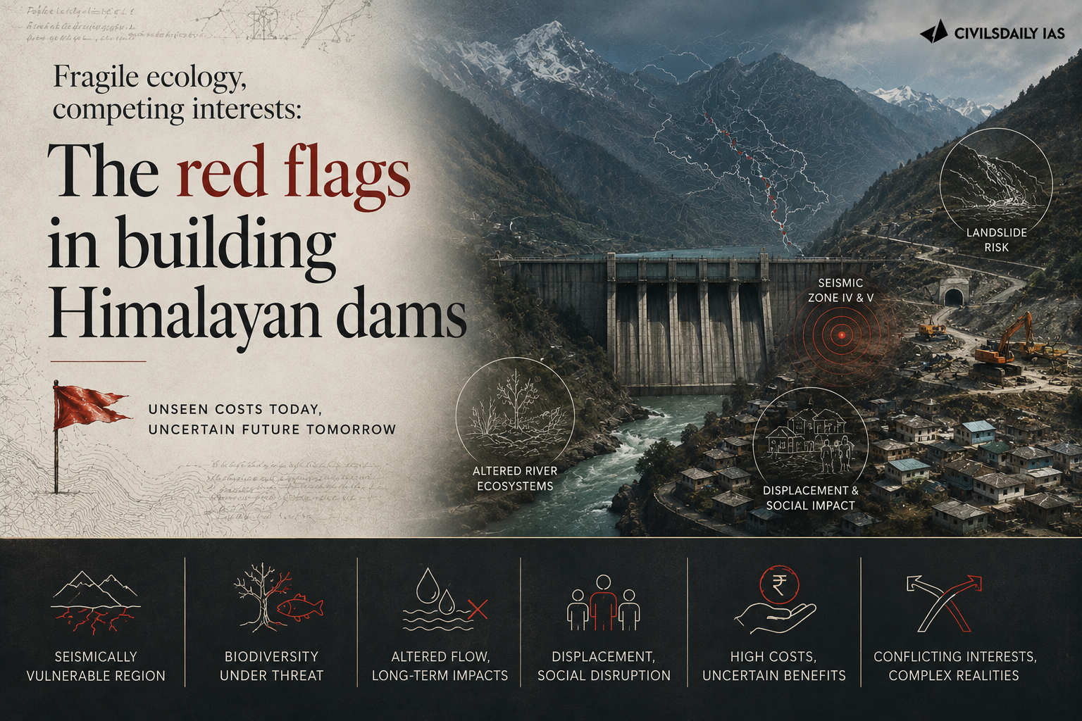
    A glacier collapse near the China Tibet border has triggered floods in Nepal that have killed over 1,100 people, with thousands still missing. The event has renewed expert concern about recent human made changes in a mountain system whose climatic conditions are shifting quickly. 13 hydropower plants, including several under construction projects, were affected.

    Why is the Himalayan system already fragile?

    1. A naturally unstable mountain system: The Himalayas are prone to earthquakes, landslides, avalanches and flash floods before any human intervention is added.
    2. The topography concentrates risk: The region carries lakes formed by melting glaciers, fast flowing rivers and steep slopes, in a zone highly vulnerable to strong earthquakes.
    3. Climate change acts on the pace of natural processes: Temperature change affects the pace and frequency of snow melting and thawing, and of glacial lake outburst floods (GLOFs), which occur when water collected from melting glaciers overflows its containing barrier.
    4. Attribution and risk are separate questions: Linking any single disaster directly to climate change still requires more scientific assessment, and the overall level of risk appears to be increasing.

    How does infrastructure build up compound the toll?

    1. Dams carry a genuine benefit: Dams and reservoirs regulate the flow of water and extend access to services for people living in remote regions.
    2. Construction alters the geology: Building a dam disturbs the geology of the area and makes it more prone to earthquakes, and the drilling and tunnelling required for further projects extends that effect.
    3. Damage runs through the assets themselves: The loss of hydropower plants in this flood dented both generation capacity and access to power.
    4. Exposure has risen with use: Infrastructure build up and high tourist footfall together compounded the disaster’s toll.

    How extensive is Himalayan hydropower now?

    1. Across the Tibetan region: One recent study identified at least 193 dams built or planned across the wider Tibetan region since 2000.
    2. In Nepal: A Nepal hydropower database lists more than 570 projects at different stages.
    3. The largest single project: China is building a massive dam on the Yarlung Tsangpo, the upper course of the Brahmaputra, near Arunachal Pradesh.
    4. A fault beneath it: In July, Chinese researchers flagged an active fault line, a fracture between two blocks of rock, directly beneath the Yarlung Tsangpo mega dam.

    Why is Himalayan dam building also a geopolitical contest?

    1. Infrastructure as a sovereignty marker: Chinese infrastructure building in Tibet is treated by China as a marker of sovereignty over Tibet, not only as an energy programme.
    2. The response is more dams: India, Nepal and Bhutan have responded with their own set of dams, and India is helping Bhutan build a series of hydropower projects.
    3. Signalling and counter signalling: The result is a pattern of signalling and counter signalling in which project decisions answer each other rather than answering the basin’s hydrology.

    What is missing in transboundary cooperation?

    1. No substantial ecosystem cooperation: There has been no substantial cooperation between China and Nepal, or between China and India, on managing the shared ecosystem.
    2. The existing mechanism is narrow: Disasters in the 2000s prompted a memorandum of understanding between India and China in 2002, with an expert level mechanism on transboundary rivers created in 2005. That mechanism has to be expanded to cover other aspects such as GLOFs.
    3. Transparency differs across the border: Nepal officially publishes fairly detailed project and licensing information. Chinese project level information exists but stays scattered across separate official documents and announcements rather than in a comparable consolidated public database.
    4. No real time upstream data: There is no clearly established public system between China and Nepal for continuous, real time sharing of upstream river flow, reservoir operations or glacial lake conditions from Tibet.
    5. Early warning fails at the border: Gaps in information and data sharing between countries complicate early warning for hazards that originate across a boundary.
    6. No arbitration route: Downstream countries lack the consensus to build alliances that can deal with China, and there is no scope for international arbitration. Even a signed agreement would face a state that does not follow such international norms, as the South China Sea dispute shows.

    What would stronger cooperation require?

    1. Continuous data sharing: Cooperation would necessarily include continuous sharing of hydrological, weather and climate data across the boundary.
    2. Paying for upstream observation: Where sustained monitoring carries a cost, downstream countries could co invest in upstream observation systems or pay for specialised datasets, creating a model that benefits both sides.
    3. Standing operational machinery: Automated public warning systems, joint scientific studies and regular emergency exercises would complement the data arrangements.
    4. A landscape rather than a national frame: A nation state centric, container approach does not fit the Himalayas, since these disasters do not confine themselves within national boundaries and their ramifications run across the landscape.

    Challenges to hydropower expansion in the Himalayas

    1. Projects sit in the highest seismic risk zones: Much of the Himalayan arc falls in seismic zones IV and V, so a design earthquake is a live engineering assumption rather than a remote one. Eg. The 2011 Sikkim earthquake damaged structures at the Teesta III project and halted work.
      The Fix: Make site specific seismic hazard assessment and independent design review a published precondition for financial closure, not a post clearance formality.
    2. Sediment load shortens the working life of a project: Himalayan rivers carry among the world’s highest silt loads, which abrades turbines and fills reservoirs faster than design assumptions allow. Eg. Run of the river plants on the Alaknanda and Bhagirathi shut down repeatedly during the monsoon for desilting.
      The Fix: Require measured basin sediment yield data in the detailed project report and size desilting capacity against it rather than against a regional average.
    3. Cascade layouts convert one failure into several: Projects built in series on the same river mean an upstream breach delivers debris and water straight into the next structure. Eg. The 2021 Chamoli flood destroyed the Rishiganga project and then struck the Tapovan Vishnugad project downstream.
      The Fix: Assess clearances at the level of the whole river cascade, so cumulative and cascading failure is evaluated once rather than project by project.
    4. Tunnelling destabilises slopes and drains aquifers: Long headrace tunnels cut through fractured rock, dewater springs and remove support from the slopes above. Eg. Land subsidence in Joshimath in 2023 followed years of tunnelling and construction in the same valley.
      The Fix: Publish pre construction and post construction spring discharge and slope movement monitoring for every tunnelled project, with construction halted on a defined trigger.
    5. Rehabilitation is settled before the risk is understood: Displaced communities are resettled onto land whose hazard exposure has not itself been mapped. Eg. Resettlement colonies for Himalayan projects have been sited on debris fans and old landslide zones.
      The Fix: Require the resettlement site to carry its own hazard clearance before the displacement award is finalised.

    Conclusion

    Himalayan risk now runs through infrastructure as much as through geology. The two positions that cannot both hold are that dams are national assets worth building at scale and that the floods which destroy them cross three borders within minutes, with no obligation on the upstream state to say what is coming. Data sharing, not engineering standards, is the binding constraint on early warning. The concrete thing to watch is whether the India China expert level mechanism is widened past monsoon river flow data to cover glacial lake and reservoir conditions.

    [2023, GS3, 10 marks] Dam failures are always catastrophic, especially on the downstream side, resulting in a colossal loss of life and property. Analyze the various causes of dam failures. Give two examples of large dam failures.”

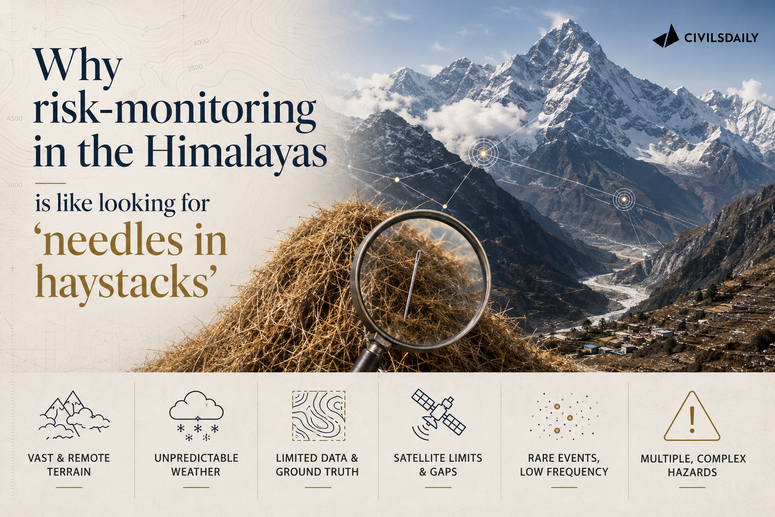
  • Why risk-monitoring in the Himalayas is like looking for ‘needles in haystacks’

    Why risk-monitoring in the Himalayas is like looking for ‘needles in haystacks’

    Why in the News

    A Senior Fellow of the Energy, Water and Sustainability Program at the Stimson Center, a US based non-profit think tank, has set out the sequence of the recent Nepal flood and the lessons it holds for hazard monitoring across the Himalayas.

    What triggered the Nepal flood, and why is the trigger still uncertain?

    1. A glacial detachment carrying bedrock: The present consensus is that the initial trigger was a glacial detachment that included bedrock on the northern slopes of Langtang Lirung, a 7,000-plus-metre peak in the Langtang range.
    2. The triggering process is not understood: The failure could be related to climate-related risks or to gradual shifts at the site itself.
    3. A slow creep, then a tipping point: Preliminary analysis indicates minor movement of the glacial mass in the weeks or months before the event, followed by a tipping point.

    How did a single glacial failure cascade more than 100 kilometres downstream?

    1. The descent: The failed mass swept down a gully toward the Lhende River, which reaches the Chinese border. The source area was around 5,200 metres, so the flow descended a couple of thousand metres.
    2. A temporary natural dam: The flow deposited a mixture of ice, rock and sediment that blocked the river.
    3. Three contested water sources: Debate continues on how much water came from the glacier itself, from melting of entrained ice, and from water that accumulated behind the landslide dam.
    4. Nine minutes to the border: The dam failed and sent a major pulse of water downstream, which reached the China border in roughly nine minutes. Footage from the Gyirong border facility shows a massive dark wave carrying a large volume of material, not just water.
    5. Back into Nepal within seconds: The border facility sat at a confluence with the Gyirong River tributary, and within seconds of hitting it the flow was already moving back into Nepal. There was no realistic opportunity to warn communities downstream, and many of those who could have generated an alert were themselves swept away.
    6. Dams, hydropower and villages: The flow destroyed dams and hydropower projects downstream, recruited additional sediment, and swept through villages along the river corridor.
    7. Beyond every mapped floodplain: The event continued into Nuwakot district and affected larger market towns in the floodplain, in areas well beyond the 100-year or 500-year floodplain (the extent a flood of that average recurrence interval is expected to reach). This was a thousand-year-plus flood event.
    8. Registered at the India-Nepal border: Significant impacts extended more than 100 kilometres downstream, and the flood pulse also registered at the India-Nepal border.

    Why are cascading hazard chains the larger Himalayan problem?

    1. A pattern across three countries: The same chain has appeared in Chamoli, in Sikkim with the South Lhonak GLOF (glacial lake outburst flood), and in Nepal with the Melamchi disaster.
    2. Climate risk as an amplifier: Climate risks are interacting with and amplifying other disaster risks, and these events are becoming more frequent and more intense.

    Why does hazard monitoring keep missing the sites that fail?

    1. Known high-risk sites exist, and this was not one: Several places around Nepal have been identified as high-risk areas for glacial detachment and surges, and glaciers immediately on the other side of Langtang Lirung are high-priority research sites. This particular location had no red flags.
    2. Hindsight still needs a target: Analysts are examining whether changes could have been detected in the days before the event, but that would still require knowing where to look.
    3. No signal to separate from noise: Monitoring every glacier and every mountainside that could collapse is not feasible without some signal that narrows the search.
    4. Satellites answer only the question they were pointed at: Remote sensing and satellite-based analysis are important, but different satellite tools answer different questions, and each needs a target. Engaging local communities is how the target is found.
    5. Almost every event came from an unknown place: Of over a dozen extreme events in the Himalayas over 10 years, almost all came from unknown places, the South Lhonak GLOF being the one known risk.
    6. No borrowed training data: Patterns are beginning to emerge, but no training dataset from the Alps or Norway can simply be transferred to the Himalayas, which have their own context and significant data scarcity and data sparsity.

    What monitoring triangle does the interview propose for India, Nepal and the Himalayas?

    1. Mapping is the baseline: The mapping exercise undertaken by India’s Home Ministry and space agencies to monitor glacial lakes and hazards is an absolute necessity. Nepal does not have the same level of resources. Some mapping has been done there, and it is not as comprehensive.
    2. Maps enable zoning; monitoring is the key: Once maps exist, hazard zoning and modelling can begin, but detection depends on continuous monitoring.
    3. Corner one, remote sensing: Remote sensing and satellite imagery form one part of the triangle.
    4. Corner two, fixed station networks: Hydromet (hydrological and meteorological) and seismic stations form the second.
    5. Corner three, localised monitoring through local government: Local governments, disaster managers and Community Disaster Management Committees can collect local data, report landslides and monitor impacts after storms.
    6. Localised monitoring through people immersed in the terrain: Yak herders and fishermen notice changes in rivers, glaciers and glacial lakes. Oral histories with elders reveal smaller avalanches, glacial-lake floods and other events that science has not recorded, helping identify potential hotspots.
    7. The combination is the detector: Combining the station network, remote sensing and localised monitoring gives a better chance of detecting changes and distinguishing the signal from the noise that tells you where to look.

    Challenges to Himalayan hazard monitoring

    1. Hydropower sited in hazard corridors without upstream sensing: Projects sit in narrow gorges below unstable ice and rock with no instrument between the source and the intake. Eg. The February 2021 Chamoli rock and ice avalanche from Ronti peak destroyed the Rishiganga and Tapovan-Vishnugad projects with no upstream warning.
      The Fix: Make a hazard chain assessment and ridge line sensors with satellite telemetry a condition of clearance for every Himalayan hydropower project.
    2. Instruments die with the event they are meant to detect: A sensor placed at the lake or in the channel is destroyed by the first surge and reports nothing. Eg. Monitoring equipment installed at South Lhonak lake in September 2023 was washed away in the October 2023 outburst that also breached the Teesta III dam at Chungthang.
      The Fix: Place redundant stations on high ground and at staggered distances downstream so at least one survives to trigger sirens.
    3. Cross-border flows carry no shared alert: The upstream country holds the first minutes of warning and no protocol obliges it to pass them on. Eg. India’s hydrological data sharing arrangement with China on the Brahmaputra lapsed in 2023.
      The Fix: Adopt a Hindu Kush Himalaya alert protocol through the International Centre for Integrated Mountain Development (ICIMOD) that pushes automatic upstream alerts to downstream disaster authorities within minutes.
    4. Warnings that never reach the last mile: A satellite detection is useless to a village asleep in a gorge with no siren and no signal. Eg. The Sikkim outburst struck after 10 pm on 3 October 2023 and reached the Teesta valley settlements in the dark.
      The Fix: Pair the National Disaster Management Authority’s Common Alerting Protocol based cell broadcast with battery-backed community sirens in every mapped downstream settlement.

    Conclusion

    India has the baseline map; Nepal has part of one. Neither has the monitoring triangle that turns a map into a warning. The unresolved gap is that detection still depends on knowing where to look, and the herders, fishermen and village committees who hold that knowledge are not yet wired into any station network. The test of the next monsoon is whether a single high mountain site with no red flag gets watched because a community reported it first.

    Back2Basics

    1. What it is: A sudden release of water from a lake formed by melting glaciers, held back by a natural dam of loose moraine debris or ice rather than bedrock.
    2. How it starts: An avalanche, rockfall or ice calving into the lake sends a displacement wave over the dam, or seepage erodes the moraine from within until it collapses.
    3. Why it is deadlier than a rain flood: The surge carries rock and sediment, arrives with minutes of warning, and can breach infrastructure far below the lake.
    4. India’s framework: The National Disaster Management Authority issued dedicated guidelines on GLOF and Landslide Lake Outburst Flood management in 2020.

    [2021, GS1, 15 marks] How does the melting of the Arctic ice and glaciers of the Antarctic differently affect the weather patterns and human activities on the Earth? Explain. (250 words)

  • Lessons India, China, and Nepal must learn

    Lessons India, China, and Nepal must learn

    Why in the News

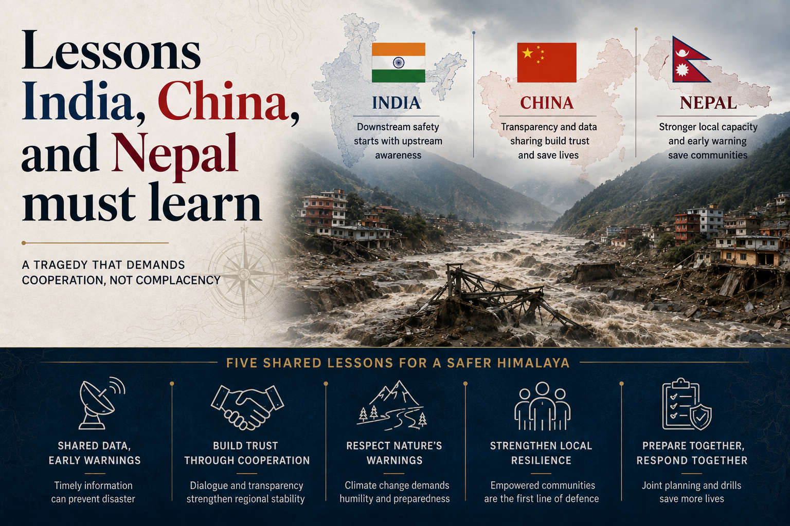
    A catastrophic flood in Nepal’s Rasuwa district, triggered by a glacial collapse near Langtang Lirung, has exposed vulnerabilities in Himalayan border management, infrastructure, disaster response and regional climate cooperation.

    Why does a border not contain a Himalayan disaster?

    1. A natural disaster does not recognise the line: The border as a geometric line, whose breach by another sovereign nation is treated as the uppermost national security concern, is not respected by a flood or an avalanche.
    2. Dependence-generating diplomacy no longer works: Nation states cannot afford to treat the sharing of information and expertise as a favour extended by one side to the other.
    3. Interdependence is the operating requirement: Data sharing, joint studies, institutional collaboration, non-sovereignty-centric treatment of climate change impact and a close inter-governmental early warning framework have become central.
    4. Science has to be converted into a public good: Translating findings into simple public awareness material is part of the same task.
    5. Border forces face a different threat set: Border defence personnel need retraining for security threats that now arrive as physical hazards rather than as incursions.
    6. Traditional knowledge belongs in operations: Human security in far-flung terrain depends on drawing on local knowledge in response operations rather than on external protocols alone.

    What does the flood expose in the region’s power system?

    1. Over 15 hydro projects were damaged on one river: The flood struck that many projects along the Trishuli, and the downstream exposure it created runs from national to trans-border scale.
    2. The cascade crosses four countries: Effects within Nepal, China and India, and further downstream in Bangladesh, can disrupt cross-border energy trading and regional power pools, producing energy insecurity.
    3. India’s oldest stake on the river is destroyed: India’s Central Water and Power Commission initiated the first hydel project on the Trishuli in 1953, an agreement was signed in 1958, and the 21 MW run-of-the-river project was commissioned at Tuphe in June 1972 at a cost of Rs 13.55 crore. It supplied power to Kathmandu for decades and now remains largely decimated.
    4. Highways were built along the river belts: Many China-built highways to Kathmandu run through valleys, including the 115 km Kathmandu to Kodari highway built in 1967 through the Sunkoshi valley, sited for strategic reasons and for easy access to sand and boulders.
    5. Ribbon development followed the alignment: Huge settlements have grown along those highways, which places population directly in the river’s path.
    6. Donors are reconsidering large infrastructure: This flood and others have pushed the funders of big infrastructure projects to rethink their strategies.

    Why does the response arrive from the wrong place?

    1. The first responder is the first victim: The impact falls at a very local level, where the area’s residents are both, and the response comes from distant capital-centric institutions in Kathmandu.
    2. Sikkim recorded the same pattern in 2023: Massive calving from the South Lhonak glacier’s snout triggered a glacial lake outburst flood in North Sikkim in October that year, and the Teesta rose 15 to 20 metres within hours.
    3. The damage crossed two States and a border: Downstream townships in Sikkim, West Bengal and Bangladesh were buried in slush and debris.
    4. The loss was 60 per cent of a State’s output: Damage was estimated at over Rs 25,000 crore, close to that share of Sikkim’s 2022-23 Gross State Domestic Product.
    5. Generation loss alone crossed Rs 19,000 crore: The 1,800 MW of capacity destroyed accounted for that much of the total.
    6. Local institutions had no capacity to absorb it: Municipalities and panchayats stood helpless before the scale of destruction, without training, technique, orientation, awareness, preparedness or the means to cope.
    7. No agency owned the warning function: No early warning mechanism existed, and no agency was responsible for creating one.
    8. The remedy named is relocation of capacity: National institutions and resources need to be based at the local level rather than at the capital.

    Why is there no common Himalayan climate policy?

    1. The region has no framework spanning its levels: The Himalayan region lacks a robust climate policy framework covering the local, national and regional levels together.
    2. The scientific warning is already published: The International Centre for Integrated Mountain Development (ICIMOD), the Kathmandu based intergovernmental knowledge centre for the Hindu Kush Himalaya, has published evidence-based reports warning of tipping points in the region’s deteriorating glaciology.
    3. India’s own instruments are national and sectoral: India has a National and State Action Plan on Climate Change with eight sectoral missions, including one for the Himalayas.
    4. The regional treaty exists on paper: The SAARC Convention on Cooperation on Environment was signed and took effect in 2013.
    5. The problem is fragmentation rather than absence: These scattered approaches have to be brought onto a common platform.

    Challenges to disaster preparedness in the Himalaya

    1. Disaster money is triggered by damage, not by risk: Spending flows overwhelmingly to relief and compensation after an event rather than to the monitoring and evacuation capacity that would reduce it. Eg. A separate National Disaster Mitigation Fund had to be created under the Disaster Management Act, 2005 precisely because response funds were not being spent on mitigation.
      The Fix: Ring-fence a fixed share of the mitigation fund for high altitude monitoring and evacuation infrastructure, with annual utilisation published State by State.
    2. Hill towns are built without a carrying capacity assessment: Settlements expand on slope debris and old landslide material without any study of how much construction the ground will bear. Eg. Land subsidence at Joshimath in January 2023 forced the evacuation of hundreds of families from a town built on old landslide debris.
      The Fix: Complete and publish carrying capacity studies for Himalayan towns, and hold new construction approvals until each town’s study is on record.
    3. No single agency owns glacier hazard: Glacier and glacial lake monitoring is split across geological, polar research and university institutions, so no body publishes a standing national risk list. Eg. India’s glacial lake inventories have been compiled separately by different agencies using different thresholds for what counts as a risk lake.
      The Fix: Designate one nodal agency to maintain and annually publish a national inventory of high risk glaciers and lakes.
    4. Reconstruction rebuilds the same exposure: Post-disaster funding restores roads, bridges and power projects on their original alignments, which returns the assets to the position that failed. Eg. Highways and hydel assets damaged in the 2013 Kedarnath floods were substantially rebuilt along the same valley routes.
      The Fix: Make a relocation-or-redesign assessment a condition of releasing post-disaster reconstruction funds for any asset in a hazard zone.
    5. Transboundary rivers carry no data obligation: Upstream flow, lake level and slope movement data are treated as strategic information rather than as a safety input owed to a downstream population. Eg. Countries in the region share river data under bilateral arrangements limited to defined seasons and defined stations.
      The Fix: Put glacier, lake and flow monitoring data into a standing regional exchange with agreed release timelines and an automatic alert threshold.

    Conclusion

    The Rasuwa flood underscores that Himalayan disasters demand cross-border cooperation, not isolated national responses. India must strengthen valley-level early warning systems, ensure real-time upstream data sharing, and establish clear institutional responsibility to prevent future disasters.

    Back2Basics: International Centre for Integrated Mountain Development

    1. Formation: An intergovernmental knowledge and learning centre established in 1983, with its headquarters at Kathmandu in Nepal.
    2. Membership: It serves eight regional member countries, namely Afghanistan, Bangladesh, Bhutan, China, India, Myanmar, Nepal and Pakistan.
    3. Coverage: Its mandate is the Hindu Kush Himalaya region, spanning the mountain systems from Afghanistan to Myanmar.
    4. Function: It produces regional assessments on glaciers, water, biodiversity and mountain livelihoods, including the Hindu Kush Himalaya Assessment reports.

    [2019, GS3, 10 marks] Disaster preparedness is the first step in any disaster management process. Explain how hazard zonation mapping will help in disaster mitigation in the case of landslides.”

  • Himalayas’ hanging glacier threat

    Himalayas’ hanging glacier threat

    Why in the News

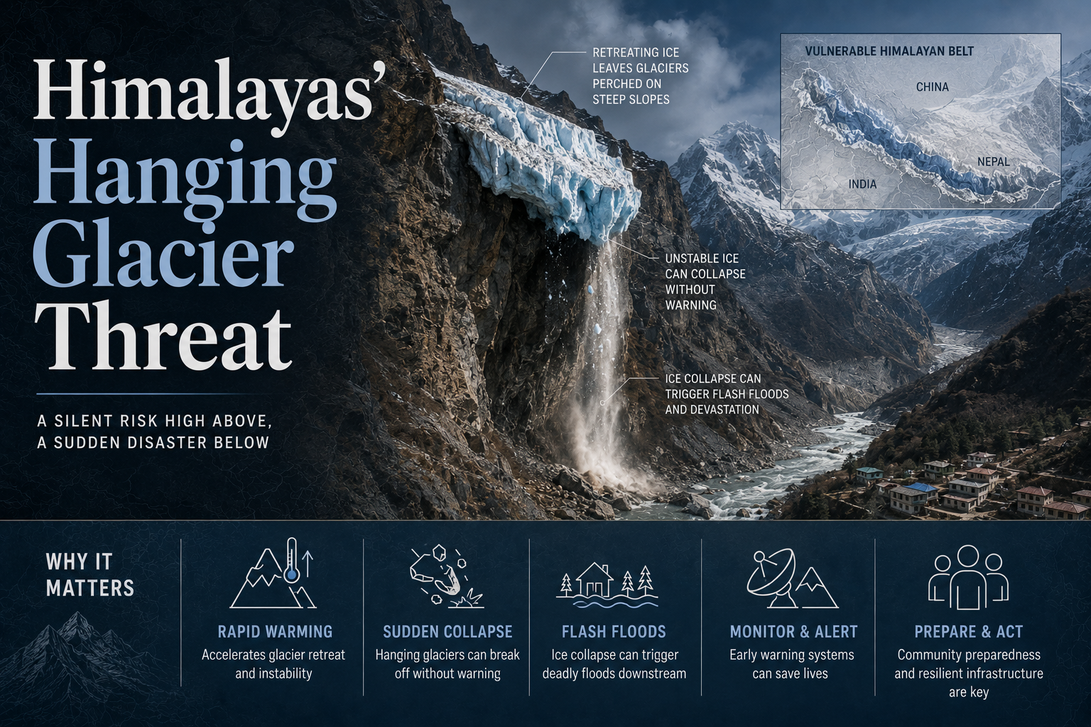
    A Nature study identified 219 hanging glaciers in the Alaknanda basin, highlighting rising Himalayan flood risks as glacier instability assessments remain limited despite repeated major incidents.

    What is a hanging glacier?

    1. A perched ice mass: It is ice sitting on a steep slope in a position from which it can detach as a mass rather than melt away in place.
    2. Instability is defined by velocity: An unstable glacier is one whose velocity may change by an order of magnitude or more over a comparatively short period.
    3. The instability redistributes the ice: That change redistributes ice across the glacier, accompanied by geometric, structural and tectonic shifts, and the redistribution is what produces a hanging glacier on a steep slope.
    4. Detachment starts a chain rather than an event: A break-off can trigger secondary hazards such as a glacial lake outburst flood, where a lake dammed by loose moraine debris is breached and releases its water downstream.

    What did the Alaknanda inventory actually measure?

    1. 219 hanging glaciers in one basin: The study identified that number across the Alaknanda basin of the Garhwal Himalaya.
    2. The unstable ice clusters upstream: Nearly a third of it is concentrated in the Upper Alaknanda basin.
    3. The inventory carries area and volume: The glaciers cover 71.7 ± 3.5 sq km with an estimated ice volume of 2.39 ± 0.42 cubic km, including 0.74 ± 0.14 cubic km of hanging ice mass.
    4. The named driver is warming and variability: Himalayan glaciers are increasingly exhibiting geometric and dynamic instability owing to rapid warming and climate variability.
    5. The method is new to this range: Hanging glaciers have been studied extensively in the Alps, and basin scale assessments in the Himalaya remain limited.
    6. The work is Indian institutional: It was carried out by researchers at the School of Earth, Ocean and Climate Sciences at the Indian Institute of Technology Bhubaneswar and the Divecha Centre for Climate Change at the Indian Institute of Science, Bengaluru.

    What would a break-off do in the Badrinath and Mana sector?

    1. Simulated avalanche flows exceed 50 metres in height: The study’s simulations place flows above that height in that sector of Uttarakhand.
    2. Settlements sit directly in the path: A severe event on that scale would swallow major settlements and infrastructure.
    3. The exposed population is seasonal as well as resident: Badrinath is one of the Char Dham shrines and Mana sits at the head of the same route, so footfall peaks in the months when the slopes are least stable.

    Why is exposure rising faster than the ice is failing?

    1. Built exposure more than doubles by 2030: Buildings and infrastructure land area at risk in the basin is projected to be 120 per cent higher in 2030 than in 2000.
    2. The exposed population rises by 17 per cent: The number of people living in those at-risk areas is projected to surge by that share.
    3. Identification and monitoring are the first response: Systematic identification and monitoring of high-risk glaciers is what the study calls for to reduce downstream hazard.
    4. Land-use planning is the second half of it: Risk-informed land-use planning has to run alongside monitoring in mountain regions.
    5. Monitoring is cheap against the loss it prevents: Much greater funding of monitoring programmes is required, and that funding is small compared with the cost of lost lives and livelihoods, per the Director of the International Cryosphere Climate Initiative.

    What separated Chamoli from Blatten?

    1. Chamoli killed over 200 people in 2021: A massive wall of ice and rock collapsed into the Rishiganga valley, destroying hydropower plants and sweeping away bridges.
    2. Blatten killed one person: A large ice-rock avalanche buried most of that Swiss village four years later.
    3. The difference was preparedness, not luck: A second study published in Nature in March attributes the survival to preparedness, monitoring and rapid response.
    4. Precursory signs were acted on: Authorities and residents in Blatten responded to signs of slope instability, which enabled a timely evacuation.
    5. The hazards are cascading rather than isolated: These events should be treated as cascading hazards rather than as separate landslides, avalanches or floods, per the head of planetary sciences at the University of Aberdeen’s School of Geosciences.
    6. Attribution should not be rushed during the emergency: Establishing which process caused an event should not be hurried during the immediate emergency response.

    Challenges to monitoring hanging glaciers in the Himalaya

    1. The instrument network is sparse and seasonal: High altitude weather and movement sensors are few and go offline through winter, so precursor slope movement is unobserved in the months it develops. Eg. Glacier mass balance in India is measured on a handful of benchmark glaciers such as Gangotri and Chhota Shigri rather than basin wide.
      The Fix: Fund a permanently telemetered high altitude sensor network, with satellite radar interferometry as the standing backup layer.
    2. A hazard map does not bind a builder: Slope and glacier instability assessments are advisory inputs, so they do not stop an approval for a road or a power project below an unstable face. Eg. Construction continued in the Rishiganga and Dhauliganga valleys after repeated warnings about instability in those catchments.
      The Fix: Make valley level hazard zonation a statutory input to environmental clearance for any project above a set altitude.
    3. Warning does not reach the valley floor: An identified hazard produces a scientific alert rather than a siren in the settlement that would be hit. Eg. Workers at downstream barrage sites in the 2021 Chamoli event had no alert before the flood wave arrived.
      The Fix: Install siren based valley warning tied to the sensor network, with a mandated evacuation drill calendar for every downstream settlement and project.
    4. Pilgrim traffic concentrates people in the exposed months: The season when the route is open is the season when avalanche and outburst risk is highest, so peak exposure and peak hazard coincide. Eg. Char Dham footfall peaks between May and October, which is also the melt and monsoon window.
      The Fix: Route daily pilgrim entry against a published hazard advisory rather than against a fixed carrying capacity number alone.

    Conclusion

    The hanging glacier threat shows that Himalayan disaster risk is becoming a race between environmental instability and expanding human exposure. Continuous monitoring, enforceable hazard zoning, real-time warnings and evacuation preparedness can turn scientific knowledge into lives saved and resilient mountain development.

    Back2Basics: Alaknanda River

    1. Source: It rises at the Satopanth and Bhagirath Kharak glaciers in the Chamoli district of Uttarakhand.
    2. Status in the Ganga system: It is one of the two headstreams of the Ganga, and it carries the larger discharge of the two at their meeting point.
    3. Panch Prayag: Its five confluences are Vishnuprayag, Nandprayag, Karnaprayag, Rudraprayag and Devprayag.
    4. Formation of the Ganga: It joins the Bhagirathi at Devprayag, and the river takes the name Ganga from that point onward.

    [2020, GS1, 10 marks] How will the melting of Himalayan glaciers have a far-reaching impact on the water resources of India?

  • The mountains have sounded a warning, we ignore it at our peril

    The mountains have sounded a warning, we ignore it at our peril

    Why in the News

    Flash floods have swept down from the mountains on the Nepal Tibet border into Nepal’s Rasuwa district. A glacial lake outburst flood (GLOF) sent a massive avalanche of water and mud down the Lhende River about 20 km east of the Rasuwagadhi border crossing, sweeping away villages, settlements and a large number of people downstream. The avalanche may have been triggered by a 4.4 magnitude earthquake recorded in the area minutes earlier. At least six hydropower projects downstream were destroyed, costing Nepal 405 MW of capacity, which is 12 per cent of its national total. The tension is that the Himalaya has produced this exact sequence repeatedly, and hydropower schemes and hill tourism have expanded on the same valleys after each event. A second front has opened across the border, where China is building the Medog dam at the great bend of the Brahmaputra and hydrological information sharing with India has never been regular.

    What is a glacial lake outburst flood?

    1. How the lake forms: A mountain river upstream is blocked by a portion of a glacier breaking away or by an avalanche. The blockage impounds a lake behind it.
    2. How the lake bursts: The loose banks of that lake give way under water pressure, and a huge volume of water and debris then hurtles downstream through narrow valleys.

    What did the flood take out beyond the power projects?

    1. The path of the surge: The floods spread south from Rasuwa into the Dhading, Gorkha and Nuwakot districts of Nepal, and the impact carries across the border into India. Chinese media reported similar loss of life and property on the Tibetan side, in Gyirong county.
    2. Indian pilgrims caught in it: Over 160 Indian pilgrims are reported missing. The hotels and guest houses they were staying in were washed away in the flood.
    3. A trade and pilgrimage artery closed: Rasuwagadhi is the most important border crossing between Nepal and Tibet for trade and for tourism, including pilgrim tours to Kailash Mansarovar. Cross border trade and traffic are likely to remain suspended for the foreseeable future.
    4. The recovery horizon: Rebuilding the lost generating capacity may take several years, and it is a loss Nepal can ill afford.
    5. India’s immediate response: India sent urgent medical and food supplies to Nepal. It also despatched specialised rescue teams.

    How large is the hazard the Himalaya now carries?

    1. Glacier area: There are 48,000 sq km of glaciers spread over the Himalaya, and another 18,000 sq km sit in the Karakoram.
    2. Mapped lakes: Researchers have mapped over 5,000 glacial lakes in the Himalaya. About 500 of them are classified as hazardous or significantly hazardous.
    3. Recorded events: There have been at least 388 recorded GLOF instances in the Himalaya Karakoram mountains, and their frequency has been increasing in recent years.
    4. What these glaciers support: Himalayan glaciers are the source of the rivers that sustain the entire Indo-Gangetic plain, which is populated by over 500 million people.

    Why has the record of past disasters not changed construction in the valleys?

    1. Dharali, August 2025: A GLOF event at Dharali in Uttarakhand, on the route to Gangotri, caused large scale loss of life and property.
    2. Kedarnath, 2013: The Kedarnath flash flood was caused by a combination of torrential rains and a GLOF at Chorabari lake to the north. The surge of flood waters and debris washed away towns and settlements along the highway to Gangotri.
    3. The rules that followed it: There was talk of assessing and strictly observing the human carrying capacity of these remote pilgrimage places. No construction within 500 metres of the river banks was to be permitted thereafter.
    4. What actually happened: Hotels and guest houses have mushroomed once again on the river banks. No lessons have been learnt from the earlier event.
    5. The load on the shrine towns: During the pilgrimage season Kedarnath may see a daily turnover of 15,000 to 20,000 pilgrims.
    6. Construction at extreme altitude: Prefabricated guest houses, restaurants and dhabas operate even at 18,000 feet, with gas cylinders transported back and forth for heating and cooking. There are no proper arrangements for waste management.
    7. The direction policy is moving in: The Uttarakhand government is reportedly considering opening Badrinath and Kedarnath for pilgrimage the whole year round.

    What has hydropower already lost to these events?

    1. Teesta-III, October 2023: A GLOF from South Lhonak lake in Sikkim completely washed away the 1200 MW Teesta-III hydropower dam and power station.
    2. Rishiganga, 2021: A sudden flash flood triggered by a glacial collapse in Chamoli in Uttarakhand wiped out the Rishiganga hydropower project. It also blocked the associated Chamoli tunnel.
    3. The seismic overlay: Hydropower development continues apace in the Himalaya, which is a known active seismic zone, so the outburst risk and the earthquake risk compound each other.
    4. The response to the evidence: Major hydropower projects continue to be pursued across the mountain zone, creating mounting risks to life and property, and those risks are being cynically ignored.

    Why is the Medog dam a transboundary risk for India?

    1. Scale of the project: China has begun constructing the gigantic Medog dam at the great bend of the Brahmaputra river just across the border. It is slated to deliver 300 billion kWh of power annually.
    2. How large that is: The largest hydro project in existence anywhere in the world, the Gezhouba on the Yangzi River, is rated at 15.6 billion kWh of power annually.
    3. The fault line under it: Chinese scientists have warned that the project sits very close to the Paizhen Fault, a major fracture in the Earth’s crust, which makes it vulnerable to seismic events. A major earthquake in the project vicinity could send a massive discharge of flood waters and debris into India’s Northeast.
    4. The information gap: The sharing of information and early warning between India and China has never been regular. It has been subject to the state of their political relations.
    5. The wider river geography: Several rivers rise on the Tibetan plateau and flow through Nepal and India. Flash floods on some of these cross border rivers have already caused large scale damage on the Indian side.

    Challenges to GLOF risk management in the Himalaya

    1. Warning systems are built for the wrong signal: A system designed to track the gradual movement of glacial water cannot register a sudden wall of debris. Eg. The Bhote Koshi warning system did not detect the surge that hit Rasuwa. Fix. Pair water level gauges with seismic and acoustic sensors that read mass movement rather than a change in river stage.
    2. A hazard rating triggers no building restriction: Classifying a lake as hazardous carries no automatic consequence for what may be built below it. Eg. A 2021 study by scientists from IIT Roorkee, IISc Bengaluru and the universities of Dayton, Graz, Zurich and Geneva flagged instability around South Lhonak lake, and the lake burst two years later killing at least 50 people. Fix. Attach a mandatory downstream no build corridor to every lake a national risk index rates as high.
    3. Clearance is granted one project at a time: A chain of dams on the same river is appraised as separate schemes, so the cumulative surge risk down the valley is never assessed. Eg. The Alaknanda and Bhagirathi basins in Uttarakhand carry dozens of projects on hydrologically connected rivers. Fix. Require a basin level cumulative impact assessment before any new project is cleared in an outburst exposed valley.
    4. Monitoring authority is split across agencies: Glacier survey, weather forecasting and dam safety sit with different bodies, so no single office can order action on a lake that is filling. Eg. The National Disaster Management Authority (NDMA) has itself proposed an integrated glacier monitoring authority coordinating the Geological Survey of India, the India Meteorological Department (IMD) and the Indian Space Research Organisation. Fix. Create that authority and give it the power to direct downstream evacuation.
    5. Nothing tests a dam that is already built: Outburst assessments became mandatory for new dams only after the Sikkim event, and existing designs are under review rather than under obligation. Eg. The requirement followed the loss of a 1200 MW station rather than preceding it. Fix. Set a dated deadline for retrofitting or de-rating existing Himalayan dams that fail a surge simulation.

    Conclusion

    The hazard sits in one country and the damage arrives in another. No amount of engineering on the Indian side changes that. What India can change is its access to upstream data, which at present moves when relations are warm and stops when they are not. The marker to watch is whether the Medog construction timetable comes with a year round data sharing commitment, because that data is the only warning the Northeast would get.

    Disaster Risk Reduction in India

    1. What it covers: Disaster risk reduction cuts exposure and vulnerability through prevention, mitigation and preparedness, rather than through relief paid after an event.
    2. Who runs it: The Ministry of Home Affairs coordinates disaster management through its Disaster Management Division. Response is primarily a State government responsibility.
    3. The four fund pillars: The National Disaster Response Fund (NDRF) and State Disaster Response Fund (SDRF) finance relief. The National and State Disaster Mitigation Funds (NDMF and SDMF) finance risk reduction projects alone.
    4. Scale of the commitment: The Fifteenth Finance Commission allocated Rs 2.28 lakh crore for 2021 to 2026 across preparedness, mitigation, response and reconstruction.

    Laws and Rules Governing Disaster Risk Reduction

    1. Disaster Management Act, 2005: Establishes structures and processes at the national, State, district and local levels.
    2. Authorities created: The NDMA chaired by the Prime Minister, State Disaster Management Authorities chaired by the Chief Minister, and District Disaster Management Authorities headed by the District Collector.
    3. Disaster Management (Amendment) Act, 2025: Modernises the 2005 framework for urban risk, climate extremes and data driven response.
    4. Urban Disaster Management Authorities: States may set up city specific authorities in State capitals and municipal corporation cities.
    5. Statutory databases: National and State disaster databases covering risk assessments, mitigation plans and real time data are now mandated.
    6. Plan ownership shifts: The NDMA and State authorities now prepare the disaster plans, earlier a task of the National and State Executive Committees.

    Government Initiatives for Disaster Risk Reduction

    1. National GLOF Risk Mitigation Project: A Rs 150 crore project covering Arunachal Pradesh, Himachal Pradesh, Sikkim and Uttarakhand.
    2. Central Water Commission lake monitoring: The Commission monitors 902 glacial lakes and has a Risk Indexing Framework to prioritise high risk ones.
    3. Common Alerting Protocol based Integrated Alert System: A Rs 354.83 crore project delivering geo-targeted warnings through SMS, television, radio, sirens and satellites.
    4. Mission Mausam (2024 to 2026): Strengthens weather forecasting and multi-hazard early warning, including for outburst related risks.

    Key Facts about Disaster Risk Reduction

    1. Sendai Framework for Disaster Risk Reduction (2015 to 2030): The global blueprint adopted at Sendai in Japan, carrying four priorities and seven global targets.
    2. The United Nations custodian: The United Nations Office for Disaster Risk Reduction anchors the agenda and runs the Sendai Framework Monitor.

    Challenges in Disaster Risk Reduction

    1. Mitigation stays funded far below response: The roughly 80:20 tilt in the fund architecture privileges relief spending over prevention. Eg. Under the mitigation fund in 2025-26 the High Level Committee approved Rs 507.37 crore for panchayat led community risk reduction, a fraction of what response draws. Fix. Set a floor share of the disaster corpus spendable only on early warning, retrofitting and nature based solutions.
    2. India’s deadliest hazards are not notified disasters: Heatwaves and lightning sit outside the notified list, so States cannot draw relief for deaths from them. Eg. The Centre has not accepted the Sixteenth Finance Commission recommendation to notify them. Fix. Notify both with an IMD linked declaration trigger and a stated compensation protocol.
    3. The urban authority created in 2025 barely exists: City specific authorities are a State mandate, and only one State has set one up. Eg. Karnataka constituted an urban authority for the Bruhat Bengaluru Mahanagara Palike. Fix. Fund the rollout centrally and fix a clear interface with the municipal corporation.
    4. The local tier remains under-empowered: Panchayats and urban local bodies are the first responders yet hold neither trained staff nor untied funds. Eg. The Aapda Mitra volunteer scheme trains community responders but reaches a small share of vulnerable districts. Fix. Route a fixed share of the mitigation fund to the local body with a training and equipment condition.

    Matching Previous Year Question

    “[2024, GS3, 15 marks] What is disaster resilience? How is it determined? Describe various elements of a resilience framework. Also mention the global targets of the Sendai Framework for Disaster Risk Reduction (2015-2030).”

  • A Himalayan tragedy

    Why in the News

    Scientists investigating the flash flood on the Bhotekoshi river in Nepal have attributed it to a sturzstrom, a high speed rock and ice avalanche near Langtang Lirung on the Nepal China border, rather than to a glacial lake outburst flood (GLOF). The reattribution matters because a flood on the same river in July of the previous year, which also occurred without rainfall, was concluded to be a glacial lake outburst flood, and that conclusion shaped what was being watched for. The flood struck at around 8.40 a.m. and has left more than 600 dead and close to 2,500 missing, including foreign nationals, mostly from India. What is now contested is whether a monitoring and warning system built around glacial lakes can see a hazard that begins as a bedrock and ice collapse.

    What is a sturzstrom?

    1. The definition: A massive rock avalanche in which a large volume of rock suddenly collapses and travels at extremely high speed over a long distance.
    2. Its high mountain form: Where the collapsing rock is mixed with ice, snow, firn and frozen soil, the same event is described as a rock and ice avalanche.
    3. Why the runout is so long: Pressure and friction inside the moving mass generate meltwater, which lubricates the mass and its base, reduces resistance and carries the debris much further than a dry rockslide would.
    4. How it ends: As it descends it takes in more ice, snow, rock, soil and water, and can transform into a massive debris flow before depositing its material.

    Why was the glacial lake explanation set aside?

    1. The precedent pointed the other way: A rainless flood on the Bhotekoshi in July of the previous year was concluded by scientists to be associated with a glacial lake outburst flood, so that was the first hypothesis tested.
    2. The velocity did not fit: The speed and ferocity of this flood, which washed away villages across three districts, Rasuwa, Nuwakot and Dhading, prompted experts to examine it from a different angle.
    3. The onset signature differs: A lake breach releases a stored volume over a measurable period, while this flood arrived with no such build up recorded at downstream gauges.
    4. It has no Nepali precedent: No comparable disaster involving a sturzstrom had been recorded in Nepal before this event.

    What does the transboundary geography add to the problem?

    1. The source area straddles the border: Nepalese and Chinese authorities have concluded that the source lay in the Langtang Lirung area, and identifying the exact collapse point and which side of the boundary it sat on may not be possible.
    2. The trigger was a compound event: Satellite imagery shared by the Chinese side pointed to a combination of an ice avalanche, permafrost movement and a rockslide, with the rockslide on the Chinese side and its impact extending into Nepal.
    3. The avalanche began in Nepal: A senior divisional hydrologist at Nepal’s Department of Hydrology and Meteorology states the avalanche originated on Nepalese territory very close to the boundary and induced flooding that crossed into China, damaging both sides.
    4. The channel is itself transboundary: The location identified is the Lhende Khola, a high altitude river rising in Gyirong County in Tibet and flowing south into Nepal as a tributary of the Bhotekoshi and Trishuli systems.
    5. The corridor carries trade and pilgrims: Rasuwagadhi in Rasuwa is the checkpoint through which most of Nepal’s trade with China passes, and from May to September hundreds of pilgrims cross there into Tibet for the Kailash Mansarovar pilgrimage, with Indians the largest share.

    How far did early warning and climate attribution actually get?

    1. The systems worked and still failed: Experts state that early warning systems were activated as intended but were rendered ineffective by the speed of the flood.
    2. The structural difficulty is the terrain: The head of the United Nations Office for Disaster Risk Reduction (UNDRR) has said the event again showed how fragile mountain ecosystems are and how hard it is to build early warning in mountain environments.
    3. Attribution stops short of a direct link: Scientists have not ruled out a role for climate change and point to rising temperatures warming the Himalayas and accelerating glacier melt, without directly linking this disaster to global warming.
    4. Access is limiting the assessment itself: The International Federation of Red Cross and Red Crescent Societies (IFRC) reports that remoteness combined with damaged infrastructure is obstructing both damage assessment and the delivery of assistance, with around 93,000 people estimated to be affected.

    What does the 2021 Chamoli comparison establish?

    1. The mechanism has an Indian precedent: The 2021 Chamoli disaster in Uttarakhand began with a bedrock failure beneath a glacier, which triggered a rock and ice avalanche that transformed into a debris flow and flood.
    2. It is described the same way in the literature: Chamoli has been scientifically described as a rock and ice avalanche and, in some literature, explicitly as a sturzstrom.
    3. The scale of material involved: Research found that more than 25 million cubic metres of rock and ice broke loose high in the Uttarakhand Himalaya before moving rapidly downstream.
    4. The comparison narrows the watch list: Two events of the same mechanism a few years apart in the same mountain system establish an unstable rock and ice slope, not only a moraine dammed lake, as a recurring source of catastrophic flooding.

    Challenges to early warning in high mountain catchments

    1. The monitored hazard is the wrong hazard: Warning networks in the Himalaya are built around glacial lake inventories and lake level telemetry, which observe nothing at an unstable rock and ice face. Eg. Nepal’s national hazard inventories catalogue glacial lakes by area and moraine condition, with no equivalent register of unstable rock and ice faces. Fix. Add slope stability and permafrost monitoring at identified rock and ice faces to the existing glacial lake inventories.
    2. Lead time collapses to minutes: A sturzstrom accelerates and reaches settlements in the time a lake outburst would take to build, so a warning chain designed for hours has nothing to work with. Eg. Riverside towns such as Betrawati in Nuwakot were buried on the same morning the collapse occurred. Fix. Move from advisory dissemination to automatic siren triggering at gauge stations, removing the human decision step from the chain.
    3. The hazard does not respect the border: The collapse zone straddles the Nepal China boundary, so neither state’s monitoring network alone observes the full source area. Eg. The trigger was established only from satellite imagery shared by the Chinese side. Fix. Put the Lhende Khola and comparable transboundary catchments under a standing data sharing arrangement with agreed real time thresholds.
    4. Exposure is concentrated in the valley floor: Trade routes, hydropower works, bazaars and pilgrimage traffic all occupy the same narrow corridor a debris flow uses. Eg. The Rasuwagadhi corridor carries most of Nepal’s China trade and the seasonal Kailash Mansarovar pilgrimage. Fix. Apply a debris flow runout based building line along these corridors rather than a flood return period line drawn from rainfall records.
    5. Assessment capacity fails exactly when it is needed: Remote terrain and destroyed access mean the size of the disaster is unknown for weeks, which delays both relief and reconstruction decisions. Eg. Officials state the full scale of damage may take weeks or months to assess. Fix. Pre position aerial survey and satellite tasking agreements so a post event damage assessment does not depend on ground access.

    Conclusion

    The scientific account of this flood has moved from a glacial lake outburst to a sturzstrom originating on an unstable rock and ice slope near the Nepal China border. That shift changes what has to be monitored, since a lake inventory does not observe a bedrock face, and it places the source area inside a boundary zone neither country monitors alone. Search and rescue continues with more than 15,000 personnel deployed. The next milestone is the joint Nepalese and Chinese determination of the exact collapse point, which will decide whether transboundary monitoring of that catchment is put in place.

    Back2Basics: Glacial Lake Outburst Flood (GLOF)

    1. What it is: The sudden release of water held in a glacial lake, which sends a large volume downstream in a short period.
    2. How the lake forms: Meltwater collects behind a moraine ridge or an ice dam left by a retreating glacier, so the impounding structure is loose debris or ice rather than rock.
    3. What breaches it: Overtopping by an avalanche or landslide into the lake, seepage that erodes the moraine from within, or failure of the ice dam itself.
    4. Why it is tracked in the Himalaya: Glacier retreat is adding to both the number and the volume of these lakes, which is why national inventories monitor them and why they were the first explanation tested for this flood.

    Matching Previous Year Question

    “[2021, GS1, 10 marks] Differentiate the causes of landslides in the Himalayan region and Western Ghats. (150 words) हिमालय क्षेत्र तथा पश्चिमी घाटों में भू-स्खलनों के विभिन्न कारणों का अंतर स्पष्ट कीजिए। (150 शब्दों में उत्तर दीजिए)”