💥Mains Ready By December. Smash Mains & Smash PYQ Admissions Open

Subject: Environment

  • Phoenix Species Project

    Why in the News

    The Phoenix Species Project, led by Re:wild and the Bezos Earth Fund with the IUCN Species Survival Commission, has launched a $200 million global initiative to recover 100 of the world’s most threatened species.

    What is the Phoenix Species Project?

    • Target: 100 species classified as Critically Endangered (CR) or Extinct in the Wild (EW) on the IUCN Red List.
    • Geographical spread: 30 countries.
    • Species covered: Mammals, birds, reptiles, amphibians, fish, invertebrates and plants.
    • Funding: $200 million
      • $100 million from Bezos Earth Fund
      • $100 million from Re:wild and supporting foundations.
    • Approach: Long-term, locally led species recovery rather than short-term conservation grants.

    Important species under the project

    • Bowmouth guitarfish: Threatened by the shark-fin trade; found in shallow waters from South Africa to Japan and Australia.
    • Hickory Nut Gorge green salamander: Restricted to a small canyon in North Carolina.
    • Charco Azul pupfish: Extinct in the wild; freshwater habitat was lost due to drought and water extraction.
    • Night parrot: Rare, nocturnal ground-dwelling bird of Australia’s arid regions.
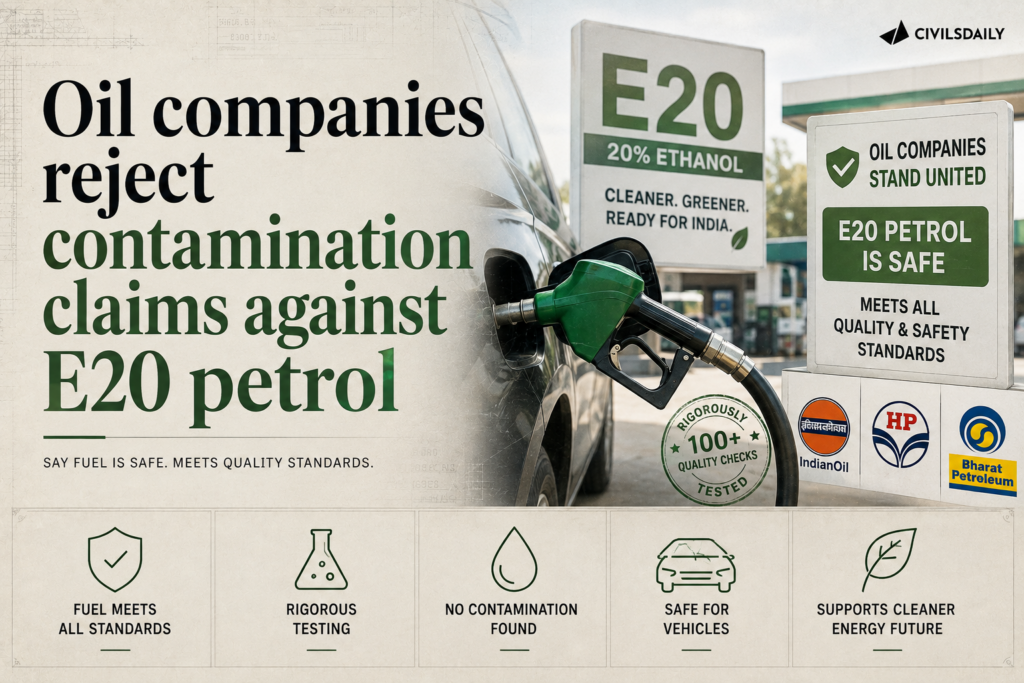
  • Oil companies reject contamination claims against E20 petrol

    Why in the News

    Oil marketing companies rejected contamination allegations against E20 petrol after pan India testing, highlighting concerns over fuel quality, engine compatibility and consumer confidence.

    What is the Ethanol Blending Programme?

    • Objective: Reduce crude oil import dependence, improve energy security and support farmers.
    • E20: Petrol containing 20% ethanol.
    • India achieved the E20 blending target ahead of its earlier 2030 deadline.
    • Key Feedstocks: Sugarcane and molasses. Maize, and Surplus rice and other approved agricultural feedstocks

    Technical Trade-offs

    • Lower energy density: May reduce fuel economy.
    • Engine compatibility: Older vehicles may require compatible components.
    • Higher octane: Ethanol has a high octane rating and can improve combustion characteristics.

    “[2020] According to India’s National Policy on Biofuels, which of the following can be used as raw materials for the production of biofuels?
    1. Cassava
    2. Damaged wheat grains
    3. Groundnut seeds
    4. Horse gram
    5. Rotten potatoes
    6. Sugar beet
    Select the correct answer using the code given below:
    (a) 1, 2, 5 and 6 only
    (b) 1, 3, 4 and 6 only
    (c) 2, 3, 4 and 5 only
    (d) 1, 2, 3, 4, 5 and 6

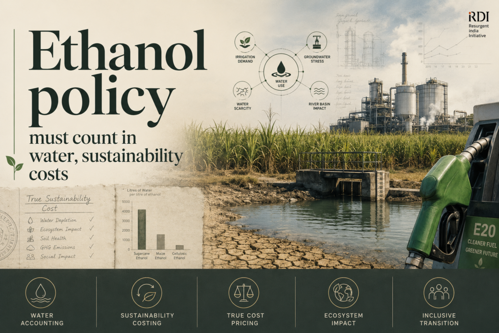
  • Ethanol policy must count in water, sustainability costs

    Why in the News

    India has achieved nearly 20% ethanol blending (E20) in petrol by 2025, making it one of the world’s largest biofuel programmes. As the blending target is achieved, attention is shifting from quantity to the programme’s water use, life cycle emissions and energy efficiency.

    What is the E20 Ethanol Blending Programme?

    1. Definition: E20 is petrol blended with 20% ethanol.
    2. Progress: Ethanol blending increased from about 1.5% in 2013-14 to nearly 20% in 2025, with annual consumption of around 700 crore litres.
    3. Benefits: Reduces crude oil imports, boosts farmers’ income and strengthens energy security. Ethanol is often described as a low-carbon fuel because sugarcane absorbs atmospheric carbon dioxide during growth.

    What is Energy Return on Energy Invested (EROEI)?

    1. Definition: EROEI measures the usable energy obtained from a fuel relative to the energy spent producing it.
    2. Sugarcane Ethanol: EROEI of about 2 to 4 due to efficient bagasse based distilleries.
    3. Grain Ethanol: EROEI ranges from 1.2 to 2 because of higher fossil fuel inputs.
    4. Significance: Higher EROEI indicates a more energy efficient fuel.

    Why is water the biggest concern?

    1. High Water Demand: Estimates by the Commission for Agricultural Costs and Prices and NITI Aayog suggest that sugarcane requires 1,500 to 2,500 mm of water during cultivation.
    2. Large Water Footprint: Producing one litre of sugarcane ethanol may consume 2,000 to 3,500 litres of water.
    3. Groundwater Stress: Major sugarcane growing states already face groundwater depletion.
    4. Resource Trade-off: Excessive ethanol production may replace oil dependence with freshwater dependence.
    5. Distorting Subsidies: Subsidised electricity and fertilisers encourage over extraction of groundwater and excessive fertiliser use. Subsidised urea promotes overuse of nitrogen fertilisers.

    What are the other challenges?

    1. Lower Energy Density: Ethanol contains about 21 MJ/litre, compared to 32 MJ/litre for petrol, reducing fuel efficiency by about 6 to 7% under E20 blends. However, ethanol has a much higher octane rating, allowing engines specifically calibrated for higher ethanol blends to achieve more efficient combustion and partially offset this disadvantage. The overall outcome depends on engine design rather than fuel properties alone.
    2. Life Cycle Emissions: Sugarcane ethanol can reduce emissions by 50 to 70%, while grain ethanol offers 20 to 50% reduction, depending on production methods.
    3. Vehicle Compatibility: E20 can corrode certain engine components in older vehicles. Vehicles manufactured from April 2023 onwards are required to be E20 compatible.

    Conclusion

    India’s ethanol programme represents an important step towards greater energy security, but its long-term success will depend on aligning environmental objectives with sound economics. A resilient biofuel strategy must be guided by transparent life-cycle carbon accounting, rigorous assessment of water use, technology-neutral incentives and market signals that reflect the true value of natural resources.

    PYQ Relevance

    [2020] According to India’s National Policy on Biofuels, which of the following can be used as raw materials for the production of biofuels?
    1. Cassava

    2. Damaged wheat grains

    3. Groundnut seeds

    4. Horse gram

    5. Rotten potatoes

    6. Sugar beet
    Select the correct answer using the code given below:
    (a) 1, 2, 5 and 6 only (b) 1, 3, 4 and 6 only (c) 2, 3, 4 and 5 only (d) 1, 2, 3, 4, 5 and 6

  • SC order on mining around Ramsar wetland sites

    Why in the News

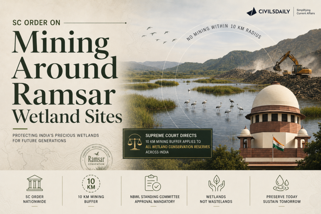
    The Supreme Court has clarified that its earlier direction restricting mining within a 10 km radius of the Asan Wetland Conservation Reserve now applies to all Wetland Conservation Reserves across India. Mining in such areas will require prior approval from the competent authority.

    What did the Supreme Court clarify?

    • Nationwide Application: The 10 km mining safeguard around the Asan Wetland Conservation Reserve will now apply to all Wetland Conservation Reserves.
    • Uniform Principle: The Court held that the protection should apply uniformly across the country.
    • Case Background: The clarification came while hearing an application filed by the Himachal Pradesh Government.
    • State’s Argument: Himachal Pradesh contended that Wetland Conservation Reserves do not have a statutory buffer zone unlike national parks.
    • Further Direction: The Court asked the National Board for Wildlife (NBWL) or the Ministry of Environment, Forest and Climate Change (MoEFCC) to examine whether the Asan Wetland extends into Himachal Pradesh.

    What is the Asan Wetland Conservation Reserve?

    • Location: Situated at the confluence of the Asan and Yamuna rivers in Uttarakhand.
    • Ramsar Status: Declared a Ramsar Site in 2020.
    • Ecological Importance: Supports migratory waterbirds and rich aquatic biodiversity.
    • Judicial Protection: Mining within a 10 km radius requires prior clearance from the NBWL or MoEFCC.

    What are Ramsar Sites?

    • Definition: Wetlands designated under the Ramsar Convention on Wetlands (1971) for their international ecological importance.
    • India’s Membership: India became a party to the Convention in 1982.
    • Current Status: India has 101 Ramsar Sites, the highest in Asia.
    • Significance: Ramsar designation commits countries to maintain the ecological character of wetlands but does not itself create a separate statutory protection regime.

    What is the legal position on mining near wetlands?

    • No Statutory Buffer: The Ramsar Convention and the Wetlands (Conservation and Management) Rules, 2017 do not prescribe a fixed buffer zone around wetlands.
    • 2010 Rules: Earlier rules listed prohibited activities and required prior approval for activities within the wetland’s zone of influence.
    • 2017 Rules: Replaced the earlier framework with a decentralised system led by State Wetland Authorities.
    • Judicial Safeguard: The Supreme Court’s ruling fills this regulatory gap by requiring prior clearance for mining near Wetland Conservation Reserves.

    [2022] Consider the following pairs: Wetland/Lake — Location
    1. Hokera Wetland — Punjab
    2. Renuka Wetland — Himachal Pradesh
    3. Rudrasagar Lake — Tripura
    4. Sasthamkotta Lake — Tamil Nadu
    How many pairs given above are correctly matched?
    (a) Only one pair

    (b) Only two pairs

    (c) Only three pairs

    (d) All four pairs

  • Glaw Lake becomes Arunachal Pradesh’s first Ramsar site

    Why in the News

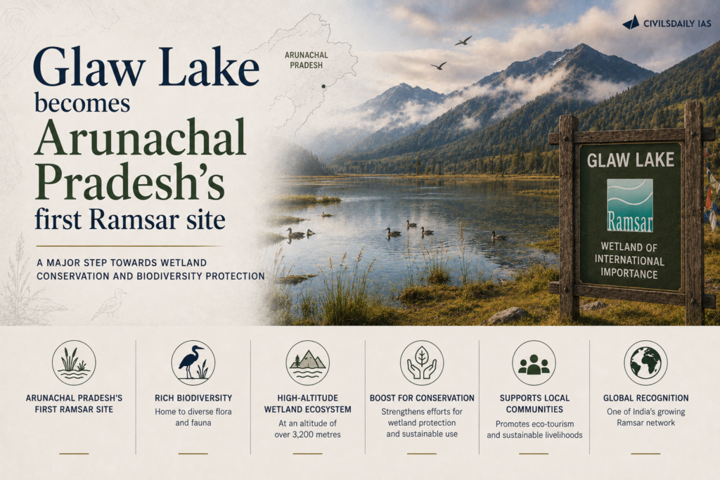
    Glaw Lake has been designated as Arunachal Pradesh’s first Ramsar Site, making it the state’s first Wetland of International Importance under the Ramsar Convention.

    What is the Ramsar Convention?

    • International treaty: An intergovernmental treaty for the conservation and wise use of wetlands.
    • Adopted: 2 February 1971 at Ramsar, Iran.
    • Came into force: 1975.
    • Objective: Promote the conservation and sustainable use of wetlands through national action and international cooperation.
    • India: A Contracting Party to the Convention.

    What is a Ramsar Site?

    • A wetland designated under the Ramsar Convention for its international ecological importance.
    • Selected based on criteria such as:
      • Unique wetland ecosystems.
      • Biodiversity significance.
      • Habitat for threatened species.
      • Importance for migratory waterbirds.

    Why is Glaw Lake Significant?

    • Location: Arunachal Pradesh.
    • First Ramsar Site: It is the first Wetland of International Importance from the state.
    • Recognition: Enhances conservation of the Eastern Himalayan wetland ecosystem.
    • Implementation: Designated under the Ramsar Convention with the involvement of the Ministry of Environment, Forest and Climate Change (MoEFCC) and the Wetlands Division.

    [2019] With reference to Wetlands, consider the following statements:
    1. Under Ramsar Convention, it is mandatory on the part of the Government of India to protect and conserve all the wetlands in the territory of India.
    2. They are covered with hydric soils.
    3. Wetlands are often referred to as Kidneys of the Earth.
    Which of the statements given above is/are correct?

    [A] 1 and 2 only

    [B] 2 and 3 only

    [C] 1 and 3 only

    [D] 1, 2 and 3

  • Why floods in Kerala are becoming more severe

    Why in the News

    Recurrent severe flooding in Kerala is traced to how the land and rivers have been altered, not rainfall alone. The tension is between treating floods as a natural disaster and recognising them as a man made outcome.

    What is driving the flood intensity?

    1. River siltation: Sediment build up reduces the carrying capacity of rivers.
    2. Dam storage loss: The extremely heavy rains have increased the water level in all dams, run by both the state electricity board and the irrigation department. A Comptroller and Auditor General (CAG) audit found major storage loss at reservoirs due to sedimentation, including 47% at Kallarkutty.
    3. Wetland shrinkage: Paddy and wetland area fell from 7.93 lakh hectares in 1979 to 1980 to 1.80 lakh in 2023 to 2024.
    4. Concretisation: Hard surfaces from urbanisation alter natural drainage. During heavy rains, these impervious surfaces channel stormwater rapidly into nearby rivers and streams, causing water levels to rise within hours.

    Why do these factors worsen floods?

    1. Reduced buffer: Lost wetlands and paddy no longer absorb excess water. Paddy fields, marshlands and wetlands, are known for absorbing a huge volume of rainfall
    2. Faster runoff: Concrete surfaces speed runoff into swollen rivers.
    3. Lower channel capacity: Silted rivers overflow at lower volumes.

    What is the state’s response?

    1. Desilting: The government plans desilting of rivers and reservoirs.
    2. Asset register: An asset register will be prepared for rivers, streams and lakes and land auditing is proposed to prevent encroachment of rivers
    3. Land use: Restoration of paddy and wetland is under consideration.

    Conclusion

    Kerala’s floods are the product of altered hydrology as much as heavy rain. The unresolved task is reversing decades of wetland loss and unplanned construction.

    Back2Basics

    Manufactured sand

    Manufactured sand, or M-sand, is an artificial fine aggregate made by crushing hard rocks like granite, basalt, or gneiss into small, sharp grains. It serves as a strong, eco-friendly replacement for natural river sand in modern construction.

    How It Is Made

    1. Quarrying and Blasting: Hard rock is pulled out from quarries.
    2. Primary and Secondary Crushing: Large rocks go through jaw or cone crushers to break down into smaller pieces.
    3. Shaping and Sizing: Vertical Shaft Impact (VSI) crushers smash and shape the particles into angular, cubical forms.
    4. Screening and Washing: Sieves sort the grain sizes, and water washes away excess rock dust and micro-fines.

    Benefits of Manufactured Sand

    1. No Impurities: Free of clay, silt, and organic trash found in riverbeds.
    2. High Strength: Sharp, angular edges interlock tightly, giving concrete better bonding and compression strength.
    3. Eco-Friendly: Stops harmful river dredging that ruins water life and river banks.
    4. Consistent Quality: Made in factories with strict size controls instead of relying on nature.

    PYQ Relevance

    [UPSC 2024] Flooding in urban areas is an emerging climate-induced disaster. Discuss the causes of this disaster. Mention the features of two such major floods in the last two decades in India. Describe the policies and frameworks in India that aim at tackling such floods.

    Linkage: The PYQ examines the causes of urban flooding and India’s policy response to flood disasters. Kerala shows how wetland loss, river siltation, concretisation and altered land use intensify floods despite heavy rainfall, highlighting the need for ecosystem-based flood management.
  • The road ahead for the Asiatic lion as its range spreads

    Why in the News

    The Asiatic lion population has recovered strongly but is increasingly living outside protected areas. The tension is between a conservation success in numbers and the rising conflict and risk that dispersal brings.

    What is the Asiatic lion?

    1. Endemic species: The Asiatic lion (Panthera leo persica) survives only in and around the Gir landscape of Gujarat.
    2. Status change: The International Union for Conservation of Nature (IUCN) moved it from Critically Endangered to Endangered.
    3. Single population: The entire wild population is concentrated in one region, making it vulnerable to a single event.

    How has the population and range changed?

    1. Recovery: Numbers grew from about 100 to 150 six decades ago to over 1,000 today.
    2. Dispersal: Nearly half the lions now live outside protected areas.
    3. Satellite groups: For the first time, data shows that more than half—497 lions—now live outside the core Gir protected areas in nine distinct satellite populations spread across 11 districts, spanning a territory of 35,000 square kilometers.

    Why does the spread create new risks?

    1. Habitat threat: A proposed limestone mine in the Babarkot corridor threatens a dispersal route.
    2. Disease risk: Past outbreaks of Canine Distemper Virus and babesiosis killed many lions.
    3. Green Status: The species remains assessed as “largely depleted” despite the numeric recovery.

    Back2Basics: Asiatic Lion (Gir)

    1. IUCN status: Endangered.
    2. Legal protection: Listed in Schedule I of the Wild Life (Protection) Act, 1972.
    3. Habitat: Gir National Park and Wildlife Sanctuary and surrounding landscape in Gujarat.
    4. Significance: Gir is the only natural home of the wild Asiatic lion.

    “[2024] Consider the following statements:
    1. Lions do not have a particular breeding season.
    2. Unlike most other big cats, cheetahs do not roar.
    3. Unlike male lions, male leopards do not proclaim their territory by scent marking.
    Which of the statements given above are correct?
    (a) 1 and 2 only
    (b) 2 and 3 only
    (c) 1 and 3 only
    (d) 1, 2 and 3

  • New study finds global warming is accelerating, with the 1.5 degree Celsius breach projected by 2030

    Why in the News

    A study in the journal Geophysical Research Letters reports evidence that global warming is accelerating, not merely continuing. After removing natural noise from five temperature datasets, the authors find the last decade warmed faster than any previous decade on record, and project the 1.5 degree Celsius threshold being breached by 2030.

    What is the 1.5 degree Celsius threshold?

    1. Paris target: Under the Paris Agreement, 2015, countries agreed to hold warming well below 2 degrees Celsius above pre industrial levels and to pursue efforts to limit it to 1.5 degrees Celsius.
    2. Why 1.5 matters: Beyond 1.5 degrees Celsius, risks of extreme heat, sea level rise, and ecosystem collapse rise sharply, making it the central guardrail of climate policy.

    What are aerosols and the masking effect?

    1. Aerosols: Aerosols are tiny particles from sources such as burning fossil fuels that reflect sunlight and exert a cooling effect on the atmosphere.
    2. How cooling works: Light-colored particles bounce sunlight back into space and help make clouds brighter, which lowers temperatures.
    3. The cooling mask: This pollution has acted like an invisible shield, hiding a portion of the total heat trapped by greenhouse gases
    4. Unmasking: As pollution controls cut aerosols, their cooling effect fades and the full warming from greenhouse gases is felt, an effect the study describes as a disappearing cooling mask.

    Why is measuring acceleration difficult?

    1. Noisy temperatures: Global temperatures fluctuate year to year because of natural factors like volcanic eruptions and changes in solar activity. (Volcano noise includes the seismic vibrations, audible sounds, and infrasound produced by subsurface magma movement, degassing, and eruptions. Solar noise refers to intense bursts of radio waves and energetic emissions naturally broadcast by the Sun.)
    2. Masked trend: These events can temporarily hide the underlying human caused warming, making it hard to prove the rate itself is rising.

    How did the study establish acceleration?

    1. Multiple datasets: The authors analysed five major global temperature datasets to avoid relying on any single record.
    2. Statistical subtraction: They used statistical methods to remove the influence of volcanic and solar noise, isolating the human driven trend.
    3. High confidence: After removing the noise, they were more than 98% certain the jump in warming rate was real rather than a short lived fluctuation, dating the change to around 2015.
    4. Timing: This change or acceleration in the rate of warming was identified to have begun around
      2015 .

    Why does the faster pace matter?

    1. Shrinking timeline: Under the earlier, slower rate, the world expected more time before breaching 1.5 degrees Celsius, and the accelerated pace brings the breach forward to 2030.
    2. Twin drivers: Greenhouse gas emissions remain the primary cause, while falling aerosol pollution adds to the acceleration.

    What are the challenges to limiting warming to 1.5 degrees Celsius?

    1. Continued emissions growth: Global carbon dioxide emissions remain near record highs, driven by fossil fuel use in power, industry, and transport.
    2. Aerosol paradox: Cutting air pollution saves lives but removes a cooling effect, accelerating near term warming.
    3. Shrinking carbon budget: The remaining budget consistent with 1.5 degrees Celsius is small and shrinks with every year of high emissions.
    4. Slow energy transition: Renewable growth has not yet displaced fossil fuels fast enough to cut absolute emissions.
    5. Feedback loops: Melting ice, thawing permafrost, and forest loss release additional carbon and reduce reflectivity, reinforcing warming.
    6. Finance and equity gaps: Developing countries lack the finance and technology transfer needed to decarbonise while meeting development needs.

    Conclusion

    The study reframes the problem from steady warming to an accelerating one, advancing the likely 1.5 degree Celsius breach to 2030. The central unresolved issue is that cleaning the air removes a cooling shield, so only deep and sustained cuts in greenhouse gases can slow the pace.

    Back2Basics:

    Paris Agreement

    1. Adopted: 2015 at the 21st Conference of the Parties (COP21), entering into force in 2016.
    2. Convening body: United Nations Framework Convention on Climate Change (UNFCCC).
    3. Core goal: Limit warming well below 2 degrees Celsius, pursuing 1.5 degrees Celsius above pre industrial levels.
    4. Mechanism: Nationally Determined Contributions, updated every five years, with a global stocktake to assess collective progress.

    PYQ Relevance

    [UPSC 2022] Discuss global warming and mention its effects on the global climate. Explain the control measures to bring down the level of greenhouse gases which cause global warming, in the light of the Kyoto Protocol, 1997.

    Linkage: The question examines the causes, impacts and mitigation of global warming through international climate frameworks. The article adds recent evidence that global warming is accelerating, highlighting the need for faster emission cuts to achieve Paris Agreement goals.

  • National Board for Wildlife clears the Panari hydropower project in the Panna Ranipur tiger corridor

    Why in the News

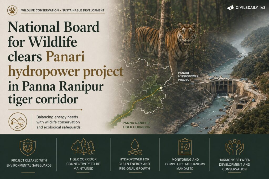
    The Standing Committee of the National Board for Wildlife (NBWL) recommended wildlife clearance for the 1,800 MW Panari Pumped Storage Hydropower Project in the Panna-Ranipur Tiger Corridor, despite concerns that it could fragment a critical wildlife corridor.

    How does a Pumped Storage Hydropower Project (PSH) work?

    • Uses two reservoirs at different elevations.
    • During low electricity demand, water is pumped to the upper reservoir.
    • During peak demand, water is released to generate electricity.
    • Acts as a grid-scale energy storage system for renewable energy.

    What is the Panna-Ranipur Tiger Corridor?

    • Connects Panna Tiger Reserve (Madhya Pradesh) with Ranipur Tiger Reserve (Uttar Pradesh).
    • Facilitates movement of tigers, leopards, and sloth bears.
    • Ensures genetic exchange and healthy wildlife populations.
      • A wildlife corridor is a natural passage connecting fragmented habitats, enabling movement, migration, breeding, and genetic exchange among wildlife populations.

    Why was the Project Cleared?

    • NBWL Standing Committee approved it based on recommendations of:
      • National Tiger Conservation Authority (NTCA)
      • Wildlife Institute of India (WII)
    • Clearance is subject to mitigation measures.

    Concerns

    • Corridor fragmentation affecting wildlife movement.
    • Increased human-wildlife conflict.
    • Loss of habitat connectivity and genetic diversity.
    • Cumulative impacts of multiple infrastructure projects.

    Mitigation Measures

    • Construction of three 30-metre-wide wildlife overpasses.
    • Relocation of muck dumping and project facilities outside the corridor.
    • Realignment of project infrastructure to reduce habitat disturbance.

    Back2Basics: Panna Tiger Reserve

    1. Designation: Tiger reserve and UNESCO Biosphere Reserve, in Madhya Pradesh.
    2. Location: Panna and Chhatarpur districts, on the Vindhyan ranges along the Ken River.
    3. Distinction: Site of a successful tiger reintroduction after its tiger population was lost around 2009.
    4. Linked project: Adjoins the Ken Betwa river linking project, India’s first interlinking of rivers.

    “[2020] Among the following Tiger Reserves, which one has the largest area under ‘Critical Tiger Habitat’?
    (a) Corbett
    (b) Ranthambore
    (c) Nagarjunsagar-Srisailam
    (d) Sunderbans

  • Supreme Court extends the 10 km mining buffer to all wetland conservation reserves

    Why in the News

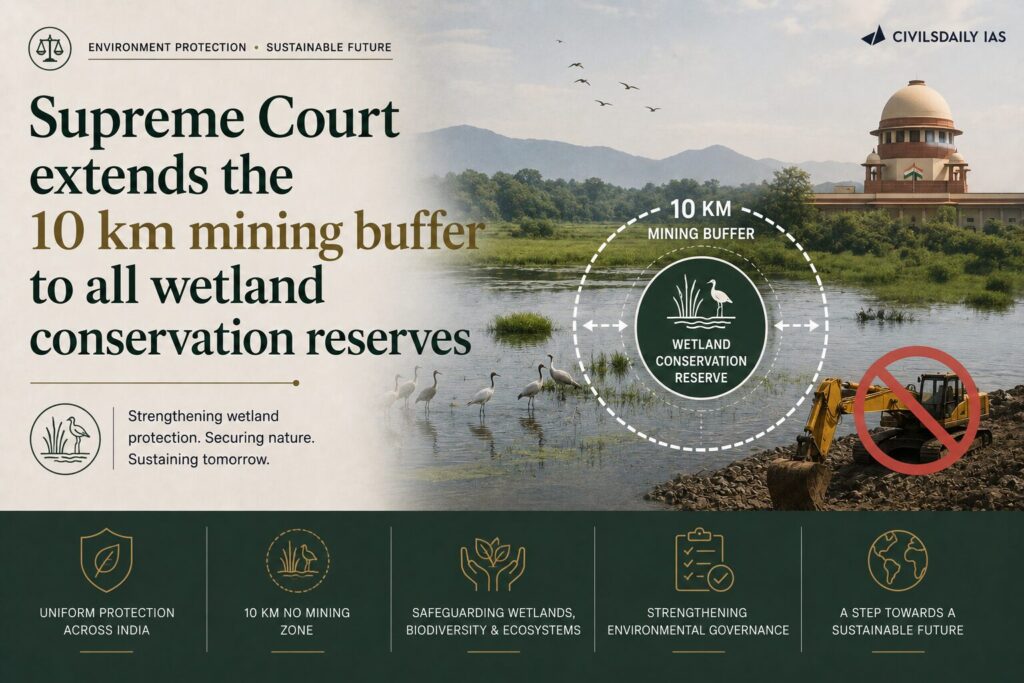
    The Supreme Court clarified that its ban on mining within a 10 km radius of the Asan Conservation Reserve (a Ramsar Site) applies to all Wetland Conservation Reserves across India unless approved by the Standing Committee of the National Board for Wildlife (NBWL) and the Ministry of Environment, Forest and Climate Change (MoEFCC).

    What is a Conservation Reserve?

    • A protected area category created under the Wildlife (Protection) Act, 1972 (through the 2002 Amendment).
    • Covers government-owned land adjacent to National Parks and Wildlife Sanctuaries.
    • Protects habitats and wildlife corridors with community participation.

    What is an Eco-Sensitive Zone (ESZ)?

    • A buffer area notified under the Environment (Protection) Act, 1986 around National Parks and Wildlife Sanctuaries.
    • Restricts activities such as mining, industries, and large-scale construction to reduce ecological impacts.

    Supreme Court Ruling

    • Extended the 10 km mining restriction to all Wetland Conservation Reserves.
    • Recognized wetlands as a distinct ecologically sensitive category.
    • Mining within the buffer requires approval from the NBWL Standing Committee and MoEFCC.

    Why is the Ruling Significant?

    • Protects wetlands from mining and habitat degradation.
    • Recognizes the importance of catchment areas for wetland health.
    • Ensures uniform protection for wetland conservation reserves across India.

    Challenges

    • Incomplete mapping and notification of wetlands.
    • Encroachment and land-use change.
    • Pollution and eutrophication.
    • Weak enforcement by State Wetland Authorities.
    • Development pressures from mining and infrastructure projects.

    Value Addition

    Ramsar Convention

    • International treaty for the conservation and wise use of wetlands.
    • Adopted in 1971 at Ramsar, Iran.
    • India became a Contracting Party in 1982.

    Wetlands (Conservation and Management) Rules, 2017

    • Regulate conservation and management of notified wetlands.
    • Implemented through State Wetland Authorities.

    Back2Basics

    National Board for Wildlife (NBWL)

    • Statutory body under the Wildlife (Protection) Act, 1972.
    • Chairperson: Prime Minister.
    • Standing Committee examines projects affecting protected areas.

    Asan Conservation Reserve

    • Location: Dehradun, Uttarakhand.
    • Ramsar Site: Since 2020 (Uttarakhand’s first Ramsar Site).
    • Formed by the Asan Barrage at the confluence of the Asan and Yamuna rivers.
    • Important wintering habitat for migratory birds.

    “[2019] Consider the following statements:
    1. Under Ramsar Convention, it is mandatory on the part of the Government of India to protect and conserve all the wetlands in the territory of India.
    2. The Wetlands (Conservation and Management) Rules, 2010 were framed by the Government of India based on the recommendations of Ramsar Convention.
    3. The Wetlands (Conservation and Management) Rules, 2010 also encompass the drainage area or catchment regions of the wetlands as determined by the authority.
    (a) 1 and 2 only
    (b) 2 and 3 only
    (c) 3 only
    (d) 1, 2 and 3