💥Join UPSC 2027,2028 Mentorship (August Batch) + XFactor Notes & Microthemes PDF

Subject: Climate Change

1. Global Warming and Issues
2. All about Pollution

  • COVID-19 and its impact on climate talks

    Context

    • Amidst the pandemic, people are breathing cleaner air and are witness to clearer, bluer skies as the human movement has been restricted due to lockdowns imposed by various countries.
    • But while the air may be getting cleaner, the lockdowns are not exactly good news for climate change research.
    • Climate talks are witnessing setbacks in the form of funding cuts, cancelled climate conferences and reduced political will to tackle climate change.

    COVID-19 impacting climate change research

    • The hard paced climate change research has been halted and it might become difficult to restart the conversation around it, even after the pandemic is brought under control.
    • The major projects that were scheduled to gather environmental data have all been cancelled or postponed and the crisis has also cast a shadow on routine monitoring of weather and climate change.
    • Further, because commercial flights are running at a lesser frequency, it has also become difficult to collect ambient temperatures and the wind speed, which is taken by in-flight sensors.
    • The other reason that other research has more or less been halted is because of restrictions including lockdowns, insistence on working from home and other social distancing requirements.

    Scope for a back seat

    • Due to the looming health crisis, human kind’s immediate survival is the biggest concern at the moment.
    • However, completely ignoring environmental policy may not be in humanity’s best interest.
    • Largely we still view the environment, and life on earth, as separate. This separation is a dangerous delusion.
    • We can and must do better if we want to prevent the next infectious pandemic.

    Climate change and infectious diseases are not separate

    • The two are not directly related, which is to say that climate change did not lead to the spread of the coronavirus.
    • However, there is a possibility that climate change could have exacerbated the impact of COVID-19 by making the consequences worse for some humans.
    • For instance, air pollution’s impact on human health could make some consequences of the disease more severe for a few humans.
    • A 2003 study on air pollution and the case fatality rate for SARS showed that people exposed to air pollution were more likely to suffer severe consequences from the disease.
  • Earth Hour

    The Earth Hour, observed annually on the last Saturday of March, was recently celebrated.

    Earth Hour

    • Earth Hour is a worldwide movement organized by the World Wide Fund for Nature (WWF).
    • It is held annually encouraging individuals, communities, and businesses to turn off non-essential electric lights, for one hour, from 8:30 to 9:30 p.m. on a specific day towards the end of March as a symbol of commitment to the planet.
    • It was started as a lights-off event in Sydney, Australia, in 2007.
  • [pib] Methanotrophs: the methane-oxidizing bacteria


    Scientists at Agharkar Research Institute (ARI), Pune have isolated 45 different strains of methanotrophic bacteria which have been found to be capable of reducing methane emissions from rice plants.

    What are Methanotrophs?

    • They are bacteria that metabolize and convert methane into carbon-di-oxide.
    • They can effectively reduce the emission of methane, which is the second most important greenhouse gas (GHG) and 26 times more potent as compared to carbon-di-oxide.
    • In rice fields, Methanotrophs are active near the roots or soil-water interfaces.
    • Besides methane mitigation studies, Methanotrophs can also be used in methane value addition (valorization) studies.
    • Bio-methane generated from waste can be used by the Methanotrophs and can be converted to value-added products such as single-cell proteins, carotenoids, biodiesel, and so on.

    Why rice fields?

    • Rice fields are human-made wetlands and are waterlogged for a considerable period. Anaerobic degradation of organic matter results in the generation of methane.
    • Rice fields contribute to nearly 10% of global methane emissions.
    • Very few studies in the world have focused on Methanotrophs from tropical wetlands or tropical rice fields.
    • Practically no cultures of indigenously isolated Methanotrophs from India were available.
    • Native and relevant Methanotrophs isolated from rice fields can be excellent models to understand the effect of various factors on methane mitigation.

    Must read:

    https://www.civilsdaily.com/news/greenhouse-gas-emissions-from-indian-paddy-fields-very-high-ny-based-study/


  • Climate change and geopolitics converge to yield locust swarms

    Context

    Abnormal rainfall in the Arabian desert and an effect of the Yemen war have revived a menace that could hit Indian crops

    Butterfly effect- a fitting metaphor for locust attack

    • What is the butterfly effect? The butterfly effect occurs when a trivial cause, such as a butterfly fluttering its wings somewhere in an Amazon rainforest, triggers a series of events that end up having a massive impact elsewhere.
      • Edward Lorenz, the American meteorologist who coined the phrase in the early 1960s, came up with it while building a mathematical model to predict weather patterns.
      • Fitting metaphor: It is a fitting metaphor to explain a “plague” that is currently destroying vegetation and livelihoods in East Africa, the Arabian peninsula, Iran, Pakistan and India.

    The impact of the locust attack in the world

    • Impact in Africa: Several countries in Africa and Asia have been dealing with “the curse of good rains”: Massive swarms—called “plagues”—of the desert locust.
      • Swarms as large as 2,400 sq. km, comprising 200 billion insects, have already damaged over 70,000 hectares of crops in Kenya and around 30,000 hectares in Ethiopia.
    • Last month, Pakistan declared a national emergency over locusts.
    • Impact in India: In India, several districts in Gujarat and Rajasthan have been affected.
      • Rajasthan has announced a compensation of ₹13,500 per hectare to affected farmers.
      • While locust swarms continue to plague African countries, for now, the outbreak has tapered down in India with swarms headed back towards Sindh and Balochistan.
    • Possibility of return of the locusts: The expectation is that the locusts will be back in June, by which time their numbers would have grown fivefold.

    What are the locusts and how they form swarms?

    • Solitary creature: The brown-coloured desert locust usually lives as a solitary creature in the desert and bushlands.
    • Transformation and swarm formation: When several of them gather in close proximity, they undergo a dramatic physical transformation, change colour to black and bright yellow, become gregarious, and start moving around in swarms.
    • Contribution of moisture and temperature: Locusts lay their eggs a few inches under the soil in the presence of moisture, which hatch faster under higher temperatures.
      • Similarly, the flightless nymphs mature faster under warmer conditions and, within weeks, turn into adults that can form swarms of hundreds of millions of insects that can fly over 100km per day.
    • The scale of destruction: Each locust can eat its own body weight—around 2-3 grams—every day.
      • Which means that a swarm can consume hundreds of tonnes of vegetation that it encounters every day.

    Change in the behaviour pattern

    • Limited to recession areas: Normally, desert locusts are limited to a recession area enveloping the African Sahel to the west and Rajasthan to the east.
      • After international preventive control measures started in the 1940s, the intensity and spread of these swarms reduced, resulting only in regional plagues.

    What contributed to this year’s infestation?

    • Two factors contributed to this year’s infestation:
      • Abnormal weather conditions.
      • Region’s geopolitics.
    • Abnormal weather conditions: In 2018, two cyclones a few months apart delivered rain to the Rub al Khali, the remote desert called the “Empty Quarter” of the Arabian peninsula.
      • The resulting ephemeral lakes created new breeding grounds for the desert locust in a poorly monitored region.
    • Region’s geopolitics: Insecticide spraying operations were not conducted because of the war in Yemen.
      • The breeding continued before the swarms crossed the Gulf into Iran and the Red Sea to Ethiopia and Somalia in the Horn of Africa.
      • Here, too, conflict and political unrest limited control operations, leading to further breeding.
    • Another cyclone in 2019: In December 2019, another cyclonic storm hit the Horn of Africa, creating conditions for yet more breeding.
      • Today, the situation is dire in Somalia, Ethiopia and Kenya, and is worsening in Uganda and Tanzania.

    How affected countries are responding to the infestation?

    • Pakistan declared national emergency: Across the Persian Gulf, the Pakistani provinces of Balochistan and Sindh were initially affected, and when Punjab was hit, the government declared a national emergency and approached China for assistance.
    • How India is responding? Across the border, several districts in Gujarat and Rajasthan were affected and neighbouring states, including Uttar Pradesh, are now on alert.
      • Cooperation between India and Pakistan: Despite political tensions, Indian and Pakistani locust control officials met almost once a month over the second half of 2019 to exchange information, if not coordinate control efforts.
      • So far, India’s surveillance, preparedness and response have been competent and effective.
      • The national Locust Warning Organization was set up in 1939 and is well connected to international institutions created to manage locust risks.
      • It publishes weekly bulletins and even has a Twitter handle.
      • Bulletins show when locusts were detected, the location, extent and tonnage of insecticide sprayed and the risk of future infestation.
    • China’s preparedness: China is largely protected against locust plagues by geographical barriers, but is relatively vulnerable in the Xinjiang region.
      • Past similar event: Faced with a similar situation a couple of decades ago, the Chinese government had deployed hundreds of thousands of ducks that would eat the locusts in response to the blowing of a whistle.
      • Reports in the Chinese media indicate that Beijing plans to do the same this year.

     The immediate concern in India

    • Factors that could worsen the problem: Climate change, with higher temperatures and changes in the Indian Ocean Dipole, could worsen the locust problem for India in coming years.
    • The problem could overwhelm the capacity to control: The immediate concern is that by June 2020, there will probably be extraordinarily large swarms in India and that these could overwhelm the country’s current capacity to control them.
      • Preparedness measures by the government: The Union government is procuring additional spraying equipment and planning helicopter and drone-based control operations should the need arise.
      • Containing the swarms at India’s border states is crucial, as India’s agricultural heartland lies just beyond.

    Conclusion

    The government should take stock of its preparedness to deal with the imminent locust attack in June take necessary actions to deal with the menace as it could threaten India’s food security and economy.



  • Explained: Marine Heatwave (MHW)


    Scientists have observed unusually high sea surface temperatures (SSTs) in the Pacific Ocean around the western coast of the United States.  This marine heatwave (MHW), covering an area of roughly 6.5 million square kilometres, can affect marine life and lead to droughts in the surrounding regions.

    What are MHWs?

    • We know that heatwaves occur in the atmosphere. We are all familiar with these extended periods of excessively hot weather.
    • However, heatwaves can also occur in the ocean and these are known as marine heatwaves, or MHWs.
    • These marine heatwaves, when ocean temperatures are extremely warm for an extended period of time can have significant impacts on marine ecosystems and industries.

    When do they occur?

    • Heatwaves can happen in summer and also in winter, where they are known as “winter warm-spells”.
    • These winter events can have important impacts, such as in the southeast of Australia where the spiny sea urchin can only colonize further south when winter temperatures are above 12 °C.

    What causes marine heatwaves?

    • Marine heatwaves can be caused by a whole range of factors, and not all factors are important for each event.
    • The most common drivers of marine heatwaves include ocean currents which can build up areas of warm water and air-sea heat flux, or warming through the ocean surface from the atmosphere.
    • Winds can enhance or suppress the warming in a marine heatwave, and climate modes like El Niño can change the likelihood of events occurring in certain regions.
    • MHWs can be caused due to large-scale drivers of the Earth’s climate like the El Niño Southern Oscillation (ENSO).

    Impacts of the MHWs

    • Marine heatwaves affect ecosystem structure, by supporting certain species and suppressing others.
    • For example, after the 2011 marine heatwave in Western Australia the fish communities had a much more “tropical” nature than previously and switched from kelp forests to seaweed turfs.
    • Marine heatwaves can cause economic losses through impacts on fisheries and aquaculture.
    • Temperature-sensitive species such as corals are especially vulnerable to MHWs. In 2016, marine heatwaves across northern Australia led to severe bleaching of the Great Barrier Reef.

    How do we measure marine heatwaves?

    • A marine heatwave occurs when seawater temperatures exceed a seasonally-varying threshold (usually the 90th percentile) for at least 5 consecutive days.
    • Successive heatwaves with gaps of 2 days or less are considered part of the same event.

    Why study MHWs?

    • MHWs are increasing in frequency due to climate change. MHWs increased by 54 per cent in the last 30 years.
    • Despite their potential impact on the health of marine ecosystems, MHWs remain one of the least studied consequences of global warming.

    Way Forward

    • Marine heatwaves clearly have the potential to devastate marine ecosystems and cause economic losses in fisheries, aquaculture, and ecotourism industries.
    • However, their effects are often hidden from view under the waves until it is too late.
    • By raising general awareness of these phenomena, and by improving our scientific understanding of their physical properties and ecological impacts, we can better predict future conditions and protect vulnerable marine habitats and resources.
  • Red Snow in Antarctica


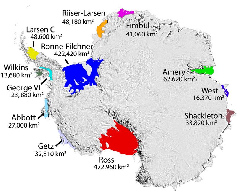
    Over the last few weeks, photographs of “red snow” off the coast of Antarctica’s northernmost peninsula, have gone viral. “Red snow” or “watermelon” is a phenomenon that has been known since ancient times. Now, it raises concerns about climate change.

    Red snow in Antarctica: Why it happens 

    • Aristotle is believed to be one of the first to give a written account of red snow, over 2,000 years ago.
    • What Aristotle described as worms and grub, the scientific world today calls algae.
    • This alga species, Chlamydomonas Chlamydomonas nivalis, exists in the snow in the polar and glacial regions and carries a red pigment to keep itself warm.

    Signs of faster melting 

    • In turn, the red snow causes the surrounding ice to melt faster. The more the algae packed together, the redder the snow.
    • And the darker the tinge, the more the heat absorbed by the snow. Subsequently, the ice melts faster.
    • While the melt is good for the microbes that need the liquid water to survive and thrive, it’s bad for glaciers that are already melting from a myriad of other causes, the study said.
    • These algae change the snow’s albedo — which refers to the amount of light or radiation the snow surface is able to reflect back. Changes in albedo lead to more melting.
  • [pib] Indian National Centre for Ocean Information Services (INCOIS)


    The INCOIS Hyderabad has launched a trio of products for users in the marine realm.

    About INCOIS

    • The institute is an autonomous organisation under the Ministry of Earth Sciences.
    • INCOIS prioritises requests for specific services from its diverse user community that ranges right from fishermen to offshore oil exploration industries.

    Products launched:

    Small Vessel Advisory and Forecast Services System (SVAS)  

    The SVAS is an innovative impact-based advisory and forecast service system for small vessels operating in Indian coastal waters.

    • The SVA system warns users about potential zones where vessel overturning can take place, ten days in advance.
    • The advisories are valid for small vessels of beam width up to 7 m.
    • This limit covers the entire range of beam widths of the fishing vessels used in all the 9 coastal states and union territories of India.
    • The warning system is based on the  ‘Boat Safety Index’ (BSI) derived from wave model forecast outputs such as significant wave height, wave steepness, directional spread and the rapid development of wind at sea which is boat-specific.

    Swell Surge Forecast System (SSFS)

    SSFS is an innovative system designed for the prediction of Kallakkadal/Swell Surge that occurs along the Indian coast, particularly the west coast.

    • Kallakadal/Swell surge are flash-flood events that take place without any noticeable advance change in local winds or any other apparent signature in the coastal environment.
    • Hence the local population remains totally unaware of these flooding events until they actually occur. Such events are intermittent throughout the year.
    • Kallakkadal is a colloquial term used by Kerala fishermen to refer to the freaky flooding episodes and in 2012 UNESCO formally accepted this term for scientific use.
    • Kallakkadal are caused by meteorological conditions in the Southern Ocean, south of 30°S.
    • These swells once generated, travel northward and reach the Indian coasts in 3-5 days time, creating havoc in the coastal areas.
    • The system will now predict Kallakkadal and warnings will be given to concerned authorities at least 2-3 days in advance, which will help the local authorities for contingency plans and to reduce damage.

    Algal Bloom Information Service (ABIS)

    • The increasing frequency of algal blooms is a major concern due to its ill effects on the fishery, marine life and water quality.
    • INCOIS has developed a service for “Detection and Monitoring of Bloom in the Indian Seas”.
    • The target users are fishermen, marine fishery resource managers, researchers, ecologists and environmentalists.
    • The service also complements INCOIS’ marine fishing advisories i.e. Potential Fishing Zone advisories.
    • INCOIS-ABIS will provide near-real-time information on spatio-temporal occurrence and spread of phytoplankton blooms over the North Indian Ocean.
    • In addition, four regions have been identified as bloom hotspots viz.

    a) North Eastern Arabian Sea

    b) coastal waters off Kerala

    c) Gulf of Mannar and

    d) coastal waters of Gopalpur

  • Northern European Enclosure Dam (NEED)


    An extraordinary measure to protect 25 million people and important economic regions of 15 Northern European countries from rising seas has been proposed. It is called Northern European Enclosure Dam (NEED) enclosing all of the North Sea.

    Northern European Enclosure Dam (NEED)

    • The scientists have proposed the construction of two dams of a combined length of 637 km — the first between northern Scotland and western Norway.
    • It would be 476 km and with an average depth of 121 m and maximum depth of 321 m; the second between France and southwestern England, of length 161 km, and average depth of 85 m and maximum depth of 102 m.
    • A/c to scientists, separating the North and Baltic Seas from the Atlantic Ocean is considered to be the “most viable option” to protect Northern Europe against unstoppable sea level rise (SLR).
    • They have also identified other regions in the world where such mega-enclosures could potentially be considered, including the Persian Gulf, the Mediterranean Sea, the Baltic Sea, the Irish Sea, and the Red Sea.

    The rationale behind

    • The concept of constructing NEED showcases the extent of protection efforts that are required if mitigation efforts fail to limit sea level rise.
    • While NEED may appear to be “overwhelming” and “unrealistic”, it could be “potentially favourable” financially and in scale when compared with alternative solutions to fight SLR, the research argues.
    • The researchers classify the solutions to SLR into three categories of taking no action, protection, and managed retreat — and submit that NEED is in the second category.
    • While managed retreat, which includes options such as managed migrations, may be less expensive than protection (NEED), it involves intangible costs such as national and international political instability, psychological difficulties, and loss of culture and heritage for migrants.
    • NEED, the paper says, will have the least direct impact on people’s daily lives, can be built at a “reasonable cost”, and has the largest potential to be implemented with the required urgency to be effective.

    Viability of NEED

    • The researchers have estimated the total costs associated with NEED at between €250 billion and €550 billion.
    • They referred to the costs of building the 33.9-km Saemangeum Seawall in South Korea and the Maasvlakte 2 extension of the Rotterdam harbour in the Netherlands as examples,
    • If construction is spread over a 20-year period, this will work out to an annual expense of around 0.07%-0.16% of the GDP of the 15 Northern European countries that will be involved.
    • Also the construction will “heavily impact” marine and terrestrial ecosystems inside and outside the enclosure, will have social and cultural implications, and affect tourism and fisheries.
  • Urban Heat Islands in India


    A recent study from IIT Kharagpur called “Anthropogenic forcing exacerbating the urban heat islands in India” noted that the relatively warmer temperature in urban areas, compared to suburbs, may contain potential health hazards due to heat waves apart from pollution.

    About the study

    • The research did study the difference between urban and surrounding rural land surface temperatures, across all seasons in 44 major cities from 2001 to 2017.
    • It found evidence of mean daytime temperature of surface urban heat island (UHI Intensity) going up to 2 degrees C for most cities, as analysed from satellite temperature measurements in monsoon and post monsoon periods.
    • Other researchers from elsewhere have also noticed similar rise in daytime temperatures in Delhi, Mumbai, Bengaluru, Hyderabad and Chennai.

    What is an Urban Heat Island?

    • An urban heat island (abbreviated as UHI) is where the temperature in a densely populated city is as much as 2 degrees higher than suburban or rural areas.
    • This happens because of the materials used for pavements, roads and roofs, such as concrete, asphalt (tar) and bricks, which are opaque, do not transmit light, but have higher heat capacity and thermal conductivity than rural areas, which have more open space, trees and grass.
    • Trees and plants are characterised by their ‘evapotranspiration’— a combination of words wherein evaporation involves the movement of water to the surrounding air, and transpiration refers to the movement of water within a plant and a subsequent lot of water through the stomata (pores found on the leaf surface) in its leaves.
    • Grass, plants and trees in the suburbs and rural areas do this. The lack of such evapotranspiration in the city leads to the city experiencing higher temperature than its surroundings.

    Latent impacts

    • UHI s also decrease air quality in the cities, thanks to pollution generated by industrial and automobile exhaust, higher extent of particulate matter and greater amounts of dust than in rural areas.
    • Due to this higher temperature in urban areas, the UHI increases the colonization of species that like warm temperatures, such as lizards and geckos.
    • Insects such as ants are more abundant here than in rural areas; these are referred to as ectotherms.
    • In addition, cities tend to experience heat waves which affect human and animal health, leading to heat cramps, sleep deprivation and increased mortality rates.
    • UHIs also impact nearby water bodies, as warmer water (thanks to the pavements, rooftops and so on) is transferred from the city to drains in sewers, and released into nearby lakes and creeks, thus impairing their water quality.

    Control of UHIs and mitigation

    • Industrialization and economic development are vital to the country, but the control of UHIs and their fallouts are equally vital. Towards this, several methods are being, and can be, tried.
    • One of them is to use greener rooftops, using light-coloured concrete (using limestone aggregates along with asphalt (or tar) making the road surface greyish or even pinkish (as some places in the US have done); these are 50% better than black, since they absorb less heat and reflect more sunlight.
    • Likewise, we should paint rooftops green, and install solar panels there amidst a green background.
    • The other is to plant as many trees and plants as possible

    Why plant more trees?

    Relevant to the present context are:

    • they combat climate change; clean the surrounding air by absorbing pollutant gases (NXOy, O3, NH3, SO2, and others) and trapping particulates on their leaves and bark;
    • they cool the city and the streets; conserve energy (cutting air-conditioning costs by 50%); save water and help prevent water pollution; help prevent soil erosion; protect people and children from UV light;
    • they offer economic opportunities; bring diverse group of people together; encourage civic pride by giving neighborhoods a new identity; mask concrete walls, thus muffling sounds from streets and highways, and eye-soothing canopy of green; and the more a business district has trees, more business follows.
  • ‘Future of Earth, 2020’ Report


    The “The Future of Earth, 2020” Report was recently released.

    About the report

    • The report is released by the South Asia Future Earth Regional Office, Divecha Centre for Climate Change, Indian Institute of Science.
    • The report was prepared with the aim of reducing carbon footprint and halting global warming below 2 degree Celsius by 2050.

    Highlights of the report

    • Five global risks that have the potential to impact and amplify one another in ways that may cascade to create global systemic crisis have been listed by report.
    • It listed the following as five global risks:
    1. failure of climate change mitigation and adaptation
    2. extreme weather events
    3. major biodiversity loss and ecosystem collapse
    4. food crises; and
    5. water crises
    • Offering examples of how the interrelation of risk factors play a role, scientists say extreme heatwaves can accelerate global warming by releasing large amounts of stored carbon from affected ecosystems, and at the same time intensify water crises and/ or food scarcity.
    • The loss of biodiversity also weakens the capacity of natural and agricultural systems to cope with climate extremes, increasing our vulnerability to food crises, they point out.