💥Join UPSC 2027,2028 Mentorship (July Batch) + XFactor Notes & Microthemes PDF

Subject: Geography

  • [3rd September 2024] The Hindu Op-ed: The Disaster Management (Amendment) Bill is knotty

    [3rd September 2024] The Hindu Op-ed: The Disaster Management (Amendment) Bill is knotty

    PYQ Relevance:

    Q Discuss the recent measures initiated in disaster management by the Government of India departing from the earlier reactive approach. (UPSC IAS/2020)

    Q Describe various measures taken in India for Disaster Risk Reduction (DRR) before and after signing ‘Sendai Framework for DRR (2015-2030)’. How is this framework different from ‘Hyogo Framework for Action, 2005’? (UPSC IAS/2018)

    Q How important are vulnerability and risk assessment for pre-disaster management? As an administrator, what are key areas that you would focus on in a Disaster Management System? (UPSC IAS/2013)

    Q Disaster preparedness is the first step in any disaster management process. Explain how hazard zonation mapping will help disaster mitigation in the case of landslides. (UPSC IAS/2019)

    Mentor comment: On August 1, 2024, the Indian government introduced the Disaster Management (Amendment) Bill in the Lok Sabha, aiming to amend the Disaster Management Act of 2005. The Bill centralized disaster management further by granting statutory status to existing bodies like the National Crisis Management Committee and establishing an Urban Disaster Management Authority for major cities. While it seeks to empower the National and State Disaster Management Authorities to prepare disaster plans and create a national disaster database, critics argue it complicates the disaster response framework and could delay actions during emergencies, undermining the Act’s original intent.

    _

    Let’s learn!

    Why in the News?

    The Disaster Management (Amendment) Bill 2024 introduced recently complicates the disaster response framework and could delay actions during emergencies, undermining the Act’s original intent

    What are the key highlights/features of this Bill?

    • Statutory Recognition for Existing Bodies: Grants statutory status to pre-existing organizations such as the National Crisis Management Committee (NCMC) and the High-Level Committee (HLC), enhancing their roles in managing major disasters.
    • Regulatory Powers: Empowers the NDMA to make regulations under the Act with prior approval from the central government, allowing for greater flexibility in disaster management.
    • Disaster Database: Mandates the creation of a disaster database at both national and state levels, which will include information on disaster assessments, fund allocations, expenditures, preparedness and mitigation plans, and risk registers.
    • Empowerment of National and State Authorities: The Bill empowers the National Disaster Management Authority (NDMA) and State Disaster Management Authorities (SDMAs) to directly prepare disaster management plans, replacing the previous role of the National and State Executive Committees.
      • It also establishes UDMAs (Urban Disaster Management Authorities) for state capitals and large cities with municipal corporations, excluding Delhi and Chandigarh.
    • State Disaster Response Force (SDRF): Provides for the constitution of SDRFs by state governments, which will be responsible for disaster response at the state level. The Bill allows states to define the functions and terms of service for these forces.
    • Focus on Disaster Risk Reduction (DRR): Expands the definition of disaster management to include disaster risk reduction, emphasizing proactive measures to reduce vulnerability and enhance preparedness.
    • Penalties for Non-compliance: Introduces provisions allowing the central and state governments to direct individuals to take necessary actions or refrain from actions to mitigate disaster impacts, with penalties for non-compliance capped at ₹10,000.

    Critics around the Disaster Management (Amendment) Bill, 2024:

    • Centralization of Decision-Making: The Bill dilutes the NDRF’s purpose by removing specific uses for the fund, which has historically led to delays in aid distribution during severe disasters, as seen in the delayed response to Tamil Nadu’s needs compared to Karnataka’s.
      • This centralization may hinder prompt action in urgent situations.
    • Restricted Definition of ‘Disaster’: The Bill does not classify ‘heatwaves’ as a notified disaster, despite their increasing frequency and severity in India. This restrictive approach limits the scope for addressing emerging climate-induced challenges effectively.

    Conclusion:

    There is a need to re-visit the Centre’s efforts in addressing the issue of financial preparedness when it comes to the management of and response to disasters. The decision should avoid the single most event of the Wayanad Disaster and needs to have a broader view. After all, a blame game will only move away from realizing the true spirit of cooperative federalism.

    https://www.thehindu.com/opinion/op-ed/the-disaster-management-amendment-bill-is-knotty/article68597815.ece

  • Land-Based Deep Depression causing extreme floods in Gujarat

    Why in the News?

    • Gujarat and parts of Rajasthan are facing severe flooding caused by a land-based deep depression.
      • The unusual formation of this deep depression over land was intensified by moisture influx from soils or the Bay of Bengal and the Arabian Sea.

    What is Land-Based Deep Depression?

    • A land-based deep depression is a type of cyclonic system characterized by a significant drop in atmospheric pressure leading to sustained wind and significant weather impact.
    • They form and intensify over land, which is relatively rare due to the limited availability of moisture.
    • Characteristics:
      • It forms over land or water.
      • Wind Speed ranges from 51 to 62 km/h, just below the threshold for a tropical cyclone (62-88 km/h).
      • Relies on moisture from soil and surrounding environments rather than oceanic sources.
      • It often has an unpredictable path and can cause significant rainfall and localized flooding.

    Implications of Land-Based Deep Depressions

    • These systems can bring prolonged and intense rainfall, leading to widespread flooding, especially in regions unaccustomed to high levels of precipitation.
    • Heavy rainfall can lead to significant soil erosion, affecting agricultural productivity and altering landscapes.
    • Prolonged flooding can cause waterlogging in agricultural fields, leading to soil salinization and reduced fertility.

    PYQ:

    [2012] Consider the following statements:

    1. The duration of the monsoon decreases from southern India to northern India.

    2. The amount of annual rainfall in the northern plains of India decreases from east to west.

    Which of the statements given above is/are correct?

    (a) 1 only

    (b) 2 only

    (c) Both 1 and 2

    (d) Neither 1 nor 2

  • India, Russia sign working plan to handle emergencies

    Why in the News?

    India and Russia signed the working plan of the Joint Russian-Indian Commission on Cooperation in the Field of Emergency Management for 2025-2026.

    Background of the Cooperation:

    • The meeting held in Moscow aimed to strategize the execution of previous agreements between India and Russia, including:
      • The Inter-Governmental Agreement (IGA) for cooperation in the field of Emergency Management was signed in December 2010.
      • The regulation was established in 2013 to create the Indo-Russian Joint Commission for Cooperation in the prevention and elimination of emergency situations.
    • The first meeting of this commission was held in New Delhi in 2016.

    About the Joint Commission on the Cooperation in the Field of Emergency Management for 2025-2026

    • It is an initiative aimed at enhancing collaboration between India and Russia in the area of disaster management and emergency response.
    • The plan covers a two-year period from 2025 to 2026 and focuses on several key areas:
      • Use of Space Monitoring Technologies: To improve risk forecasting and emergency response capabilities.
      • Exchange of Experiences: On responding to large-scale disasters to enhance preparedness and response strategies.
      • Training of Specialists: In fire and rescue operations to build a robust capacity for emergency management.
    • The next meeting is scheduled to be held in India in 2026 to facilitate cooperation and strategic planning in emergency management.

    About the Indo-Russian Joint Commission for Cooperation 

    • Established in 2013, it seeks to formalize and enhance cooperation between India and Russia in the prevention and elimination of emergency situations.
    • It was formed under the framework of the Inter-Governmental Agreement (IGA) for Cooperation in the Field of Emergency Management, signed in December 2010.
    • The commission serves as a platform for India and Russia to collaborate on various aspects of disaster management, including:
      • Prevention and Preparedness: Developing strategies and sharing expertise to prevent and prepare for potential disasters.
      • Response and Recovery: Coordinating efforts to respond to emergencies and support recovery efforts following disasters.
      • Capacity Building: Enhancing the skills and knowledge of personnel involved in emergency management through joint training programs and knowledge exchange.
    • It facilitates a structured approach to managing disasters by leveraging the strengths and resources of both countries.
  • Frequent mass wasting in Tibet a cause for worry in India 

    Why in the News?

    A recent study on frequent mass wasting in Sedongpu Gully and rapid warming raises concerns for India’s Northeast region.

    About Sedongpu Gully:

    • The Sedongpu gully (29°47′7.20′′N, 94°55′24′′E) is in the large bend region of the Yarlung Tsangpo River, located in the southeastern Tibetan Plateau.
    • Debris flows have occurred in two adjacent gullies, namely Sedongpu Gully (SDP) and Zelongnong Gully (ZLN), since the 1950s.

    Mass Wasting in the Gully: Stats and Reasons

    • Since 2017, over 700 million cubic meters of debris have been mobilized in the Sedongpu Gully catchment, with more than 68% of the total 19 identified mass-wasting events occurring in this period.
      • The events include ice-rock avalanches (IRAs), ice-moraine avalanches (IMAs), and glacier debris flows (GDFs).
    • Causes: The increased frequency of mass wasting is attributed to a combination of long-term warming and seismic activity.
      • The area rarely experienced temperatures above 0º C before 2012, but climate change has led to significant warming, destabilizing permafrost and increasing landslide activity.
      • The 6.4-magnitude Nyingchi earthquake in November 2017 also contributed to the destabilization of slopes.

    Implications of sedimentation from mass wasting events:

    • River Choking and Flash Floods: The study warns that the increased sedimentation from mass wasting events could choke river channels, particularly affecting the Brahmaputra River system. 
    • Hydropower Projects: China is planning to construct a massive 60-gigawatt hydropower project on the Tsangpo River, which could exacerbate sedimentation issues downstream.
      • This project is expected to have three times the capacity of the Three Gorges Dam, raising concerns about river management and flood risks in India and Bangladesh.
    • Historical Flood Events: Past incidents, like the 2000 floods in Arunachal Pradesh caused by landslides blocking the Tsangpo River, show how dangerous landslides can be for areas downstream.
      • The chance of similar disasters is higher now because of the ongoing geological instability in the Sedongpu Gully.

    Way forward: 

    • Bilateral and Multilateral Dialogues: India should intensify diplomatic efforts with China, advocating for shared water management strategies and transparency in hydropower projects on the Tsangpo River.
    • Real-Time Monitoring: Establish advanced real-time monitoring systems for the Brahmaputra River and its tributaries, using satellite imagery, remote sensing, and ground-based observations to track landslides, sedimentation, and water flow.

    Mains question for practice:

    Q Discuss the potential risks posed by the increasing frequency of mass wasting events in the Sedongpu Gully and the implications for India’s Northeast region. (150 words) 10M

  • In news: Gumti River

    Why in the News?

    India has refuted allegations that the recent floods in eastern Bangladesh were caused by the opening of the Dumbur dam over Gumti River in Tripura.

    About Gumti River

    Details
    Origin Dumboor Lake, Tripura, India
    Length Approximately 150 kilometers
    Course
    • Flows southward through Tripura, India, and then into Bangladesh;
    • Joins the Meghna River.
    Tributaries
    • Left: Raima, Manu
    • Right: Deo, Khowai
    Terrain Hilly terrain in upper course, fertile plains in lower course
    Biodiversity Supports diverse flora and fauna
    Projects Installed
    • Gumti Hydroelectric Project: Located near Dumbur; Generates hydroelectric power in Tripura; Bangladesh also receives 40 MW.
    • Gumti Irrigation Project: Supports irrigation for agriculture in Tripura, India


    PYQ:

    [2014] Consider the following rivers:

    1. Barak
    2. Lohit
    3. Subansiri

    Which of the above flows / flow through Arunachal Pradesh?

    (a) 1 only

    (b) 2 and 3 only

    (c) 1 and 3 only

    (d) 1, 2 and 3

  • Shiveluch Volcano

    Why in the News?

    The Shiveluch Volcano in Russia erupted following a 7.0 magnitude earthquake off the country’s eastern coast.

    About Shiveluch Volcano

    Details
    Location
    • Kamchatka Peninsula, Russia
    • Approximately 56°39′N 161°21′E
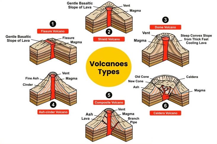
    • Stratovolcano (Composite Volcano)
    • Approximately 3,283 meters (10,771 feet)
    Geological Features Large actively growing lava dome, andesitic to dacitic lava
    Eruption History Frequent eruptions; significant activity in 2005, 2010, and ongoing in 2023-2024
    Hazards Ash plumes, pyroclastic flows, lahars
    Kamchatka Peninsula
    • Lies in far eastern Russia, between the Sea of Okhotsk on the west and the Pacific Ocean and Bering Sea on the east.
    • One of the world’s most concentrated areas of geothermal activity, with about 30 active volcanoes.
    • Approximately 1,200 km long and 480 km across at its widest.
    • Climate: Severe, with prolonged, cold, and snowy winters and wet, cool summers.
    • Regional Capital: Petropavlovsk-Kamchatsky.
    • Kuril Island chain runs from the southern tip of the peninsula to near Japan’s northern Hokkaido Island.
  • What is a Waterspout?

    Why in the News?

    A yacht sank off the coast of Sicily, Italy after being hit by a Waterspout.

    What are Waterspouts?

    • A waterspout is a rotating column of air and mist over a water body.
    • It is a weaker relative of tornadoes and typically lasts for about five minutes, although it can occasionally last up to 10 minutes.
    • Size and Strength:
      • Average diameter: Around 165 feet.
      • Wind speeds: Can reach up to 100 km/hr.
    • Waterspouts are more common in tropical waters but can form anywhere with high humidity and relatively warm water temperatures compared to the overlying air.

    Types of Waterspouts:

    • Tornadic Waterspouts
        • These are actual tornadoes that either form over water or move from land to water.
    • They are associated with severe thunderstorms and can be accompanied by high winds, large hail, and dangerous lightning.
    • Fair-Weather Waterspouts:
      • These are more common and form only over water during fair weather.
      • They are generally smaller and less dangerous than tornadic waterspouts.

    PYQ:

    [2020] Consider the following statements:

    1. Jet streams occur in the Northern Hemisphere only.

    2. Only some cyclones develop an eye.

    3. The temperature inside the eye of a cyclone is nearly 10ºC lesser than that of the surroundings.

    Which of the statements given above is/are correct?

    (a) 1 only

    (b) 2 and 3 only

    (c) 2 only

    (d) 1 and 3 only

  • [pib] FloodWatch India Version 2.0 App

    Why in the News?

    The Union Ministry of Jal Shakti has launched Version 2.0 of the ‘FloodWatch India’ mobile application.

    About FloodWatch India Version 2.0

    • FloodWatch India Version 2.0 is a mobile application developed by Central Water Commission (CWC) under the Union Ministry of Jal Shakti.
    • The app provides real-time information and forecasts related to flood situations across India.
    • It now covers 592 flood monitoring stations, up from 200 in the previous version, offering a more comprehensive overview of flood conditions.
    • The app includes information on the storage positions of 150 major reservoirs in India, aiding in flood management.
    • Key features include:
      • It provides real-time river flow data and flood forecasts up to 7 days in advance.
      • Users can view state-wise and basin-wise flood forecasts and advisories.
      • The app uses satellite data analysis, mathematical modelling, and real-time monitoring to ensure accurate and timely flood information.
      • The app is available in English and Hindi and offers both readable and audio broadcast formats.

    PYQ:

    [2016] The frequency of urban floods due to high intensity rainfall is increasing over the years. Discussing the reasons for urban floods, highlight the mechanisms for preparedness to reduce the risk during such events.

  • What is the Nankai Trough?  

    Why on the News?

    Japanese authorities have warned its citizens of a ‘megaquake’ and large tsunamis along the Nankai Trough.

    What is the Nankai Trough?

    • The Nankai Trough is an extensive subduction zone, nearly 900 km long.
    • It is the place of collision of the Eurasian Plate over the Philippine Sea Plate.
    • This trough has a history of producing large earthquakes approximately every 100 to 150 years.
    • The most recent Nankai Trough quake happened in 1946 with magnitude 8.0 tremor and 6.9 metre tsunami, killing 1,330 people.

    Potential for a Megaquake: 

    • Japan’s researchers estimated in January 2022 that there is a roughly 70% chance of a magnitude 8-9 megaquake striking the Nankai Trough within next 30 years.
    • Such a quake could affect a vast region stretching from central Shizuoka, about 150 km south of Tokyo, to southwestern Miyazaki.

    PYQ:

    [2014] Explain the formation of thousands of islands in Indonesian and Philippines archipelagos.

  • What is the Perseid Meteor Shower?

    Why in the News?

    The Perseid meteor shower, which began in July, is currently at its peak activity from August 11 to 13, 2024.

    About Perseid Meteor Shower

    Details
    Origin Named after the constellation Perseus, from which the meteors appear to originate.
    Cause Caused by debris left behind by Comet Swift-Tuttle as it orbits the Sun.
    How It Occurs
    • Consists of ice, rock, and dust particles shed by Comet Swift-Tuttle.
    • Earth passes through this debris field annually between mid-July and late August.
    • Particles enter Earth’s atmosphere at around 214,000 km/h, causing them to heat up and create bright streaks of light.
    Discovery The connection between the Perseid meteor shower and Comet Swift-Tuttle was established in 1862 by Lewis Swift and Horace Tuttle.
    Historical Observations Observed for centuries, with records dating back to ancient Chinese, Japanese, and European civilizations.
    Impact of Earth’s Gravity
    • Earth’s gravity pulls particles from the debris field, causing them to enter the atmosphere.
    • Larger particles can create fireballs—bright meteors that are more intense and last longer.

    Note: In the 1990s, scientists feared comet Swift-Tuttle might hit Earth or the Moon in 2126, but later calculations confirmed safety for two millennia.

    PYQ:

    [2011] What is the difference between asteroids and comets?

    1. Asteroids are small rocky planetoids, while comets are formed of frozen gases held together by rocky and metallic material.
    2. Asteroids are found mostly between the orbits of Jupiter and Mars, while comets are found mostly between Venus and Mercury.
    3. Comets show a perceptible glowing tail, while asteroids do not.

    Which of the statements given above is/are correct?

    (a) 1 and 2 only
    (b) 1 and 3 only
    (c) 3 only
    (d) 1, 2 and 3