💥Join UPSC 2027,2028 Mentorship (July Batch) + XFactor Notes & Microthemes PDF

Subject: Geography

  • Atmospheric Research Testbed in Central India (ART-CI)

    Why in the news-

    • The Ministry of Earth Sciences has commissioned Atmospheric Research Testbed-Central India (ART-CI) near Bhopal.

    About Atmospheric Research Testbed

    • ART-CI stands as an innovative testbed facility, pioneering the exploration of monsoon convection and land-atmosphere interactions, marking a significant advancement in climate research.
    • The Indian Institute of Tropical Meteorology (IITM), Pune leads ART-CI, operating under the Ministry of Earth Sciences (MoES).

    Mission Objectives

    • ART-CI primarily targets the monsoon trough area, encompassing the Monsoon Core Zone (MCZ), a critical component of the regional climate system.
    • Understanding this zone is paramount for precise weather forecasts and accurate climate modelling within India.

    Monsoon Core Zone (MCZ)


    • MCZ is a region in India stretching from Gujarat to West Bengal in the east.
    • India Meteorological Department demarcates it as an agricultural region where cropping is mostly rainfed.
    • It is the region within the monsoon trough area that plays a central role in the dynamics of the Indian monsoon system.
    • It is characterized by intense convective activity, significant rainfall, and crucial atmospheric interactions that influence the overall behavior of the monsoon.
    • The MCZ typically experiences a concentration of atmospheric processes that drive the onset, progression, and withdrawal of the monsoon rains across the Indian subcontinent.

    Features and Capabilities

    • ART-CI’s development unfolds incrementally as part of the Atmosphere & Climate Research-Modelling Observing Systems & Services (ACROSS) umbrella scheme.
    • The facility will feature an extensive array of remote-sensing and in-situ instruments.
    • These tools would help monitoring of various atmospheric parameters like convection, cloud cover, precipitation, soil moisture, radiation levels, and microphysics.
  • In news: Popocatepetl Volcano

    In the news

    • Popocatepetl, Mexico’s most dangerous active volcano has erupted 13 times in the past day, hurling columns of ash and smoke into the sky.

    About Popocatepetl Volcano

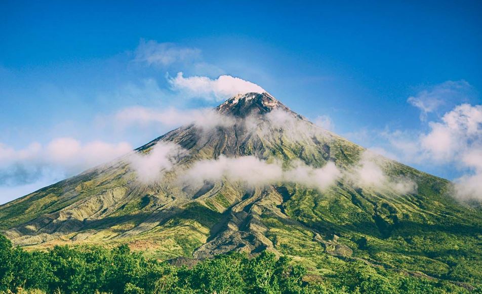
    • Popocatepetl — which means “Smoking Mountain” in the Aztec Nahuatl language — is located in central Mexico roughly 72 km southeast of Mexico City.
    • Popocatepetl is situated in the eastern half of the Trans-Mexican Volcanic Belt, in Central Mexico.
    • It lies on the border between the states of Puebla and Morelos.
    • The summit of Popocatepetl stands at an elevation of about 5,426 meters above sea level, making it the second-highest peak in Mexico after Citlaltepetl (Pico de Orizaba).

    Geological Details

    • Popocatepetl is a stratovolcano (composite volcano) characterized by its steep, conical shape built up by successive layers of volcanic ash, lava flows, and pyroclastic materials.
    • It is one of Mexico’s most active volcanoes, with documented eruptions dating back to the 14th century.
    • In the modern era, significant eruptions have occurred in 1947, 1994, 2000, 2005, and ongoing activity since 2013.
    • The volcano’s eruptions are primarily andesitic to dacitic in composition, characterized by the eruption of viscous lava flows and explosive eruptions producing ash clouds, pyroclastic flows, and lahars (mudflows).

    Try this PYQ from CSE Mains 2021

    Q. Mention the global occurrence of volcanic eruptions in 2021 and their impact on regional environment.

  • Scientists vote down Declaration of Anthropocene Epoch

    In the news

    • The proposal to declare the start of the Anthropocene Epoch, signifying the impact of human activity on Earth’s geological history, has sparked debate among scientists.
    • Despite mounting evidence of human-induced changes to the planet, a recent vote by a scientific committee has rejected the notion.

    Understanding Geological Time

    • Geologic Time Scale: Geoscientists use the Geologic Time Scale (GTS) to measure Earth’s history, categorizing it into aeons, eras, periods, epochs, and ages.
    • Chronostratigraphic Classification: The GTS is based on chronostratigraphic units, marked by significant geological events, shaping the planet’s conditions.

    The Proposed ‘Human Epoch’

    • Holocene Epoch: The Holocene began approximately 11,700 years ago, following the Last Glacial Period, coinciding with the rise of human civilization.
    • Anthropocene Proposal: The Anthropocene concept suggests that human activities have altered Earth significantly, warranting recognition as a distinct geological epoch.

    Understanding the Anthropocene Epoch

    • Coined Term: The Anthropocene epoch was first coined by Nobel Prize-winning chemist Paul Crutzen and biology professor Eugene Stoermer in 2000.
    • Human Impact: The Anthropocene represents the geological time interval characterized by radical changes in the Earth’s ecosystem due to human impact, particularly since the onset of the Industrial Revolution.
    • Environmental Changes: Numerous phenomena associated with the Anthropocene include global warming, sea-level rise, ocean acidification, mass-scale soil erosion, deadly heat waves, and environmental deterioration.
    • Geological Strata: The AWG’s website states that these changes are reflected in a distinctive body of geological strata, with the potential to be preserved into the far future.

    Rejection of the Proposal

    • Scientific Deliberations: Despite the Anthropocene Working Group’s proposal, the Subcommission on Quaternary Stratigraphy voted against declaring the Anthropocene epoch.
    • Criticism and Concerns: Critics argue against defining the Anthropocene based on recent events, questioning the significance of the proposed start date and the boundary between epochs.

    Geological Implications

    • Definition of Epochs: The rejection highlights the challenge of defining geological epochs based on human-induced changes, given the traditional criteria for epoch delineation.
    • Permanence and Recognition: While the vote does not negate human impact on the planet, it raises questions about the formal recognition of the Anthropocene as a distinct epoch.

    Future of the Anthropocene Concept

    • Beyond Epochs: Some scientists propose viewing the Anthropocene as an “event” rather than a formal epoch, acknowledging its transformative nature without conforming to traditional geological classifications.
    • Relevance and Recognition: Regardless of formal classification, the concept of the Anthropocene underscores the profound impact of human activity on Earth’s systems, shaping discussions on environmental stewardship and sustainability.

    Back2Basics: Geological Time Scale

    • The Geological Time Scale is a system used by geologists and palaeontologists to divide Earth’s history into distinct time intervals based on significant geological and biological events.
    • It provides a framework for organizing and understanding the vast expanse of time since the formation of the Earth, approximately 4.6 billion years ago, up to the present day.
    • The Scale is divided into several hierarchical units, including eons, eras, periods, epochs, and ages.

    Here is a simplified overview of the major divisions:

    (1) Eon: The largest division of time on the Geological Time Scale. The history of Earth is typically divided into four eons:

    • Hadean Eon: Represents the earliest stage of Earth’s history, from its formation to around 4 billion years ago.
    • Archean Eon: Covers the period from around 4 billion to 2.5 billion years ago. It includes the formation of the Earth’s crust, the emergence of life, and the development of the first continents.
    • Proterozoic Eon: Encompasses the time between 2.5 billion and 541 million years ago. It includes significant evolutionary developments, such as the emergence of complex multicellular life.
    • Phanerozoic Eon: The current eon, spanning from 541 million years ago to the present. It is further divided into eras.

    (2) Era: The second-largest division of time, encompassing longer periods of geological history within an eon. The Phanerozoic Eon is divided into three eras:

    • Paleozoic Era: Covers the time from 541 million to 252 million years ago. It is known for the diversification of life, including the appearance of complex marine organisms, fish, insects, and the first terrestrial plants.
    • Mesozoic Era: Spans from 252 million to 66 million years ago. It is often referred to as the “Age of Reptiles” and includes the dominance of dinosaurs, as well as the rise of mammals and birds.
    • Cenozoic Era: Extends from 66 million years ago to the present. It is sometimes called the “Age of Mammals” and includes the diversification and proliferation of mammals, the appearance of humans, and the development of modern ecosystems.

    (3) Period: A subdivision of an era, representing a distinct interval of time characterized by specific geological and biological events. For example:

    • The Paleozoic Era is divided into periods such as the Cambrian, Ordovician, Silurian, Devonian, Carboniferous, and Permian.
    • The Mesozoic Era is divided into periods including the Triassic, Jurassic, and Cretaceous.
    • The Cenozoic Era is divided into periods such as the Paleogene, Neogene, and Quaternary.

    (4) Epoch: A smaller subdivision of a period, representing a shorter interval of time. Epochs are defined by more localized geological and biological changes.

    (5) Age: The smallest division of time on the Geological Time Scale. Ages represent relatively brief periods, often defined by specific fossil or rock layers.

  • Singhbhum Craton: Insights from the Archaean Age

    Why in the News?

    • Some recent study about the Singhbhum Craton in India, reveals that explosive volcanic eruptions were frequent around 3.5 billion years ago in regions that are also present in South Africa, and Australia.

    What are Cratons?

    • Cratons are stable, ancient portions of the continental lithosphere, consisting of Earth’s two topmost layers—the crust and the uppermost mantle.
    • Cratons are typically found in the interiors of tectonic plates and are characterized by their ancient crystalline basement rock, often dating back to the Archean Eon.
    • Mantle plume events have played a significant role in the evolution of cratons.

    About Singhbhum Craton:

    • The Singhbhum Craton is a geological region in India.
    • Location: It is located in eastern India, covering parts of the states of Jharkhand, Odisha, and West Bengal. The craton is separated from the Bastar Craton by the Mahanadi Graben and is in the vicinity of two Proterozoic mobile belts: the Satpura Mobile Belt and the Eastern Ghat Mobile Belt.
    • Geological features:
      • The rocks in the Singhbhum Craton are predominantly of Archean age, ranging from Paleoarchean to Paleoproterozoic.
      • It is a part of the larger Indian Shield, which is a stable continental crust that formed during the Archean Eon.
      • The Singhbhum Craton is known for its abundant occurrences of Banded Iron Formations (BIFs), which are closely associated with basic volcanic and ultrabasic intrusive. The craton is also known for its iron ore deposits, which are found in the Iron Ore Group (IOG) and are closely associated with lavas and tuffs.
      • The Singhbhum Craton has undergone regional metamorphism of the amphibolite facies and is believed to have evolved as a consequence of multiple phases of compressive deformation.
      • The craton is made up of multiple pulses of discrete mantle plume events, resulting in a complex geological history.

    Archaean Eon

    • The Archaean Eon, one of the two formal divisions of Precambrian time, began about 4 billion years ago and extended to the start of the Proterozoic Eon.
    • During this period, life on Earth was limited to simple single-celled organisms lacking nuclei, known as Prokaryota.
    • The atmosphere lacked oxygen, and the Earth’s crust had cooled enough to allow the formation of continents.
    • Volcanic activity was considerably higher than today, with numerous lava eruptions.
    • The oldest rock formations exposed on Earth are from the Archaean Eon.
    • The Archaean rock system includes Archaean Gneisses and Schists, which are the oldest metamorphosed rocks found in abundance in regions like the Dharwar district of Karnataka.

    What are the recent key findings?

    • Submarine Mafic Volcanism: The prevalence of submarine mafic volcanic eruptions between 3.5 and 3.3 billion years ago is documented, enriching our understanding of ancient volcanic and sedimentary processes.
    • Geodynamic Insights: Comparative analysis enhances our comprehension of early Earth tectonic activities and surface/atmospheric processes during the Archaean.

    Research Methodology Used:

    • Field Studies and Radiometric Dating: Detailed field-based studies coupled with uranium-lead radiometric-age dating were employed to establish geological timelines and understand magma crystallization.
    • Comparative Analysis: The geological similarities between the Singhbhum Craton and counterparts in South Africa and Australia were studied, focusing on volcanic eruption patterns.

    Implications and Significance of the study:

    • Earth’s Formative Years: Insights into Earth’s early tectonic activities contribute significantly to understanding the planet’s formative years.
    • Habitable Conditions: Unique geological features, such as greenstone belts, provide invaluable information about early habitable conditions and the emergence of life.
    • Global Geodynamic Processes: Comparative studies across cratons worldwide facilitate the construction of comprehensive models elucidating ancient geodynamic processes prevalent during the Archaean.
  • What is Humboldt’s Enigma and What does it mean for India?

    Humboldt’s Enigma

    Introduction

    • The question of where biodiversity is concentrated has intrigued explorers and naturalists for centuries. Humboldt has tried to answer this question.

    Humboldt’s Insights

    • Alexander von Humboldt: A polymath of the 18th century, Humboldt recorded diverse natural observations, proposing a relationship between temperature, altitude, humidity, and species distribution.
    • Mountain Exploration: During his exploration of South America, Humboldt studied plant distribution on mountains, noting variations with elevation.
    • Chimborazo Mountain: Humboldt used Chimborazo Mountain in Ecuador as an example, illustrating the concept of mountain diversity.

    What is Humboldt’s Enigma?

    • Sun’s Energy: Tropical areas receive more solar energy, fostering greater primary productivity and biodiversity due to the availability of ecological niches.
    • Mountain Exception: Mountains, despite being outside the tropics, have been an exception to the rule, posing Humboldt’s enigma.

    Biodiversity Drivers

    • Earth’s History, Geography, and Climate: These factors are the primary drivers of mountain diversity.
    • Geological Processes: Mountains serve as ‘cradles’ for new species due to geological processes like uplifts, creating new habitats.
    • Climatic Stability: Climatologically stable mountains act as ‘museums,’ preserving species over time.
    • Coastal Tropical Sky Islands: Examples like the Shola Sky Islands in the Western Ghats exhibit both cradle and museum characteristics.

    Eastern Himalaya: An Anomaly

    • Diversity Beyond Tropics: Eastern Himalaya boasts exceptional diversity, challenging the conventional tropical biodiversity paradigm.
    • Multiple Factors: Climate dissimilarity and geological heterogeneity contribute to high biodiversity.
    • Climate Variability: Different temperature and rainfall levels on the same mountain support diverse biomes.

    Unresolved Questions

    • Complexity of Biodiversity: Numerous factors drive diversification and Humboldt’s enigma in different regions, leading to over a hundred hypotheses.
    • Data Limitations: Fine-scale species occurrence data are lacking, hindering precise explanations.
    • Call for Research: India’s under-studied areas need more extensive research, including the use of genetics, to understand true biodiversity.
    • National Initiatives: Programs like the National Mission on Himalayan Studies and Biodiversity need strengthening to support basic research.

    Conclusion

    • Humboldt’s enigma represents one facet of mountain biodiversity, offering opportunities for study and insights into global climate and landscape change issues.
  • ISRO’s develops 2nd Generation Distress Alert Transmitter (DAT-SG)

    Introduction

    • The Indian Space Research Organisation (ISRO) has pioneered an innovative Distress Alert Transmitter (DAT) to enhance the safety of fishermen at sea.
    • This second-generation DAT, known as DAT-SG, offers advanced capabilities and features, revolutionizing how emergency messages are communicated from fishing boats.

    About Distress Alert Transmitter (DAT-SG)

    • Operational Since 2010: The initial version of DAT became operational in 2010, enabling fishermen to send emergency messages through a communication satellite.
    • Central Control Station: Messages were received at the Indian Mission Control Centre (INMCC), a central control station, where alert signals were decoded to identify the distressed fishing boat.
    • Coordination with MRCCs: The extracted information was then forwarded to Maritime Rescue Coordination Centres (MRCCs) under the Indian Coast Guard (ICG), facilitating coordinated search and rescue operations.
    • Widespread Use: Over 20,000 DATs were deployed and utilized for distress communication.

    Evolution to DAT-SG

    • Technological Advancements: ISRO leveraged advancements in satellite communication and navigation to create the second-generation DAT (DAT-SG).
    • Acknowledgement Feature: DAT-SG now includes an acknowledgement feature, providing assurance to fishermen that their distress alert has been received and that help is on the way.
    • Two-Way Communication: In addition to sending distress signals, DAT-SG can receive messages from control centers. This allows the transmission of advance alerts regarding adverse weather conditions, cyclones, tsunamis, or other emergencies, enabling fishermen to make informed decisions for their safety.
    • Enhanced Fishing Zone Information: DAT-SG also disseminates information about potential fishing zones to fishermen at regular intervals, optimizing their catch and conserving time and fuel.
    • Mobile Connectivity: DAT-SG can be connected to mobile phones via Bluetooth, and messages can be displayed in the fishermen’s native language using a dedicated mobile app.

    Central Control and Coordination

    • Sagarmitra Network: The central control station, INMCC, employs a web-based network management system called Sagarmitra. This system maintains a database of registered DAT-SGs and facilitates real-time access for MRCCs.
    • Real-time Coordination: Sagarmitra enables Indian Coast Guard personnel to swiftly respond to distress calls without delay, enhancing search and rescue operations.
    • Operational 24/7: DAT-SG services are available round-the-clock, ensuring continuous support to fishermen facing emergencies at sea.

    Also read:

    Nabhmitra: Satellite-Based Safety Device for Fishermen

  • How Lakshadweep’s Unique Cultural Landscape developed?

    Lakshadweep

    Introduction

    • PM’s recent trip to Lakshadweep has brought the islands into the national conversation.

    About Lakshadweep

    Details
    Location In the Arabian Sea, off the southwestern coast of India.
    Geographical Formation Formed by coral activities and have a coral atoll structure.
    Formation as UT Formed as a Union Territory of India in 1956.
    Total Islands Comprises 36 islands, including atolls, coral reefs, and submerged banks.
    Inhibition 10 of the 36 islands are inhabited.
    Capital Kavaratti is the capital of the Union Territory.
    Area Total area of 32 sq km.

    Cultural Uniqueness of Lakshadweep

    • Diverse Influences: The islands exhibit a unique blend of cultural influences from Malayalis, Arabs, Tamils, and Kannadigas.
    • Distinct Islamic Practice: The form of Islam practiced here is distinct from the rest of India, reflecting the islands’ diverse ethnic and linguistic heritage.

    Historical Roots: A Pre-Islamic Hindu Society

    • Early Settlers: Scholar Andrew W Forbes suggests that the first settlers were likely Malabari sailors, possibly castaways.
    • Hindu Influence: Evidence points to a pre-Islamic Hindu society, with remnants like buried idols and traditional songs hinting at past Hindu practices.

    Conversion to Islam: A Gradual Transition

    • Arab Influence: Regular contact with Arab merchants and sailors led to the gradual conversion of islanders to Islam, distinct from the Islamic practices in mainland India.
    • Peaceful Introduction of Islam: Historian Mahmood Kooria notes that Islam’s introduction in the region, including Lakshadweep, was marked by minimal political conflict, primarily through commercial interactions.

    Cultural Development: Insulation from Mainland Influences

    • Control by the Arakkal Kingdom: In the 16th century, the islands fell under the Arakkal kingdom of Kannur, Kerala’s only Muslim dynasty.
    • European Interactions: Despite conflicts with European powers, the islands maintained a degree of protection and isolation.
    • British Era: The British rule further insulated Lakshadweep, allowing its culture to evolve distinctly from mainland India.
    • Linguistic Diversity: The islands’ isolation is reflected in their linguistic diversity, with Malayalam, Jazari, and Mahl being the main languages.

    Matrilineal Society: A Unique Aspect of Lakshadweep’s Islam

    • Matriliny in Islamic Society: Lakshadweep’s Islamic society is characterized by matriliny, tracing descent and property through the mother’s line.
    • Anthropological Perspectives: Anthropologist Leela Dube highlights the compatibility of matriliny with Islam in Lakshadweep, contrary to conventional Islamic practices.
    • Kerala’s Influence: Historian Manu Pillai links the matrilineal tradition to Kerala’s cultural patterns, where Nairs and Namboodiris practised matriliny.
    • Broader Indian Ocean Context: Kooria points out that matriliny is common among Muslims in the Indian Ocean region, suggesting a broader cultural context.

    Religious and Sociological Interpretations

    • Islamic Justification for Matriliny: Islanders believe their matrilineal practice aligns with Islam, citing Prophet Muhammad’s life with his first wife, Khadija.
    • Sociological Viewpoint: Dr. N P Hafiz Mohamad emphasizes that the islanders see matriliny as integral to their Islamic practice.

    Conclusion

    • Preservation of Unique Traditions: Lakshadweep’s relative isolation has helped preserve its unique cultural and religious practices.
    • Integration of Diverse Influences: The islands represent a remarkable integration of various cultural and religious influences, forming a distinct identity within the Indian subcontinent.
    • Significance in Broader Indian Ocean Culture: Lakshadweep’s cultural practices, particularly its matrilineal society, highlight the interconnectedness and diversity of cultures across the Indian Ocean region.
  • IIT-D develops India’s first National Landslide Susceptibility Map

    Introduction

    • In the wake of severe monsoon-triggered landslides, IIT Delhi has developed its first National Landslide Susceptibility Map.

    About National Landslide Susceptibility Map

    • High-Resolution Mapping: The map offers a detailed (100 sq. m resolution) overview of landslide susceptibility across India, including previously unrecognized areas.
    • Revealing New Risk Zones: It highlights traditional high-risk areas and uncovers new regions of concern, broadening the scope of landslide monitoring.
    • Innovative Analysis Method: An ensemble machine learning approach was utilized to enhance prediction accuracy and address data gaps in uncharted regions.
    • Advantages of Ensemble Models: This method effectively combines multiple models to provide a more reliable estimation of landslide risks.

    Data Gathering and Analytical Process

    • Extensive Data Compilation: Researchers collated data on around 150,000 landslide incidents from various sources, including the Geological Survey of India.
    • Identifying Contributing Factors: The team pinpointed 16 critical factors influencing landslide susceptibility, utilizing tools like GeoSadak for remote data collection.

    Implications for Disaster Management

    • Tool for Stakeholders: The map serves as a critical resource for government bodies, disaster management authorities, and organizations focused on landslide mitigation.
    • Enhancing Preparedness and Planning: It will facilitate vulnerability assessment, infrastructure planning, and implementation of mitigation measures.

    Need for such map

    • Persistent Hazard: Landslides, affecting a small but significant portion of India, pose a recurrent threat, especially in hilly regions.
    • Challenges in Management: The localized and sporadic nature of landslides has historically hindered effective tracking and prediction, underscoring the need for a comprehensive mapping solution.

    Future Directions and Public Accessibility

    • Developing an Early Warning System: Building on the map, efforts are underway to create a comprehensive Landslide Early Warning System.
    • Infrastructure Vulnerability Cartogram: A cartogram to identify susceptible infrastructure is also in progress.
    • Public Access and Engagement: The map and its data will be accessible through a web interface, promoting public interaction and awareness.
  • Earthquake and Tsunami strikes Central Japan

    japan

    Central Idea

    • On January 1, 2024, a 7.5-magnitude earthquake hit Ishikawa prefecture in Japan, triggering tsunami waves over a meter high.

    Japan’s Geographical Vulnerability

    • Japan’s geographical vulnerability, particularly concerning plate tectonics, is a critical aspect of its environmental and disaster management challenges.
    • The country’s location at the convergence of several major tectonic plates makes it highly susceptible to seismic activities.

    Here’s a detailed look at how plate tectonics contribute to Japan’s geographical vulnerability:

    [1] Convergent Plate Boundaries:

    • Pacific Ring of Fire: Japan is located on the Pacific Ring of Fire, an area with a high level of seismic activity due to the presence of numerous tectonic plate boundaries.
    • Plates Involved: The primary tectonic plates interacting near Japan are the Pacific Plate, the Philippine Sea Plate, the Eurasian Plate, and the North American Plate.
    • Subduction Zones: The Pacific and Philippine Sea plates are subducting beneath the Eurasian and North American plates. This subduction process is a significant source of seismic activity, including powerful earthquakes and volcanic eruptions.

    [2] Earthquake Activity:

    • Frequent Earthquakes: The movement of these plates results in frequent earthquakes. Japan experiences thousands of tremors annually, ranging from minor to catastrophic.
    • Major Earthquakes: Historical events like the 2011 Great East Japan Earthquake and the 1995 Great Hanshin Earthquake demonstrate the potential for massive destruction and loss of life due to Japan’s tectonic setting.

    [3] Tsunami Risk:

    • Generation of Tsunamis: Earthquakes occurring under the sea or along the coast can displace large volumes of water, leading to tsunamis. The 2011 tsunami, triggered by a massive undersea earthquake, caused widespread devastation and the Fukushima nuclear disaster.
    • Coastal Impact: Japan’s extensive coastline makes it particularly vulnerable to tsunamis, which can arrive within minutes of an undersea earthquake, leaving little time for evacuation.

    [4] Volcanic Activity:

    • Volcanic Eruptions: The subduction of the Pacific and Philippine Sea plates not only causes earthquakes but also contributes to significant volcanic activity. Magma generated by the melting of the subducted plate rises to the surface, leading to volcanic eruptions.
    • Active Volcanoes: Japan has over 100 active volcanoes, a direct result of its tectonic setting. Eruptions pose risks to nearby populations and can disrupt air travel and local economies.

    [5] Geological Complexity:

    • Intersecting Faults: The interaction of multiple tectonic plates creates a complex network of faults, increasing the unpredictability and variability of seismic events.
    • Diverse Seismic Phenomena: This complexity leads to a range of seismic phenomena, including deep-focus earthquakes, which occur at greater depths and can affect broader areas.
  • Floods and a ‘preventive measure’ that needs review

    Floods and a 'preventive measure' that needs review - The Hindu

    Central idea 

    Dr. Mani Sivasubramanian emphasizes the long-lasting impact of decisions made after Cyclone Michuang in Chennai, particularly regarding electricity cutoffs. The central idea revolves around the need for accountability in decision-making during crises, highlighting the delicate balance between safety measures and potential hazards for vulnerable populations, such as the elderly. The way forward involves a hierarchical approach, periodic reviews, and fixing responsibility for sub-optimal decisions.

    Key Highlights:

    • Dr. Mani Sivasubramanian, a heart surgeon, author, and social entrepreneur, discusses the long-lasting impact of decisions made after Cyclone Michuang in Chennai.
    • Emphasizes the importance of accountability for decisions with visible and hidden consequences.
    • Raises concerns about the practice of prolonged electricity cutoffs after a natural disaster, especially for vulnerable populations like the elderly.

    Key Challenges:

    • Balancing the need for safety measures, such as electricity cutoffs during cyclones, with potential hazards like accidents and security concerns.
    • The complexity of decision-making during a crisis, requiring a dynamic and evolving approach.
    • Striking a balance between conservative choices and potential complications due to inaction.

    monsoon, monsoons, floods, flood evacuation, WHO, WHO India, World Health  Organization, COVID-19, flood precautions, COVID appropriate behaviours

    Key Terms:

    • Decision accountability
    • Electricity cutoff
    • Vulnerable populations
    • Dynamic balance
    • Cataclysmic disaster
    • Intellectual and analytical judgment

    Key Phrases for good marks in mains:

    • “Consequences of choices should be accounted for.”
    • “Power disruption poses significant hazards, especially for the elderly.”
    • “Decision-making in a crisis is an extreme test of judgment and personal strength.”
    • “Potential cost of mistakes looms large in a decision-maker’s mind.”

    Key Quotes:

    • “There is no objectively ‘safe’ choice; it is a constantly evolving, dynamic balance.”
    • “A bureaucrat should justify and document decisions in real-time for review.”
    • “Complex decision-making should not become a contest of cheap populism.”

    Key Statements:

    • Decision-makers should justify and document choices in real-time.
    • Accountability is crucial, especially when decisions impact millions.
    • Calls for a hierarchy-based approach in decision-making during crises.

    Key Examples and References:

    • Mentions the 2015 floods in Chennai as a reference to the consequences of decision-making during natural disasters.

    Key Facts:

    • In 2021, Tamil Nadu had 13.8 crore people over the age of 60 years.
    • Chennai metropolitan area’s population is estimated to be over 12 million.

    Key Data:

    • 500,000 people in Chennai are above 60 years old, and over 50,000 are aged 80 or above.

    Critical Analysis:

    • Acknowledges the complexity of decision-making during a natural disaster.
    • Emphasizes the need for a balance between safety measures and potential hazards.
    • Advocates for accountability and periodic reviews of decisions.

    Way Forward:

    • Suggests a hierarchy-based approach with scaled levels of responsibility.
    • Proposes involvement of more than one person in major decision-making.
    • Calls for periodic reviews by an oversight team to challenge and reverse questionable choices.
    • Highlights the importance of fixing responsibility for sub-optimal decisions.