💥Join UPSC 2027,2028 Mentorship (July Batch) + XFactor Notes & Microthemes PDF

Subject: Geography

  • India’s Arctic imperative

    Why in the news? 

    The Indian government appears interested in capitalizing on seabed mining and resource exploitation in the Arctic

    About Artice Region:

    • The Arctic region is rich in energy resources, including oil, natural gas, and renewable energy sources such as wind, solar, hydro, geothermal, and tidal power.
    • The Arctic covers an area of approximately 8 million square kilometers, with interests belonging to Denmark, Canada, Iceland, Finland, Russia, Norway, Sweden, and the United States

    The reason behind the growing interest in the Arctic Region:

    • Climate Change Concerns: India’s increased interest in the Arctic stems from scientific data revealing accelerated warming in the region.
    • Trade Route Opportunities: India seeks to capitalize on the opening up of Arctic sea routes, particularly the Northern Sea Route, to enhance its trade efficiency.
    • Geopolitical Considerations: India’s focus on the Arctic is also driven by geopolitical factors, including concerns over China’s expanding presence and Russia’s decisions regarding access to Arctic routes.
    • Historical Engagement: India’s involvement in the Arctic dates back to 1920 with the signing of the Svalbard Treaty.

    Indian Initiatives:

    • Arctic Council: As an Observer in the Arctic Council, India actively participates in various working groups and expert meetings. India’s involvement in these discussions helps in understanding Arctic governance issues and contributes to the development of sustainable policies for the region.
    • INS Himadri: In 2019, India launched its first scientific expedition to the Arctic with the INS Himadri, an ice-class research vessel. The expedition aimed to study climate change, oceanography, and marine biodiversity, furthering India’s expertise in polar research.
    • PAME: India’s commitment to sustainable development in the Arctic is reflected in its engagement with Arctic Council initiatives like the ‘Protection of the Arctic Marine Environment’ (PAME).

    Way Forward – Potential for Collaboration:

    • Green Energy and Clean Industries: India’s current policy emphasizes cooperation with Arctic countries, particularly Norway, in green energy and clean industries. This aligns with India’s goal of positioning itself as a responsible stakeholder in global environmental initiatives.
    • Transformational Partnership: Collaboration with Norway could be transformative for India, offering opportunities for increased participation in Arctic Council working groups
    • Scientific Research and Environmental Protection: A partnership with Norway is expected to focus on scientific research, climate, and environmental protection. These areas align with India’s Arctic Policy pillars, emphasizing the importance of addressing environmental challenges through research and cooperation.
  • Mount Etna’s Volcanic Vortex Rings: A Rare Natural Phenomenon

    Mt. Etna

    Why in the news?

    Mount Etna, located on the east coast of Sicily in Italy recently gained attention for emitting circular rings of vapor from its summit, known as volcanic vortex rings.

    About Mount Etna

    • Mount Etna is located on the east coast of Sicily, Italy.
    • It is an active stratovolcano, characterized by its conical shape formed by layers of hardened lava, ash, and volcanic rocks.
    • It is Europe’s tallest active volcano, standing at approximately 3,329 meters (10,922 feet) above sea level.
    • It is one of the most active volcanoes in the world and has been erupting for thousands of years, with the first recorded eruption dating back to around 1500 BCE.
    • Mount Etna and its surrounding area have been designated as a UNESCO World Heritage Site since 2013, recognizing its geological significance and natural beauty.
    • It boasts five craters responsible for eruptions, alongside numerous vents along its slopes.

    What are Volcanic Vortex Rings?

    • Volcanic vortex rings are a rare phenomenon observed when gas, primarily water vapor, is rapidly released through a vent in the volcano’s crater, forming circular rings of smoke above the mountain.
    • This phenomenon, similar to smoke rings blown by cigarette smokers, occurs when gas is expelled through a nearly perfect circular vent in the crater.
    • These rings can rise in the air for up to 10 minutes but may disintegrate quickly under windy conditions.

    Volcanism in Italy

    • The volcanism of Italy is due chiefly to the presence, a short distance to the south, of the boundary between the Eurasian Plate and the African Plate.
    • Italy is a volcanically active country, containing the only active volcanoes in mainland Europe (while volcanic islands are also present in Greece, in the volcanic arc of the southern Aegean).
    • The lava erupted by Italy’s volcanoes is thought to result from the subduction and melting of one plate below another.
    • Other active volcanoes include Mt. Stromboli and Vesuvius.

    Historical and Recent Observations

    • Etna produces more vapor rings than any other volcano on Earth, making it a hotspot for studying this phenomenon.
    • The occurrence of volcanic vortex rings was first documented in 1724 at Mount Etna and Vesuvius in Italy, and has since been observed at various volcanoes worldwide.
    • Recent observations of this phenomenon have been reported at volcanoes in Alaska, Ecuador, Guatemala, Iceland, Italy, Japan, Vanuatu, New Zealand, and Nicaragua.

    Recent Volcanic Eruptions in News:

    Many of the world’s most active volcanoes are concentrated in the Pacific Ring of Fire, encompassing regions like New Zealand, Southeast Asia, Japan, and the western coast of the Americas. This volatile area also experiences about 90% of all earthquakes globally.

    • Kilauea, Hawaii: The Kilauea volcano in Hawaii captivated the world with a nearly nonstop eruption that began in 1983 and continued for an astonishing 35 years until 2018. Remarkably, it rekindled in 2021, with the eruption still ongoing.
    • Dukono, Indonesia: Erupting since August 1933, Dukono volcano in Indonesia stands as a testament to long-term volcanic activity, defying the passage of time.
    • Santa Maria, Guatemala: The eruption of Santa Maria in Guatemala commenced in June 1922 and persists to this day, underscoring the enduring nature of certain volcanic phenomena.
    • Yasur, Vanuatu: Yasur in Vanuatu first erupted around 1270 and has maintained its volcanic activity, continuing as of June 9, 2023.

    Understanding Volcanoes

    • Volcanoes are geological features characterized by openings or vents through which lava, tephra (small rocks), and steam erupt onto the Earth’s surface.
    • They result from both their own eruptions and the broader processes of tectonic plate movement.
    • Volcanic eruptions are essentially the result of magma, or molten rock, beneath the Earth’s surface rising, bubbling, and ultimately overflowing, much like boiling milk spilling out of a pot on a stove.
    • The magma seeks pathways to vents within the volcano, where it erupts and is expelled across the land and into the atmosphere, a phenomenon referred to as lava.

    Appearance Formation Eruption Style Notable Examples
    Cinder Cones Small, steep, conical Formed from basaltic magma with high gas content Often explosive eruptions with cinders/scoria Paricutin (Mexico), Sunset Crater (USA)
    Composite/Stratovolcanoes Tall and symmetrical Result from alternating layers of lava, ash, etc. Both explosive and effusive eruptions Mount St. Helens (USA), Mount Fuji (Japan)
    Shield Volcanoes Broad and gently sloping Primarily formed from basaltic magma Primarily non-explosive with extensive lava flows Mauna Loa, Mauna Kea (Hawaii)
    Lava Domes Rounded dome-like shape Formed from slow extrusion of viscous magma Typically non-explosive but can be dangerous Novarupta Dome (Alaska), Mount St. Helens’ Lava Dome (USA)


    PYQ:

    [2018] Consider the following statements:

    1.    The Barren Island volcano is an active volcano located in the Indian Territory.

    2.    Barren Island lies about 140 km east of Great Nicobar.

    3.    The last time the Barren Island volcano erupted was in 1991 and it has remained inactive since then.

    Which of the statements given above is/are correct?

    (a) 1 only

    (b) 2 and 3

    (c) 3 only

    (d) 1 and 3

  • In news: Total Solar Eclipse

    Why in the news?

    A rare Total Solar Eclipse will be visible across North America on April 8.

    What are Eclipses?

    • Eclipses are astronomical events that occur when the sun, moon, and Earth align in specific ways.
    • There are two primary types of eclipses: solar and lunar.
    1. A solar eclipse happens when the moon comes between the sun and Earth during a new moon, blocking out the sun’s light.
    2. Conversely, a lunar eclipse occurs when the Earth is positioned between the sun and the moon during a full moon, casting a shadow on the moon.

    What is a Total Solar Eclipse?

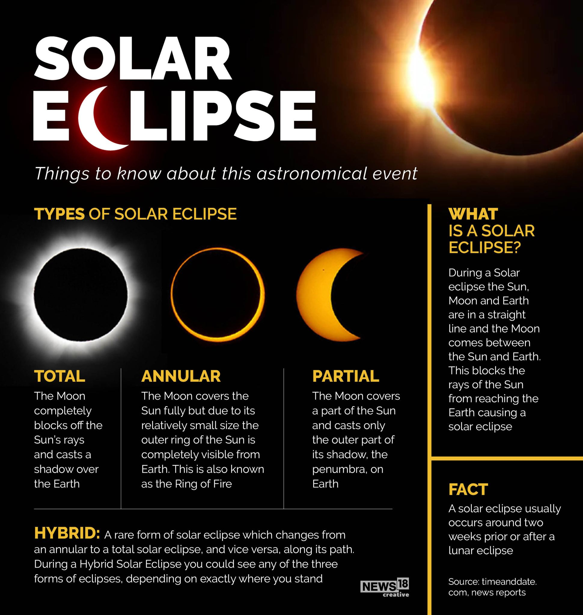
    • During a total solar eclipse, the moon passes between the sun and Earth, entirely covering the face of the sun along a small path of our planet’s surface.
    • This is called the “path of totality.”
    • The daytime sky turns dark, similar to dusk or dawn, and nocturnal animals have been known to wake up, confused into believing night has arrived.

    Stages of a Total Solar Eclipse

    A total solar eclipse unfolds in several distinct stages.

    1. It starts with a partial eclipse phase as the moon begins to pass between Earth and the sun, partially blocking it and leaving the sun looking like it has a crescent shape.
    2. In the subsequent Baily’s Beads phase, points of light from the sun shine around the moon’s edges because of the irregular lunar topography, producing small beads of light.
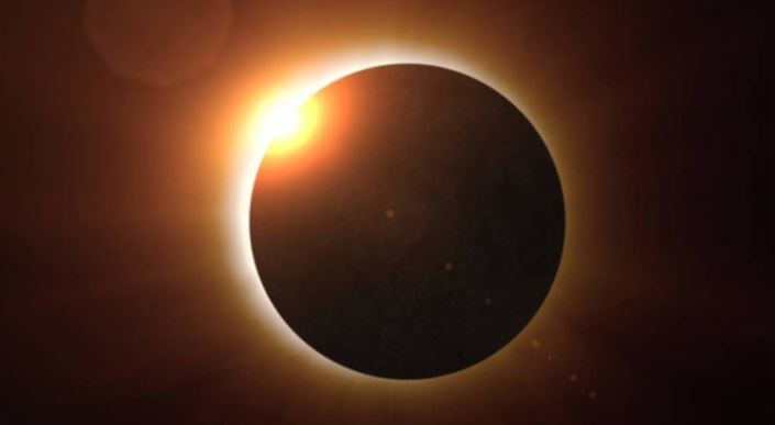
    3. In the diamond ring phase, a single bright spot appears along the lunar edge even as the sun’s atmosphere leaves a ring of light around the moon. This phenomenon precedes totality.
    4. After totality, the other phases repeat as the moon keeps moving along its path until the eclipse ends.

    Other types of solar eclipses:

    1. Partial Solar Eclipse
    • This happens when the sun, moon and Earth are not exactly lined up.
    • The sun appears to have a dark shadow on only a small part of its surface.
    1. Annular Solar Eclipse
    • An annular eclipse happens when the moon is farthest from Earth. Because the moon is farther away from Earth, it seems smaller. It does not block the entire view of the sun. The moon in front of the sun looks like a dark disk on top of a larger sun-coloured disk. This creates what looks like a ring around the moon.
    • During a solar eclipse, the moon casts two shadows on Earth. The first shadow is called the Umbra. This shadow gets smaller as it reaches Earth. It is the dark centre of the moon’s shadow.
    • The second shadow is called the Penumbra. The penumbra gets larger as it reaches Earth. People standing in the penumbra will see a partial eclipse. People standing in the umbra will see a total eclipse.

    Why don’t solar eclipses happen at every New Moon?

    • The reason is that the Moon’s orbit tilts 5° to Earth’s orbit around the Sun.
    • Astronomers call the two intersections of these paths nodes.
    • Eclipses only occur when the Sun lies at one node and the Moon is at its New (for solar eclipses) or Full (for lunar eclipses) phase.
    • During most (lunar) months, the Sun lies either above or below one of the nodes, and no eclipse happens.

    PYQ:

    2013:

    Consider the following phenomena

    1. Size of the sun at dusk

    2. Colure of the sun at dawn

    3. Moon being visible at dawn

    4. Twinkle of stars in the sky

    5. Polestar being visible in the sky

    Which of the above are optical illusions?

    (a) 1, 2 and 3

    (b) 3, 4 and 5

    (c) 1, 2 and 4

    (d) 2, 3 and 5


    Practice MCQ:

    Which of the following statements best characterizes a Total Solar Eclipse?

    (a) A total solar eclipse occurs when the Moon partially blocks the Sun, leaving a visible ring of sunlight around the Moon’s silhouette.

    (b) During a total solar eclipse, the Moon completely covers the Sun, casting a shadow on a narrow path on the Earth’s surface called the umbra.

    (c) Total solar eclipses occur more frequently than partial solar eclipses due to the precise alignment of the Sun, Earth, and Moon.

    (d) Total solar eclipses can only be observed from specific locations on Earth, making them rare and highly sought-after astronomical events.

  • In news: Ramapo Fault

    Why in the news?

    • An earthquake of magnitude 4.8 hit the New York City in a rare event.
    • The Ramapo Fault in Appalachian Mountains near New Jersey is a being considered as a reason behind this earthquake.

    Appalachian Mountains

    • The Appalachian Mountains extend from the Canadian province of Newfoundland and Labrador in the north to central Alabama in the southern US.
    • The total length of the Appalachian Mountain range is approximately 2,200 miles (3,500 kilometers), making it one of the longest mountain chains in the world.
    • Geologically, it is one of the oldest mountain ranges on Earth, formed over 480 million years ago during the Ordovician Period. They are considered a Paleozoic mountain range.
    • They were formed through a series of tectonic collisions and uplift events, including the assembly of the supercontinent Pangaea.
    • The highest peak in the range is Mount Mitchell in North Carolina, standing at an elevation of 6,684 feet (2,037 meters) above sea level.
    • The Appalachian Mountains hold cultural significance for various indigenous tribes, including the Cherokee, as well as early European settlers who established communities in the region.

    About Ramapo Fault

    • Fault lines are fractures in the Earth’s crust that facilitate movement of tectonic plates, triggering earthquakes.
    • The Ramapo Fault is resulted from tectonic activity associated with the breakup of the supercontinent Pangaea during the Mesozoic Era.
    • It is primarily a right-lateral strike-slip fault, formed by horizontal movement along the fault line due to the ongoing motion between the North American and Eurasian plates.
    • While the Ramapo Fault is not as seismically active as faults in other regions, it has experienced earthquakes in the past and remains a potential source of seismic hazards.

    Geographical Distribution:

    • The fault extends across three states in the northeastern United States: Pennsylvania, New Jersey, and New York.
    • The fault crosses various topographic features, including rift valleys, hills, and ridges, reflecting the diverse geological history of the region.
    • It intersects with the Appalachian Mountains, influencing the overall topography of the surrounding areas.

    PYQ:

    [2012] When you travel in Himalayas, you will see the following:

    1.    Deep gorges

    2.    U-turn river courses

    3.    Parallel mountain ranges

    4.    Steep gradients causing land-sliding

    Which of the above can be said to be the evidences for Himalayas being young fold mountains?

    (a) 1 and 2 only

    (b) 1, 2 and 4 only

    (c) 3 and 4 only

    (d) 1, 2, 3 and 4


  • Taiwan’s Earthquake and the Pacific Ring of Fire

    Why in the news?

    • Taiwan was struck by its most powerful earthquake in at least 25 years.
    • Its susceptibility to earthquakes is attributed to its location along the Pacific “Ring of Fire” where a majority of the world’s seismic activity occurs.
    • Taiwan is primarily influenced by the collision of the Philippine Sea Plate and the Eurasian Plate.

    What is the Pacific ‘Ring of Fire’?

    • The Pacific ‘Ring of Fire’ or Pacific Rim, or the Circum-Pacific Belt, is an area along the Pacific Ocean that is characterized by active volcanoes and frequent earthquakes.
    • Volcanic arcs and oceanic trenches partly encircling the Pacific Basin form the so-called Ring of Fire.
    • It is home to about 75 per cent of the world’s volcanoes – more than 450 volcanoes.
    • Also, about 90 per cent of the world’s earthquakes occur here.

    Its spread

    • Its length is over 40,000 kilometres and traces from New Zealand clockwise in an almost circular arc covering Tonga, Kermadec Islands, Indonesia.
    • It is moving up to the Philippines, Japan, and stretching eastward to the Aleutian Islands, then southward along the western coast of North America and South America.

    Seismic activity of the region

    • The area is along several tectonic plates including the Pacific plate, Philippine Plate, Juan de Fuca plate, Cocos plate, Nazca plate, and North American plate.
    • The movement of these plates or tectonic activity makes the area witness abundant earthquakes and tsunamis every year.
    • Along much of the Ring, tectonic plates move towards each other creating subduction zones.
    • One plate gets pushed down or is subducted by the other plate.
    • This is a very slow process – a movement of just one or two inches per year.
    • As this subduction happens, rocks melt, become magma and move to Earth’s surface and cause volcanic activity.

    PYQ:

    2020: Discuss the geophysical characteristics of Circum-Pacific Zone.

  • Kallakkadal: Coastal Flooding Phenomena in Kerala

    Why in the news?

    • Coastal areas of Kerala, including Alappuzha, Kollam, and Thiruvananthapuram districts, are grappling with flooding caused by high sea waves, known as swell waves or Kallakkadal in Malayalam.
    • The recent swell surge occurred following a low-pressure system originating in the South Atlantic Ocean, leading to the formation of waves reaching heights of up to 11 meters.

    What is Kallakkadal?

    1. Origin and Meaning:
    • Kallakkadal refers to coastal flooding during the (April-May) pre-monsoon season.
    • It is caused by ocean swell waves on the southwest coast of India.
    • The term “Kallakkadal” originates from Malayalam, combining “Kallan” (thief) and “Kadal” (sea), denoting the sea’s unexpected intrusion akin to a thief.
    • In 2012, the term was formally approved by the UNESCO (United Nations Educational, Scientific and Cultural Organization).
    1. Causes:
    • These waves stem from distant storms, such as hurricanes, generating significant energy transfer from the atmosphere to the water.
    • Kallakkadal typically results from strong winds in the southern Indian Ocean, generating ocean swells that travel northward towards the Kerala coast.

    Features of Kallakkadal

    • This phenomenon occurs mostly during pre-monsoon season and sometimes during post monsoon.
    • It continues for a few days.
    • It inundates the low lying coasts.
    • Initially sea recedes before the surge.
    • During high tide the run-up, water level can reach as much as 3–4 m above Maximum Water Level (MWL).

    How is it distinct from Tsunami?

    • Nature of Phenomenon: Kallakkadal, though often confused with tsunamis, arises from distant storm-generated waves, contrasting with tsunamis triggered by underwater disturbances, typically seismic activities.
    • Clarification: Understanding this distinction is crucial for implementing effective early warning systems and mitigating the impact of coastal hazards.

    PYQ:

    2017: At one of the places in India, if you stand on the seashore and watch the sea, you will find that the sea water recedes from the shore line a few kilometres and comes back to the shore, twice a day, and you can actually walk on the sea floor when the water recedes. This unique phenomenon is seen at-

    (a) Bhavnagar

    (b) Bheemunipatnam

    (c) Chandipur

    (d) Nagapattinam


    Practice MCQ:

    The Coastal areas of Kerala recently witnessed the Oceanic Swell Waves locally known as Kallakkadal. In this regard consider the following statements:

    1.    Kallakkadal typically occurs during the spring season (March-April).

    2.    These waves stem from distant storms in the southern Indian Ocean.

    Which of the given statements is/are NOT correct?

    (a) Only 1

    (b) Only 2

    (c) Both 1 and 2

    (d) Neither 1 nor 2

  • Places in news: Afanasy Nikitin Seamount

    Why in the news?

    • India has applied to the International Seabed Authority (ISBA) for exploration rights in the Afanasy Nikitin (AN) Seamount in the Indian Ocean outside its jurisdiction.
    • India’s application is motivated by reports of Chinese vessels conducting reconnaissance in the same region, raising concerns about strategic interests and resource competition.

    About International Seabed Authority (ISBA)


    • The ISBA is an intergovernmental organization established under the United Nations Convention on the Law of the Sea (UNCLOS).
    • It was established in 1994 and headquartered in Kingston, Jamaica.
    • ISA is tasked with regulating mineral-related activities in the international seabed area beyond national jurisdiction, which includes polymetallic nodules, polymetallic sulphides, and cobalt-rich ferromanganese crusts.
    • The Authority issues exploration and exploitation contracts to countries and private entities for deep-sea mining activities, subject to certain regulations and environmental safeguards.
    • ISA comprises various organs, including the Assembly, the Council, the Legal and Technical Commission, and the Secretariat, each with specific functions related to deep-sea mining regulation.
    • According to Article 156(2) of the UNCLOS, all UNCLOS parties are members of ISBA.
    • As of 2023 has 169 members, including 168 member states and the European Union.
    • India became a member of the UNCLOS in 1994.


    About AN Seamount

    • The AN Seamount, located about 3,000 km from India’s coast, is a substantial structural feature in the Central Indian Ocean Basin.
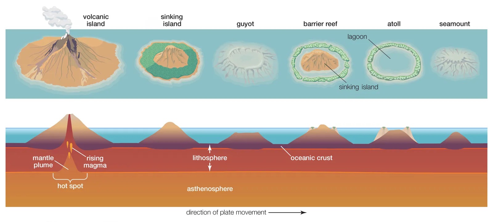
    • A seamount is a large submarine landform that rises from the ocean floor without reaching the surface, and thus is not an island.
    • It is 400 km-long and 150 km-wide. From an oceanic depth of about 4,800 metres it rises to about 1,200 metres.
    • It was discovered during a marine research expedition, named after the Russian explorer Afanasy Nikitin.
    • It is renowned for its polymetallic nodules containing cobalt, nickel, manganese, and copper

    Continental Shelf Claims and Implications

    • Sri Lanka has applied for continental shelf claims up to 500 nautical miles beyond its Exclusive Economic Zone (EEZ), citing a special provision.
    • India, noting Chinese presence, has staked a claim for exploration rights to prevent future consequences.
    • India has also applied for permission to explore another region, spanning 3,00,000 square km, called the Carlsberg Ridge in the Central Indian Ocean to investigate for polymetallic sulphides, which are reportedly rich in copper, zinc, gold and silver.

    PYQ:

    2021: Consider the following statements:​

    1. The Global Ocean Commission grants licences for seabed exploration and mining in international waters.​
    2. India has received licences for seabed mineral exploration in international waters.​
    3. ‘Rare earth minerals’ are present on seafloor in international waters.​

    Which of the statements given above are correct?​

    a)    1 and 2 only ​

    b)    2 and 3 only​

    c)    1 and 3 only ​

    d)    1, 2 and 3​


    Practice MCQ:

    Consider the following statements about the International Seabed Authority (ISBA):

    1. ISBA is an intergovernmental organization established under the United Nations Convention on the Law of the Sea (UNCLOS).
    2. All UN members are naturally parties to the ISBA.

    Which of the given statements is/are correct?

    a)    Only 1

    b)    Only 2

    c)    Both 1 and 2

    d)    Neither 1 nor 2

  • Karnataka approaches Supreme Court over NDRF Funds for Drought Management

    What is the news?

    • The Karnataka government has approached the Supreme Court against the Union government, seeking the release of drought relief funds from the National Disaster Response Fund (NDRF).
    • This disagreement marks the second major dispute after alleged ‘injustice’ in tax devolution and other allocations.

    Extent of Drought and Water Scarcity in Karnataka

    • Rainfall Deficit: During the last monsoon season, Karnataka experienced significant rainfall deficits, exacerbating the drought situation and affecting agricultural productivity.
    • Drought conditions: Karnataka faces extensive drought conditions, with 223 out of 236 taluks (mandals) declared as drought-hit areas, resulting in substantial crop loss.
    • Compensation Sought: The state has sought substantial financial assistance from the Centre, amounting to Rs 18,171 crores, to address the damages caused by drought.

    Karnataka’s Writ Petition to the Supreme Court


    • Legal Action: Karnataka’s petition under Article 32 of the Constitution seeks relief against the Union government’s alleged inaction in providing financial assistance for drought management.
    • Basis of Petition: The petition argues that the delay in releasing funds violates fundamental rights guaranteed under Articles 14 and 21 of the Constitution, pertaining to equality before the law and protection of life and personal liberty.


    What is National Disaster Response Fund (NDRF)?

    • The NDRF is a statutory body constituted under the Disaster Management Act, 2005.
    • It supplements State Disaster Response Fund (SDRF) of a State, in case of a disaster of severe nature, provided adequate funds are not available in SDRF.
    • The July 2015 guidelines states that natural calamities of cyclone, drought, earthquake, fire, flood, tsunami, hailstorm, landslide, avalanche, cloud burst, pest attack and cold wave and frost will qualify for immediate relief assistance from NDRF.
    • NDRF is managed in the “Public Accounts” under “Reserve Funds not bearing interest”.
    • The Comptroller and Auditor General of India (CAG) audits the accounts of NDRF.

    Disaster Relief for Indian states

    • Under the 2005 Disaster Management Act, there is no definition of disasters.
    • It can include any event arising from natural or man-made causes that can severely disrupt life for people, going beyond their coping capacity.
    • The 15th Finance Commission introduced a new methodology for state-wise allocations, considering factors like past expenditure, risk exposure, hazard, and vulnerability.

    Institutional Mechanism

    • States have the State Disaster Relief Funds (SDRF).
    • The Centre contributes 75% of the funds (and 90% for Himalayan and NE states) and states contribute the remainder.
    • The total amount is decided as part of the budgetary allocations and released periodically by the Centre.

    In case a state needs the Centre’s assistance, it must follow a procedure:

    1. It should detail the extent of the damage in a memorandum and submit it
    2. If this is acknowledged by Centre, an Inter-Ministerial Central Team (IMCT) conducts on-ground inspections to survey the damage
    3. A National Executive Team analyses the IMCT report
    4. Based on its recommendations, a High Level Committee shall approve the release of immediate relief from NDRF.

    Additionally, the Union Ministry of Home Affairs oversees the utilisation of NDRF releases.


    PYQ:

    2014: Drought has been recognized as a disaster in view of its spatial expanse, temporal duration, slow onset and lasting effects on vulnerable sections. With a focus on the September 2010 guidelines from the National Disaster Management Authority (NDMA), discuss the mechanisms for preparedness to deal with likely El Nino and La Nina fallouts in India.


    Practice MCQ:

    Consider the following statements about National Disaster response fund (NDRF):

    1. NDRF is a part of consolidated fund of India.
    2. Comptroller and Auditor General of India (CAG) audits the accounts of NDRF.

    Which among the above statements is/are correct?

    1. Only 1
    2. Only 2
    3. Both 1 and 2
    4. Neither 1 nor 2
  • Subduction Zone discovered beneath Gibraltar Strait

    What is the news?

    • Scientists in Portugal have uncovered a concerning revelation about the fate of the Atlantic Ocean, highlighting a potential ‘Ring of Fire’ (a Subduction Zone).
    • Researchers caution that the Atlantic may be on the brink of closure due to subduction activity.

    Why discuss this?


    • Closure of Gibraltar Strait: Computer simulations project the subduction zone’s expansion over the next 20 million years, forming the ‘Ring of Fire’ in the Atlantic leading to the closure of Gibraltar Strait.
    • Geological Parallel: This process mirrors the Pacific Ocean’s Ring of Fire, reshaping the ocean basin through gradual subduction of the ocean floor beneath continents.


    About Gibraltar Strait

    Details
    Location
    • Connects the Atlantic Ocean to the Mediterranean Sea;
    • Separating the southern tip of the Iberian Peninsula of Europe from the northern coast of Africa.
    Width Approximately 13 km (8.1 miles) at its narrowest point.
    Depth Varies, with the deepest point reaching around 300 meters (984 feet).
    Formation
    • Convergence point for the Eurasian Plate and the African Plate.
    • Formed around 5.33 million years ago during the Messinian salinity crisis when the Atlantic Ocean breached the barrier separating it from the Mediterranean Sea, resulting in a catastrophic flood known as the Zanclean flood.
    • The strait’s current shape and depth were further influenced by tectonic movements and erosional processes over geological time.
    Historical Significance Serves as a key maritime passage for trade and military purposes.
    Disputes
    • Subject of contention between Spain and the United Kingdom;
    • Gibraltar Overseas Territory under British control.


    What are Subduction Zones?

    • Subduction zones occur at convergent plate boundaries, where two tectonic plates move toward each other.
    • This convergence is often between an oceanic plate and a continental plate or between two oceanic plates.
    • Subduction Process:
    1. Collision of Tectonic Plates: When two tectonic plates collide, the denser oceanic plate is forced beneath the less dense continental plate or another oceanic plate.
    2. Partial Melting: As the oceanic plate descends into the mantle, it generates intense heat and pressure, causing partial melting of the mantle material.
    3. Volcanic Activity: The molten material formed by the subduction process rises through the Earth’s crust, leading to volcanic eruptions at the surface.
    4. Formation of Volcanic Arcs: These eruptions often occur in chains known as volcanic arcs, which parallel the subduction zone. Ex. Andes in S. America; Cascade Range in North America.

    Implications of this Activity

    • Earthquakes: Subduction zone earthquakes can be particularly destructive and may trigger tsunamis due to the displacement of large volumes of water.
    • Trench Formation: The surface expression of a subduction zone is often a deep oceanic trench, where the descending plate bends and plunges into the mantle.
    • Mountain Building: Over time, the continuous subduction of oceanic crust can lead to the uplift and deformation of the overriding plate, resulting in the formation of mountain ranges adjacent to the subduction zone. These mountains may exhibit complex geological structures, including folds and faults.
    • Recycling of Oceanic Crust: As oceanic plates are subducted, they are gradually consumed by the mantle, releasing minerals and elements that are eventually returned to the surface through volcanic activity.

    PYQ:

    2010: Which one of the following can one come across if one travels through the Strait of Malacca?

    1. Bali
    2. Brunei
    3. Java
    4. Singapore


    2011: Between India and East Asia, the navigation time and distance can be greatly reduced by which of the following?

    1. Deepening the Malacca straits between Malaysia and Indonesia.
    2. Opening a new canal across the Kra Isthmus between the Gulf of Siam and Andaman sea.

    Which of the statements given above is/are correct?

    1. 1 only
    2. 2 only
    3. Both 1 and 2
    4. Neither 1 nor 2


    Practice MCQ:

    Which of the given statement about the Gibraltar Strait is NOT correct?

    1. It connects the Atlantic Ocean to the Mediterranean Sea.
    2. It is approximately 13 kilometers wide at its narrowest point.
    3. The deepest point of the Gibraltar Strait reaches around 300 meters.
    4. It was formed around 5.33 million years ago during the Holocene Epoch due to tectonic movements.
  • Geo-Heritage Sites in India

    Why in the news

    • Pandavula Gutta, an ancient geological marvel predating the Himalayan hills, has been officially designated as Telangana’s sole Geo-heritage site.
    • Also the 165 million-year-old meteor Ramgarh Crater in Rajasthan was declared geo-heritage site.

    [A] Pandavula Gutta

    • Pandavula Gutta is located in Jayashankar Bhupalpally District in Telangana.
    • It is known for its rock art and geological heritage.
    • The site features Paleolithic cave paintings depicting wildlife and symbols.
    • Discovered in 1990, it showcases habitation from the mesolithic to medieval times.
    • Recognized as the sole Geo-heritage site in Telangana, older than the Himalayan hills.


    [B] Ramgarh Crater

    • The Ramgarh Crater, also known as Ramgarh structure, Ramgarh Dome, and Ramgarh astrobleme, is a meteor impact crater located near the town of Ramgarh in Baran district of Rajasthan.
    • It is established as an asteroid impact crater in India, excavated within sandstone, shale, and limestone horizons of the Lower Bhander Group of the Vindhyan Region.
    • It was formed by a meteorite impact, with a diameter of 3.2 kilometers and an elevation of over 200 meters above the surrounding terrain.
    • It is declared Conservation Reserve, namely Ramgarh Conservation Reserve, under the Wildlife (Protection) Act, 1972 and a notified wetland under Wetland (Conservation & Management) Rules, 2017.


    What are Geo-Heritage Sites?

    • Geo-Heritage Sites in India are geological features of significant importance, either culturally or inherently, that provide insights into the Earth’s evolution or serve educational purposes.
    • These sites are recognized and protected by the Geological Survey of India (GSI) and the respective State governments.
    • India presently has 34 National Geological Heritage Monument Sites.
    • Examples:
      1. Mawmluh Cave in Meghalaya
      2. Majuli Island in Assam
      3. Chabimura in Tripura
    • Purpose:
      1. Promote geotourism
      2. Preserve unique geological formations
      3. Enhance geological literacy among the public


    Tap this link to read more about all Geo-Heritage Parks in India:

    https://vikaspedia.in/education/childrens-corner/geological-heritage-sites-of-india


    PYQ:

    Q.Which one of the following statements is correct?​ (2021)

    1. Ajanta Caves lie in the gorge of Waghora River.​
    2. Sanchi Stupa lies in the gorge of Chambal River.​
    3. Pandu-Lena Cave Shrines lie in the gorge of Narmada River.​
    4. Amaravati Stupa lies in the gorge of Godavari River.​

    Practice MCQ:

    Which of the given statements about the Ramgarh Structure is NOT correct?

    1. It is an asteroid impact crater.
    2. It is located in the Deccan Plateau.
    3. It is a notified wetland under Wetland (Conservation & Management) Rules, 2017.
    4. It is under Conservation Reserve under the Wildlife (Protection) Act, 1972.